13 301 résultats
ria9780415136075_inpHardback. New. New Book; Fast Shipping from UK; Not signed; Not First Edition; Taking issue with both economic methodologists and practicing economists the author argues both that there has been too much 'methodology for methodology's sake' and that mainstream economics might benefit by using it. hardcover
1956X18123xToronto: The Students Administrive Council 1956. Paperback. Good. Students. Toronto University Students School Student Yearbook. For The Year 1956. Hardcover In Good Condition. The Book Has The Old Paper Smell.- Specializing in academic collectible and historically significant providing the utmost quality and customer service satisfaction. For any questions feel free to email us. The Students Administrive Council paperback
SONG0444511288North Holland 15/08/2004. 1. hardcover. Used: Good. 6.72x1.51x9.60. Buy with confidence. Excellent Customer Service & Return policy. North Holland hardcover
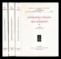
1988449652Firenze : L.S. Olschki 1988. First Edition. Softcover. Very good paperback copies; wrappers slightly creased and edge-dulled. Set remains otherwise very well-preserved; unread with unopened pages bright clean and tight. Series; Biblioteca dell'""Archivum Romanicum."" Serie I Storia letteratura paleografia ; vol. 208. Physical description; Complete in 3 volumes viii 1437 pages : illustrations ; 26 cm. Notes; Edited by Antonio Franceschetti. Subjects; Italian literature History and criticism Congresses. Art and literature Italy Congresses. Art in literature Congresses. Firenze : L.S. Olschki paperback
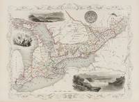
18512014AG1851. London & New York J & F. Tallis 1851. Original steel engraving / Vintage map. Drawn and engraved by John Rapkin. Partly hand-coloured. Plate Size: 33.3 cm x 25.5 cm. Sheet Size: 37.5 cm x 27.2 cm. Vintage 19th century map in very good condition. John Tallis 7 November 1817 3 June 1876 was an English cartographic publisher. His company John Tallis and Company published views maps and atlases in London from roughly 1838 to 1851. Tallis set up as a publisher with Frederick Tallis in Cripplegate in 1842; the business moved to Smithfield in 1846 and was dissolved in 1849. From 1851 to 1854 Tallis operated as John Tallis and Company. He started The illustrated news of the world and national portrait gallery of eminent personages in 1858 selling it for £1370 in 1861; it folded in 1863. Wikipedia The most important project John Tallis undertook was the 'Illustrated Atlas' from 1851. The original map we offer here was part of this exceptional Atlas and all the maps it contained are still today considered as the last reminder of an era of lavish map production. Tallis worked the project together with John Rapkin 1815-1876 and it was Rapkin's style and talent that we have to thank for when we marvel at these maps today. What makes these maps so special is the detail of engraved vignettes that surround the map and often show indigenous scenes people in their environment and even more so historical buildings or historical views of towns and cities architecture and landscape. The project of 'The Illustrated Atlas' was designed to be finished just in time for the anxiously awaited "Great Exhibition of the Works of Industry of All Nations" or The Great Exhibition sometimes referred to as the Crystal Palace Exhibition in reference to the temporary structure in which it was held was an international exhibition that took place in Hyde Park London from 1 May to 11 October 1851. It was the first in a series of World's Fairs exhibitions of culture and industry that became popular in the 19th century and it was a much anticipated event. The Great Exhibition was organized by Henry Cole and Prince Albert husband of the reigning monarch Queen Victoria. It was attended by numerous notable figures of the time including Charles Darwin Samuel Colt members of the Orléanist Royal Family and the writers Charlotte Brontë Charles Dickens Lewis Carroll George Eliot and Alfred Tennyson. Music for the opening was under the direction of Sir George Thomas Smart and the continuous music from the exhibited organs for the Queen's procession was "under the superintendence of William Sterndale Bennett". Wikipedia unknown
18512013AG1851. London & New York J & F. Tallis 1851. Original steel engraving / Vintage map. Drawn and engraved by John Rapkin. Partly hand-coloured. Plate Size: 25 cm x 32.5 cm. Sheet Size: 37.5 cm x 27.2 cm. Vintage 19th century map in very good condition. John Tallis 7 November 1817 3 June 1876 was an English cartographic publisher. His company John Tallis and Company published views maps and atlases in London from roughly 1838 to 1851. Tallis set up as a publisher with Frederick Tallis in Cripplegate in 1842; the business moved to Smithfield in 1846 and was dissolved in 1849. From 1851 to 1854 Tallis operated as John Tallis and Company. He started The illustrated news of the world and national portrait gallery of eminent personages in 1858 selling it for £1370 in 1861; it folded in 1863. Wikipedia The most important project John Tallis undertook was the 'Illustrated Atlas' from 1851. The original map we offer here was part of this exceptional Atlas and all the maps it contained are still today considered as the last reminder of an era of lavish map production. Tallis worked the project together with John Rapkin 1815-1876 and it was Rapkin's style and talent that we have to thank for when we marvel at these maps today. What makes these maps so special is the detail of engraved vignettes that surround the map and often show indigenous scenes people in their environment and even more so historical buildings or historical views of towns and cities architecture and landscape. The project of 'The Illustrated Atlas' was designed to be finished just in time for the anxiously awaited "Great Exhibition of the Works of Industry of All Nations" or The Great Exhibition sometimes referred to as the Crystal Palace Exhibition in reference to the temporary structure in which it was held was an international exhibition that took place in Hyde Park London from 1 May to 11 October 1851. It was the first in a series of World's Fairs exhibitions of culture and industry that became popular in the 19th century and it was a much anticipated event. The Great Exhibition was organized by Henry Cole and Prince Albert husband of the reigning monarch Queen Victoria. It was attended by numerous notable figures of the time including Charles Darwin Samuel Colt members of the Orléanist Royal Family and the writers Charlotte Brontë Charles Dickens Lewis Carroll George Eliot and Alfred Tennyson. Music for the opening was under the direction of Sir George Thomas Smart and the continuous music from the exhibited organs for the Queen's procession was "under the superintendence of William Sterndale Bennett". Wikipedia unknown
18512015AG1851. London & New York J & F. Tallis 1851. Original steel engraving / Vintage map. Drawn and engraved by John Rapkin. Partly hand-coloured. Plate Size: 32.2 cm x 25 cm. Sheet Size: 37.7 cm x 27.2 cm. Vintage 19th century map in very good condition. John Tallis 7 November 1817 3 June 1876 was an English cartographic publisher. His company John Tallis and Company published views maps and atlases in London from roughly 1838 to 1851. Tallis set up as a publisher with Frederick Tallis in Cripplegate in 1842; the business moved to Smithfield in 1846 and was dissolved in 1849. From 1851 to 1854 Tallis operated as John Tallis and Company. He started The illustrated news of the world and national portrait gallery of eminent personages in 1858 selling it for £1370 in 1861; it folded in 1863. Wikipedia The most important project John Tallis undertook was the 'Illustrated Atlas' from 1851. The original map we offer here was part of this exceptional Atlas and all the maps it contained are still today considered as the last reminder of an era of lavish map production. Tallis worked the project together with John Rapkin 1815-1876 and it was Rapkin's style and talent that we have to thank for when we marvel at these maps today. What makes these maps so special is the detail of engraved vignettes that surround the map and often show indigenous scenes people in their environment and even more so historical buildings or historical views of towns and cities architecture and landscape. The project of 'The Illustrated Atlas' was designed to be finished just in time for the anxiously awaited "Great Exhibition of the Works of Industry of All Nations" or The Great Exhibition sometimes referred to as the Crystal Palace Exhibition in reference to the temporary structure in which it was held was an international exhibition that took place in Hyde Park London from 1 May to 11 October 1851. It was the first in a series of World's Fairs exhibitions of culture and industry that became popular in the 19th century and it was a much anticipated event. The Great Exhibition was organized by Henry Cole and Prince Albert husband of the reigning monarch Queen Victoria. It was attended by numerous notable figures of the time including Charles Darwin Samuel Colt members of the Orléanist Royal Family and the writers Charlotte Brontë Charles Dickens Lewis Carroll George Eliot and Alfred Tennyson. Music for the opening was under the direction of Sir George Thomas Smart and the continuous music from the exhibited organs for the Queen's procession was "under the superintendence of William Sterndale Bennett". Wikipedia unknown
65911C5a. Very Good. Hardcover. Hardcover. 8vo. Oblong. Published by C H Parmelee Ottawa Canada. 1909. Sessional Paper No. 19a. 3 Volumes. Vol 1. Report Upon Survey With Plans and Estimates of Cost; Vol 2. Plates 1 to 15 To Accompany Report; Vol 3. Typical Views. Xxii 601 pgs. Illustrated with 26 folding plates photographs diagrams charts with an accompanying volume of 24 folding panoramas of views along the route. Bound in tan boards with titles present to the spine and front board. Boards have shelf-wear present to the extremities library mark present to the front board; boards are scuffed and worn with wear present to the edges of the boards. No ownership marks present. Text is clean and free of marks. Binding tight and solid. The proposed Georgian Bay Ship Canal was promoted as a project with the magnitude of a Panama Canal. This waterway would have allowed Great Lake freighters to travel directly from Lake Huron to Montreal. The surveyed waterway was essentially a scheme to canalize a number of rivers and lakes which exist along the old voyageur fur trading route of the French Mattawa and Ottawa Rivers. EB; 8vo 8" - 9" tall . hardcover
1856193721London: Chapman and Hall 1856. First edition. Hardcover. Good/No Dustjacket. 8vo. pp. xvi 343; viii 324 two volume set binding on volume one starting to crack but holding together Chapman and Hall hardcover
5562157like new. unknown
42468Newark U.C. Niagara-on-the Lake. Probably Printed by Gideon Tiffany 1796. 1 page. 4to. 26.5cm broadside. printed page is 21x 15cm caption-title uncut in fine condition. cgc.bx. Broadside: Act Regulating Licencing of Public HousesNot in Tremaine or TPL. A separately printed copy of this act not abstracted from the collected Statues of 1796. Gideon Tiffany succeeded Louis Roy the first printer of Upper Canada in November 1794. This act amends 36 George 3. chapter 12 regarding the regulation of liquor licenses and introduces a fine of 20 pounds for violation of the laws and changes the procedure for applications for licenses from annually to quarterly. [Newark, U.C. (Niagara-on-the Lake). Probably Printed by Gideon Tiffany, 1796] unknown
42542Quebec. Printed for the contractors by Hunter Rose & Co. 1861. 8vo. 24cm 176p. in the original printed blue wrappers with the title repeated on the upper cover in publisher's frame border a fine copy rare. cdn. T.P.L. 3960. Our first copy. no records and listings located. With a list of places visited including the Quarantine Hospital Grosse Isle. Report addressed to Sir Edmund Walker Head Governor General of the British Provinces in North America. Includes also Lunatic Asylums Marine Hospitals Penitentiary Reformatories. Quebec. Printed for the contractors, by Hunter, Rose & Co. 1861 unknown
129717Ottawa: Department of Indian Affairs and Northern Development NONE NONE 1978. hardcover NP. Near fine. Large folio. Published in a paperback fromat this copy is rebound in navy faux leather beautiful. First published in 1971 this is a 1978 reprint. Fold out map sheets. There is a name penned small to the top of the title page; else is clean and bright in fine condition. Department of Indian Affairs and Northern Development NONE Hardcover
34270Toronto. R. Stanton Printer. 1838. Soft cover. 8vo 21cm 91 & 60p. appendix in the original printed yellow wrappers slight dust worn a very good copy. on T.P.L. 2231 Fleming 1271. Sabin 10578. Casey 1656. Summarizes the state of the province immediately after the Rebellion of 1837 38 giving recommendations for governing the province a brief history of the uprising and a considerable discussion of the dangers from the United States. The appendix reprints numerous documents relating to the Rebellion including militia orders government decrees and proclamations of the provisional government of the rebels. [Toronto]. R. Stanton, Printer. 1838 unknown
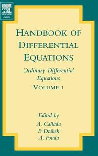
ria9780444520272_inpHardcover. New. New Book; Fast Shipping from UK; Not signed; Not First Edition; Contains chapters covering a variety of problems in ordinary differential equations. This work reflects both pure mathematical research and real word applications. It is written by leading researchers in the area. hardcover
1955ZB394519Association de Recherches sur les Sciences Religieuses et Profanes au Can 1955. volumes 4; 7-10; 13; 15; 23-31. 1955-1970 all complete volumes partly bound library markings textually clean & tight PRICE IS FOR THE LOT. - If you are reading this this item is actually physically in our stock and ready for shipment once ordered. We are not bookjackers. Buyer is responsible for any additional duties taxes or fees required by recipient's country. Photos available upon request. Association de Recherches sur les Sciences Religieuses et Profanes au Can unknown
1869088165Montreal; n/a; Paris; Montreal; Montreal; New York: Eusebe Senecal; Canadian Naturalist; Librairie catholique de Périsse frères; John Lovell; Presses a vapeur de La Minerve; Christern 1869. Leather Bound. pp. 24; 31; 192; 110; 80; 64. 8vo. 3/4 tan leather over marbled boards. Gilt lettering to spine reads "Mélange Historique". Light edgewear ink title list to front free endpaper two library rubber stamps. Contents unmarked binding sound. Eusebe Senecal; Canadian Naturalist; Librairie catholique de Périsse frères; John Lovell; Presses a vapeur de La Minerve; Chri unknown
1860083899London: Printed by George Edward Eyre & William Spottiswoode for H.M.S.O. 1860. Hardcover. pp. 217. 1/2 black cloth over grey paper-covered boards. Gilt lettering to spine. 2 plates and 6 folding hand-coloured maps. Corners and spine ends frayed old tape to verso of title page has caused a yellowed brittle spot and another piece has stuck the title page a little crookedly to the next; text block age-toned a few old repairs to map folds; overall very nice condition. Peel 365: "Includes hand-coloured maps and one more chapter than Toronto edition.' See also Sabin 31937. Printed by George Edward Eyre & William Spottiswoode for H.M.S.O. hardcover
2026x-0367484560Taylor & Francis Ltd 2026. Hardcover. New. 252 pages. 9.18x6.12x9.45 inches. Taylor & Francis Ltd hardcover
2026x-1041154682Taylor & Francis Ltd 2026. Hardcover. New. 256 pages. 9.18x6.12x9.45 inches. Taylor & Francis Ltd hardcover
2018x-1620366762Stylus Pub Llc 2018. Hardcover. New. 161 pages. 9.50x6.25x0.75 inches. Stylus Pub Llc hardcover
110607Vancouver: Macdonalds circa 1913. Oblong folio hardcover Not paginated. Good to very good no dust jacket. Padded red leather binding with gilt lettering. Map photographs. Corners of cover are worn small tears to top and bottom of spine front free endpaper partially detached. Descriptive essays and souvenir photographs of cities towns and places from coast to coast across Canada. Canada Cities and Towns. Macdonalds Hardcover
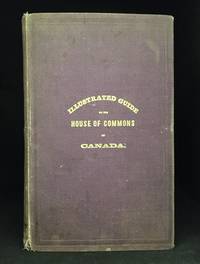
153162Ottawa: J. Bureau 1875. Hardcover 152pp. Good no dust jacket. Burgundy cloth with gilt lettering on the front cover. Plans fold-out plan illustrated photographic postcards tables advertisements. The spine is faded and edgeworn at the top and bottom the front hinge is starting to crack and the pages are dampstained. "In presenting this book to the public the Editor is satisfied he has succeeded in attaining the object which he had proposed to himself viz: 1. To procure to the Members of the houseof Commons the means of knowing each other by gathering their portraits together; 2. To supply persons frequenting the House of Commons with necessary information to make them acquainted with the proceedings of the said House; 3. To give to the public in general the greatest amount possible of interesting and useful informations" - from the Preface. Time Period 1870's & 19th Century. Locale: Ottawa--Ontario. History--Canada Government--Canada History--Canada House of Commons--Canada. J. Bureau Hardcover
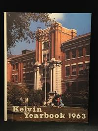
132261Winnipeg: Kelvin High School 1963. 4to 143pp. Very good plus. Issued without dust jacket. School yearbook format and content. Includes a small portrait photograph of Neil Young as a grade 10 student and portrait and write-up of Fred Penner in grade 11. Photograph of Fred Penner & Neil Young. Locale: Prairie Provinces; Western Canada; Winnipeg. Manitoba Kelvin High School--Winnipeg School Yearbooks--Manitoba Schools--Manitoba. Kelvin High School Hardcover
100856Toronto: William Briggs 1890 1st printing. Hardcover Very good. Issued without dust jacket. 764pp. Rebound in textured black cloth with no lettering. Frontispiece illustrations plates. A slight dampstain at the bottom of the first few pages and a previous owner's name and place on the front endpaper. Deals mainly with Portage la Prairie. Peel 3 1890 Locale: Manitoba; Portage la Prairie--Manitoba; Prairie Provinces; Western Canada. Manitoba Local History--Manitoba. William Briggs Hardcover