13 301 résultats
1946104999Banff Alberta: Alpine Club of Canada 1946. Softcover. very good. 1st Edition. viii177-308pp. 4pp adspp. Octavo in original green wrappers with plates from photos maps etc. very good Contents include "Troop Training in the Rockies" and "First Traverse of the Bennington Icefield" by Major Rex Gibson; "Early Explorers of the West" by Elizabeth Parker; and "Birds and Mammals of Revelstoke National Park" by I. McT Cowan and J. A. Munro. 1946 Alpine Club of Canada paperback
1953105004Banff Alberta: Alpine Club of Canada 1953. Softcover. very good. 1st Edition. viii174pp. 6pp. adspp. Octavo in original green wrappers with plates from photos and maps and illustrations in text maps. Includes panorama plate from peak of by a German party laid in loose often missing. very good Contents include "South Georgia" by Walter Roots; King Peak - Yukon Expedition 1952" by Gibson Reynolds; "The Yale Logan Expedition" by Dudley W. Bolyard; "The Franco-American Ascent of Salcantay" by Fred Ayers; and "In the Northern Purcells" by Peter Robinson. 1953 Alpine Club of Canada paperback
1930104987Banff Alberta: Alpine Club of Canada 1930. Softcover. good to very good. 1st Edition. iv133pp. 5pp. adspp. Octavo in original green wrappers with plates 1 folding from photos. Covers slightly worn Old owners name on front endpaper otherwise a very good plus copy Includes the first ascent of Sir Alexander MacKenzie and contibutions from L. S. Amery on a Month between Lake Louise and Jasper ascents south of Banff by Kate Gardiner Eastern Alps by J. M. Thorington plus the Canadian Rockies from Yellowhead Pass to Jarvis Pass and a Purcell pilgrimage. 1930 Alpine Club of Canada paperback
1916104977Banff Alberta: Alpine Club of Canada 1916. Softcover. fine. 1st Edition. viii128pp. 4pp. adspp. Octavo in original greenish grey wrappers with plates 1 folding and 3 folding sketch maps. Slight wear and fading to wrappers. fine Articles include the first ascent of Mt. Tetragonga Labrador by A. P. Coleman first ascent of Mt Edith Cavell by E.W.D. Holway experiences in the Canadian Rockies in 1915 by J.W.A. Hickson and on Alexander MacKenzie by Mary L. Jobe. 1916 Alpine Club of Canada paperback
1942104997Banff Alberta: Alpine Club of Canada 1942. Softcover. very good. 1st Edition. viii146pp. 4pp. adspp. Octavo in original green wrappers spine faded as usual with plates from photos maps etc and illustrations in text including maps very good Contents include "Early Explorations in the Coast Mountaisn" by W. A. Don Munday and the first ascent in the Seven Sisters Range. 1942 Alpine Club of Canada paperback
1919105286Banff Alberta: Alpine Club of Canada 1919. Softcover. fine. 1st Edition. viii120pp. Octavo in original dark green wrappers with plates from photos. A rare issue fine Contents include 'Around Lake Louise in 1918" by Val A. Fynn " A Trip to Mount Robson " by H. E. Bulyea Jasper Park and the Byways of Banff. 1919 Alpine Club of Canada paperback
1915104975Banff Alberta: Alpine Club of Canada 1915. Softcover. very good. 1st Edition. viii263pp. Octavo in original wrappers slightly soiling from use with plates from photos and 3 maps 1 folding very good Articles about the northern Rockies including first ascents of Mt Robson and Mt. Whitehorn by Conrad Kain ascents of Mt. Natazhat Alaska and Mt Respendent; the southern Rockies including first ascents of Mt. Beaver and Duncan by E. W. D. Holway and Mt Farnham and Farnham Tower by A. H.MacCarthy exploration in the Southern Selkirks and the ttraverse of Mt. McBean Selkirks; scientific articles including 'Place Names in Vicinity of Yellowhead Pass' by James White; and miscellaneous "The Expedition to "Mt Kitchi." by Mary L. Jobe the Cathedral and Mount Robson camps 1913 and the camp in the Upper Yoho Valley 1914 1915 Alpine Club of Canada paperback
1913105283Banff Alberta: Alpine Club of Canada 1913. Softcover. fine. 1st Edition. viii137pp. 5pp. adspp. Octavo bound in original green wrappers with plates from photos etc. And 2 maps 1 folding. Minor fading on spine but pages are clean. fine Includes articles on "The Mountains of Lake Chilko' Strathcona Park the Vermillion Pass Camp of 1912 and 'Camps in the Altai' by N. Hollister. 1913 Alpine Club of Canada paperback
1912104973Banff Alberta: Alpine Club of Canada 1912. Softcover. fine. 1st Edition. vi151pp. 4pp ads;iv97pp. Two volumes Octavo in original brown wrappers with plates some folding from photos maps etc and 2 folding maps at end of each volume fine Includes account of the Club's expedition to Jasper Park Yellowhead Pass and Mount Robson Region 1911 by Arthur O. Wheeler; 'A Mountaineering Experience Near Arolla' by J. W. A. Hickson; and 'First Ascents in the Southern Selkirks' by Edward W. Harnden. 1912 Alpine Club of Canada paperback
1938104993Banff Alberta: Alpine Club of Canada 1938. Softcover. very good. 1st Edition. viii164pp. 6pp adspp. Octavo in original green wrappers with plates from photos maps etc and illustrations in text including maps. Slight wear and fading to wrapper. very good Contents include the Harry Snyder Canadian Expedition Nahanni 1937; Canadian Climbs 1937 by Kate Gardiner; Bella Coola Mountains by W. A. Don Munday; Climbs within the Arctic Circle; Following the Footsteps of the Fur Traders by Cyril G. Wates; the Forbidden Plateau Vancouver Island; and winter mountaineering and ski section. 1938 Alpine Club of Canada paperback
1924105288Banff Alberta: Alpine Club of Canada 1924. Softcover. fine. 1st Edition. vi159pp. 5pp adspp. Octavo in original greenish/grey wrappers with plates from photos and 2 folding maps. fine Contents include articles about a trip around Bow Pass the Saskatchewan River and Cathedral Crags the Columbia Icefield by William S. Ladd and J. Monroe Thorington ascents of Mt. Neptuak and the west face of Sir Donald first ascents of Mt. Barbican Mt Geike and by Lady Members Mt. Robson. Contributors also include J. N. Collie on the Canadian Rocky Mountains a Quarter Century Ago James White on Cheadle's "Journal Across the Mountains.1863 and Tom Wilson on "Memories of Golden Days". 1924 Alpine Club of Canada paperback
1934104991Banff Alberta: Alpine Club of Canada 1934. Softcover. very good. 1st Edition. viii236pp. 4pp adspp. Octavo in original green wrappers with plates one folding from photos maps etc illustartions in text and folding map. very good Contents include "High Peaks of the Coast Range" and Mt. Waddington 1934 by W. A. Munday; first ascents of Needle Peak and Molar Tower; climbs in the Rockies and Selkirks during the summer of 1933 by Kate Gardiner; the summer of 1894 around Lake Louise by Yandell Henderson; records of glacial observations in the canadian Cordillera 1933 and 1934 by A. O. Wheeler; and winter mountaineering and ski section. 1934 Alpine Club of Canada paperback
1913126436Banff Alberta: Alpine Club of Canada 1913. Hardcover. very good. 1st Edition. viii137pp. 5pp. adspp. Octavo in original green cloth with plates from photos and 2 maps 1 folding. Minor wear to cover but pages are clean in fine condition. very good Includes articles on "The Mountains of Lake Chilko' Strathcona Park the Vermillion Pass Camp of 1912 and 'Camps in the Altai' by N. Hollister. 1913 Alpine Club of Canada hardcover
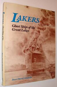
1988855c6104Canada: Eden Press 1988. Book. Illus. by Altobello Peter David. Very Good. Hardcover. First Edition. Folio - over 12" - 15" tall. 128 pages. "Bears witness to a bygone era when the ships of the Great Lakes were built according to a single premise the need to transport steel iron ore grain and cargo from port to port. Yet the exteriors of these extraordinary ships belie the interiors which were constructed with a less utilitarian purpose in mind. Fine woodwork was applied to crew cabins; dining rooms and staterooms were finished with white oak mahogany walnut and brass. This elegant beauty suggested a state of mind dedicated to exquisite craftsmanship which like the ships themselves is gone forever. Here are 64 of the author's stunning illustrations capturing the mood and atmosphere he felt lingering in each ship. The S.S. Birchglen and other ships are preserved in the rich full textures of these sketches." - from dust jacket. Book clean tight and unmarked with light wear. Average wear to price-clipped dust jacket. A sound copy. Eden Press Hardcover
1944008395Montreal / Toronto: Aluminum Company of Canada 1944. 2nd Edition 1st Printing. Hardcover. Very Good. 4to - over 9¾ - 12" tall. Alcan Technical Books - Second Edition - 1947. Blue boards with illustration on face internal spiral binding. xiii 128 pages with B&W photos / tables. Minor rubbing to boards with slight bump to top corner. Internals clean & tight <br/> <br/> Aluminum Company of Canada hardcover
1950008394Montreal / Toronto: Aluminum Company of Canada 1950. 1st Edition 1st Printing. Hardcover. Near Fine. 4to - over 9¾ - 12" tall. Alcan Technical Books - D. I . 201-37/50 Black illustrated boards with internal spiral binding.ix 66 pages with B&W photos / illustrations glossary & index. <br/> <br/> Aluminum Company of Canada hardcover
0666700753.Ghardcover. Good. Access codes and supplements are not guaranteed with used items. May be an ex-library book. hardcover
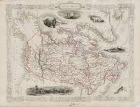
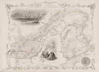
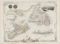
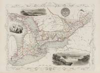
18512018AG1851. London & New York J & F. Tallis 1851. Original steel engraving / Vintage map. Drawn and engraved by John Rapkin. Partly hand-coloured. Plate Size: 33 cm x 24.6 cm. Sheet Size: 37.4 cm x 27.4 cm. Some fraying to the upper margins. Otherwise in very good condition with a small inkstain to the Montreal image. Beautifully Mounted ! John Tallis 7 November 1817 3 June 1876 was an English cartographic publisher. His company John Tallis and Company published views maps and atlases in London from roughly 1838 to 1851. Tallis set up as a publisher with Frederick Tallis in Cripplegate in 1842; the business moved to Smithfield in 1846 and was dissolved in 1849. From 1851 to 1854 Tallis operated as John Tallis and Company. He started The illustrated news of the world and national portrait gallery of eminent personages in 1858 selling it for £1370 in 1861; it folded in 1863. Wikipedia The most important project John Tallis undertook was the 'Illustrated Atlas' from 1851. The original map we offer here was part of this exceptional Atlas and all the maps it contained are still today considered as the last reminder of an era of lavish map production. Tallis worked the project together with John Rapkin 1815-1876 and it was Rapkin's style and talent that we have to thank for when we marvel at these maps today. What makes these maps so special is the detail of engraved vignettes that surround the map and often show indigenous scenes people in their environment and even more so historical buildings or historical views of towns and cities architecture and landscape. The project of 'The Illustrated Atlas' was designed to be finished just in time for the anxiously awaited "Great Exhibition of the Works of Industry of All Nations" or The Great Exhibition sometimes referred to as the Crystal Palace Exhibition in reference to the temporary structure in which it was held was an international exhibition that took place in Hyde Park London from 1 May to 11 October 1851. It was the first in a series of World's Fairs exhibitions of culture and industry that became popular in the 19th century and it was a much anticipated event. The Great Exhibition was organized by Henry Cole and Prince Albert husband of the reigning monarch Queen Victoria. It was attended by numerous notable figures of the time including Charles Darwin Samuel Colt members of the Orléanist Royal Family and the writers Charlotte Brontë Charles Dickens Lewis Carroll George Eliot and Alfred Tennyson. Music for the opening was under the direction of Sir George Thomas Smart and the continuous music from the exhibited organs for the Queen's procession was "under the superintendence of William Sterndale Bennett". Wikipedia unknown
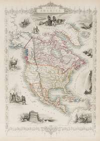
18512014AG1851. London & New York J & F. Tallis 1851. Original steel engraving / Vintage map. Drawn and engraved by John Rapkin. Partly hand-coloured. Plate Size: 33.3 cm x 25.5 cm. Sheet Size: 37.5 cm x 27.2 cm. Vintage 19th century map in very good condition. John Tallis 7 November 1817 3 June 1876 was an English cartographic publisher. His company John Tallis and Company published views maps and atlases in London from roughly 1838 to 1851. Tallis set up as a publisher with Frederick Tallis in Cripplegate in 1842; the business moved to Smithfield in 1846 and was dissolved in 1849. From 1851 to 1854 Tallis operated as John Tallis and Company. He started The illustrated news of the world and national portrait gallery of eminent personages in 1858 selling it for £1370 in 1861; it folded in 1863. Wikipedia The most important project John Tallis undertook was the 'Illustrated Atlas' from 1851. The original map we offer here was part of this exceptional Atlas and all the maps it contained are still today considered as the last reminder of an era of lavish map production. Tallis worked the project together with John Rapkin 1815-1876 and it was Rapkin's style and talent that we have to thank for when we marvel at these maps today. What makes these maps so special is the detail of engraved vignettes that surround the map and often show indigenous scenes people in their environment and even more so historical buildings or historical views of towns and cities architecture and landscape. The project of 'The Illustrated Atlas' was designed to be finished just in time for the anxiously awaited "Great Exhibition of the Works of Industry of All Nations" or The Great Exhibition sometimes referred to as the Crystal Palace Exhibition in reference to the temporary structure in which it was held was an international exhibition that took place in Hyde Park London from 1 May to 11 October 1851. It was the first in a series of World's Fairs exhibitions of culture and industry that became popular in the 19th century and it was a much anticipated event. The Great Exhibition was organized by Henry Cole and Prince Albert husband of the reigning monarch Queen Victoria. It was attended by numerous notable figures of the time including Charles Darwin Samuel Colt members of the Orléanist Royal Family and the writers Charlotte Brontë Charles Dickens Lewis Carroll George Eliot and Alfred Tennyson. Music for the opening was under the direction of Sir George Thomas Smart and the continuous music from the exhibited organs for the Queen's procession was "under the superintendence of William Sterndale Bennett". Wikipedia unknown
18512020AG1851. London & New York J & F. Tallis 1851. Original steel engraving / Vintage map. Drawn and engraved by John Rapkin. Partly hand-coloured. Plate Size: 24.2 cm x 35.4 cm. Sheet Size: 27.4 cm x 37.5 cm. Vintage 19th century map in very good condition. John Tallis 7 November 1817 3 June 1876 was an English cartographic publisher. His company John Tallis and Company published views maps and atlases in London from roughly 1838 to 1851. Tallis set up as a publisher with Frederick Tallis in Cripplegate in 1842; the business moved to Smithfield in 1846 and was dissolved in 1849. From 1851 to 1854 Tallis operated as John Tallis and Company. He started The illustrated news of the world and national portrait gallery of eminent personages in 1858 selling it for £1370 in 1861; it folded in 1863. Wikipedia The most important project John Tallis undertook was the 'Illustrated Atlas' from 1851. The original map we offer here was part of this exceptional Atlas and all the maps it contained are still today considered as the last reminder of an era of lavish map production. Tallis worked the project together with John Rapkin 1815-1876 and it was Rapkin's style and talent that we have to thank for when we marvel at these maps today. What makes these maps so special is the detail of engraved vignettes that surround the map and often show indigenous scenes people in their environment and even more so historical buildings or historical views of towns and cities architecture and landscape. The project of 'The Illustrated Atlas' was designed to be finished just in time for the anxiously awaited "Great Exhibition of the Works of Industry of All Nations" or The Great Exhibition sometimes referred to as the Crystal Palace Exhibition in reference to the temporary structure in which it was held was an international exhibition that took place in Hyde Park London from 1 May to 11 October 1851. It was the first in a series of World's Fairs exhibitions of culture and industry that became popular in the 19th century and it was a much anticipated event. The Great Exhibition was organized by Henry Cole and Prince Albert husband of the reigning monarch Queen Victoria. It was attended by numerous notable figures of the time including Charles Darwin Samuel Colt members of the Orléanist Royal Family and the writers Charlotte Brontë Charles Dickens Lewis Carroll George Eliot and Alfred Tennyson. Music for the opening was under the direction of Sir George Thomas Smart and the continuous music from the exhibited organs for the Queen's procession was "under the superintendence of William Sterndale Bennett". Wikipedia unknown
18512013AG1851. London & New York J & F. Tallis 1851. Original steel engraving / Vintage map. Drawn and engraved by John Rapkin. Partly hand-coloured. Plate Size: 25 cm x 32.5 cm. Sheet Size: 37.5 cm x 27.2 cm. Vintage 19th century map in very good condition. John Tallis 7 November 1817 3 June 1876 was an English cartographic publisher. His company John Tallis and Company published views maps and atlases in London from roughly 1838 to 1851. Tallis set up as a publisher with Frederick Tallis in Cripplegate in 1842; the business moved to Smithfield in 1846 and was dissolved in 1849. From 1851 to 1854 Tallis operated as John Tallis and Company. He started The illustrated news of the world and national portrait gallery of eminent personages in 1858 selling it for £1370 in 1861; it folded in 1863. Wikipedia The most important project John Tallis undertook was the 'Illustrated Atlas' from 1851. The original map we offer here was part of this exceptional Atlas and all the maps it contained are still today considered as the last reminder of an era of lavish map production. Tallis worked the project together with John Rapkin 1815-1876 and it was Rapkin's style and talent that we have to thank for when we marvel at these maps today. What makes these maps so special is the detail of engraved vignettes that surround the map and often show indigenous scenes people in their environment and even more so historical buildings or historical views of towns and cities architecture and landscape. The project of 'The Illustrated Atlas' was designed to be finished just in time for the anxiously awaited "Great Exhibition of the Works of Industry of All Nations" or The Great Exhibition sometimes referred to as the Crystal Palace Exhibition in reference to the temporary structure in which it was held was an international exhibition that took place in Hyde Park London from 1 May to 11 October 1851. It was the first in a series of World's Fairs exhibitions of culture and industry that became popular in the 19th century and it was a much anticipated event. The Great Exhibition was organized by Henry Cole and Prince Albert husband of the reigning monarch Queen Victoria. It was attended by numerous notable figures of the time including Charles Darwin Samuel Colt members of the Orléanist Royal Family and the writers Charlotte Brontë Charles Dickens Lewis Carroll George Eliot and Alfred Tennyson. Music for the opening was under the direction of Sir George Thomas Smart and the continuous music from the exhibited organs for the Queen's procession was "under the superintendence of William Sterndale Bennett". Wikipedia unknown
18512015AG1851. London & New York J & F. Tallis 1851. Original steel engraving / Vintage map. Drawn and engraved by John Rapkin. Partly hand-coloured. Plate Size: 32.2 cm x 25 cm. Sheet Size: 37.7 cm x 27.2 cm. Vintage 19th century map in very good condition. John Tallis 7 November 1817 3 June 1876 was an English cartographic publisher. His company John Tallis and Company published views maps and atlases in London from roughly 1838 to 1851. Tallis set up as a publisher with Frederick Tallis in Cripplegate in 1842; the business moved to Smithfield in 1846 and was dissolved in 1849. From 1851 to 1854 Tallis operated as John Tallis and Company. He started The illustrated news of the world and national portrait gallery of eminent personages in 1858 selling it for £1370 in 1861; it folded in 1863. Wikipedia The most important project John Tallis undertook was the 'Illustrated Atlas' from 1851. The original map we offer here was part of this exceptional Atlas and all the maps it contained are still today considered as the last reminder of an era of lavish map production. Tallis worked the project together with John Rapkin 1815-1876 and it was Rapkin's style and talent that we have to thank for when we marvel at these maps today. What makes these maps so special is the detail of engraved vignettes that surround the map and often show indigenous scenes people in their environment and even more so historical buildings or historical views of towns and cities architecture and landscape. The project of 'The Illustrated Atlas' was designed to be finished just in time for the anxiously awaited "Great Exhibition of the Works of Industry of All Nations" or The Great Exhibition sometimes referred to as the Crystal Palace Exhibition in reference to the temporary structure in which it was held was an international exhibition that took place in Hyde Park London from 1 May to 11 October 1851. It was the first in a series of World's Fairs exhibitions of culture and industry that became popular in the 19th century and it was a much anticipated event. The Great Exhibition was organized by Henry Cole and Prince Albert husband of the reigning monarch Queen Victoria. It was attended by numerous notable figures of the time including Charles Darwin Samuel Colt members of the Orléanist Royal Family and the writers Charlotte Brontë Charles Dickens Lewis Carroll George Eliot and Alfred Tennyson. Music for the opening was under the direction of Sir George Thomas Smart and the continuous music from the exhibited organs for the Queen's procession was "under the superintendence of William Sterndale Bennett". Wikipedia unknown
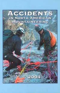
2004Q-0930410963Amer Alpine Club 2004-08-15. Paperback. New. In shrink wrap. Looks like an interesting title! Amer Alpine Club paperback
THPL-91397Paperback Advantage. NEW. US Standard Edition. We will ship same day or next day with trackable delivery method. Expedited Shipping Available. We don't entertain INTERNATIONAL orders ATM. 30-day money-back guarantee. paperback
1332534473.Gpaperback. Good. Access codes and supplements are not guaranteed with used items. May be an ex-library book. paperback