605 résultats
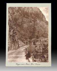
18865321n.p. 1886. Mounted Photograph. Near Fine. A gold-toned 1886 photograph credited to Edouard Deville measuring 7.75 x 5.5 inches wide and mounted onto a 9 x 6-1/8 inch thick green card captioned in black ink near lower edge "Waggon Road and Fraser River Canonsp". Deville was the Surveyor General of Canada from 1885 to 1924 and was responsible for introducing new techniques such as photogrammetry to Canadian surveying. The BC Archives hold of copy of this 1886 photo which they also credit to Deville see 198604-011. Verso with a badly damaged 6 x 8 inch wide photo captioned "Hog's Back Falls Ottawa". The Hog's Back Falls officially known as the Prince of Wales Falls is rarely referred to by this name today. Deville photo with minor stains and rubs. An intriguing photo from a seminal moment of the "connecting" of a new nation fastening together here in a single photo-narrative the latest technological advances of the country's road builders tunnel and bridge makers telegraph operators and the Canadian Pacific Railway. unknown
18846549Paris Plon-Nourrit et Cie 1884 In-12 314 pp, frontispice, 8 gravures hors-texte, une carte dépliante in-fine. Dos orné de filets dorés. Coupes, coins et plats frottés, fines épidermures sur coiffes, manque de papier sur 1er plat. Rousseurs
1872WRCAM39322Montreal: Dawson Brothers 1872. Colored folding map 33 x 22 1/2 inches. Folded into original pebbled cloth. Front board detached. Bisected and mounted on linen as issued. Old bookplate and withdrawal stamp on front pastedown short closed tear along linen fold of upper outer section not affecting map itself. A handsome detailed folding map showing southeast Canadian territory including Cape Breton the Province of Quebec and provides detailed illustration of the northeast United States spanning from eastern Michigan all the way to New York Harbor. With two small insets of Newfoundland and the environs of Montreal and one larger inset extending to British Columbia and Manitoba. Also illustrates railway routings completed and those under construction and denotes "Free Grant Lands" with color illustration. An interesting late 19th-century map of Canada published only one year after western British Columbia joined the Canadian Confederation to help form the Canadian Pacific Railway. Dawson Brothers hardcover books
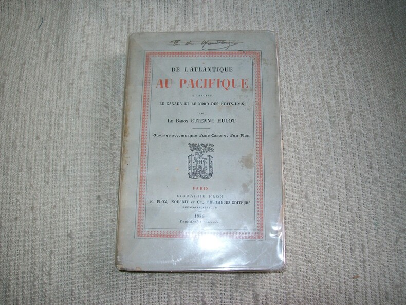
1888GITa8Paris Plon 1888. In-18 broché 339pp. Orné d'un croquis replié et 1 carte dépliante. Petite tache et petit manque en bordure du 1er plat de couverture.
1895se79Delhomme et Briguet Relié 1895 In-8 (17,8 x 26,3 cm), reliure demi-toile, plats d'origine contrecollés aux plats, 240 pages ; quelques traces à la coiffe supérieure, quelques traces, rousseurs et déchirures sur les plats d'origine contrecollés, des rousseurs à l'intérieur bruni, par ailleurs assez bon état général. Livraison a domicile (La Poste) ou en Mondial Relay sur simple demande.
188714151Paris A. Dupret 1887 in-12 toile noire de l'époque, défraîchie
1869088165Montreal; n/a; Paris; Montreal; Montreal; New York: Eusebe Senecal; Canadian Naturalist; Librairie catholique de Périsse frères; John Lovell; Presses a vapeur de La Minerve; Christern 1869. Leather Bound. pp. 24; 31; 192; 110; 80; 64. 8vo. 3/4 tan leather over marbled boards. Gilt lettering to spine reads "Mélange Historique". Light edgewear ink title list to front free endpaper two library rubber stamps. Contents unmarked binding sound. Eusebe Senecal; Canadian Naturalist; Librairie catholique de Périsse frères; John Lovell; Presses a vapeur de La Minerve; Chri unknown
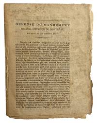
183743482Np: Np 1837. Rare. 12mo 17x 13cm uncut 8p. an original document self wraps foxed Gagnon I 1085. T.P.L. 2054. Ducharme Catalogue No. 1 of the Victor Morin collection no. 895<br /> issued April 1950 calls it très rare and prices it at $7.00. - The pamphlet is a defense of Bishop Lartigue's pastoral letter of October 24 1837 denouncing the actions of the Patriote leaders. Np unknown
1886091031Ottawa: Department of Militia and Defence of the Dominion of Canada 1886. Hardcover. pp. xii 384. 8vo. Burgundy library-style binding with original wraps laid-in. Plates all present as called-for with some showing splits at folds and some chipping at edges. Ex-library with call number to spine and pocket remains to front endpaper. Edges scuffed contents brittle with some pages laid-in loose and chipped at edges. Scarce. Only two libraries in Canada hold a copy of this title. Peel 1396. OCLC 825062083. Contains General Middleton's report and that of the War Claims Commission and Map of Part of the Dominion of Canada Illustrating the Use of the Canadian Pacific Railway in the Movement of Troops to Quell the North-West Troubles in 1885 laid-in loose showing chips and tears. Department of Militia and Defence of the Dominion of Canada hardcover
1858087745Quebec: Presses à vapeur de J. T. Brousseau 1858. Hardcover. pp. 252. 12mo. Pebbled black cloth binding with gilt lettering to spine. Edgewear spotting to top page edge a few ownership rubber stamps to pages. Binding sound contents generally unmarked. Presses à vapeur de J. T. Brousseau hardcover
189927283Ottawa: issued by authority of Hon. Clifford Sifton 1899. Only edition English issue there was also an issue in Swedish; folio pp. 10; includes 5 color maps partly double-p.; original printed wrappers; inside wrappers with information on the trade centers of Canada population and agricultural statistics; some spotting and staining of the wrappers but generally very good. <br/><br/> issued by authority of Hon. Clifford Sifton unknown books
190017520s. l., Imprimé sous la directions des Commissaires Canadiens de l'Exposition, 1900. 8°. Avec des illustrations n/b et deux plans pliants en couleurs. 28 (1) p., 54 (2) p., demi-reliure de toile illustrée. With b/w illustrations and two coloured fold-out maps, illustrated half-cloth binding. Quelques cachets d'une bibliothèque sur la page de titre, un autre sur le deuxième plan pliant. Les plans pliants sont un peu écornés. Several stamps of a library on the title page, another one on the second map. The maps are a bit dog-eared.
18895370Québec: Darveau 1889. Title con'td. And the uses to which it may be applied in abridging telegraphic and other correspondence. Introduction: Française: XXVII. English: XXVIIerrata346pp.302pp.285pp.foldout chart. Very unusal attempt at creating a Universal language with numbers. Wraps torn & tattered text not affected. Prev. owners bookplate stamp on french title page. First Edition. Wraps. Fair. 7 X 6. Darveau Hardcover
189937817ABBerlin, Mittler & Sohn 1899. 8°. XIV, 407 S. HLwd der Zt mit Rückentitel in Gold. Zart gebräunt; wenige Ecken mit geringfügiger Knickspur; Exlibris. (=Die Europäischen Kolonien. Dritter Band).
1881B7060Toronto: Dudley & Burns. 1881. A very good example. Interior clean and crisp. Extremities lightly rubbed. Lower hinge split. Binding: Full blind-stamped brown cloth boards diced. Spine lettered in gilt. Yellow pasted and free endpapers. Notes: Small 8vo. 190 x 130 mm. Size: Small 8vo. Pages: 128 pp. Category: Book Canada; Dudley & Burns. hardcover
188612941Montréal Imprimerie générale 1886 In-8, 39p. Couverture imprimée.
1886088054Quebec 1886. Stapled Wraps. pp. 54. 8vo. Sewn wraps. Engraved portraits on last two pages of Faisan Rouge and Gros Ours. Edges a bit tattered age-toned and a bit brittle but complete and internally unmarked. Peel 1550. Transcript. With the signature of Quebec politician Louis-Joseph Riopel above the title.: "L. Riopel M.P. unknown
18560006091London: Longman Brown Green Longmans & Roberts 1856. First edition. Hardcover. Very Good. Commander S. Gurney Cresswell R. N. with four lithographs and a folding map . Octavo xix 405 ii 24pp. in blue embossed publisher's cloth leaf 13/14 has a repaired horizontal tear lacks preliminaries; rebacked in new quarler leather new endpapers and paper label. <br/><br/>On this voyage in the "Investigator" the found the westward entrance to the desired Northwest Passage in the Prince of Wales Strait traveling in a route which is detailed in color on the folding map here. Due to unthawed pack ice -through several summers - they had to abandon the "Investigator" to her fate in the ice. M'Clure's name appears on at least eight geographical sites around Alaska and the Northwest Territory. Note: co-author Osborn also became an Admiral. Illustrated by Commander S. Gurney Cresswell R. N. with four lithographs and a folding map. Longman, Brown, Green, Longmans, & Roberts hardcover
1888086950Québec: L. J. Demers & Frère 1888. Hardcover. pp. 619. 8vo. 1/4 leather over pebbled cloth with raised bands and gilt lettering to spine. Speckled page edges. Light shelfwear rubbing to spine; library rubber stamps to front free endpapers and title pages no other lib. marks light foxing; very good. Text in French. L. J. Demers & Frère hardcover
187054639ABParis; Bruxelle, Regis Ruffet et Cie / Librairie Perisse Freres de Paris, 1870. 8° (18x11), xix, 364 p., avec frontispice, reliure d'editeuer pleine toile, richement ornee, tranches dorees, papier avec des rousseurs, bonne et solide,
1836elala1147<p>Toronto: R.Reynolds Printer 1836. 1836. 8vo. pp. 256 4. original cloth-backed bds. short split in upper front joint covers spotted some scattered light foxing. A scarce and important report. Charles Duncombe a prominent American-born physician and politician in Upper Canada was appointed in 1835 to visit and report upon the systems of education pursued in the United States and to offer recommendations for the educational institutions of Upper Canada. His report pp. 68 in which he stresses the need for practical education and adequate financial support for common schools and teacher education is followed by a lengthy appendix of supporting documentation pp. 69-256. Although Duncombe's proposals were not immediately implemented many would be introduced under the administration of Egerton Ryerson and would form the basis of Ontario educational policy until 1871 i.e. local assessment elective school boards female education the creation of normal schools non-sectarian religious instruction &c. Fleming 1059. Gagnon I 1201. Sabin 21268. TPL 2011. DCB IX pp. 228-32. Hardcover.</p> Toronto: R.Reynolds, Printer, 1836. hardcover
18710103624Toronto: Hunter Rose & Company 1871. First edition. Hardcover. pp. 381 ads. 8vo. Bound in orange cloth with gilt and black lettering and decoration to spine and front board. Frontispiece. Rebacked spine and newer endpapers. Edgewear some soiling and spotting. "Novel describing the experiences of a family from Ontario who immigrated to the Red River Settlement. The book was obviously written to attract immigrants. An appendix informs the prospective immigrant about routes to Red River." -Peel 614. Hunter, Rose & Company hardcover
18841125558145Saint John N.B.: T. O'Brien 1884. Book. Near Fine. Hardcover. 1st Edition. 12mo - over 6¾ - 7¾" tall. redgilt decorated cloth 98 pages .beveled edges light scattered foxing light wear at corners Mrs. Jean E.U. Nealis born Fredericton N.B. Sept 25 1842. married Hugh Nealis in 1864. The preface was written by Irish-American immigrant Mary Anne Madden Sadlier born CootehillCo. Cavan 1820 She was an editor publisher businesswoman and prolific writer and translator- authoring sixty volumes of novels short stories plays children's texts and translations of French romances and religious works.The only daughter of a successful English engineer and cartographer Jane Elizabeth Ursula Wilkinson 1842-1910 enjoyed a quiet childhood in Fredericton where her mother of United Empire Loyalist stock was noted for her wild flower illustrations. Musically talented she became organist at Christ Church Cathedral in Fredericton.Anthologized in: Lockhart THE HARP OF ACADIA 1923; Maxwell THE RIVER ST. JOHN AND ITS POETS 1947. T. O'Brien Hardcover
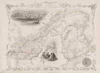
18512014AG1851. London & New York J & F. Tallis 1851. Original steel engraving / Vintage map. Drawn and engraved by John Rapkin. Partly hand-coloured. Plate Size: 33.3 cm x 25.5 cm. Sheet Size: 37.5 cm x 27.2 cm. Vintage 19th century map in very good condition. John Tallis 7 November 1817 3 June 1876 was an English cartographic publisher. His company John Tallis and Company published views maps and atlases in London from roughly 1838 to 1851. Tallis set up as a publisher with Frederick Tallis in Cripplegate in 1842; the business moved to Smithfield in 1846 and was dissolved in 1849. From 1851 to 1854 Tallis operated as John Tallis and Company. He started The illustrated news of the world and national portrait gallery of eminent personages in 1858 selling it for £1370 in 1861; it folded in 1863. Wikipedia The most important project John Tallis undertook was the 'Illustrated Atlas' from 1851. The original map we offer here was part of this exceptional Atlas and all the maps it contained are still today considered as the last reminder of an era of lavish map production. Tallis worked the project together with John Rapkin 1815-1876 and it was Rapkin's style and talent that we have to thank for when we marvel at these maps today. What makes these maps so special is the detail of engraved vignettes that surround the map and often show indigenous scenes people in their environment and even more so historical buildings or historical views of towns and cities architecture and landscape. The project of 'The Illustrated Atlas' was designed to be finished just in time for the anxiously awaited "Great Exhibition of the Works of Industry of All Nations" or The Great Exhibition sometimes referred to as the Crystal Palace Exhibition in reference to the temporary structure in which it was held was an international exhibition that took place in Hyde Park London from 1 May to 11 October 1851. It was the first in a series of World's Fairs exhibitions of culture and industry that became popular in the 19th century and it was a much anticipated event. The Great Exhibition was organized by Henry Cole and Prince Albert husband of the reigning monarch Queen Victoria. It was attended by numerous notable figures of the time including Charles Darwin Samuel Colt members of the Orléanist Royal Family and the writers Charlotte Brontë Charles Dickens Lewis Carroll George Eliot and Alfred Tennyson. Music for the opening was under the direction of Sir George Thomas Smart and the continuous music from the exhibited organs for the Queen's procession was "under the superintendence of William Sterndale Bennett". Wikipedia unknown
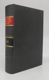
1891122356Toronto: The Law Society of Upper Canada 1891 1901. Hardcover. Very good. 2 vols. in one: x 2 630; vii 181 p. 23 cm. Bound in black cloth with red spine label. Bookplate residue on front pastedown. <br/><br/>Second title page reads: "Election Cases. Reports of Decisions under the Dominion and Ontario Election Acts and the Ontario Voters' Lists Act." The Law Society of Upper Canada hardcover