(Alaska)Biblio.com
172 résultats
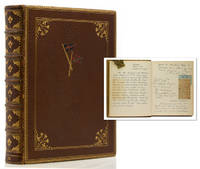
1934320413Aboard the Hussar Washington Alaska etc. 1934. 97 pp. profusely illustrated with dozens of snapshots newspaper clippings and a map of coastal Alaska. 1 vols. 4to. Full light brown morocco gilt upper board with yachting pennant of the Yacht Hussar onlays in red blue and gold within gilt fillet border with floral corner ornaments board edges and dentelles gilt a.e.g. by James MacDonald Co. A few scuffmarks at extremities else fine. 97 pp. profusely illustrated with dozens of snapshots newspaper clippings and a map of coastal Alaska. 1 vols. 4to. Manuscript diary in a secretarial hand or perhaps by Hutton's wife Marjorie Merriwether Post but signed by each of the member of the travelling party of a 1934 cruise of Edward F. Hutton's 320-foot yacht Hussar along Alaskan coastal waters to hunt bear largely around the islands near Juneau. The party included Hutton his wife and daughter movie producer Hal Roach and wife Marguerite Ernest H. Rice and wife Miriam 'war ace' Dave McCullough and others. Roach had lived in Valdez and Fairbanks for 2 years early in his career. <br /> <br /> In all besides good eating and drinking deck games and other fun on board the group saw 76 black bear and 59 brown bear on the excursion even bringing a cub on board. The trip was cut short however when McCullough was seriously wounded by one of the guides in a shooting accident. unknown
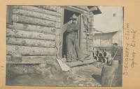
1901List2108Alaska 1901. Oblong folio 12 ½ x 9 inches. Twelve leaves with 89 photographs rebound in modern cloth. Binding in fine condition photographs generally excellent some leaves with clear tape repairs. A well preserved album of photographs showing mining operations in the Golovin Bay region about fifty to seventy-five miles northwest of Nome during the tail end of the Klondike Gold Rush period in 1900-1901. The album shows the operations of the Pioneer Company in Alaska in great detail including the travel by boat and the camps along Opher Creek as well as many photographs of the mining operation itself. According to a caption in one of the photographs $12000 worth of gold was taken out of the “Discovery Claim†on Ophir Creek. The album also includes several photographs of the indigenous population. The compiler of the book appears to have been a student at a mining college at some point as some of the photographs show a “Class of ‘04’†sign. The photographs are dated from 1897 to 1901. Interior scenes and a particularly broad portrayal of mining life and operations make this an uncommonly informative photographic document of Alaskan mining operations during this period. <br /> <br /> Lowny J.D. The Golovin Bay Region of Northwestern Alaska. In: The Engineering and Mining Journal Vol. 71 pp. 781-782. June 15 1901. Accessed online 6/23. unknown
19053538Copper River Valley Ak 1905. Very good. Forty-five printing-out paper photographs between 3.25 x 3.25 and 4 x 6 inches plus three real photo postcards. Minor wear a few creases occasional light soiling. A unique collection of almost fifty images capturing scenes in and around Copper Center in the Copper River Valley of Alaska in the years after gold was first found there in 1898. The images document pioneers panning for gold running dog sled teams posed in front of early wooden buildings in a bleak snow-covered landscape and more as well as capturing shots of a riverside mill a wooden bridge scenery on the Copper River and the majesty of the surrounding forests. A handful of the images capture pioneer women and children posed for the camera in winter clothing worn to combat the bitter Alaskan winters. One image pictures three men and two dogs standing outside the Hotel Holman an early Copper Center roadhouse that began in a tent but was opened in a wooden structure in 1899; the present image captures the post-1899 wooden structure. The Holman Hotel was established in July 1898 by Copper Center's first resident Andrew Holman in order to provide shelter for prospectors on their way to the Klondike gold fields. Copper Center is located northeast of Anchorage and served as a brief but important way station for gold prospectors in southeastern Alaska; one image here apparently pictures the early riverside settlement or is perhaps an early view of Anchorage. A rare view of Alaskan life in an uncommonly-seen settlement during the first decade of the 20th century. unknown
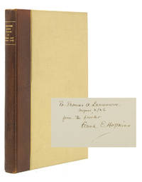
1924313772Flushing Long Island: Marion Press 1924. Copy #X of 50 copies. Printed at the Marion Press. Inscribed on the colophon page to Thomas A. Larremore April 2/26 from the printer Frank E. Hopkins. Larremore was the bibliographer of the Marion Press. Illustrated with folding map folding view numerous photographic plates and inserted sketch maps. Pp. 103 1 colophon. 1 vols. 8vo. Original quarter brown morocco and cloth titled in gilt. Stamp of Robert Pierce on the front pastedown. Copy #X of 50 copies. Printed at the Marion Press. Inscribed on the colophon page to Thomas A. Larremore April 2/26 from the printer Frank E. Hopkins. Larremore was the bibliographer of the Marion Press. Illustrated with folding map folding view numerous photographic plates and inserted sketch maps. Pp. 103 1 colophon. 1 vols. 8vo. "A very interesting journal with sketch maps and drawings and photographs. Touches much country not before described and goats are discovered near Frances Lake ." - Phillips<br /> <br /> Streeter: Hunter's narration of his journey "to the Yukon in quest of Frances Lake" is taken from his diary. "Many things that I wrote in the field last summer read queerly today but that may be accounted for by the fact that here on Long Island I am neither tired hungry nor wet. These three things strangely influence the amateur explorer."<br /> <br /> The author thanks Charles Sheldon of Washington D.C. in the Apologia for giving him the idea to search for sheep at Frances Lake. Hunter retraced some of the 1887 explorations of George M.Dawson published in The Yukon Territory 1898 which collected acounts by Dall Dawson and Ogilvie. Streeter 3627; Phillips p. 190. Larremore The Marion Press no. 183 & pp. 150 & 160; Not in Heller [Marion Press] unknown
1932177173Alaska: 1932-3. The first Hollywood film to be shot in a Native American language A collection of behind-the-scenes photographs documenting the production of Eskimo 1933. With a mostly Native American cast it was the first feature film shot entirely on location in Alaska and the first to incorporate the Iñupiat language. Produced over a 17-month period it captured scenes of hunting and daily life with documentary realism. The photographs include images of the cast and crew among them the Iñupiaq lead Ray Mala Lotus Long Peter Freuchen and director W. S. Van Dyke as well as indigenous actors in traditional parkas and mukluks. Also shown are scenes of walrus and moose hunts extras posed in igloos animal processing and film equipment in use. Mala accompanied the Danish Arctic explorer Knud Rasmussen on an expedition from 1921 to 1924 collecting and describing Inuit songs and legends. The following year Mala commenced his career in Hollywood where he worked for almost 30 years. Eskimo later re-released as Mala the Magnificent was directed by Van Dyke and adapted from Freuchen's writings. Depicting encounters between Inuit communities and Western traders the film was not a commercial success. Still it was praised for its realism and awarded the inaugural Academy Award for Best Film Editing. Van Dyke known as "One Take Woody" for his efficient work made several other early sound films including Tarzan the Ape Man 1932 The Thin Man 1934 and San Francisco 1936. 48 silver gelatin prints from 64 x 88 to 87 x 105 mm. portrait and landscape format some stamped "Velox" on the verso others with pencilled numbers. A small number are copy prints. Some a little yellowed or with silver mirroring a few minor surface abrasions: a very good collection. Frank Javier Garcia Berumen American Indian Image Makers of Hollywood 2020; R. Bruce Macdonald Sisters of the Ice 2021. unknown
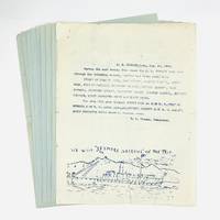
1908770201908. Significant collection of bulletins clarifying the route of the S.S. Spokane in the summer of 1908. Each is naively illustrated with views from the ship - Sitka Seymour Narrows Taku Glacier Patterson Glacier and Devil's Thumb - as well as Alaska Natives and even baseball.<br /> <br /> An elegant passenger liner the S.S. Spokane was constructed by the Pacific Coast Steamship Company. The vessel was launch in San Francisco in 1901 and made her first voyage to Seattle in 1902. A year later she had the distinction of transporting President Theodore Roosevelt and his party to Seattle. The Spokane was able to carry nearly 300 passengers at a time including 171 in first class.<br /> <br /> From these broadsides we learn the S.S. Spokane sailed from the Strait of Juan de Fuca and on to Kasaan Discovery Passage Queen Charlotte Sound and Juneau in August 1908. Three years later the ship was wrecked on an uncharted rock in Seymour Narrows with the loss of two lives. The Spokane was later raised and repaired returning to service in early 1912.<br /> <br /> Nine broadsides 8 1/2" x 11" or 280 x 215 mm printed on the recto only of the blue or white paper. Old folds with evidence of stapling to the upper left corner and some minor edgewear. unknown
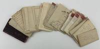
19104010Various locations including Sprague Wa.; Vancouver British Columbia; and Nome Ak 1910. Very good. Thirteen autograph letters signed totaling thirty-nine pages and a few original transmittal envelopes. Original mailing folds occasional short fold separations otherwise minor wear. Overall a well-preserved group stored in an antique wooden box from the St. Paul Rubber Company. An interesting collection of manuscript letters written to Fred Lindberg of Hallock Minnesota by his brother and other individuals participating in the Alaskan and Yukon gold rushes between 1897 and 1910. The preponderance of the correspondence relates to the ill-fated experiences of Fred's brother Albert William Lindberg who writes four letters while on his way to the Alaskan gold fields before apparently committing suicide in Nome in 1909. Albert William "Willie" Lindberg was a Swedish-American gold prospector from Minnesota who spent significant time in Washington State before trying his luck albeit unsuccessfully in Alaska.<br /> <br /> The four letters from Willie begin with his February 20 1897 letter to his brother Fred in Hallock Minnesota. With unbridled enthusiasm Willie writes from Sprague Washington that he has "heard so much about Alaska that I made up my mind to go." Willie encourages Fred to join him to work in the mines where he expects to "pick gold nuggets." Willie informs Fred that he has sold his horses and saddle and has collected about $400 with which he intends to "make a raise or go broke" in Alaska. He extolls Fred to raise his own money and come to Alaska where he intends to "make a fortchen sic fortune." Willie concludes: "And when we get there you will see one of the luckiest Swedes that ever struck Alaska." Lindberg next writes from Vancouver on March 20 1898 again to his brother Fred informing him that he is on the way to Alaska. He promises to "stake out a clame" for Fred once he gets there though he now believes that going to Alaska might be "a foolish trip." Still he intends to stay "as long as I can" in the Alaskan gold fields in the company of "an old miner he has mined for the last 35 years."<br /> <br /> Willie writes another letter on March 20 after he arrives in Juneau which he describes as "quite a town and everything is just as cheap here as in Seattle or Vancouver and food and lodging is $1.00 a day." Here Willie informs Fred that he intends to go further north to Dyea north of Skagway because "I want to go where the big strikes is made." Willie's last letter emanates from Seattle where he has apparently returned perhaps for the winter from the previous year but now informs Fred that he intends to start on his "wild goose chase again." Instead of "Cape Nome" Willie intends to go to Skagway then "down the Youkon River it is mining camps all along the Youkon River and I think it will be better up there than down at Cape Nome it is bound to be over down at Cape Nome this summer when all these people get there."<br /> <br /> Willie's letters are accompanied by a pocket-sized notebook in which he recorded a small amount of financial information for the Nome Bank in 1908-09 as well as listings of food and other goods he purchases there and a five-page diary-style entry dated February 15 1907. In the latter Willie writes introspectively about his state of mind and habits at one point noting that "at times you are liable to become blue and depressed really there is no cause to be that way." <br /> <br /> Lindberg's single diary entry in the notebook is especially intriguing considering he apparently committed suicide in Nome in 1909 according to five letters present here dated in the summer and fall of 1909. This includes two letters sent from Wentworth Brothers the undertakers in charge of Willie's remains. The first of these letters dated May 24 1909 begins: "On May 11th 1909 Mr. Lindberg W. was found in cabin on Belmount Point dead. Cause gun shot wound and the Coroners Jury brought in verdict of suicide. Two of his friends Mr. Godfry Johnson and John Olson furnished the funeral arrangements - as he was without money." In each of the two letters the undertakers ask that Fred Lindberg respond to them whether he wishes Willie to be buried in Alaska or have the body shipped to Minnesota. The other three letters were written from two of the men who found Willie's body; the authors were responding to Fred Lindberg's wife who sent letters to Nome inquiring about Willie's death. Two of the letters were written by Phillip Corrigan of the Nome Mine Workers Union in August and the third by Gotfred Johnson in September. Corrigan details finding the body wondering if "may be he was fooling with the gun and accidentally shot himself." He then writes that he has known of Willie prospecting in the area since 1907 but that he "did not find pay at any time" and had no money at the time of his death" though "he may have some claims here."<br /> <br /> In the next letter Corrigan details both a quartz and placer claim in which Willie had an interest then provides further detail on the claims and what must be done to maintain them. Johnson writes a highly-detailed five-page letter conveying his background and experiences with Willie providing important biographical material and informing Fred that Willie seemed in "good spirits" when he last saw him "3 or 4 days" before his suicide. Another letter from Nome in August 1909 is present here written on the same Nome Mine Workers Union stationery as Corrigan's letters by Carl de la Motte; the two-page letter seems to relate information on Willie but is written in Swedish.<br /> <br /> The present archive also includes four letters written to Fred Lindberg from his friend Edward A. Johnson in Circle City Alaska. Written between July 5 1905 and June 10 1906 Johnson's letters indicate he was tasked by Fred to find his brother Willie. In his first letter Johnson writes from Mastodon Creek that he has been unable to find anything "about Will." In his subsequent three letters Johnson details his search for Willie often mentioning that he expects to locate him in Fairbanks or Nome but never does. In the process Johnson relates other interesting details about Alaska and his experiences there including a report on weather patterns as they relate to the seasonal nature of the mining industry informative descriptions of the Alaskan country he visits in "the Tanana districts at Fairbanks" his decision to acquire claims near Mastodon Creek and the unreliable nature of the Alaskan postal schedule. The archive also includes several unrelated Lindberg family letters mostly written to Willard Lindberg of Hamline University in St. Paul Minnesota in the mid-1920s but these are not included in the letter and page counts above.<br /> <br /> An unusual collection of manuscript letters of particular interest to the study of suicide in American history documenting both the optimism of a young Minnesota man on his way to find fortune in the Alaskan gold fields and his tragic end by his own hand in Nome a little over a decade later. unknown
194463533Hutchinson KS & Kodiak Alaska Territory: Carrie B. Mitchell Woman’s American Baptist Home Mission Society Alaska Steamship Co. 1944-1969. Oblong folio. 11.5 x 17 in. 36 pp unpaginated. on brown sack paper. With over 100 pieces of ephemera neatly affixed with tape including 6 silver gelatin photographs & RPPC’s clippings numerous ALS & TLS on letterhead some preserved in the original envelopes postcards missals programmes and more. Wooden spruce plywood post-binder sewn at gutter margin w/ cord decoupaged front cover w/ pictograms and “Story of Alaska†w/ totem pole motifs leather strap hinges held by brass brads some scuffing edgewear occasional toning scuffing to a few pieces still a VG exemplar. This intriguing scrapbook carefully documents the aspiration of Carrie Mitchell 1890-1979 to travel as a missionary to Kodiak Alaska Territory during World War II where she served as housemother to McWhinnie cottage at the Kodiak Baptist Mission School & Orphanage from 1944-1946. In classical Alutiiq Athabascan and Inupiaq societies orphans were typically adopted into wealthy Indigenous Peoples families as laborers working in return for food clothing and shelter. Often mistreated this would occasionally result in violent revenge against the tribes by the orphans. After 1893 the Kodiak Baptist Mission established their school and cottage system to educate clothe and prepare the orphans or abandoned Alutiiq children for society. Unfortunately the Baptist Mission forbade the Indigenous Peoples spiritual rituals or Russian Orthodoxy -- the predominant religious beliefs of the Kodiak area peoples and forced them to convert to Baptist beliefs. In some cases the children were forcibly removed against the will of their parents and were not orphans to receive vocational instruction and religious training at the Mission. Jan. 25 1944 Alice Crimson Executive Secretary to the W.A.B.H.M.S. wrote to Carrie how she and her staff were wondering if she would be interested “in going to Alaska as Assistant to the missionary in one of our children’s homes. It is not a managing position. It is a position of helping to make a home by assuming a share of the cooking cleaning even the washing as well as the mending of clothes. . . .†Several letters included here pass back and forth discussing Carrie’s interview her need to stay available and not travel to Texas to visit her daughter application for applying for a pass with the Headquarters Alaskan Dept. Base Echelon including fingerprint card and travel instructions. Due to wartime shortages after approval Carrie Mitchell’s travel was delayed after April 1944 because sailing times to Kodiak were curtailed but she would finally reach Kodiak AK in mid-May 1944. The grueling position had been opened because Cecile Tucker who had been housemother to McWhinnie beginning in June 1941 had decided to leave. M. Tucker regularly took care of 12-17 Alutiiq children and before being assigned to Alaska had spent 17 years working the the Mono Indigenous Peoples in the Auberry CA Baptist Mission School. Two original letters from one of Carrie Mitchell’s Indigenous charges George Yosheda 1928-2003 at McWhinnie House writes to her after leaving McWhinnie to attend school in Wrangell AK and she notes on the outside of the envelope that he was “a little homesick I think.†In his second letter from 1945 he writes about how he “can play basketball. . . if I don’t have anything to do I usually go for a walk or play the guitar.†She writes on an ALS from Enid Myers that Enid “gave up the work in Sept. 1944. That left me alone with a houseful of children until the Chandlers came. The other staff members helped me as much as they could.†By March 1946 the workload had worn her down and she wanted to retire from the position. Alice crimson writes her again that “I am very happy that you are staying in Alaska until I can find someone who will go in your place. I realize that it is difficult work physically and I think you would be wise to come out when we can replace you.†Thank you cards notices theatre programmes and several clippings concerning the 1964 Earthquake and Tsunami which struck Alaska appear within the scrapbook. See: Timothy Smith The Evangel Returns to Kodiak for the First 4th of July since Statehood July 1959 Tanignak 2020. Orphan -- Liliya’aq Alutiiq Museum Archaeological Repository 2025. Carrie B. Mitchell, Woman’s American Baptist Home Mission Society, Alaska Steamship Co., hardcover
190170819New York:: Doubleday Page & Company 1901. First edition. publisher's gilt green ribbed cloth t.e.g. in publisher's flexible cloth gilt-lettered wrappers. Engraved bookplates on each pastedown; a beautiful set. 4to. Illustrated throughout from photographs and engravings. Doubleday, Page & Company, hardcover
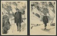
1917List3507Alaska 1917. Photo album measuring 7 ¼ x 11 ½ inches containing 187 photos 2 unaffixed and five loose real photo postcards with a contemporaneous newspaper clipping. Photos approximately 3 x 4 inches with generally excellent contrast and in Near Fine condition. Overall excellent to Near Fine. A photo album belonging to brothers Ruben 1892–1984 and Daniel 1895–1969 Diener documenting their 1916–1917 journey to the Territory of Alaska. The newspaper clipping reproduces a letter from Dan Diener describing their time there:<br /> <br /> “I went with an old prospector to try and locate a lost mine. We found it but there was not enough gold to pay for mining it so in that respect our trip was a failure. . I lived in a tent with a small sheet iron stove during all this time and strange as it seems it was fairly comfortable. . One day I walked or snowshoed 30 miles for my mail when the thermometer was 58 below. . But the hardships were sweetened at times with the most beautiful scenery man can imagine.†March 1917<br /> <br /> The Dieners’ trip took them to Alaska’s southern coast to Ketchikan Cordova Valdez and Seward. There are some identifiable ships including the Admiral Farragut the Mariposa shortly before its sinking and the wreck of the James Drummond in British Columbia.<br /> <br /> Subjects include Chief Johnson’s totem pole in Ketchikan erected in 1902 in honor of Chief Gut Wain George Johnson; d. 1938 of the Gaanaxadi clan of the Tongass tribe—a real photo postcard from Kasaan shows many brightly colored totem poles along the shore with dilapidated wooden houses behind them—boats filled with fish outside the Carlisle Packing Company in Cordova and a real photo postcard of a man and dog captioned “READY FOR THE SUMMER TRAIL / SEWARD ALASKA†on the back of which Ruben Dieners has written:<br /> <br /> “Oct 9 1916. Here you are. This is Judge Hildreth of whom we have written you. Our best friend here and hereafter. We are going prospecting with him next spring. The dog in the picture carry’s fifty pounds. Brother Ruben.â€<br /> <br /> H.H. Hildreth was a district court commissioner in Seward editor of the Alaskan newspaper in Sitka and The Alaska Prospector in Valdez and secretary of the Matanuska Mining Company. <br /> <br /> The shots of towns show the development of the region: in some an area of forest has been recently cleared and stumps of trees might surround a few small wooden houses or platforms where houses are to be erected; while others show towns with telegraph lines graded dirt roads with sidewalks dense housing and railroad and tram lines. Two shots from Seward show the paved sidewalk of its main street with a hotel and bars and a dog team waiting outside the hardware store. As Dieners wrote they lived in a tent and several photos show the outside of the quarters: two semi-permanent canvas tents next to a wide wooden walkway. Others show men presumably the brothers snowshoeing hiking and riding in a canoe; and of course many are scenery shots of forests waterfalls and snowcapped mountains.<br /> <br /> Of interest to historians of post-gold rush Alaska. unknown
19145195Various locations mostly in Canada and Alaska 1914. Very good plus. 36 leaves illustrated with 147 vernacular photographs and real photo postcards almost all with manuscript captions written in white pencil. Oblong quarto. Contemporary black textured cloth with "Photographs" in gilt on front cover and with handwritten caption in white pencil reading "1914 July 16 August 31." Minor wear to covers. Contents clean with easily-readable captions. A well-annotated vernacular photograph album assembled by F.A. Patterson of Arlington Heights Massachusetts documenting his or her travels through western Canada and Alaska just prior to World War I. The album opens with a small printed map of North America with the route Patterson took from "Boston to Alaska" between July 16 and August 31 1914. The photographs begin with thirteen leaves featuring scenes in Ontario and Alberta including scenes of Lake Huron St. Mary's River Sault Ste. Marie Winnipeg "Ontario farms" Banff the town wildlife mountain scenes and more Lake Minnewanka Lake Louise Laggan Valley of the Ten Peaks Morain Lake and more. The album then moves westward to British Columbia and other points then northwestward to Alaska for most of the remainder of the album. The westward photos open with scenes of the Illecillewaet Glacier Meeting of the Waters Trail Glacier and other locations in British Columbia. Scenes in Victoria picture various gardens Parliament Hotel Empress Chinese Bell and more. The scenes in Alaska begin with views of Taku Glacier and other scenes in and around Juneau. Other Alaskan images feature Lake Bennett several scenes in White Pass a view toward Skagway abandoned buildings Pitchfork Falls Sitka the harbor a "Russian Greek Church" a view of the town "Old Russian Black House" several totem poles including a "Totem Pole Patch" two angles of an "Old Russian Trading Post" and more. A particularly interesting pair of images of two buildings pictures what is left of Bennett Alaska which is captioned: "Formerly 5000 population. Now 4 houses. One occupied. August 5th 1914." The final few pages of Alaskan images features an Indian Village in Killisnoo and another in Hunter Bay as well as a close-up view of a group of indigenous peoples in Hunter Bay. The last five leaves capture scenes in Salt Lake City Utah and Colorado mostly Pike's Peak and Royal Gorge. unknown
19412368Various locations in south-central Alaska 1941. Very good plus. Eighteen photographs each 6 x 8 inches most signed and titled in manuscript by the photographer. Minor wear. A collection of eighteen beautiful photographs taken by noted Alaskan photographer Maurice L. Sharp featuring various subjects and scenes around south-central Alaska in the late-1930s. The photographs were published in various issues of the Alaska Sportsman between 1938 and 1941. Most of the images are signed and titled by Sharp in the bottom margins or on the verso. The photographs feature subjects and scenes such as "Yukon Boys - Alaska" "Mt. McKinley from Wonder Lake" three images "Harbor Anchorage" "Colonist's Home Alaska" two images "Pioneer's Cabin" "Palmer Alaska" "Gulls" "Northern Lights - Anchorage" "'Leader' Alaskan sled dog" "Sunset Tide" "The Old Cache" two images an uncaptioned image of sled dogs and more. A few of the present photographs were printed by Sharp on textured paper to achieve a different more artistic result to his printed images. unknown
19224725Alcova Wy.; Gulham and Achorage Ak 1922. Very good. Eight autograph letters signed totaling approximately 32pp. All in original transmittal envelopes. Old mailing folds minor wear. A small archive of letters documenting brief bouts of time in the life of a young Massachusetts man working in Wyoming and Alaska in the years during and just after World War I. William Sherman Platt 1896-1969 was born in Troy New York. Throughout his life he worked as a shipper at a lumber yard and eventually as the manager and then proprietor of a coal company by 1950. He served in the military during the latter portion of the First World War but apparently did not serve in Europe. Later at the age of 46 he filled out a draft card for World War II but it is unclear whether he served during the war likely not. The present collection of his letters document two brief snapshots of Platt's life as a young man from about ages eighteen to twenty-six.<br /> <br /> Platt wrote his earliest five letters from Gate Ranch in Wyoming to his parents back in Leominster Massachusetts. Platt's earliest letter from Wyoming dated July 4 1914 includes his initial reaction to the place and a stark appraisal of the locals: "I think I will enjoy things here very much indeed when I get accustomed to the place & the people. They are for the most part ignorant animals but they all mean well." In his second letter Platt complains about the slowness of the mail then offers an appraisal of the food in Wyoming: "The food is plain but well cooked and palatable and there is always plenty of it." In his third letter Platt describes the road work he was performing in and around Alcova: "Last week myself and two other fellows went down toward Alcova fixing the road. We were fixing up an old wood road for Mr. Schoolmaker to use as an auto road We camped out cooking out or meals and sleeping in our tents. It was very interesting." He describes some of his other work in his penultimate letter from Wyoming on July 30: "You want to know what I am doing. Well I am working. So far I have worked at carpentering surveying irragating sic road building and fence repairing beside hoeing weeds and helping a little with the chores once in a while. I don't know what I may strike yet. I am very busy but it is not what you would call distinctively Western work. I might do it anywhere. Still it is all right." He then provides another impression of the locals in Wyoming: "I have more fun than a little listening to these fellows around here talk. They are mostly old American stock who think that they are as good as anybody and a little better. They have views on all conceivable subjects which they are glad to air on all occasions aided with a copious flow of profanity. They sure are some fun." Platt writes his last letter from Wyoming on August 2 and reports further on his activities reading helping the cook the food again and also discusses his prospects for college which he apparently meant to start soon. He prefers to attend Clark University in Worcester but also mentions staying on the ranch in Wyoming "to learn something about ranch work" until December and then heading home to Massachusetts after going to see San Francisco.<br /> <br /> Apparently Platt enlisted in the Marines sometime in 1917 as one of his letters is dated September 16 from that year while at Paris Island South Carolina. Platt details his training and "hard labor" in the military. He had apparently left the military for the timber industry in Alaska by 1920 as his final two letters emanate from Chitina Alaska in the Fall of 1920. Platt's first letter is dated October 5 1920 and describes his work in Alaska: "Since I wrote last I have been working in the woods steadily.so long as I stay here. Really the logging here is a joke. The timber is small scattered and almost all rotten at the butt. Today there were 7 of us in the woods and we only got 70 logs short ones at that 12 to 16 ft. I have been climbing the trees all the time and I guess that will be my regular job from now on. It is easy. Most of the limbs are dead and break off." He also describes the short working day his camping rituals his like for malamute dogs and their work eating caribou and more. The present collection also includes two letters from Platt's mother sent to him in Alaska reacting to his activities but largely reporting on events from home. Platt's second and last letter from Alaska dates from January 11 1922 from Anchorage when he writes a friend also named Bill. Platt spends about half of this letter detailing the opportunities for mining in Alaska and describes a trip into the Alaskan interior: "But there is all kinds of mining on all sides of it. For quartz why the Willow Creek District is about the best. There is probably a dozen outfits operating. There is also a few coal mines in operation some at Kenana Healey & Eska Creek and a few other smaller layouts in different places. Summer before last I took a trip in through the Interior but I found it very unsatisfactory. Very expensive to move and the wages wasn't over 5 or 6 dollars a day and board for labor." In addition to his own letters the present group includes a 1917 letter from Platt's grandmother asking him to stay away from the current "awful war" as well as four family letters from the late-19th century. A small but informative group of letters surrounding a young Massachusetts man adventuring in the American West and Alaska in his younger years. unknown
190375062London: McCorquodale 1903. First edition of this atlas map folio 16 1/4 x 27 1/2 inches. 5 sheets of British Commission maps and index map; 13 sheets of United States Commission maps Alaska boundary atlas and index map. Total of 20 maps 19 folding and 5 in color Maps are 53 x 32 inches. All but the British index map folded and backed in linen. Quarter red morocco over red cloth. Gilt Royal Seal to front board and spine. Maps mounted on linen and sectioned as issued. Portfolio case with moderate rubbing chipping to leather. Does not include the 10 cards to accompany the U.S. Commission maps seems to be common that these smaller ones are missing. Old staining to cloth. Toning and edge wear to British Index map. Slight toning and offsetting to maps. Overall a very good copy; quite scarce. [McCorquodale] hardcover
190455454London: Rowland Ward Ltd. 1904. Tall 8vo. xvi 292 pp. plus 2 pp. publisher’s ads. Photo frontisp. 44 photos and plates 1 large folding map in rear pocket. Green publisher’s cloth gilt lettering front cover & spine simulated Zebra skin endpapers minor bumping to corners edgewear slight spotting on the spine still VG copy. First edition of this excellent early account of hunting on the Kenai Peninsula including descriptions of Alaskan Native Americans salmon cannery operations and more. Radclyffe had acquired a permit from the Bureau of Biological Survey with the USDA in order to collect big game specimens for the British Museum and the account was dedicated to a longtime fellow hunter and friend Theodore Roosevelt. The author details his experiences with hunting Alaskan Brown Bears Grizzly Bears Moose Dall Sheep and running afoul of the zealous US Deputy Marshal Sexton a stickler for the new game regulations instituted on the Kenai in 1903 not to mention destroying the distilling operation of Alaskan hunter & miner Andrew Berg. He managed to survive a charging bear sow after being abandoned by his guide as well as the Alaskan courtroom but his companions were not so lucky as the judge ruled that the permit did not extend to the hunting party. Radclyffe returned later to hunt Alaska on the Kenai in August 1910 employing Andrew Berg as his head guide. See: Catherine Cassidy Alaska’s No. 1 Guide: The History and Journals of Andrew Berg 1869-1939 pp. 28-29 38. Rowland Ward Ltd., hardcover
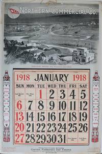
1918137331San Francisco: International Printing Co. 1918. Undetermined. very good. Colour calendar on heavy cardstock. 21" X 14". Occasional very light chipping and to edges. Corners bumped with some creasing. A few other light creases to edges. Full calendar pad Jan - Dec present with penciled notation in most days. Original string hanger present. Colours bright and unfaded. This poster is in very good condition. A scarce advertising calendar for the Northern Commercial Company N.C.Co. a retail company which maintained rural village stores across Alaska and in the Yukon. N.C.Co also operated steamships through Alaskan trade routes. The image on the poster features mining at Iditarod Alaska. Two totem poles on either side of the calendar pad list several stations of the N.C.Co. including Fairbanks Dawson Yukon Territory Bettles Iditarod and many others. The verso of the calendar is a full-page map of Alaska showing sea routes and locations of N.C.Co posts. A later incarnation of the business still maintains 30 stores across rural Alaska. See two other examples in this catalogue. 1918 International Printing Co. unknown
1917List1730Chicago: Poole Brothers 1917. Folding map measuring 38 ½ x 26 ¾ inches. Tape repairs to verso some tears at folds and edges still bring and attractive good to very good overall with excellent restoration potential. A map of the canneries in Alaska British Columbia and Washington operated by the Deming and Gould Company who were influential in the growth of the Alaskan salmon trade. The map’s date of printing 1917 suggests that perhaps it was related to the war effort as salmon demand increased during this period. The Demings based in Chicago were influential in the growth of the salmon trade in Alaska and the Pacific Northwest founding Pacific American Fisheries Inc. in 1899 and continuing in various iterations until their sale of the firm in 1934 due to president E.B. Deming’s ailing health. The map shows seventeen different canneries several on the Alaska peninsula and the one in Bellingham. We find no record of this imprint only a later and small version held at the University of Washington. Poole Brothers unknown
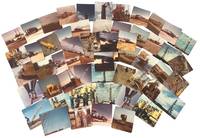
1966233371966. Cook Inlet offshore drilling photo archive of 57 chromogenic color photographs documenting the transport assembly and field operation of oil platform equipment in Alaska in 1966 including derrick sections drill pipe draw works components service trucks staging yards flare fire and rig floor assembly during the period when offshore construction expanded rapidly across the basin between 1964 and 1968. Alaska's first offshore platform was erected in Cook Inlet in 1964 exploration drilling peaked in 1966 and the photographs place the group within the short formative period when Cook Inlet became the proving ground for Alaska's offshore petroleum industry. The photographs record named individuals large platform components drill pipe derrick sections service trucks and specialized machinery moving from yard to worksite and from transport into operation.<br /> <br /> Photo archive of 57 chromogenic color photographs Kodacolor snapshot prints ranging from 3.5 x 3.5 to 3.5 x 4.5 inches Cook Inlet Alaska 1966. The derrick and draw works sections are hauled on heavy trucks across dirt roads rig components unloaded in open staging yards drill pipe rising within the derrick structure and crews in hard hats and work clothes working at the base of drilling machinery. Several photographs isolate specific stages of petroleum work rather than completed structures including a float identified on the verso as "Flatt & Doghouse" a "Tool box & work area on float" machinery captioned "Unloading Draworks from our truck #103 to Gary Bobs Road truck" pipe identified as "13000 ft pipe in deric" and repeated views of muddy haul roads flare fire active equipment and rig floor assembly from both elevated and ground level vantage points. The versos preserve contemporaneous functional captions and named personnel including "Front view with Jerry Blackwood driving" "Little Red & Ramdro discussing plans" "Putting Deric on the floor" "two trucking the Deric" "Bottom 1/2 of the Deric. This is the way we haul it" and "My truck hauling top 1/2 deric pulled over for the day too muddy to proceed to location" giving the archive unusual specificity at the level of individual labor and task sequence. A yard sign for Canadian Superior places part of the group within the corporate landscape of Cook Inlet petroleum development.<br /> <br /> Cook Inlet's offshore fields were the first large scale petroleum infrastructure projects in Alaska waters and the photographs preserve the hauling stages yard transfer pipe handling rig erection truck transport and field conditions through which the basin moved from exploration into sustained production. Named workers truck numbers hauling stages yard transfer pipe handling rig erection and field conditions place the group within the daily labor structure of offshore oil development rather than in finished platform views alone. The seller's Spurr attribution merits caution since later platform compendia place Platform Spurr in Trading Bay in 1968 but that discrepancy does not alter the archive's value as a 1966 record of Cook Inlet drilling logistics and offshore construction practice. Front surfaces show scattered paper residue or adhesion from prior storage with light wear minor discoloration and ordinary handling marks. Overall good condition. A 1966 Cook Inlet drilling archive centered on truck haulage derrick assembly pipe handling named workers and offshore construction logistics during the basin's first major oil boom. unknown
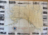
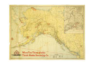
191737386Chicago: Poole Bros. 1917. 1917. ALASKA. First edition. A full-color folded map of Alaska showing both the coastal and seagoing routes that leave from Seattle to Alaska by the Alaska Steamship Company. Points of interest are indicated in red and include the Klondike Region Fairbanks Gold Placers Mt. McKinley National Park Kennecott Copper Mines etc. In the upper right corner is an 11" x 8" inset black & white map of the Copper River & Northwestern RY. and the Alaska Railroad showing Copper River Region in Alaska Prince William Sound the Richardson Automobile Highway Mt. McKinley National Park and Government Telegraph Line and Tributary Territory. Map has a few tears at folds some soiling to the map's surface and general wear from handling and use. Overall a good map of Alaska. Poole Bros., 1917. unknown
19303726Juneau Ak.: Winter & Pond 1930. Good. Panoramic photograph 10 x 34.5 inches. A few heavy creases a handful of short closed tears minor surface soiling and rubbing. An early-20th century panoramic image showing the development of the Alaskan capital city of Juneau produced by prolific local studio Winter & Pond. The image features the downtown portion of Juneau complete with paved streets telephone and electrical wires and hundreds of houses set between nearby Mount Juneau and the Gastineau Channel. <br /> <br /> "Lloyd Winter and Percy Pond preserved the legacy of Alaska's past through their photographs taken over a period of 50 years. The studios of Winter and Pond Company in Juneau Alaska provided local residents and visitors with a rich perspective of Alaska that is now considered a unique reflection of the state in the early 20th century. During the company's existence Alaska expanded mining fishing and resource development into profitable ventures that transformed it from a frontier district to a thriving territory of the United States. The portraits that Winter and Pond produced show the diversity of Alaska's people through the years from the gold rush of the Klondike in 1898 to the end of the mining operations in the Juneau Gold Belt District during the 1940s" - Alaska State Library's Historical Note for the Winter and Pond Collection. <br /> <br /> OCLC reports a few different Winter & Pond views of Juneau from 1909 to 1928 with the present example likely dating from a bit later but nonetheless rare. Winter & Pond unknown
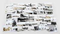
1942218151942. Photograph archive circa 1920s-1944 documenting the construction of the Alaska Highway and related military infrastructure during World War II. The material records wartime military logistics and infrastructure development through photographs of road construction engineering operations heavy machinery and military transport routes in Alaska and western Canada during the war. The photographs include terrain modification machinery deployment bridge construction and coordinated labor by military and civilian crews working under wartime conditions.<br /> <br /> Archive comprises 30 black-and-white photographs including approximately 21 captioned images issued by the Public Roads Administration and War Information Board dating from circa 1942-1944 alongside 10 earlier vernacular snapshots from the 1920s-1930s. Sizes range from approximately 2.5 x 1.5 inches to 5.5 x 3.5 inches. Official photographs depict graded roadways cutting through mountainous and forested terrain heavy machinery including tractors and graders clearing timber and earth and crews working in challenging conditions such as permafrost excavation. Several images show pontoon bridges early roadbeds and military vehicles including jeeps and convoys positioned along newly constructed routes. Captions reference wartime labor and engineering activity. Vernacular photographs depict earlier regional life including individuals traveling by sled posing with fish working in sawmills and operating equipment. Additional scenes include a Chinese barber shaving a client and frontier couples posed outdoors with handwritten verso captions referencing locations such as Juneau and Valdez.<br /> <br /> The photographs record the rapid development of the Alaska Highway following the strategic urgency created by World War II particularly after the attack on Pearl Harbor and military concerns in the Aleutian region. Official photographs focus on wartime infrastructure projects while the vernacular photographs record prewar labor and daily life in Alaska and the Yukon. The archive includes military construction transportation systems sawmill labor travel and regional commercial activity before and during wartime expansion. Light curling and handling wear to vernacular photographs; minor edge wear and occasional markings to official prints; overall very good condition. A visual archive of wartime engineering and northern frontier life during a period of military expansion. unknown
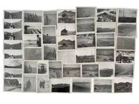
1945215781945. AArchive of 64 original black-and-white photographs documenting American military operations and engineering activities in the Aleutian Islands during World War II. Photographs measure approximately 4.5" x 3.5" and provide an extensive visual record of one of the most remote and environmentally challenging theaters of the war. The images chronicle the daily work of U.S. Army personnel and Army Engineers stationed across the Aleutian chain where military forces confronted not only the threat of enemy action but also some of the harshest conditions faced by American troops anywhere during the conflict. Soldiers appear throughout the archive wearing cold-weather gear field jackets heavy boots and M1 steel helmets while working patrolling and constructing infrastructure amid windswept volcanic landscapes.<br /> <br /> A significant portion of the collection documents the enormous logistical effort required to sustain military operations in the islands. Engineers are shown surveying terrain operating equipment cutting and processing timber and building facilities essential to maintaining isolated military outposts. Several striking photographs depict large timber-log chutes descending steep hillsides toward the shoreline apparently designed to move heavy equipment and supplies through terrain where conventional transportation proved difficult. Other images record lumber operations construction projects and the continual adaptation of military infrastructure to the rugged environment. The archive also contains numerous panoramic views of the Aleutian landscape itself. Snow-covered mountains barren volcanic ridges isolated coastlines glacial valleys and treeless tundra dominate many photographs illustrating why the campaign became as much a battle against geography and weather as against enemy forces. The Aleutian chain stretching deep into the North Pacific and containing dozens of active and dormant volcanoes represented one of the most isolated regions under American military control during the war.<br /> <br /> Naval and maritime operations are likewise represented. Several photographs show transport and supply vessels anchored offshore or approaching remote coastal installations highlighting the dependence of Aleutian bases upon sea-borne logistics. Military camps consisting of Quonset huts and tent encampments appear throughout the collection while one particularly notable image captures an aircraft flying above a military installation underscoring the importance of aerial reconnaissance and patrol operations in protecting the northern approaches to Alaska. Although often overshadowed by campaigns in Europe and the Central Pacific the Aleutian campaign held considerable strategic importance. Following the Japanese occupation of Attu and Kiska in 1942 American forces undertook a costly effort to secure the islands and maintain control of the northern Pacific. These photographs document the infrastructure manpower and determination required to operate in a theater where extreme weather isolation and difficult terrain shaped every aspect of military life. A substantial and visually compelling archive documenting the engineering logistical and environmental realities of America's northernmost front during World War II. Photographs remain in very good condition with minor surface wear and occasional light creasing. unknown
1939286138Seattle: Farwest Lithograph and Printing Co 1939. Map. Color Lithograph. 21" x 28".<br/> <br/> This beautifully colored map of Alaska and the Gulf of Alaska shows the Alaskan boat lines from Seattle and was first drawn by Edward Camy for the Alaska Steamship Company in 1934. A great pictographic map includes an inset showing the Alaska Railways route from Seward to Fairbanks and the Richardson Automobile Highway. The bottom of the map shows a series of cartoons of events on the ship. In good condition a great example of Alaska.<br/> <br/> Farwest Lithograph and Printing Co unknown
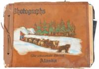
1945191491945. Unidentified compiler photograph album of United States Army troops stationed near Seward Alaska circa 1945 documenting military life and operations in a strategic northern deployment during the closing period of World War II. The material provides primary visual evidence of troop activity infrastructure development and social life within a remote military environment supporting research into wartime logistics soldier experience and the role of Alaska in U.S. military defense during the conflict.<br /> <br /> Photograph album containing 58 black and white silver gelatin prints most measuring approximately 3.5 x 6 inches depicting soldiers engaged in both formal and informal activities. Images include groups of men standing at attention with rifles constructing wooden buildings in rugged terrain and participating in daily routines within camp settings. A series of photographs documents a dance event for troops featuring a jazz band with music stands marked "153" alongside an emblem suggesting a possible connection to the 153rd Infantry Regiment which was stationed in Alaska during the period. Additional images show steamships including the S.S. Baranof S.S. Alaska S.S. Denali and S.S. Columbia navigating the Inside Passage and areas near Taku Glacier indicating transportation and supply routes. The album also contains a "memory leaves" section with handwritten notes and addresses from fellow servicemen reflecting interpersonal networks and efforts to maintain contact beyond deployment.<br /> <br /> 58 photographs mounted in an album with decorated leather covers featuring a hand-painted image of Alaskan sled dogs titled "The Malamute Limited." During World War II Alaska served as a critical military zone due to its geographic proximity to the Pacific theater with troop deployments focused on defense infrastructure and logistics in challenging environmental conditions. This album captures both operational and social dimensions of that presence including labor recreation and movement through the region. Light handling wear to album and photographs contents well-preserved; overall very good condition. A cohesive and detailed visual record of U.S. Army life in wartime Alaska. unknown
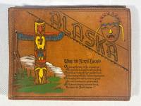
1943217811943. Civilian construction labor photo album documenting on the Alaska-Canada Military Highway during World War II one of the largest emergency infrastructure projects undertaken in North America during the war. The material records wartime military logistics federal civilian contracting and frontier transportation construction through photographs official permits military certifications and worker inscriptions connected to the rapid building of the ALCAN Highway in 1942-1943. Compiled by civilian laborer Paul Cecil Pemble an employee of Ferguson-Diell Construction Company the album connects private contractors federal agencies and the U.S. Army Corps of Engineers to the construction of a strategic military supply route linking the contiguous United States to Alaska following Japan's Aleutian Islands campaign. The archive provides primary-source evidence for wartime infrastructure mobilization civilian labor under military authority and the logistical expansion of defense systems in the North American Arctic frontier.<br /> <br /> Oblong string-tied photo album in original painted suede leather covers titled Alaska - Where the North Begins with embossed and hand-colored totemic decoration. Contains approximately 66 silver gelatin photographs ranging in size from approximately 4.5 x 3.25 inches to 10 x 8 inches alongside multiple official documents licenses permits correspondence and autograph pages. Included documents identify Paul Cecil Pemble as a civilian heavy equipment operator employed on the Alaska Highway project. These include a Public Roads Administration license issued under the Federal Works Agency dated June 29 1943; a U.S. Army Corps of Engineers certification dated August 4 1943 signed by First Lieutenant Colin L. Park authorizing operation of trucks tractors and wheeled scrapers; and an Alcan Military Highway Command permit dated August 19 1943 authorizing travel on the restricted military roadway. A typed letter from Tok Junction dated October 8 1943 confirms the extension of Pemble's Selective Service deferment due to essential wartime labor. Several opening pages titled "Memory Leaves" contain approximately sixty signatures and inscriptions from fellow workers many identifying hometowns in Iowa and including humorous remarks and nicknames such as "Cook" "Butch" and "Alaska Thunderbolt." The photographs extensively document construction activity and camp life including bulldozers graders cranes timber bridge scaffolding military truck convoys wrecked vehicles stranded in ditches muddy roadbeds and large encampments of prefabricated structures. Multiple images show men constructing river crossings operating machinery and posing in work clothes beside heavy equipment. Additional photographs depict interior bunkhouses mess hall scenes with workers gathered around tables and a large group portrait of more than fifty civilian laborers posed before a treeline. Wildlife and recreation also appear throughout the album including black bears scavenging through refuse fishing scenes with large catches displayed by workers dogs resting beside snowy roads and Pemble's trailer quarters attached to the back of a truck. The final pages include panoramic camp views and directional signpost photographs listing construction companies and distances to Fairbanks Whitehorse and multiple contractor camps along the route.<br /> <br /> The album records the logistical effort required to construct the Alaska Highway across remote and environmentally severe terrain during wartime emergency conditions. Built in response to fears of Japanese expansion into Alaska and the North Pacific the highway became a critical military supply corridor linking airfields fuel depots transport infrastructure and defense installations across Alaska and western Canada. The album focuses on civilian laborers operating within military-controlled systems including contract workers represented through photographs permits deferment documents and personal inscriptions. The combination of photographs permits deferment documents and personal inscriptions records daily life labor conditions and federal wartime administration on the ALCAN project. Photographs mounted cleanly to black paper leaves with corner tabs; occasional light creasing and minor wear to several prints. Leather covers lightly rubbed but structurally sound and visually bright. Overall very good condition. A documentary archive of civilian wartime labor and military infrastructure construction during one of the most ambitious engineering projects of the Second World War. unknown