[FLORIDA HISTORY] - Ruggles HubbardBiblio.com
1 698 résultats
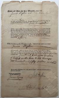
1815267901New York 1815. unbound. 2 pages front and back 13 x 8 inches signed "Ruggles Hubbard" as Sheriff of New York City -- an arrest warrant for two defendants to appear in Mayors Court September 25 1815 in part: ".I Ruggles Hubbard Sheriff of the City of New York do hereby assign the within written Bail Bond to the use of the plaintiff s to be sued for _____ according to the form of the statute in that case made and provided." Evenly toned with usual folds and a minimum of fraying at the borders; very good condition overall.<br/> <br/> New York City Sheriff and adventurer who joined his friend General Gregor McGregor's expedition in conquering Spanish Florida June 29 1817 - December 23 1817 culminating in his appointment as Governor of Fernandina. His six-week reign came to an abrupt end after being overthrown by the notorious pirate Luis Aury who claimed Florida in the name of Mexico.<br/> <br/> unknown
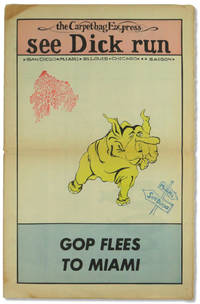
197254577Miami: Florida People's Coalition 1972. Hardcover. Very good. Hardcover. 16. Newsprint paper in tabloid format. Pages tanned as usual with horizontal fold to the middle else very good. Three color "Confront the GOP Convention" centerfod. Possible one shot published to bring attention and funds for the Florida People's Coalition. <br/><br/> [Florida People's Coalition] hardcover
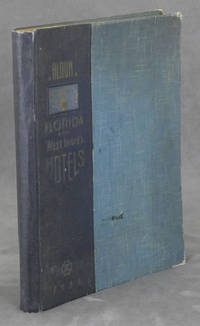
19380086079Miami Beach FL: Davis and Campbell 1938. Hardcover. Very Good. 1938. Hardcover folio spiral-bound in cloth-backed boards. 196 pp. profusely illustrated with b&w photos. Very Good. Rubbing and light soil to the boards; corners worn; faint dampstain to upper corner of the first 10 pages only; otherwise clean and unmarked. A rare book -- OCLC locates only 10 copies. A showcase of the area at its peak includes The Hollywood Beach Hotel Stetson University the Gulfstream Apartments Whitman Kenmore Hotel El Comodoro Miramar as well as sections on Cuba Key West Palm Beach Tampa Winter Haven and many many more. Davis and Campbell hardcover
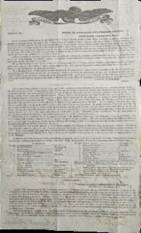
1831List3518New York City 1831. Two-page printed circular measuring 7 ¾ x 12 ¾ inches with manuscript note from Aaron H. Palmer. Folded with some small tears larger tear at seal not intersecting with text. Overall excellent. Aaron Haight Palmer 1779–1863 was the director of the “American and Foreign Agency for Claimsâ€â€”essentially a high-end collections agency—and later Consul General of the Republic of Ecuador. He was extremely well-connected and his activities included a tour of Europe and Asia to gather information about commerce there for the Rothschilds.1 <br /> <br /> Offered here is an 1831 circular from Palmer’s Agency signed by Palmer and sent to A. Lang Esq. in Selkirk Scotland. The circular advertises the sale of “a large tract of land lying on the Gulf of Mexico in East Florida†which “is owned in sole propriety by Richard S. Hackley Esq. an American citizen.†Hackley 1770–1843 a merchant and later US Consul in Spain had been deeded twelve million acres of land around present-day Tampa by the Duke of Alagon in 1819—who himself had been granted the land by Ferdinand VII in 1817. The circular extols the virtues of the land for sale especially Tampa as “a favorable site for the foundations of a great maritime city†and Chatham Bay’s “proximity to the West India marketsâ€. At the time Florida was in the midst of the Seminole Wars; the Treaty of Payne’s Landing would soon demand that all Indigenous people in Florida leave for Indian Territory. It is not clear what came of Palmer’s attempt to sell Hackley’s land; the latter’s heirs’ claims to his estate were settled in 1908 when the US Supreme Court decided that the Kingdom of Spain had annulled the grant prior to the Adams-OnÃs Treaty giving Florida to the US.<br /> <br /> We find one copy of the circular on OCLC. Of interest to historians of the settlement of Florida.<br /> <br /> 1 Jessica Lepler “‘There is no need for anyone to go to America’: commercial correspondence and nineteenth-century globalisation†Rothschild Archive https://www.rothschildarchive.org/materials/no_need_to_go_to_america.pdf accessed February 12 2026. unknown
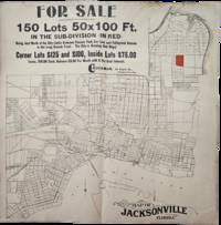
1900List3420Likely Jacksonville Florida 1900. Folded poster on newsprint measuring 16 x 16 inches. With toning stain to top right; very good. A poster published by the C. Buckman Company advertising 50x100 lots in what is currently the Longbranch neighborhood of Jacksonville. The tract is highlighted in red on a larger map of the city. The city saw significant growth during this period from tourism the lumber trade and the expansion of railways. C. Buckman is Courtland Buckman 1863–1952 a lifelong Floridian the son of a Civil War veteran and the brother of Florida State Legislator Henry Holland Buckman for whom the H. H. Buckman Bridge in Orange Park is named. Courtland Buckman was the Deputy County Clerk for Duval County in 1886 and later in the 1880s served one term as the Mayor of Daytona Beach. In 1894 he returned to Jacksonville and joined the C. C. Robertson Real Estate Company before opening his own real estate firm the C. Buckman Company in 1897. He had an active role in the development of Jacksonville and was prominent in business and civic life there including serving on the Jacksonville Board of Trade.1<br /> <br /> 1 Courtland Buckman Papers Thomas G. Carpenter Library University of North Florida Jacksonville Florida. https://archives.unf.edu/repositories/3/resources/17 Accessed January 16 2026. unknown
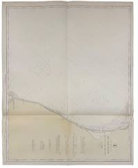
192140729Washington D.C.: Published by the United States Coast and Geodetic Survey 1921. Large folding nautical chart printed on heavy paper stock. Colored. A rare original coastal survey of the Northern Gulf coast from Florida to Louisiana encompassing Panama City Rosemary Beach Seaside Grayton Destin Pensacola Gulf Shores Mobile Gulfport and the Mississippi Delta.<br/> <br/> Established by President Thomas Jefferson in 1807 as the Survey of the Coast the U.S. Coast and Geodetic Survey was the United States' first civilian scientific agency. This agency has followed its mission to survey the U.S. coastline create nautical charts of the coast and help increase maritime safety since its founding and has often played fascinating roles in significant chapters of U.S. history. It served in all theaters of the Civil War in the service of the Union Army and Navy pioneered acoustic exploration in the wake of the sinking of the Titanic and during WWI it worked to detect enemy submarines. In addition this agency worked to survey and produce detailed maps and renderings of the U.S. coast. These nautical survey maps commonly referred to as "T-sheets" provide fascinating insights into the history of the United States coastline which has and will continue to shift. These maps are the most important data source for understanding the physical and ecological characteristics of the U.S. shoreline. The present map is a highly detailed and accurate sea chart of the Gulf coasts of Florida Alabama Mississippi and Louisiana and an important historical view of the developing states. Published by the United States Coast and Geodetic Survey unknown
191940687Washington D.C.: Published by the United States Coast and Geodetic Survey 1919. Nautical chart printed on heavy paper stock. Colored. A rare coastal survey of the Florida Georgia and South Carolina including Daytona Palm Coast St. Augustine Ponte Vedra Amelia Island Jacksonville Fernandina Jekyll Island St. Simons Sea Island Tybee Savannah Hilton Head Kiawah and Folly Beach.<br/> <br/> Established by President Thomas Jefferson in 1807 as the Survey of the Coast the U.S. Coast and Geodetic Survey was the United States' first civilian scientific agency. This agency has followed its mission to survey the U.S. coastline create nautical charts of the coast and help increase maritime safety since its founding and has often played fascinating roles in significant chapters of U.S. history. It served in all theaters of the Civil War in the service of the Union Army and Navy pioneered acoustic exploration in the wake of the sinking of the Titanic and during WWI it worked to detect enemy submarines. In addition this agency worked to survey and produce detailed maps and renderings of the U.S. coast. These nautical survey maps commonly referred to as "T-sheets" provide fascinating insights into the history of the United States coastline which has and will continue to shift. These maps are the most important data source for understanding the physical and ecological characteristics of the U.S. shoreline. The present map is a highly detailed and accurate sea chart of the coasts of Florida Georgia and Alabama and an important historical view of the developing states. Published by the United States Coast and Geodetic Survey unknown
190840737Washington D.C.: Published by the United States Coast and Geodetic Survey 1908. Large folding nautical chart printed on heavy paper stock. Colored. A rare original coastal survey of the Gulf coasts of Florida Alabama Mississippi and Louisiana including the Keys Fort Myers Sarasota Tampa Panama City Destin Pensacola Gulf Shores Mobile Biloxi Gulfport New Orleans and the Mississippi Delta.<br/> <br/> Established by President Thomas Jefferson in 1807 as the Survey of the Coast the U.S. Coast and Geodetic Survey was the United States' first civilian scientific agency. This agency has followed its mission to survey the U.S. coastline create nautical charts of the coast and help increase maritime safety since its founding and has often played fascinating roles in significant chapters of U.S. history. It served in all theaters of the Civil War in the service of the Union Army and Navy pioneered acoustic exploration in the wake of the sinking of the Titanic and during WWI it worked to detect enemy submarines. In addition this agency worked to survey and produce detailed maps and renderings of the U.S. coast. These nautical survey maps commonly referred to as "T-sheets" provide fascinating insights into the history of the United States coastline which has and will continue to shift. These maps are the most important data source for understanding the physical and ecological characteristics of the U.S. shoreline. The present map is a highly detailed and accurate sea chart of the coasts Florida Alabama Mississippi and Louisiana along the Gulf of Mexico and an important historical view of the developing states. Published by the United States Coast and Geodetic Survey unknown
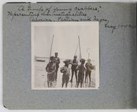
19012885Various locations in Florida 1901. About very good. 16 leaves illustrated with thirty-two original vernacular photographs all 3.5 x 3.5 inches most with manuscript captions in ink above the images. Oblong octavo. Contemporary gray paper wrappers white titles on front cover. Spine mostly split a few shallow chips to edges. Internally clean. A small but important vernacular photograph album containing rare views of the devastation wrought by the Great Fire of 1901 in Jacksonville Florida which took place on May 3 1901. The most destructive event in the history of Jacksonville the Great Fire swept through 146 city blocks destroying over 2000 buildings killing seven people and leaving almost 10000 residents without homes. It is considered the third-largest urban fire in United States history after the Great Chicago Fire and the 1906 San Francisco conflagration.<br /> <br /> The photographs in the present album were taken by an unidentified passenger aboard the Clyde Line steamer Comanche. Eight of the images capture the scene in devastated Jacksonville including a shot of the ruins of the Windsor and St. James hotels shots from atop the "Jacksonville Government Building" a group picture of the city guard "ruins of Jacksonville Court House" "An unknown ruin" a crowded scene at the Jacksonville wharf and a distant shot showing "Ruins of Jacksonville taken from Steamer Comanche May 12." All of the photographs of Jacksonville are dated in manuscript on May 12 1901 nine days after the Great Fire.<br /> <br /> In addition to the Jacksonville pictures other identified locations along the photographer's voyage include the Hillsborough River near Tampa the Tampa Court House scenes around the Tampa Bay Hotel family pictures in Florida the Comanche and its crew Fort Sumter and four views around Charleston. One particularly notable photograph shows six boys standing in shallow water holding fishing nets likely near Tampa. The image is captioned "A group of young crabbers representing three nationalities American Italian and Negro May 10 1901. unknown
191640717Washington D.C.: Published by the United States Coast and Geodetic Survey 1916. Large folding nautical chart printed on heavy paper stock. Uncolored. Rare original coastal survey of Florida's Apalachee bay.<br/> <br/> Established by President Thomas Jefferson in 1807 as the Survey of the Coast the U.S. Coast and Geodetic Survey was the United States' first civilian scientific agency. This agency has followed its mission to survey the U.S. coastline create nautical charts of the coast and help increase maritime safety since its founding and has often played fascinating roles in significant chapters of U.S. history. It served in all theaters of the Civil War in the service of the Union Army and Navy pioneered acoustic exploration in the wake of the sinking of the Titanic and during WWI it worked to detect enemy submarines. In addition this agency worked to survey and produce detailed maps and renderings of the U.S. coast. These nautical survey maps commonly referred to as "T-sheets" provide fascinating insights into the history of the United States coastline which has and will continue to shift. These maps are the most important data source for understanding the physical and ecological characteristics of the U.S. shoreline. The present map of the Florida coastline is notable for the inclusion of St Marks light house built at the head of the St Marks River to assist in navigation to and from the important 19th century agricultural port of St Marks. This map is a highly detailed and accurate sea chart of the Apalachee Bay from Fish Creek to Alligator Point and an important historical view of a developing Florida. Published by the United States Coast and Geodetic Survey unknown
191640680Washington D.C.: Published by the United States Coast and Geodetic Survey 1916. Large folding nautical chart printed on heavy paper stock. Colored. A rare coastal survey of Apalachee Bay including Alligator Point and St. George Island.<br/> <br/> Established by President Thomas Jefferson in 1807 as the Survey of the Coast the U.S. Coast and Geodetic Survey was the United States' first civilian scientific agency. This agency has followed its mission to survey the U.S. coastline create nautical charts of the coast and help increase maritime safety since its founding and has often played fascinating roles in significant chapters of U.S. history. It served in all theaters of the Civil War in the service of the Union Army and Navy pioneered acoustic exploration in the wake of the sinking of the Titanic and during WWI it worked to detect enemy submarines. In addition this agency worked to survey and produce detailed maps and renderings of the U.S. coast. These nautical survey maps commonly referred to as "T-sheets" provide fascinating insights into the history of the United States coastline which has and will continue to shift. These maps are the most important data source for understanding the physical and ecological characteristics of the U.S. shoreline. The present map is a highly detailed and accurate sea chart of the Apalachee Bay and an important historical view of a developing Florida. Published by the United States Coast and Geodetic Survey unknown
192040721Washington D.C.: Published by the United States Coast and Geodetic Survey 1920. Large folding nautical chart printed on heavy paper stock. Uncolored. A rare original coastal survey of Apalachicola Bay and Cape San Blas including St. George Island.<br/> <br/> Established by President Thomas Jefferson in 1807 as the Survey of the Coast the U.S. Coast and Geodetic Survey was the United States' first civilian scientific agency. This agency has followed its mission to survey the U.S. coastline create nautical charts of the coast and help increase maritime safety since its founding and has often played fascinating roles in significant chapters of U.S. history. It served in all theaters of the Civil War in the service of the Union Army and Navy pioneered acoustic exploration in the wake of the sinking of the Titanic and during WWI it worked to detect enemy submarines. In addition this agency worked to survey and produce detailed maps and renderings of the U.S. coast. These nautical survey maps commonly referred to as "T-sheets" provide fascinating insights into the history of the United States coastline which has and will continue to shift. These maps are the most important data source for understanding the physical and ecological characteristics of the U.S. shoreline. The present map of the Florida coastline precedes the development of the town of Eastpoint and the building of the John Gorrie Memorial Bridge which connects Eastpoint with Apalachicola. The current site of Eastpoint is marked as Godleys Bluff on the present map. This map is a highly detailed and accurate sea chart of the coastal Florida and an important historical view of the developing state. Published by the United States Coast and Geodetic Survey unknown
187231647Tallahassee: Charles H. Walton State Printer 1872. Stitched untrimmed and uncut. 350 2 blanks 76 pp. Except for a spotted title page which is chipped at the blank corners a clean Very Good copy.<br /> <br /> An informative Journal recounting Floridians' resistance to Radical Reconstruction. Governor Harrison Reed's Message addresses ongoing disturbances and "fatal and disgraceful violence. Nine-tenths of the suffering induced has fallen upon Republicans and mainly upon colored citizens-- giving unerring evidence that these excesses have been strongly tinctured by if they have not entirely originated in political prejudice." Many murders and disruptions had occurred in Calhoun and Jackson Counties forcing citizens to flee their homes and seek shelter in other parts of the State. A Committee of Five was appointed "to examine into the cause of said murders and to ascertain why the perpetrators have not been brought to justice." <br /> The Committee concluded that "there exists an organized band whose object is to resist the laws and who are the supposed authors of the many murders and outrages committed in the county." Threats of violence and a "reign of terror" had deterred witnesses from coming forward. In Jackson County "no less than one hundred and eighty -four murders fifteen of the number being women and children and almost the entire number being colored people brutally assassinated by this band of outlaws for daring to think for themselves." Similar outrages occurred in Lafayette and other counties. <br /> Governor Reed Florida's governor from 1868-73 faced impeachment charges from this Assembly as he had in 1868 and 1870. He was later charged in sixteen Articles with illegally issuing state bonds embezzlement and bribery. The charges were dismissed. The Assembly treated other matters of government including special elections marred by violence; "an act to incorporate Brown's Theological Institute" now Edward Waters College founded in 1866 to educate former slaves and considered the oldest historically black college in Florida. Senate Bill No 82 "to be entitled an act to incorporate the Buckingham Smith Asylum for the colored people of St. Augustine" was passed. Charles H. Walton, State Printer unknown
191840712Washington D.C.: Published by the United States Coast and Geodetic Survey 1918. Large folding nautical chart printed on heavy paper stock. Colored. A rare original coastal survey of Florida from Jupiter to Tampa including West Palm Beach Miami Boca Raton Fort Lauderdale Miami the Keys and Fort Meyers as well as the Bahamas and a partial mapping of the northern Cuban coastline including Havana.<br/> <br/> Established by President Thomas Jefferson in 1807 as the Survey of the Coast the U.S. Coast and Geodetic Survey was the United States' first civilian scientific agency. This agency has followed its mission to survey the U.S. coastline create nautical charts of the coast and help increase maritime safety since its founding and has often played fascinating roles in significant chapters of U.S. history. It served in all theaters of the Civil War in the service of the Union Army and Navy pioneered acoustic exploration in the wake of the sinking of the Titanic and during WWI it worked to detect enemy submarines. In addition this agency worked to survey and produce detailed maps and renderings of the U.S. coast. These nautical survey maps commonly referred to as "T-sheets" provide fascinating insights into the history of the United States coastline which has and will continue to shift. These maps are the most important data source for understanding the physical and ecological characteristics of the U.S. shoreline. The present map is a highly detailed and accurate sea chart of Southern Florida and the Northern Caribbean region and an important historical view of a developing Florida. Published by the United States Coast and Geodetic Survey unknown
191640693Washington D.C.: Published by the United States Coast and Geodetic Survey 1916. Nautical chart printed on heavy paper stock. Colored. A rare coastal survey of Florida from Sanibel Island to Fort Myers Beach including Naples and Marco Island.<br/> <br/> Established by President Thomas Jefferson in 1807 as the Survey of the Coast the U.S. Coast and Geodetic Survey was the United States' first civilian scientific agency. This agency has followed its mission to survey the U.S. coastline create nautical charts of the coast and help increase maritime safety since its founding and has often played fascinating roles in significant chapters of U.S. history. It served in all theaters of the Civil War in the service of the Union Army and Navy pioneered acoustic exploration in the wake of the sinking of the Titanic and during WWI it worked to detect enemy submarines. In addition this agency worked to survey and produce detailed maps and renderings of the U.S. coast. These nautical survey maps commonly referred to as "T-sheets" provide fascinating insights into the history of the United States coastline which has and will continue to shift. These maps are the most important data source for understanding the physical and ecological characteristics of the U.S. shoreline. The present map is a highly detailed and accurate sea chart of the coast around Fort Myers and an important historical view of a developing Florida. Published by the United States Coast and Geodetic Survey unknown
191640727Washington D.C.: Published by the United States Coast and Geodetic Survey 1916. Large folding nautical chart printed on heavy paper stock. Colored. A rare original coastal survey of Cape Canaveral to Key West including Jupiter West Palm Beach Boca Raton Fort Lauderdale Hollywood Miami the Keys the Everglades Naples and the Bahamas.<br/> <br/> Established by President Thomas Jefferson in 1807 as the Survey of the Coast the U.S. Coast and Geodetic Survey was the United States' first civilian scientific agency. This agency has followed its mission to survey the U.S. coastline create nautical charts of the coast and help increase maritime safety since its founding and has often played fascinating roles in significant chapters of U.S. history. It served in all theaters of the Civil War in the service of the Union Army and Navy pioneered acoustic exploration in the wake of the sinking of the Titanic and during WWI it worked to detect enemy submarines. In addition this agency worked to survey and produce detailed maps and renderings of the U.S. coast. These nautical survey maps commonly referred to as "T-sheets" provide fascinating insights into the history of the United States coastline which has and will continue to shift. These maps are the most important data source for understanding the physical and ecological characteristics of the U.S. shoreline. The present map is a highly detailed and accurate sea chart of Florida's Coast and Keys region and an important historical view of the developing state. Published by the United States Coast and Geodetic Survey unknown
191540691Washington D.C.: Published by the United States Coast and Geodetic Survey 1915. Large folding nautical chat printed on heavy paper stock. Colored. A rare coastal survey of Cape Canaveral including the Kennedy Space Center Cocoa Beach Merritt Island and Satellite Beach.<br/> <br/> Established by President Thomas Jefferson in 1807 as the Survey of the Coast the U.S. Coast and Geodetic Survey was the United States' first civilian scientific agency. This agency has followed its mission to survey the U.S. coastline create nautical charts of the coast and help increase maritime safety since its founding and has often played fascinating roles in significant chapters of U.S. history. It served in all theaters of the Civil War in the service of the Union Army and Navy pioneered acoustic exploration in the wake of the sinking of the Titanic and during WWI it worked to detect enemy submarines. In addition this agency worked to survey and produce detailed maps and renderings of the U.S. coast. These nautical survey maps commonly referred to as "T-sheets" provide fascinating insights into the history of the United States coastline which has and will continue to shift. These maps are the most important data source for understanding the physical and ecological characteristics of the U.S. shoreline. The present map is a highly detailed and accurate sea chart of Cape Canaveral and an important historical view of a developing Florida. Published by the United States Coast and Geodetic Survey unknown
191640732Washington D.C.: Published by the United States Coast and Geodetic Survey 1916. Large folding nautical chart printed on heavy paper stock. Colored. A rare original coastal survey of Cape Sable and Everglades National Park.<br/> <br/> Established by President Thomas Jefferson in 1807 as the Survey of the Coast the U.S. Coast and Geodetic Survey was the United States' first civilian scientific agency. This agency has followed its mission to survey the U.S. coastline create nautical charts of the coast and help increase maritime safety since its founding and has often played fascinating roles in significant chapters of U.S. history. It served in all theaters of the Civil War in the service of the Union Army and Navy pioneered acoustic exploration in the wake of the sinking of the Titanic and during WWI it worked to detect enemy submarines. In addition this agency worked to survey and produce detailed maps and renderings of the U.S. coast. These nautical survey maps commonly referred to as "T-sheets" provide fascinating insights into the history of the United States coastline which has and will continue to shift. These maps are the most important data source for understanding the physical and ecological characteristics of the U.S. shoreline. The present map is a highly detailed and accurate sea chart of the Everglades and an important historical view of a developing Florida. Published by the United States Coast and Geodetic Survey unknown
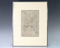
1797139014Paris: Rigobert Bonne 1797. Rare 18th century map of North America by Royal Hydrographer Rigobert Bonne. One page the engraved map extends from Illinois to Florida with one of the earliest insets of Kansas City. Born in the Lorraine region of France French cartographer Rigobert Bonne 1727-1794 was a skilled cartographer and hydrographer and succeeded Jacques Nicolas Bellin as Royal Hydrographer at the Depot de la Marine in 1773. He published many charts for the Depot including some of those for the Atlas Maritimeof 1762. In near fine condition. Matted and framed. The entire piece measures 17 inches by 16 inches. La Louisiane named after Louis XIV of France became a colony of the Kingdom of France in 1682 before passing to Spain in 1763. Louisiana was formed in part of the became part of the Louisiana Purchase from France in 1803. The U.S. would divide that area into two territories the Territory of Orleans which formed what would become the boundaries of Louisiana and the District of Louisiana. Louisiana was admitted as the 18th state of the United States on April 30 1812. Appointed hydrographer of the French Navy at the age of eighteen Jacques-Nicolas Bellin was appointed Hydrographer to the King in 1741. He published numerous sea atlases and charts which would be reprinted into the nineteenth century as well as many maps depicting French colonial territories in the New World. His craftsmanship and commitment to accuracy earned him a distinguished reputation as one of the world's leading cartographers and many other European mapmakers turned to him for source material. Rigobert Bonne unknown
191640723Washington D.C.: Published by the United States Coast and Geodetic Survey 1916. Large folding nautical chart printed on heavy paper stock. Uncolored. A rare original coastal survey of the Cedar Keys and west-central coastline of Florida including Steinhatchee.<br/> <br/> Established by President Thomas Jefferson in 1807 as the Survey of the Coast the U.S. Coast and Geodetic Survey was the United States' first civilian scientific agency. This agency has followed its mission to survey the U.S. coastline create nautical charts of the coast and help increase maritime safety since its founding and has often played fascinating roles in significant chapters of U.S. history. It served in all theaters of the Civil War in the service of the Union Army and Navy pioneered acoustic exploration in the wake of the sinking of the Titanic and during WWI it worked to detect enemy submarines. In addition this agency worked to survey and produce detailed maps and renderings of the U.S. coast. These nautical survey maps commonly referred to as "T-sheets" provide fascinating insights into the history of the United States coastline which has and will continue to shift. These maps are the most important data source for understanding the physical and ecological characteristics of the U.S. shoreline. The present map is a highly detailed and accurate sea chart of the Cedar Keys region and an important historical view of a developing Florida. Published by the United States Coast and Geodetic Survey unknown
191740710Washington D.C.: Published by the United States Coast and Geodetic Survey 1917. Folding nautical chart printed on heavy paper stock. Uncolored. A rare original coastal survey of Florida's Cedar Keys area.<br/> <br/> Established by President Thomas Jefferson in 1807 as the Survey of the Coast the U.S. Coast and Geodetic Survey was the United States' first civilian scientific agency. This agency has followed its mission to survey the U.S. coastline create nautical charts of the coast and help increase maritime safety since its founding and has often played fascinating roles in significant chapters of U.S. history. It served in all theaters of the Civil War in the service of the Union Army and Navy pioneered acoustic exploration in the wake of the sinking of the Titanic and during WWI it worked to detect enemy submarines. In addition this agency worked to survey and produce detailed maps and renderings of the U.S. coast. These nautical survey maps commonly referred to as "T-sheets" provide fascinating insights into the history of the United States coastline which has and will continue to shift. These maps are the most important data source for understanding the physical and ecological characteristics of the U.S. shoreline. The present map is a highly detailed and accurate sea chart of Florida's Cedar Keys and an important historical view of a developing Florida. Published by the United States Coast and Geodetic Survey unknown
191740682Washington D.C.: Published by the United States Coast and Geodetic Survey 1917. Nautical chart printed on heavy paper stock. Colored. A rare coastal survey of the Pensacola area including Destin Fort Walton Santa Rosa Island and Pensacola Beach.<br/> <br/> Established by President Thomas Jefferson in 1807 as the Survey of the Coast the U.S. Coast and Geodetic Survey was the United States' first civilian scientific agency. This agency has followed its mission to survey the U.S. coastline create nautical charts of the coast and help increase maritime safety since its founding and has often played fascinating roles in significant chapters of U.S. history. It served in all theaters of the Civil War in the service of the Union Army and Navy pioneered acoustic exploration in the wake of the sinking of the Titanic and during WWI it worked to detect enemy submarines. In addition this agency worked to survey and produce detailed maps and renderings of the U.S. coast. These nautical survey maps commonly referred to as "T-sheets" provide fascinating insights into the history of the United States coastline which has and will continue to shift. These maps are the most important data source for understanding the physical and ecological characteristics of the U.S. shoreline. The present map is a highly detailed and accurate sea chart of the Pensacola area and an important historical view of a developing Florida. Published by the United States Coast and Geodetic Survey unknown
192240698Washington D.C.: Published by the United States Coast and Geodetic Survey 1922. Large folding nautical chart printed on heavy paper stock. Colored with minor wear. A rare coastal survey of the Florida coast from Fort Walton Beach to Panama City Beach including Destin Grayton Beach Seaside Alys Beach Rosemary Beach and Laguna Beach.<br/> <br/> Established by President Thomas Jefferson in 1807 as the Survey of the Coast the U.S. Coast and Geodetic Survey was the United States' first civilian scientific agency. This agency has followed its mission to survey the U.S. coastline create nautical charts of the coast and help increase maritime safety since its founding and has often played fascinating roles in significant chapters of U.S. history. It served in all theaters of the Civil War in the service of the Union Army and Navy pioneered acoustic exploration in the wake of the sinking of the Titanic and during WWI it worked to detect enemy submarines. In addition this agency worked to survey and produce detailed maps and renderings of the U.S. coast. These nautical survey maps commonly referred to as "T-sheets" provide fascinating insights into the history of the United States coastline which has and will continue to shift. These maps are the most important data source for understanding the physical and ecological characteristics of the U.S. shoreline. The present map is a highly detailed and accurate sea chart of 30A area in Florida and an important historical view of the developing state. Published by the United States Coast and Geodetic Survey unknown
191740715Washington D.C.: Published by the United States Coast and Geodetic Survey 1917. Large folding nautical chart printed on heavy paper stock. Colored. Rare original coastal survey of the entrance to Tampa Bay including Anna Maria Island Bradenton and Fort De Soto Park.<br/> <br/> Established by President Thomas Jefferson in 1807 as the Survey of the Coast the U.S. Coast and Geodetic Survey was the United States' first civilian scientific agency. This agency has followed its mission to survey the U.S. coastline create nautical charts of the coast and help increase maritime safety since its founding and has often played fascinating roles in significant chapters of U.S. history. It served in all theaters of the Civil War in the service of the Union Army and Navy pioneered acoustic exploration in the wake of the sinking of the Titanic and during WWI it worked to detect enemy submarines. In addition this agency worked to survey and produce detailed maps and renderings of the U.S. coast. These nautical survey maps commonly referred to as "T-sheets" provide fascinating insights into the history of the United States coastline which has and will continue to shift. These maps are the most important data source for understanding the physical and ecological characteristics of the U.S. shoreline. The present map is a highly detailed and accurate sea chart of the Tampa region and an important historical view of a developing Florida. Published by the United States Coast and Geodetic Survey unknown
192140685Washington D.C.: Published by the United States Coast and Geodetic Survey 1921. Nautical chart printed on heavy paper stock. Colored. A rare coastal survey of Florida from Fernandina to Jacksonville including Amelia Island Atlantic Beach Neptune Beach and the St. Johns River.<br/> <br/> Established by President Thomas Jefferson in 1807 as the Survey of the Coast the U.S. Coast and Geodetic Survey was the United States' first civilian scientific agency. This agency has followed its mission to survey the U.S. coastline create nautical charts of the coast and help increase maritime safety since its founding and has often played fascinating roles in significant chapters of U.S. history. It served in all theaters of the Civil War in the service of the Union Army and Navy pioneered acoustic exploration in the wake of the sinking of the Titanic and during WWI it worked to detect enemy submarines. In addition this agency worked to survey and produce detailed maps and renderings of the U.S. coast. These nautical survey maps commonly referred to as "T-sheets" provide fascinating insights into the history of the United States coastline which has and will continue to shift. These maps are the most important data source for understanding the physical and ecological characteristics of the U.S. shoreline. The present map is a highly detailed and accurate sea chart of the Florida coast from Fernandina to Jacksonville and is an important historical view of the state. Published by the United States Coast and Geodetic Survey unknown