[Florida]Biblio.com

1 698 résultats
192140681Washington D.C.: Published by the United States Coast and Geodetic Survey 1921. Nautical chart printed on heavy paper stock. Colored. A rare coastal survey of Miami.<br/> <br/> Established by President Thomas Jefferson in 1807 as the Survey of the Coast the U.S. Coast and Geodetic Survey was the United States' first civilian scientific agency. This agency has followed its mission to survey the U.S. coastline create nautical charts of the coast and help increase maritime safety since its founding and has often played fascinating roles in significant chapters of U.S. history. It served in all theaters of the Civil War in the service of the Union Army and Navy pioneered acoustic exploration in the wake of the sinking of the Titanic and during WWI it worked to detect enemy submarines. In addition this agency worked to survey and produce detailed maps and renderings of the U.S. coast. These nautical survey maps commonly referred to as "T-sheets" provide fascinating insights into the history of the United States coastline which has and will continue to shift. These maps are the most important data source for understanding the physical and ecological characteristics of the U.S. shoreline. The present map is a highly detailed and accurate sea chart of the Miami area and an important historical view of a developing Florida. Published by the United States Coast and Geodetic Survey unknown
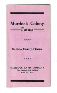
191577876Chicago: Murdock Land Company 1915. Informational booklet for the short-lived Murdock Colony Farms on the Arcadia Prairie in South Florida. At the time the property was located in DeSoto County; today it would be situated in Charlotte County on the Gulf side of the Florida peninsula.<br /> <br /> Includes detailed answers to 111 frequently asked questions and a monthly planting calendar. "The entire tract is divided into 3395 farms and 3395 town lots - and sold a farm and a lot together for $210.00 - payable ten dollars each month. The farms range in size from a 400 acre general farm to a 10 acre fruit farm and truck farm."<br /> <br /> According to an article in the November 2021 issue of Between the Lines the official newsletter of the Charlotte County Libraries and History "John Milton Murdock's Colony Farms failed after the first rainy season brought extensive flooding that destroyed crops. Attempts to create a canal system to prevent flooding and provide irrigation during the dry season proved unsuccessful and Murdock ultimately fled the area after only a few years."<br /> <br /> Booklet: 32 pp. including the wrappers 3 1/4" x 6" with a map on the rear panel. Printed on pink paper and bound with two staples. Some very mild toning and wear; otherwise very good. Scarce OCLC locates no holdings. Murdock Land Company unknown
192140700Washington D.C.: Published by the United States Coast and Geodetic Survey 1921. Large folding nautical chart printed on heavy paper stock. Colored. A rare coastal survey of Pensacola Bay including Perdido Key Pensacola and Pensacola Beach.<br/> <br/> Established by President Thomas Jefferson in 1807 as the Survey of the Coast the U.S. Coast and Geodetic Survey was the United States' first civilian scientific agency. This agency has followed its mission to survey the U.S. coastline create nautical charts of the coast and help increase maritime safety since its founding and has often played fascinating roles in significant chapters of U.S. history. It served in all theaters of the Civil War in the service of the Union Army and Navy pioneered acoustic exploration in the wake of the sinking of the Titanic and during WWI it worked to detect enemy submarines. In addition this agency worked to survey and produce detailed maps and renderings of the U.S. coast. These nautical survey maps commonly referred to as "T-sheets" provide fascinating insights into the history of the United States coastline which has and will continue to shift. These maps are the most important data source for understanding the physical and ecological characteristics of the U.S. shoreline. The present map is a highly detailed and accurate sea chart of Pensacola Bay and an important historical view of a developing Florida. Published by the United States Coast and Geodetic Survey unknown
192240699Washington D.C.: Published by the United States Coast and Geodetic Survey 1922. Large folding nautical chart printed on heavy paper stock. Colored. A rare coastal survey of Florida and Alabama around Pensacola Bay including Orange Beach Perdido Key Pensacola Pensacola Beach and Santa Rosa Island.<br/> <br/> Established by President Thomas Jefferson in 1807 as the Survey of the Coast the U.S. Coast and Geodetic Survey was the United States' first civilian scientific agency. This agency has followed its mission to survey the U.S. coastline create nautical charts of the coast and help increase maritime safety since its founding and has often played fascinating roles in significant chapters of U.S. history. It served in all theaters of the Civil War in the service of the Union Army and Navy pioneered acoustic exploration in the wake of the sinking of the Titanic and during WWI it worked to detect enemy submarines. In addition this agency worked to survey and produce detailed maps and renderings of the U.S. coast. These nautical survey maps commonly referred to as "T-sheets" provide fascinating insights into the history of the United States coastline which has and will continue to shift. These maps are the most important data source for understanding the physical and ecological characteristics of the U.S. shoreline. The present map is a highly detailed and accurate sea chart of the Pensacola area and an important historical view of a developing Florida. Published by the United States Coast and Geodetic Survey unknown
192040683Washington D.C.: Published by the United States Coast and Geodetic Survey 1920. Nautical chart printed on heavy paper stock. Colored. A rare coastal survey of Pensacola Bay including Pensacola and Santa Rosa Island.<br/> <br/> Established by President Thomas Jefferson in 1807 as the Survey of the Coast the U.S. Coast and Geodetic Survey was the United States' first civilian scientific agency. This agency has followed its mission to survey the U.S. coastline create nautical charts of the coast and help increase maritime safety since its founding and has often played fascinating roles in significant chapters of U.S. history. It served in all theaters of the Civil War in the service of the Union Army and Navy pioneered acoustic exploration in the wake of the sinking of the Titanic and during WWI it worked to detect enemy submarines. In addition this agency worked to survey and produce detailed maps and renderings of the U.S. coast. These nautical survey maps commonly referred to as "T-sheets" provide fascinating insights into the history of the United States coastline which has and will continue to shift. These maps are the most important data source for understanding the physical and ecological characteristics of the U.S. shoreline. The present map is a highly detailed and accurate sea chart of the Pensacola Bay and an important historical view of a developing Florida. Published by the United States Coast and Geodetic Survey unknown
191640684Washington D.C.: Published by the United States Coast and Geodetic Survey 1916. Nautical chart printed on heavy paper stock. Colored. A rare coastal survey of Florida from Venice Beach to Fort Myers including Cape Coral Boca Grande and Port Charlotte.<br/> <br/> Established by President Thomas Jefferson in 1807 as the Survey of the Coast the U.S. Coast and Geodetic Survey was the United States' first civilian scientific agency. This agency has followed its mission to survey the U.S. coastline create nautical charts of the coast and help increase maritime safety since its founding and has often played fascinating roles in significant chapters of U.S. history. It served in all theaters of the Civil War in the service of the Union Army and Navy pioneered acoustic exploration in the wake of the sinking of the Titanic and during WWI it worked to detect enemy submarines. In addition this agency worked to survey and produce detailed maps and renderings of the U.S. coast. These nautical survey maps commonly referred to as "T-sheets" provide fascinating insights into the history of the United States coastline which has and will continue to shift. These maps are the most important data source for understanding the physical and ecological characteristics of the U.S. shoreline. The present map is a highly detailed and accurate sea chart of the Fort Myers area and an important historical view of a developing Florida. Published by the United States Coast and Geodetic Survey unknown
191640695Washington D.C.: Published by the United States Coast and Geodetic Survey 1916. Large folding nautical chart printed on heavy paper stock. Uncolored. A rare coastal survey of the Fort Myers area including the San Carlos Bay Caloosahatchee River Cape Coral Sanibel Island and Fort Myers Beach.<br/> <br/> Established by President Thomas Jefferson in 1807 as the Survey of the Coast the U.S. Coast and Geodetic Survey was the United States' first civilian scientific agency. This agency has followed its mission to survey the U.S. coastline create nautical charts of the coast and help increase maritime safety since its founding and has often played fascinating roles in significant chapters of U.S. history. It served in all theaters of the Civil War in the service of the Union Army and Navy pioneered acoustic exploration in the wake of the sinking of the Titanic and during WWI it worked to detect enemy submarines. In addition this agency worked to survey and produce detailed maps and renderings of the U.S. coast. These nautical survey maps commonly referred to as "T-sheets" provide fascinating insights into the history of the United States coastline which has and will continue to shift. These maps are the most important data source for understanding the physical and ecological characteristics of the U.S. shoreline. The present map is a highly detailed and accurate sea chart of Fort Myers area and an important historical view of a developing Florida. Published by the United States Coast and Geodetic Survey unknown
191840725Washington D.C.: Published by the United States Coast and Geodetic Survey 1918. Large folding nautical chart printed on heavy paper stock. Colored. A rare original coastal survey of the far Lower Keys region including Marquesas Keys and Boca Grande Key.<br/> <br/> Established by President Thomas Jefferson in 1807 as the Survey of the Coast the U.S. Coast and Geodetic Survey was the United States' first civilian scientific agency. This agency has followed its mission to survey the U.S. coastline create nautical charts of the coast and help increase maritime safety since its founding and has often played fascinating roles in significant chapters of U.S. history. It served in all theaters of the Civil War in the service of the Union Army and Navy pioneered acoustic exploration in the wake of the sinking of the Titanic and during WWI it worked to detect enemy submarines. In addition this agency worked to survey and produce detailed maps and renderings of the U.S. coast. These nautical survey maps commonly referred to as "T-sheets" provide fascinating insights into the history of the United States coastline which has and will continue to shift. These maps are the most important data source for understanding the physical and ecological characteristics of the U.S. shoreline. The present map is a highly detailed and accurate sea chart of the Lower Keys region and an important historical view of a developing Florida. Published by the United States Coast and Geodetic Survey unknown
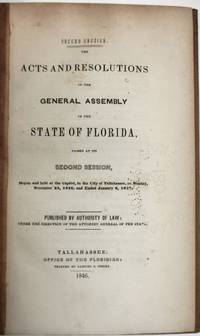
184739054Tallahassee: Office of the Floridian: Printed by Samuel S. Sibley. 1847. 99 V pp. Perforation stamp on title leaf a couple of other institutional marks else Very Good. Bound in later buckram with gilt-lettered red morocco spine title Social Law Library stamped at base of spine. <br /> <br /> Florida joined the Union in 1845. This was its second meeting as a State. Much work was required to establish the framework of State government. The legislature created procedures for selecting presidential electors; enacted fees and costs for civil and criminal cases; regulated slave patrols; enacted incorporations; prohibited vessels from bringing into the Island of Key West any Free Negro or Mulatto; established counties and their boundaries; created pilotage laws and a variety of other Statutes and Resolutions including one to remove the remaining Seminole Indians.<br /> Servies 3243. Office of the Floridian: Printed by Samuel S. Sibley. unknown
191640731Washington D.C.: Published by the United States Coast and Geodetic Survey 1916. Large folding nautical chart printed on heavy paper stock. Uncolored with minor wear. A rare original coastal survey of Florida along Everglades National Park and including Marco Island.<br/> <br/> Established by President Thomas Jefferson in 1807 as the Survey of the Coast the U.S. Coast and Geodetic Survey was the United States' first civilian scientific agency. This agency has followed its mission to survey the U.S. coastline create nautical charts of the coast and help increase maritime safety since its founding and has often played fascinating roles in significant chapters of U.S. history. It served in all theaters of the Civil War in the service of the Union Army and Navy pioneered acoustic exploration in the wake of the sinking of the Titanic and during WWI it worked to detect enemy submarines. In addition this agency worked to survey and produce detailed maps and renderings of the U.S. coast. These nautical survey maps commonly referred to as "T-sheets" provide fascinating insights into the history of the United States coastline which has and will continue to shift. These maps are the most important data source for understanding the physical and ecological characteristics of the U.S. shoreline. The present map is a highly detailed and accurate sea chart of the Everglades National Park and an important historical view of a developing Florida. Published by the United States Coast and Geodetic Survey unknown
192040702Washington D.C.: Published by the United States Coast and Geodetic Survey 1920. Large folding nautical chart printed on heavy paper stock. Colored with minor wear. A rare coastal survey of Florida around St. Augustine including Vilano Beach St. Augustine Beach Butler Beach Crescent Beach Palm Coast and Ormond Beach.<br/> <br/> Established by President Thomas Jefferson in 1807 as the Survey of the Coast the U.S. Coast and Geodetic Survey was the United States' first civilian scientific agency. This agency has followed its mission to survey the U.S. coastline create nautical charts of the coast and help increase maritime safety since its founding and has often played fascinating roles in significant chapters of U.S. history. It served in all theaters of the Civil War in the service of the Union Army and Navy pioneered acoustic exploration in the wake of the sinking of the Titanic and during WWI it worked to detect enemy submarines. In addition this agency worked to survey and produce detailed maps and renderings of the U.S. coast. These nautical survey maps commonly referred to as "T-sheets" provide fascinating insights into the history of the United States coastline which has and will continue to shift. These maps are the most important data source for understanding the physical and ecological characteristics of the U.S. shoreline. The present map is a highly detailed and accurate sea chart of St. Augustine area and an important historical view of a developing Florida. Published by the United States Coast and Geodetic Survey unknown
192040728Washington D.C.: Published by the United States Coast and Geodetic Survey 1920. Large folding nautical chart printed on heavy paper stock. Colored with minor wear and small loss to the top margin. A rare original coastal survey of the St Johns River and Lake George in north-central Florida bisected into two parts.<br/> <br/> Established by President Thomas Jefferson in 1807 as the Survey of the Coast the U.S. Coast and Geodetic Survey was the United States' first civilian scientific agency. This agency has followed its mission to survey the U.S. coastline create nautical charts of the coast and help increase maritime safety since its founding and has often played fascinating roles in significant chapters of U.S. history. It served in all theaters of the Civil War in the service of the Union Army and Navy pioneered acoustic exploration in the wake of the sinking of the Titanic and during WWI it worked to detect enemy submarines. In addition this agency worked to survey and produce detailed maps and renderings of the U.S. coast. These nautical survey maps commonly referred to as "T-sheets" provide fascinating insights into the history of the United States coastline which has and will continue to shift. These maps are the most important data source for understanding the physical and ecological characteristics of the U.S. shoreline. The present map is a highly detailed and accurate sea chart of the Lake George region and an important historical view of a developing Florida. Published by the United States Coast and Geodetic Survey unknown
191640686Washington D.C.: Published by the United States Coast and Geodetic Survey 1916. Nautical chart printed on heavy paper stock. Colored. A rare coastal survey of the St. Johns River near Orlando with an inset map of the river continuation in the bottom left corner.<br/> <br/> Established by President Thomas Jefferson in 1807 as the Survey of the Coast the U.S. Coast and Geodetic Survey was the United States' first civilian scientific agency. This agency has followed its mission to survey the U.S. coastline create nautical charts of the coast and help increase maritime safety since its founding and has often played fascinating roles in significant chapters of U.S. history. It served in all theaters of the Civil War in the service of the Union Army and Navy pioneered acoustic exploration in the wake of the sinking of the Titanic and during WWI it worked to detect enemy submarines. In addition this agency worked to survey and produce detailed maps and renderings of the U.S. coast. These nautical survey maps commonly referred to as "T-sheets" provide fascinating insights into the history of the United States coastline which has and will continue to shift. These maps are the most important data source for understanding the physical and ecological characteristics of the U.S. shoreline. The present map is a highly detailed and accurate sea chart of the St Johns River and an important historical view of a developing Florida. Published by the United States Coast and Geodetic Survey unknown
191640716Washington D.C.: Published by the United States Coast and Geodetic Survey 1916. Large folding nautical chart printed on heavy paper stock. Uncolored. A rare original coastal survey of the St. Johns River from Jacksonville to Fleming Island.<br/> <br/> Established by President Thomas Jefferson in 1807 as the Survey of the Coast the U.S. Coast and Geodetic Survey was the United States' first civilian scientific agency. This agency has followed its mission to survey the U.S. coastline create nautical charts of the coast and help increase maritime safety since its founding and has often played fascinating roles in significant chapters of U.S. history. It served in all theaters of the Civil War in the service of the Union Army and Navy pioneered acoustic exploration in the wake of the sinking of the Titanic and during WWI it worked to detect enemy submarines. In addition this agency worked to survey and produce detailed maps and renderings of the U.S. coast. These nautical survey maps commonly referred to as "T-sheets" provide fascinating insights into the history of the United States coastline which has and will continue to shift. These maps are the most important data source for understanding the physical and ecological characteristics of the U.S. shoreline. The present map is a highly detailed and accurate sea chart of St. Johns River around Jacksonville and an important historical view of a developing Florida. Published by the United States Coast and Geodetic Survey unknown
192140694Washington D.C.: Published by the United States Coast and Geodetic Survey 1921. Nautical chart printed on heavy paper stock. Colored. A rare coastal survey of Florida including Laguna beach Panama City Mexico Beach and Cape San Blas.<br/> <br/> Established by President Thomas Jefferson in 1807 as the Survey of the Coast the U.S. Coast and Geodetic Survey was the United States' first civilian scientific agency. This agency has followed its mission to survey the U.S. coastline create nautical charts of the coast and help increase maritime safety since its founding and has often played fascinating roles in significant chapters of U.S. history. It served in all theaters of the Civil War in the service of the Union Army and Navy pioneered acoustic exploration in the wake of the sinking of the Titanic and during WWI it worked to detect enemy submarines. In addition this agency worked to survey and produce detailed maps and renderings of the U.S. coast. These nautical survey maps commonly referred to as "T-sheets" provide fascinating insights into the history of the United States coastline which has and will continue to shift. These maps are the most important data source for understanding the physical and ecological characteristics of the U.S. shoreline. The present map is a highly detailed and accurate sea chart of BLANK and an important historical view of a developing Florida. Published by the United States Coast and Geodetic Survey unknown
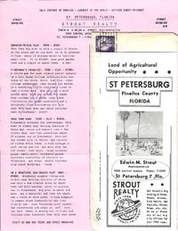
77880Small packet of materials concerning investment opportunities in St. Petersburg Florida mailed by Strout Realty to Mr. and Mrs. Ray Spencer of Delavan Wisconsin on March 22 1957. The contents consist of an informational brochure about the city and a detailed list with pricing information for fifteen "Strout Bargains" in St. Petersburg. Four of the properties are marked "Sold" and there is a holographic correction to the price of the final listing: "A Retirement Gem" for $3950. Located on the Pinellas peninsula between Tampa Bay and the Gulf of Mexico "St. Pete" experienced a population boom during the 1950s with the return of retiree resettlement which had declined precipitously during the Great Depression. At this same time as the brochure notes there was "increasing demand for Florida citrus products" which attracted many small farmers to the region. unknown
191640706Washington D.C.: Published by the United States Coast and Geodetic Survey 1916. Large folding nautical chart printed on heavy paper stock. Colored. A rare coastal survey of Tampa Bay including Tampa St. Petersburg Clearwater Anna Maria Island and Bradenton.<br/> <br/> Established by President Thomas Jefferson in 1807 as the Survey of the Coast the U.S. Coast and Geodetic Survey was the United States' first civilian scientific agency. This agency has followed its mission to survey the U.S. coastline create nautical charts of the coast and help increase maritime safety since its founding and has often played fascinating roles in significant chapters of U.S. history. It served in all theaters of the Civil War in the service of the Union Army and Navy pioneered acoustic exploration in the wake of the sinking of the Titanic and during WWI it worked to detect enemy submarines. In addition this agency worked to survey and produce detailed maps and renderings of the U.S. coast. These nautical survey maps commonly referred to as "T-sheets" provide fascinating insights into the history of the United States coastline which has and will continue to shift. These maps are the most important data source for understanding the physical and ecological characteristics of the U.S. shoreline. The present map is a highly detailed and accurate sea chart of Tampa Bay and an important historical view of a developing Florida. Published by the United States Coast and Geodetic Survey unknown
191540709Washington D.C.: Published by the United States Coast and Geodetic Survey 1915. Large folding nautical chart printed on heavy paper stock. Colored. Coastal survey map encompassing Tampa Bay up to Cape San Blas including St. Petersburg Tampa Clearwater St. George Island and Cedar Keys.<br/> <br/> Established by President Thomas Jefferson in 1807 as the Survey of the Coast the U.S. Coast and Geodetic Survey was the United States' first civilian scientific agency. This agency has followed its mission to survey the U.S. coastline create nautical charts of the coast and help increase maritime safety since its founding and has often played fascinating roles in significant chapters of U.S. history. It served in all theaters of the Civil War in the service of the Union Army and Navy pioneered acoustic exploration in the wake of the sinking of the Titanic and during WWI it worked to detect enemy submarines. In addition this agency worked to survey and produce detailed maps and renderings of the U.S. coast. These nautical survey maps commonly referred to as "T-sheets" provide fascinating insights into the history of the United States coastline which has and will continue to shift. These maps are the most important data source for understanding the physical and ecological characteristics of the U.S. shoreline. The present map is a highly detailed and accurate sea chart of the coast of Florida from Tampa Bay to Cape San Blas and is an important historical view of the developing state. Published by the United States Coast and Geodetic Survey unknown
191740713Washington D.C.: Published by the United States Coast and Geodetic Survey 1917. Large folding nautical chart printed on heavy paper stock. Uncolored. Coastal survey map of Tortugas Harbor and approaches with an inset map in the upper left corner of Fort Jefferson.<br/> <br/> Established by President Thomas Jefferson in 1807 as the Survey of the Coast the U.S. Coast and Geodetic Survey was the United States' first civilian scientific agency. This agency has followed its mission to survey the U.S. coastline create nautical charts of the coast and help increase maritime safety since its founding and has often played fascinating roles in significant chapters of U.S. history. It served in all theaters of the Civil War in the service of the Union Army and Navy pioneered acoustic exploration in the wake of the sinking of the Titanic and during WWI it worked to detect enemy submarines. In addition this agency worked to survey and produce detailed maps and renderings of the U.S. coast. These nautical survey maps commonly referred to as "T-sheets" provide fascinating insights into the history of the United States coastline which has and will continue to shift. These maps are the most important data source for understanding the physical and ecological characteristics of the U.S. shoreline. The present map is inset with a detailed view of Fort Jefferson on Garden Key. Fort Jefferson was an ambitious civil war era coastal defence site which became the largest brick structure in the US. This map is a highly detailed and accurate sea chart of Tortugas Harbor and an important historical view of a developing Florida. Published by the United States Coast and Geodetic Survey unknown
191640722Washington D.C.: Published by the United States Coast and Geodetic Survey 1916. Large folding nautical chart printed on heavy paper stock. Uncolored. A rare original coastal survey of the central Florida coast around Cedar Keys.<br/> <br/> Established by President Thomas Jefferson in 1807 as the Survey of the Coast the U.S. Coast and Geodetic Survey was the United States' first civilian scientific agency. This agency has followed its mission to survey the U.S. coastline create nautical charts of the coast and help increase maritime safety since its founding and has often played fascinating roles in significant chapters of U.S. history. It served in all theaters of the Civil War in the service of the Union Army and Navy pioneered acoustic exploration in the wake of the sinking of the Titanic and during WWI it worked to detect enemy submarines. In addition this agency worked to survey and produce detailed maps and renderings of the U.S. coast. These nautical survey maps commonly referred to as "T-sheets" provide fascinating insights into the history of the United States coastline which has and will continue to shift. These maps are the most important data source for understanding the physical and ecological characteristics of the U.S. shoreline. The present map of the Florida coastline precedes the inclusion of Yankeetown; chartered in 1923 and the site of one of only two completed sections of the proposed Cross Florida Barge Canal. This map is a highly detailed and accurate sea chart of the central Florida coastal region and an important historical view of a developing Florida. Published by the United States Coast and Geodetic Survey unknown
183932262New York: Wiley and Putnam 1839. First Edition. Hardcover. Good. Small octavo. 1 xii 13-199 pages 1. Brown cloth hardcover with gilt lettered title on the spine. The brown cloth is faded and creased with a few light spots and edge wear head and base of the spine. Light to moderate scattered foxing and toning to the contents. Previous owner name on the front paste down. No author name indicated. <br /> <br /> Clark Old South III 257; Sabin 104829. Wiley and Putnam hardcover
189059940Key West FL: Hunt Photographer 211 Duval St. ca. 1890. Oblong 8vo. One albumen photo sized 4.25 x 6.5 in. mounted on printed 5.25 x 8.5 in. boudoir-sized studio board w/ photographer’s imprint in lower margin of board manuscript pencil title on verso minor chipping & slight tears to upper fore-edge of image still a VG- photo w/ bright strong contrast. A scarce 19th-century albumen boudoir photograph capturing the historic fish market in Key West Florida which at the time held a monopoly on the sponge trade in the United States. Beginning with sponges introduced before the Civil War eventually 1200 spongers on hook boats caught up to 2000 tons of sponges a year. At the time turtling or turtle fishing was a significant industry and the Charter Fishing Boat presence was still quite small and would eventually grow during the Progressive Era drawing ever greater numbers of tourists. Hunt fl. 1880-1900 in Key West Florida operated a photography studio at 211 Duval for over a decade and was originally from Indiana. Hunt, Photographer, 211 Duval St., unknown
182332839Washington DC: Printed by Gales & Seaton 1823. First Edition. Wraps. Good. Disbound wraps. 5 pages 1 blank page. Printed name of Waters Smith at the bottom page 5 and attested by the Secretary F. J. Fatio. Scarce. 2 copies located in OCLC as of 4/2019 Jacksonville PL AAS. Florida became a territory of the United States in 1822 and obtained statehood in 1845. Printed by Gales & Seaton unknown
1863D19919Florida: Munsell San Augustin de la Florida 1863. Poor. One of 160 copies. Defective disbound without only remnants of original wraps. Sold as is. "The unknown author of this authoritative account of Sonora is thought to have been a Jesuit missionary named Juan Nentuig who reached Sonora in 1750. From a reference on p. 196 it must have been written as late as November 21 1762. Nentuig remained until the expulsion of the Jesuits in 1767. The false imprint of Saint Augustine Florida on the title derives from Buckingham Smith's pride in his home town" - Streeter. "The author resided at a place on the River Yaqni where that stream flows through a cañon so deep as to shut out three quarters of the heavens from sight. The first sixty-nine pages are occupied with a natural history of the country .The subjects relating to the Indians occupy pp.69 to 173" - Field. <br/><br/> Munsell, San Augustin, de la Florida paperback
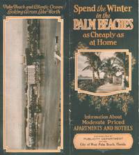
34507West Palm Beach: City of West Palm Beach Florida n.d. Brochure. Good. Folded brochure. Vintage brochure measures 9" x 4" when folded. 28 pages. Illustrated with black and white photographs of hotels buildings the beach etc. Color illustration on the front cover and aerial photograph of the city on the back cover. A few spots to the contents. Good condition. City of West Palm Beach, Florida unknown