1 698 résultats
SONG1786604825Rowman & Littlefield Publishers 2018-04-30. hardcover. Used: Good. 6.30x1.09x9.27. Buy with confidence. Excellent Customer Service & Return policy. Rowman & Littlefield Publishers hardcover
1396075402.Ghardcover. Good. Access codes and supplements are not guaranteed with used items. May be an ex-library book. hardcover
43577243-nnew. unknown
43577243like new. unknown
mon0003765385Lexington Books 10/18/2021 12:00:01. hardcover. Very Good. 1.0600 9.2500 6.2200. Lexington Books hardcover
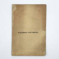
1837370450New York 1837. First edition. 16pp. 8vo. Original printed yellow wrappers repairs to small chips and separation at fold. Provenance: Thomas W. Streeter booklabel on inner rear wrapper pencil notes on front wrapper and first page of text. First edition. 16pp. 8vo. Comprising 1.4 million acres of land on the Gulf of Mexico between the Apalachicola and Wakulla Rivers in West Florida the Forbes land grant was ceded by the Seminoles and Lower Creeks to John Forbes & Company in payment for debts. With trade with Native Americans unprofitable during the War of 1812 Forbes sold the claim. The treaty transferring Florida to the United States did not go into effect until 1821 and private title under Spanish land grants with the territory was questionable. Decades of lawsuits ensued going as high as the Supreme Court. After the resolution of claims the title was reorganized as the Apalachiocola Land Company in 1835. The present report by the President of the Board of Directors of the New York-based company describes the geography of the region and outlines the plan for its division into lots for dwellings and businesses. The report summarizes the surveys of the region and describes the land and its resources and flora. Sabin calls for a map in this report although Servies does not note one. However the text references a map on page 7 which was likely not issued with all copies. <br /> <br /> The development of the land was not successful and the company eventually folded. "As an object of speculation the Forbes Purchase not only originated in a chaotic era but was hampered for many years by uncertain title to the land. Its development was also hindered by a lack of good agricultural land as well as by competition from the United States itself which was selling new lands in the American West at the same time the Apalachicola Land Company was getting started" Upchurch.<br /> <br /> This Streeter copy is the only example appearing in auction records and the only one we can trace in the market. Streeter purchased it from Rosenbach in 1936 for $50 and it was acquired at the Streeter sale for $65 by dealer and former Rosenbach employee John Fleming. It was eventually acquired by the collector Jay Kislak. Servies 2010; Streeter sale 1240 this copy; Sabin 5878; American Imprints 43274. See John C. Upchurch "Aspects of the Development and Exploration of the Forbes Purchase" Florida Historical Quarterly Vol. XLVIII No. 2 October 1969 unknown
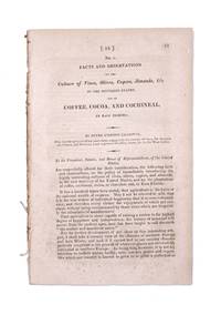
1822339169Washington D.C.: Gales & Seaton 1822. 17th Congress 1st Session House Report No. 14. 13-35 1 blankpp. 8vo. Disbound. 17th Congress 1st Session House Report No. 14. 13-35 1 blankpp. 8vo. The appendix to a memorial not present presented to the House Committee on the Public Lands requesting that the association formed by Chazotte be allowed to purchase land in the Key Largo area for the purpose of cultivating coffee cocoa and tropical fruits. The Appendix with its own caption title was first published separately in Philadelphia in 1821. Shoemaker 11211 [Gales & Seaton] unknown
1966730756PN. New. 1966. Soft Cover. Date is original print. This is a reprint edition. . PN paperback
1993Q-0945612346Madison House 1993-01-01. Hardcover. New. In shrink wrap. Looks like an interesting title! Madison House hardcover
192140685Washington D.C.: Published by the United States Coast and Geodetic Survey 1921. Nautical chart printed on heavy paper stock. Colored. A rare coastal survey of Florida from Fernandina to Jacksonville including Amelia Island Atlantic Beach Neptune Beach and the St. Johns River.<br/> <br/> Established by President Thomas Jefferson in 1807 as the Survey of the Coast the U.S. Coast and Geodetic Survey was the United States' first civilian scientific agency. This agency has followed its mission to survey the U.S. coastline create nautical charts of the coast and help increase maritime safety since its founding and has often played fascinating roles in significant chapters of U.S. history. It served in all theaters of the Civil War in the service of the Union Army and Navy pioneered acoustic exploration in the wake of the sinking of the Titanic and during WWI it worked to detect enemy submarines. In addition this agency worked to survey and produce detailed maps and renderings of the U.S. coast. These nautical survey maps commonly referred to as "T-sheets" provide fascinating insights into the history of the United States coastline which has and will continue to shift. These maps are the most important data source for understanding the physical and ecological characteristics of the U.S. shoreline. The present map is a highly detailed and accurate sea chart of the Florida coast from Fernandina to Jacksonville and is an important historical view of the state. Published by the United States Coast and Geodetic Survey unknown
192140696Washington D.C.: Published by the United States Coast and Geodetic Survey 1921. Large folding nautical chart printed on heavy paper stock. Colored. A rare coastal survey of Florida from Fernandina to Jacksonville including Amelia Island Atlantic Beach Neptune Beach and the St. Johns River.<br/> <br/> Established by President Thomas Jefferson in 1807 as the Survey of the Coast the U.S. Coast and Geodetic Survey was the United States' first civilian scientific agency. This agency has followed its mission to survey the U.S. coastline create nautical charts of the coast and help increase maritime safety since its founding and has often played fascinating roles in significant chapters of U.S. history. It served in all theaters of the Civil War in the service of the Union Army and Navy pioneered acoustic exploration in the wake of the sinking of the Titanic and during WWI it worked to detect enemy submarines. In addition this agency worked to survey and produce detailed maps and renderings of the U.S. coast. These nautical survey maps commonly referred to as "T-sheets" provide fascinating insights into the history of the United States coastline which has and will continue to shift. These maps are the most important data source for understanding the physical and ecological characteristics of the U.S. shoreline. The present map is a highly detailed and accurate sea chart of Florida from Fernandina to Jacksonville and an important historical view of the developing state. Published by the United States Coast and Geodetic Survey unknown
191640704Washington D.C.: Published by the United States Coast and Geodetic Survey 1916. Nautical chart printed on heavy paper stock. Colored. A rare coastal survey of the border of Georgia and Florida including Cumberland Island Fernandina and Amelia Island.<br/> <br/> Established by President Thomas Jefferson in 1807 as the Survey of the Coast the U.S. Coast and Geodetic Survey was the United States' first civilian scientific agency. This agency has followed its mission to survey the U.S. coastline create nautical charts of the coast and help increase maritime safety since its founding and has often played fascinating roles in significant chapters of U.S. history. It served in all theaters of the Civil War in the service of the Union Army and Navy pioneered acoustic exploration in the wake of the sinking of the Titanic and during WWI it worked to detect enemy submarines. In addition this agency worked to survey and produce detailed maps and renderings of the U.S. coast. These nautical survey maps commonly referred to as "T-sheets" provide fascinating insights into the history of the United States coastline which has and will continue to shift. These maps are the most important data source for understanding the physical and ecological characteristics of the U.S. shoreline. The present map is a highly detailed and accurate sea chart of the Fernandina area and an important historical view of a developing Florida. Published by the United States Coast and Geodetic Survey unknown
0484550365.Ghardcover. Good. Access codes and supplements are not guaranteed with used items. May be an ex-library book. hardcover
0484717235.Ghardcover. Good. Access codes and supplements are not guaranteed with used items. May be an ex-library book. hardcover
19991320291PN. New. 1999. Soft Cover. Date is original print. This is a reprint edition . PN paperback
0428361374.Gpaperback. Good. Access codes and supplements are not guaranteed with used items. May be an ex-library book. paperback
1991246788PN. New. 1991. Soft Cover. Date is original print. This is a reprint edition . PN paperback
ria9780357130797_inpHardback. New. New Book; Fast Shipping from UK; Not signed; Not First Edition; Develop a clear understanding of why financial markets exist how financial institutions serve these markets and what services those institutions offer with Madura''s best-selling FINANCIAL MARKETS AND INSTITUTIONS 13E. Packed with to hardcover
2012BN1926552012. 2012. Softcover. Financial Institutions and Markets International Edition with Stock Trak Coupon <br/><br/>Financial Institutions and Markets International Edition with Stock Trak Coupon Jeff Florida Atlantic University Madura paperback
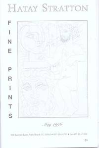
71-5523Vero Beach FL.: Hatay Stratton 1996. 8vo. 17 pp. Soft Cover. Stapled binding. Black and white illustrations throughout. Price list tipped in. Very Good minor surface rubs. Vero Beach, FL.: Hatay Stratton, 1996. paperback
0469033568.Ghardcover. Good. Access codes and supplements are not guaranteed with used items. May be an ex-library book. hardcover
046903355X.Gpaperback. Good. Access codes and supplements are not guaranteed with used items. May be an ex-library book. paperback
1334779600.Gpaperback. Good. Access codes and supplements are not guaranteed with used items. May be an ex-library book. paperback
0332394840.Ghardcover. Good. Access codes and supplements are not guaranteed with used items. May be an ex-library book. hardcover
1938ZB311479Tallahassee: 1938-1944. 7 items bound as 1; sizes vary from small octavo to quarto each 40 to 87 pages and mostly tabular; ex library in one later cloth binding with softcover reatined good. - If you are reading this this item is actually physically in our stock and ready for shipment once ordered. We are not bookjackers. Buyer is responsible for any additional duties taxes or fees required by recipient's country. Photos available upon request. Tallahassee: paperback