Florida Constitutional ConventionBiblio.com

1 698 résultats
B9781018669151Hardback. New. hardcover
0331757206.Gpaperback. Good. Access codes and supplements are not guaranteed with used items. May be an ex-library book. paperback
0331757281.Ghardcover. Good. Access codes and supplements are not guaranteed with used items. May be an ex-library book. hardcover
0656761679.Ghardcover. Good. Access codes and supplements are not guaranteed with used items. May be an ex-library book. hardcover
1332907458.Gpaperback. Good. Access codes and supplements are not guaranteed with used items. May be an ex-library book. paperback
1966730070PN. New. 1966. Soft Cover. Date is original print. This is a reprint edition. . PN paperback
1966730071PN. New. 1966. Soft Cover. Date is original print. This is a reprint edition. . PN paperback
1999182125Tallahassee : Florida State University Museum of Fine Arts 1999. First Edition. Paperback. Fine copy in the original stiff-card wrappers. Particularly and surprisingly well-preserved; tight bright clean and especially sharp-cornered. Signed by the author. ; 8vo 8"" - 9"" tall; 80 pages; Physical desc.: 80 p. : ill. some col. ; 26 cm. Subject: Chicago Judy 1939- --Exhibitions --Feminism in art --Women in art --Women artists --United States --Exhibitions. Tallahassee : Florida State University Museum of Fine Arts paperback
191740733Washington D.C.: Published by the United States Coast and Geodetic Survey 1917. Large folding nautical chart printed on heavy paper stock. Colored. A rare original coastal survey of the south eastern Florida coastline from Boca Raton to Jupiter encompassing Lake Worth West Palm Beach and Delray Beach.<br/> <br/> Established by President Thomas Jefferson in 1807 as the Survey of the Coast the U.S. Coast and Geodetic Survey was the United States' first civilian scientific agency. This agency has followed its mission to survey the U.S. coastline create nautical charts of the coast and help increase maritime safety since its founding and has often played fascinating roles in significant chapters of U.S. history. It served in all theaters of the Civil War in the service of the Union Army and Navy pioneered acoustic exploration in the wake of the sinking of the Titanic and during WWI it worked to detect enemy submarines. In addition this agency worked to survey and produce detailed maps and renderings of the U.S. coast. These nautical survey maps commonly referred to as "T-sheets" provide fascinating insights into the history of the United States coastline which has and will continue to shift. These maps are the most important data source for understanding the physical and ecological characteristics of the U.S. shoreline. The present map is a highly detailed and accurate sea chart of the coast of southeast Florida and an important historical view of the developing state. Published by the United States Coast and Geodetic Survey unknown
192140714Washington D.C.: Published by the United States Coast and Geodetic Survey 1921. Large folding nautical sea chart printed on heavy paper stock. Colored. A rare coastal survey of Florida from Jupiter to Miami bisected into two parts including Jupiter West Palm Beach Boca Raton Pompano Beach Fort Lauderdale Hollywood Miami and Key Biscayne.<br/> <br/> Established by President Thomas Jefferson in 1807 as the Survey of the Coast the U.S. Coast and Geodetic Survey was the United States' first civilian scientific agency. This agency has followed its mission to survey the U.S. coastline create nautical charts of the coast and help increase maritime safety since its founding and has often played fascinating roles in significant chapters of U.S. history. It served in all theaters of the Civil War in the service of the Union Army and Navy pioneered acoustic exploration in the wake of the sinking of the Titanic and during WWI it worked to detect enemy submarines. In addition this agency worked to survey and produce detailed maps and renderings of the U.S. coast. These nautical survey maps commonly referred to as "T-sheets" provide fascinating insights into the history of the United States coastline which has and will continue to shift. These maps are the most important data source for understanding the physical and ecological characteristics of the U.S. shoreline. The present map is a highly detailed and accurate sea chart of the Florida coast from Jupiter to Miami and an important historical view the developing state. Published by the United States Coast and Geodetic Survey unknown
192140707Washington D.C.: Published by the United States Coast and Geodetic Survey 1921. Large folding nautical chart printed on heavy paper stock. Colored. A rare coastal survey of Florida from Jupiter to Miami bisected into two parts including Jupiter West Palm Beach Boca Raton Pompano Beach Fort Lauderdale Hollywood Miami and Key Biscayne.<br/> <br/> Established by President Thomas Jefferson in 1807 as the Survey of the Coast the U.S. Coast and Geodetic Survey was the United States' first civilian scientific agency. This agency has followed its mission to survey the U.S. coastline create nautical charts of the coast and help increase maritime safety since its founding and has often played fascinating roles in significant chapters of U.S. history. It served in all theaters of the Civil War in the service of the Union Army and Navy pioneered acoustic exploration in the wake of the sinking of the Titanic and during WWI it worked to detect enemy submarines. In addition this agency worked to survey and produce detailed maps and renderings of the U.S. coast. These nautical survey maps commonly referred to as "T-sheets" provide fascinating insights into the history of the United States coastline which has and will continue to shift. These maps are the most important data source for understanding the physical and ecological characteristics of the U.S. shoreline. The present map is a highly detailed and accurate sea chart of the Florida coast from Jupiter to Miami and an important historical view the developing state. Published by the United States Coast and Geodetic Survey unknown
B195049-1Valencia 1998. 190 2pp. Prof. illus. Lrg. 4to. Cloth. D.j. Parallel texts in Spanish and English. Valencia, 1998. hardcover
1973357791International Exhibition Foundation 1973. First Edition. Hardcover. Good copy in the original title-blocked pictorial cloth. Slightest suggestion only of dust-dulling to the spine bands and panel edges. Remains well-preserved overall; tight bright clean and strong. Physical description; ix 151 p. : ill. some col. port. ; 28 cm. Notes; SIGNED and inscribed. Biog.; Exhibs.; Wks. in Colls. Bibl. Exhibiton circulated by the Interantional Exhibitions Foundation. Subjects; Karl Knaths. Painting. exhibition guides. Genre; Illustrated. International Exhibition Foundation hardcover
B9781169592544New. unknown
1169592546.Ghardcover. Good. Access codes and supplements are not guaranteed with used items. May be an ex-library book. hardcover
1162107375.Ghardcover. Good. Access codes and supplements are not guaranteed with used items. May be an ex-library book. hardcover
189059940Key West FL: Hunt Photographer 211 Duval St. ca. 1890. Oblong 8vo. One albumen photo sized 4.25 x 6.5 in. mounted on printed 5.25 x 8.5 in. boudoir-sized studio board w/ photographer’s imprint in lower margin of board manuscript pencil title on verso minor chipping & slight tears to upper fore-edge of image still a VG- photo w/ bright strong contrast. A scarce 19th-century albumen boudoir photograph capturing the historic fish market in Key West Florida which at the time held a monopoly on the sponge trade in the United States. Beginning with sponges introduced before the Civil War eventually 1200 spongers on hook boats caught up to 2000 tons of sponges a year. At the time turtling or turtle fishing was a significant industry and the Charter Fishing Boat presence was still quite small and would eventually grow during the Progressive Era drawing ever greater numbers of tourists. Hunt fl. 1880-1900 in Key West Florida operated a photography studio at 211 Duval for over a decade and was originally from Indiana. Hunt, Photographer, 211 Duval St., unknown
192240720Washington D.C.: Published by the United States Coast and Geodetic Survey 1922. Large folding nautical chart printed on heavy paper stock. Colored. A rare original coastal survey of Key West Harbor.<br/> <br/> Established by President Thomas Jefferson in 1807 as the Survey of the Coast the U.S. Coast and Geodetic Survey was the United States' first civilian scientific agency. This agency has followed its mission to survey the U.S. coastline create nautical charts of the coast and help increase maritime safety since its founding and has often played fascinating roles in significant chapters of U.S. history. It served in all theaters of the Civil War in the service of the Union Army and Navy pioneered acoustic exploration in the wake of the sinking of the Titanic and during WWI it worked to detect enemy submarines. In addition this agency worked to survey and produce detailed maps and renderings of the U.S. coast. These nautical survey maps commonly referred to as "T-sheets" provide fascinating insights into the history of the United States coastline which has and will continue to shift. These maps are the most important data source for understanding the physical and ecological characteristics of the U.S. shoreline. The present map of the Florida coastline is notable in displaying the Overseas Railroad as the only main land transportation link between the Keys. At the time this map was published the overseas highway had yet to be built and tourism and travel in the region was limited to boat or train. This map is a highly detailed and accurate sea chart of Key West and an important historical view of a developing Florida. Published by the United States Coast and Geodetic Survey unknown
191940697Washington D.C.: Published by the United States Coast and Geodetic Survey 1919. Large folding nautical chart printed on heavy paper stock. Colored. A rare coastal survey of Key West Harbor including Key West and several anchorage points for potential naval use complete with a U.S. Navy seal.<br/> <br/> Established by President Thomas Jefferson in 1807 as the Survey of the Coast the U.S. Coast and Geodetic Survey was the United States' first civilian scientific agency. This agency has followed its mission to survey the U.S. coastline create nautical charts of the coast and help increase maritime safety since its founding and has often played fascinating roles in significant chapters of U.S. history. It served in all theaters of the Civil War in the service of the Union Army and Navy pioneered acoustic exploration in the wake of the sinking of the Titanic and during WWI it worked to detect enemy submarines. In addition this agency worked to survey and produce detailed maps and renderings of the U.S. coast. These nautical survey maps commonly referred to as "T-sheets" provide fascinating insights into the history of the United States coastline which has and will continue to shift. These maps are the most important data source for understanding the physical and ecological characteristics of the U.S. shoreline. The present map is a highly detailed and accurate sea chart of Key West and an important historical view of a developing Florida. Published by the United States Coast and Geodetic Survey unknown
842273-nnew. unknown
842273like new. unknown
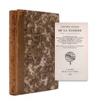
1853351784Paris: Jannet 1853. One of 100 copies. 4 xvi 228pp. 12mo. Early calf backed marbled paper boards spine abraded. One of 100 copies. 4 xvi 228pp. 12mo. A reprint of the first edition of 1586 one of the earliest books on Florida and one of the first works to describe the native American tribes of Florida. "This rare little volume is dedicated to Sir Walter Raleigh in whose praise there are also several Latin poems; one of them by Hakluyt. It contains an account of Ribault's Voyage in 1562 Laudonniere's in 1564. Ribault's second voyage in 1565 and Gorgues' in 1567" Rich. According to Sabin 100 copies were printed of this edition. Sabin 39235. Sabin 39235 <br/><br/> Jannet hardcover
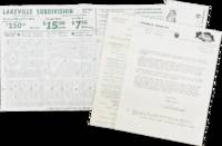
77874Small packet of marketing materials for the Lakeville Subdivision in North Fort Myers Florida. Housed in a Thomas Realty envelope mailed on April 15 1957 to E.R. Spencer of Delavan Wisconsin the contents include an introductory letter a carbonless purchase contract in triplicate and a detailed plat map 16" x 10". The letter references a booklet which is not present.<br /> <br /> Located along the Tamiami Trail U.S. 41 north of Fort Myers the Lakeville Subdivision was advertised as a "tropical wonderland" with homesites starting at $250. The plat map corresponds to the second section of the subdivision; presumably the first section had already been sold. However it appears the second section did not attract sufficient investors as this portion of the property remains largely undeveloped. unknown
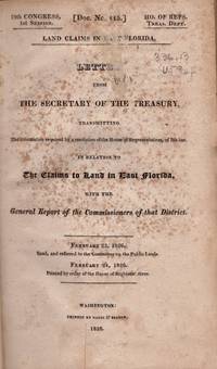
182630784Washington D. C.: Printed by Gales & Seaton 1826. First Edition. Hardcover. Fair. Octavo. 148 pages. 13 folding tables. Original issued wraps rebound in plain burgundy cloth hardcover with title on the spine. Ex-institutional copy with New Hampshire Historical Society label on the front paste down. Penciled numbers on the title page. Small label removed from the lower spine. Moderate scattered foxing and toning to contents. Much of the correspondence settling land claims originated from St. Augustine. The folding tables include names of claimants acreage who conceded etc. Florida became an United States territory in 1821. Florida achieved Statehood in 1845. Printed by Gales & Seaton hardcover
ria9781118531280_inpPaperback / softback. New. New Book; Fast Shipping from UK; Not signed; Not First Edition; This innovative introduction outlines the structure and distribution of the world s languages charting their evolution over the past 200000 years. paperback