1 528 résultats
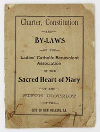
19014227New Orleans: A.M. Escudier Book and Job Printers 1901. About good. 19pp. Original printed front wrapper rear wrapper not present. Front wrapper a bit chipped and creased old adhesive repairs to closed tears bottom corner reinforced with tissue partially split along spine. Text block a bit toned foxed and creased. A seemingly unrecorded turn-of-the-20th century New Orleans imprint recording the founding and governing documents of the Ladies' Catholic Benevolent Association of the Sacred Heart of Mary of the Fifth District of New Orleans. The work contains the group's charter letters of support from various Louisiana officials the constitution and by-laws of the New Orleans chapter. The LCBA was organized in 1890 in Titusville Pennsylvania as a mutual aid society to provide insurance to women as most insurance companies of the time considered women uninsurable. The members of the association would pool their money together in order to cover various insurance needs as they arose from the membership. The group is actually still in operation today now known as the Loyal Christian Benefit Association. Though social action by Catholic women is more prevalent today it was uncommon in the 19th and early-20th century but the present group was strong-willed and often clashed with the hierarchy including some Bishops. No copies listed in OCLC. A.M. Escudier, Book and Job Printers unknown
188960663New York: Harper & Brothers 1889. 12mo. 6 204 pp. plus 4 pp. publisher’s ads. Brick-red decorated cloth coral and sea star Arts & Crafts motifs front cover & spine minor rubbing very minor bumping to head of spine couple corners still a VG bright copy from the library of Irving Brooks w/ Art Deco bookplate on front pastedown. First edition of this moody and striking novella the author’s first set against the backdrop of a young Creole girl who survived the 1856 Last Island Hurricane which destroyed the pleasure resort island including all of the structures. Hearn has designed the novella to detail the story of Chita a supposed orphan growing up in the family of a fisherman who later finds her survivor father. BAL 7918. Harper & Brothers, hardcover
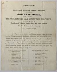
1867865New Orleans: Pelican Job Print 1867. Very good. Broadside 9.75 x 7.75 inches. Quarto on a folded folio sheet. Old fold lines. Minor soiling. Broadside circular advertising the services of James W. Price "merchandise and produce broker" located at No. 34 Tchoupitoulas Street in New Orleans. The text reads: "I will give personal attention to all business entrusted to my care for the purchase of every description of Merchandise and Produce also Manufactured Tobacco Havana and Domestic Cigars Leaf Tobacco for Cigar purposes Tobacco in Hogsheads and Bales for the Mexican and Texas Trade for Plantation use -- a superior article for sheep wash. I feel confident in my ability to give entire satisfaction in all business entrusted to my care and refer to the following well-known firms of this city and of Texas where I resided for twenty years." There follows a list of twenty-two businesses from New Orleans Galveston and Houston. An ephemeral piece from the Reconstruction period in Louisiana. Pelican Job Print unknown
192241168Washington D.C.: Published by the United States Coast and Geodetic Survey 1922. Large folding nautical chart printed on heavy paper stock. Colored. A rare original coastal survey of southwest wetlands from Calcasieu Pass to Constance Bayou and including Pecan Island and the Mermentau River.<br/> <br/> Established by President Thomas Jefferson in 1807 as the Survey of the Coast the U.S. Coast and Geodetic Survey was the United States' first civilian scientific agency. This agency has followed its mission to survey the U.S. coastline create nautical charts of the coast and help increase maritime safety since its founding and has often played fascinating roles in significant chapters of U.S. history. It served in all theaters of the Civil War in the service of the Union Army and Navy pioneered acoustic exploration in the wake of the sinking of the Titanic and during WWI it worked to detect enemy submarines. In addition this agency worked to survey and produce detailed maps and renderings of the U.S. coast. These nautical survey maps commonly referred to as "T-sheets" provide fascinating insights into the history of the United States coastline which has and will continue to shift. These maps are the most important data source for understanding the physical and ecological characteristics of the U.S. shoreline. The present map is a highly detailed and accurate sea chart of the wetlands from Constance Bayou to Calcasieu Pass and an important historical view of the developing Louisiana. Published by the United States Coast and Geodetic Survey unknown
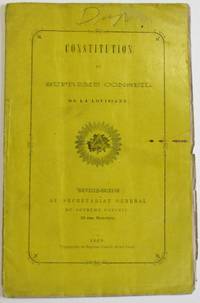
186937231Nouvelle-Orleans: Au Secretariat General du Supreme Conseil 1869. Original printed glazed yellow wrappers. 23 1 blank pp. Light wear top edge uncut. Entirely in the French language.<br /> Not in Thompson. OCLC 4953870 13 as of August 2022. Au Secretariat General du Supreme Conseil unknown
188436123New Orleans: City Item Publishing Company 1884. Original printed wrappers stitched. 15 1 blank pp. Text clean. Wrappers loosened with a couple of old institutional stamps shallow wrapper edge wear. Good.<br /> <br /> A committee of sugar planters arranged the Convention. Delegates are listed. Its purpose was "to defend the Louisiana protected interests at Washington" from the spectre of free trade. Reports are presented on the lukewarm reception they encountered from Washington politicians.<br /> OCLC 12424829 5- LSU Johns Hopkins UNC R.B. Hayes Lib. WI Hist. Soc. as of July 2019. City Item Publishing Company unknown
19192278Crowley 1919. About very good. 31pp. 16mo. Original printed wrappers stapled. Moderate soiling to covers contemporary pencil ownership notation on front cover. Doodle inside front cover. Minor soiling internally. "The city that sets the pace in the race for prosperity in the rice belt takes nobody's dust and keeps her head turned always in the direction of success." A promotional work for the city of Crowley Louisiana located in the south-central portion of the state. The work is extensively illustrated with views of the city as well as scenes of rice fields and a map of the state showing Crowley's location and all of the railroads that connect it to the wider world. We locate four copies in OCLC -- University of Alabama Yale University of Louisiana at Lafayette and the Louisiana state library. unknown
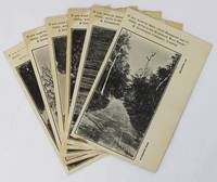
19203617Hammond La: Vindicator Job Print 1920. Very good. Six photographically-illustrated postcards each 5.5 x 3.5 inches. Minor edge wear some toning around the edges and at corners one slightly misprinted with very minor loss of text. A visually-interesting group of a half dozen promotional postcards picturing various locations around Hammond Louisiana issued by the Hammond Real Estate & Investment Company Limited. The company encourages potential emigrants and investors to contact them: "If you want to know about Hammond and vicinity write to the Hammond Real Estate & Investment Company Limited." The photographs on the postcards feature distinct locations and each is printed with a different caption at lower right. These captions read: "A Country Road" "Pines and Palmettoes" "A River Drive" "The Tangipahoa River" "The 'Hammond Oak'" and "Oak Street." The printer Vindicator Job Print was the local newspaper started in 1892 as the Hammond Graphic and by 1919 was known as the Hammond Vindicator. No results found in OCLC. Vindicator Job Print unknown
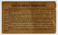
19143424N.p. likely near Bogalusa La 1914. Very good. 5pp. on a single folded sheet of cardstock. Oblong 12mo. Some toning and dust-soiling light chipping to one edge. A seemingly unrecorded promotional item touting the economic advantages of Bogalusa Louisiana located near the Mississippi border in the northeastern portion of the state. The population of the town is given as "10000 of which 6500 are whites and 3500 colored." The text primarily promotes the lumber industry as well as the mills railroads schools hotels and other amenities offered by the town. One item brags that "Every house occupied by a white person in Bogalusa has modern sanitary conveniences and electric lights." The last two lines highlight Bogalusa's "fine Base Ball Park" and that fact that "There were 363 babies born in Bogalusa in the year 1913" the only date listed anywhere on the item. No copies of the present publication in OCLC - just a similarly titled but more official publication produced by the Bogalusa Chamber of Commerce a dozen years later. unknown
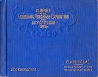
190434022Chicago: Laird & Lee Publishers 1904. Hardcover. Good. Oblong 12mo. unpaginated. Illustrated with 32 "Colorgraph Views" and 168 "Copper Plate Scenes". Blue cloth hardcover with blind stamped design and gilt embossed title on the front cover. Light shelf wear and soiling to the covers. Light edge wear to the cloth extremities. Interior contents clean and hinges in good condition. Laird & Lee, Publishers hardcover
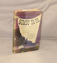
194528944Boston:: Houghton Mifflin 1945. Later printing. A Near Fine copy in orange cloth binding in a Very Good dust jacket with some light edgewear and tape shadows to the front and rear flaps. Uncommon in dust jacket. Long considered the finest collection of Louisiana folktales and customs this anthology of short stories from Lyle Saxon Edward Dreyer and Robert Tallant chronicles the tales and legends that emerged from the bayou country more than seventy years ago.On every page are new delights: garlic hangs from the rafters the Loup Garou holds a convention on Bayou Goula spiders dwell in haunted houses and images of St. Rosalia are carried from church to church. All aspects of the bayou state's society are detailed in this wonderful album of Louisiana tradition. Even ghosts haunt the pages including the headless horseman of Natchitoches and the whimsical apparition who startled citizens of Monroe. Houghton Mifflin, hardcover
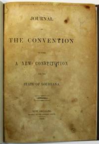
185236379New Orleans: Printed at the Crescent Office 1852. 100pp. Toned with some foxing light rubberstamp on title page. Upper blank corners of last two leaves renewed couple of small holes in last leaf affecting about five letters. Good in modern boards.<br /> <br /> The new Constitution mandated that "the Legislature shall apportion the representation among the several parishes and election districts on the basis of the total population. A representative number shall be fixed and each parish and election district shall have as many Representatives as its aggregate population shall entitle it to." This meant that in apportioning representatives slaves would be counted in determining the "total population" even though the franchise was limited to adult white males. The legislative deck was thus stacked in favor of election districts with large slaveholding plantations; and the interests of that segment of the State would dominate governmental councils.<br /> This provision created significant opposition to the proposed Constitution which was adopted by the narrowest of margins. Many called it "anti-republican" arguing that it reflected "a calculated effort to reduce the political power of regions where the black population remained sparse" Hyde Pistols and Politics 70 LSU Press: 1996.<br /> The Journal records the Convention's daily proceedings during July 1852 and prints the proposed Constitution. <br /> Jumonville 2151. Thompson 1300. Cohen 3106. Not in Harv. Law Cat. or Marke. Printed at the Crescent Office unknown
192041182Washington D.C.: Published by the United States Coast and Geodetic Survey 1920. Large folding nautical chart printed on heavy paper stock. Colored. A rare original coastal survey of coast between Louisiana and Mississippi and includes Lake Borgne Lake Ponchartrain the Mississippi Sound St Louis Bay Cat Island Long Beach and Gulfport.<br/> <br/> Established by President Thomas Jefferson in 1807 as the Survey of the Coast the U.S. Coast and Geodetic Survey was the United States' first civilian scientific agency. This agency has followed its mission to survey the U.S. coastline create nautical charts of the coast and help increase maritime safety since its founding and has often played fascinating roles in significant chapters of U.S. history. It served in all theaters of the Civil War in the service of the Union Army and Navy pioneered acoustic exploration in the wake of the sinking of the Titanic and during WWI it worked to detect enemy submarines. In addition this agency worked to survey and produce detailed maps and renderings of the U.S. coast. These nautical survey maps commonly referred to as "T-sheets" provide fascinating insights into the history of the United States coastline which has and will continue to shift. These maps are the most important data source for understanding the physical and ecological characteristics of the U.S. shoreline. The present map is notable for its inclusion of Gulfport as it was gridded in 1920 and Cat Island a barrier island used for an undercover WWII program Dogs for Defense. Cat Island was chosen as the training camp dedicated to a specialized training program based off the untrue belief that dogs could differentiate humans by smell based on their cultural heritage. The top secret program attempted to train dogs to track and attack Japanese soldiers in the Pacific Theater and was held at Cat Island because of its similar terrain to that of the Pacific Islands and its uninhabited status. This operation was unsuccessful due to the incorrect assumption and shut down in 1944. This map is a highly detailed and accurate sea chart of the coastal border between Louisiana and Mississippi and is an important historical view of the developing Louisiana and Mississippi. Published by the United States Coast and Geodetic Survey unknown
192041171Washington D.C.: Published by the United States Coast and Geodetic Survey 1920. Large folding nautical chart printed on heavy paper stock. Colored. A rare original coastal survey of New Orleans area and includes Lake Maurepas Lake Pontchartrain and the city of New Orleans with mentions of Audubon Park and the Cotton Exchange.<br/> <br/> Established by President Thomas Jefferson in 1807 as the Survey of the Coast the U.S. Coast and Geodetic Survey was the United States' first civilian scientific agency. This agency has followed its mission to survey the U.S. coastline create nautical charts of the coast and help increase maritime safety since its founding and has often played fascinating roles in significant chapters of U.S. history. It served in all theaters of the Civil War in the service of the Union Army and Navy pioneered acoustic exploration in the wake of the sinking of the Titanic and during WWI it worked to detect enemy submarines. In addition this agency worked to survey and produce detailed maps and renderings of the U.S. coast. These nautical survey maps commonly referred to as "T-sheets" provide fascinating insights into the history of the United States coastline which has and will continue to shift. These maps are the most important data source for understanding the physical and ecological characteristics of the U.S. shoreline. The present map of the Louisiana coastline is notable for the inclusion of New Orleans featuring Audubon Park neighborhood Carrollton and the Cotton Exchange which was demolished and rebuilt in this period. It is a highly detailed and accurate sea chart of New Orleans and neighboring lakes and an important historical view of the developing Louisiana. Published by the United States Coast and Geodetic Survey unknown
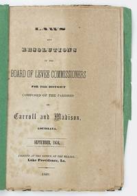
18585156Lake Providence La: Printed at the Office of the Herald 1858. Very good. 40pp. Original plain green wrappers. Minor wear two binding holes punched through inner margin and soft vertical fold throughout. Moderate tanning and occasional foxing to text signed on page 32 by the secretary of the commission with his embossed seal. Untrimmed. A very rare antebellum Louisiana imprint discussing the creation and maintenance of levees along the Mississippi River in the northeastern part of the state and printed there in 1858. Lake Providence is located on the Mississippi River in the northeast corner of Louisiana about fifty miles north of Vicksburg Mississippi. The present work was printed by the city's contemporary newspaper of record the Lake Providence Herald. The work includes the founding documents of the Levee District covering the parishes of Carroll Madison and Catahoula printing the district's laws and legislative resolutions by-laws governing the commissioners' work in the district the rules of order for their meetings the "Boundaries of Wards" for the seventeen wards within the state and an example contract for the commissioners engineers and contractors working on the levees. The work is signed at the conclusion of the by-laws by secretary Charles Robertson Purdy 1833-1863 who later served as captain of the Lake Providence Cadets of the 4th Louisiana Regiment in the Civil War and died in the Siege of Port Hudson. OCLC reports just a single copy at Historic New Orleans. Printed at the Office of the Herald unknown
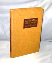
193927182Baton Rouge:: Louisiana State University Press 1939. First Printing of the First US Edition. A Very Good plus copy in brown cloth binding with some rubbing to the spine lettering though still readable. The author worked both alone and with Allan Lomax collecting songs "in the field". Some of the lyrics in this rare volume are in Cajun French some in "regular" French and some in a curious combination of the two. All of which is to say that they are typical folksongs. Includes a Bibliography and an Index of Songs. Louisiana State University Press, hardcover
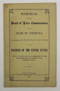
18663572New Orleans 1866. Very good. 12pp. Original printed wrappers sewn. Minimal soiling light edge wear to wrappers. Vertical center crease throughout. Light even toning to text otherwise very clean. A scarce work issued by the Reconstruction government of the state of Louisiana seeking funds from the United States Congress to make repairs to the Mississippi River levees "together with its tributaries the Arkansas and Red rivers." The Board of Levee Commissioners was seeking federal aid because the state of Louisiana had become so impoverished by the end of the Civil War stating here that "The State crippled as she is in her resources is still making herculean efforts to protect her citizens." Before the war argues the Board the state as well as the proprietors of the lands along the Mississippi River were able to maintain the levees albeit "at an immense outlay of labor and money" but "at a time of general prosperity when labor was abundant and cheap." In other words slave labor was formerly employed to maintain the levees and now that the people of Louisiana can no longer use slaves the state wants make the federal government pay literally. One passage in the work even discusses in detail the impact of slaves and free persons of color who have abandoned thirteen parishes which are now "almost altogether desolated." The report cites census and crop yield data to make the point that without this practically free labor force as well as the cotton sugar molasses and corn they produced the labor and economic impact on Louisiana of taking away a free labor force was onerous.<br /> <br /> Works by the Board of Levee Commissioners are rather rare in institutions with just eight copies of the present work in OCLC at LSU Tulane the University of Alabama the Library of Congress the Minnesota Historical Society Library Duke the Rutherford B. Hayes Presidential Center and UT-Austin. unknown
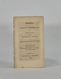
18109018Washington City: R. C. Weightman 1810. Disbound. Very Good binding. Octavo. 9 1 pp. Removed from volume. Respined with archival tape and all leaves reinforced at the inner margin in the same fashion. Petition for statehood addressed to "the Senate and House of Representatives of the United States." The memorialists solicit information on how they may become truly a part o f the United States. They explain their past attempts and past services to the United States and promise equal loyalty in the future. Shaw & Shoemaker 21724. R. C. Weightman unknown
192041175Washington D.C.: Published by the United States Coast and Geodetic Survey 1920. Large folding nautical chart printed on heavy paper stock. Colored. A rare original coastal survey of the end of the Mississippi River as it splits into passes of the Bird's Foot Delta into the Gulf of Mexico.<br/> <br/> Established by President Thomas Jefferson in 1807 as the Survey of the Coast the U.S. Coast and Geodetic Survey was the United States' first civilian scientific agency. This agency has followed its mission to survey the U.S. coastline create nautical charts of the coast and help increase maritime safety since its founding and has often played fascinating roles in significant chapters of U.S. history. It served in all theaters of the Civil War in the service of the Union Army and Navy pioneered acoustic exploration in the wake of the sinking of the Titanic and during WWI it worked to detect enemy submarines. In addition this agency worked to survey and produce detailed maps and renderings of the U.S. coast. These nautical survey maps commonly referred to as "T-sheets" provide fascinating insights into the history of the United States coastline which has and will continue to shift. These maps are the most important data source for understanding the physical and ecological characteristics of the U.S. shoreline. The present map of the Louisiana coastline is notable for the inclusion of the Bird's Foot Delta the mouth of the Mississipi River as it splits into smaller passes. This map is fascinating because this is the youngest lobe of the Mississippi Delta and has seen notable changes in the past 100 years. This map is a highly detailed and accurate sea chart of the Mississippi River and an important historical view of the developing Louisiana. Published by the United States Coast and Geodetic Survey unknown
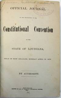
187936489New Orleans: Jas. S. Cosgrove Convention Printer 1879. 337 1 blank 156 pp plus two folding tables. Each page printed in two columns. Bound in buckram with gilt-lettered morocco spine labels light rubberstamp on title page. Clean text. Very Good. Last leaf with a tear affecting about five letters of a two-page report in the Appendix concerning drainage and taxation in the City of New Orleans.<br /> <br /> The Convention dominated by white Democrats returned Louisiana to Home Rule. It was consumed with issues of State debt financial auditing bonds and the public treasury. One delegate expressing his colleagues' deep resentment of Reconstruction asserted that "the deplorable gloomy and painful condition of Louisiana must be the result of the most barefaced prostitution of power the most barefaced abuse of sacred trusts and the most infamously corrupt application of the people's money" page 298. The Journal a day-by-day account of these Proceedings does not print the Constitution. <br /> Not in Marke Harv. Law Cat. Thompson. Jas. S. Cosgrove, Convention Printer unknown
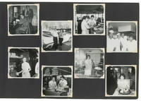
196328031New Orleans 1963. Very Good -. New Orleans: ca. 1960-1965. Large oblong quarto 27x41cm.; brown gilt-tooled leatherette bound with leather strap; 47ll. to which are mounted 311 photographic snapshots nearly all black and white and measuring 8.5x8.5cm. Album a bit scuffed at extremities joints significantly cracked from use and poor quality of leatherette leaves a bit thumbed along fore-edge margins a number of photographs apparently removed though otherwise Good to Very Good contents that remain mostly in fine condition.<br /> <br /> Extensive though sadly uncaptioned personal photo album of a young white woman in New Orleans in the early to mid-1960s documenting her social family and work life date based on shots time-stamped 1963 and 1964. What we have gathered from the contents the compiler worked at least briefly as a server at a diner whose staff was mixed-race though still separated by position: the servers all appear to be white while the grill cooks and kitchen staff are Black. <br /> <br /> Of special note are the compiler's frequent trips to the Pontchartrain Beach amusement park in New Orleans a popular destination in the 1960s though the park was sold and its rides disbursed in the 1980s due to declining attendance. This album however beautifully captures its heyday including shots of the rides carnival games swimming pool tiki bar and a perennial favorite an oversized head inside of which our compiler loved to pose. <br /> <br /> The compiler as well as being a dog-lover was evidently a serious party-goer and additional snapshot vignettes capture various couples making out at a New Year's party or dressed up for Halloween. <br /> <br /> An excellent record of white New Orleans working class life marking the advent of the Swinging Sixties. unknown
192041174Washington D.C.: Published by the United States Coast and Geodetic Survey 1920. Large folding nautical chart printed on heavy paper stock. Uncolored. A rare original coastal survey of the Atchafalaya Basin area including Marsh Island Cote Blanche Bays Atchafalaya Bay and River.<br/> <br/> Established by President Thomas Jefferson in 1807 as the Survey of the Coast the U.S. Coast and Geodetic Survey was the United States' first civilian scientific agency. This agency has followed its mission to survey the U.S. coastline create nautical charts of the coast and help increase maritime safety since its founding and has often played fascinating roles in significant chapters of U.S. history. It served in all theaters of the Civil War in the service of the Union Army and Navy pioneered acoustic exploration in the wake of the sinking of the Titanic and during WWI it worked to detect enemy submarines. In addition this agency worked to survey and produce detailed maps and renderings of the U.S. coast. These nautical survey maps commonly referred to as "T-sheets" provide fascinating insights into the history of the United States coastline which has and will continue to shift. These maps are the most important data source for understanding the physical and ecological characteristics of the U.S. shoreline. The present map of the Louisiana coastline is notable for the inclusion of the Atchafalaya Basin the nation's largest river swamp containing 1 million acres of America's most significant bottomland hardwoods swamps bayous and backwater lakes. It also is home to a diverse wildlife population containing 65 species of reptiles and amphibians 100 species of fish and 250 species of birds containing the largest nesting concentration of bald eagles in the south central United States. The map also notes Marsh Island which was deeded to the state in 1920 the year this map was produced. It is a highly detailed and accurate sea chart of the Atchafalaya Basin and an important historical view of the developing Louisiana. Published by the United States Coast and Geodetic Survey unknown
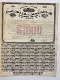
187233610New York: Maverick Stephan & Co. Lithographers 1872. Broadsheet 18" x 23-1/2". Recto printed with black ink red underprinted; verso entirely in green ink. Top half of the sheet contains mortgage certificate with a large vignette of a stream train and a small vignette of mother pelican with her babies and the words "I Live and Die for Those I Love." Bond has preprinted signature of Levi Parsons President. Bottom half of sheet has 60 small coupons attached with bond numbers rubberstamped in blue ink and preprinted with the signature of Chas. V. Ware. Denominated in both dollars and British sterling each payment coupon $35/L7.4S. The verso contains the title of the bond 28 sections for registering names and dates as well as the backs of the coupons. Minor wear few very tiny holes in one coupon with minimal loss. Very Good to Near Fine. <br /> <br /> The New Orleans Baton Rouge & Vicksburg Railroad was officially chartered in 1872 and ran until about 1881. Maverick, Stephan & Co., Lithographers unknown
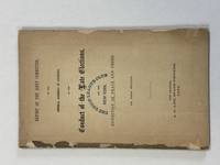
186841040New Orleans LA: A.L. Lee State Printer 1868. 68pp. Stitched without wrappers. Old rubberstamp of Union League Club New York. A few shallow blank extremity chips. Good. <br /> <br /> During the election year 1868 "White gangs roamed New Orleans intimidating blacks and breaking up Republican meetings" Foner Reconstruction 342. Other Parishes experienced the same story; in St. Landry a mob "invaded the plantations killing as many as 200 blacks.Unable to hold meetings and fearful that attempts to bring out their vote would only result in further massacres Georgia and Louisiana Republicans abandoned the Presidential campaign" Id. <br /> The Republican Party controlled Louisiana's General Assembly. Its Report is a frightening picture of violent resistance to Reconstruction describing "a state of lawlessness terrorism and crime that is unparalleled in any civilized country." Not only are the "desperate and infamous characters" who directly perpetrate the violence responsible; blameworthy also is "that large and respectable class of the people of the State. . . who refrain studiously from any efforts to restrain or bring them to justice." The Report is a detailed Parish-by-Parish examination of atrocities. <br /> FIRST EDITION. Thompson 1226. A.L. Lee, State Printer unknown
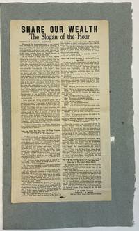
193640262Baton Rouge 1936. Folio broadside 9-3/8" x 17-1/8." Printed in two columns union bug at the bottom margin several type sizes and styles. Mounted at the upper blank verso on pale blue paper. Fine.<br /> <br /> O.K. Allen became Louisiana's governor in 1932 when Huey Long resigned the office to become a U.S. Senator. "Allen was considered a political stooge for former governor Long. His brother Earl Long once joked that a leaf blew into Allen's office one day and that he signed it thinking it was legislation from Long" Wikipedia. Gerald L.K. Smith "began his career as a leader of the populist Share the Wealth movement during the Great Depression. . . He was a preeminent antisemite and a white supremacist" Wikipedia.<br /> This broadside supports Allen's campaign to win the Democratic nomination for U.S. Senate. Huey Long's 1936 assassination had rendered the seat vacant. The broadside announces the unbreakable partnership "between the Louisiana Democratic Association of which O.K. Allen is the Head and the Share Our Wealth Society of which Gerald L.K. Smith is the Head." They have vowed to carry on the work of "our late beloved Senator Long." Allen died a week before the election.<br /> Not located on OCLC as of July 2024. unknown