1 546 résultats
1989LFA-126712742Publication trimestrielle : 64 pages, format 170 x 250 mm, brochée, illustrée
0365969443.Gpaperback. Good. Access codes and supplements are not guaranteed with used items. May be an ex-library book. paperback
0366200046.Ghardcover. Good. Access codes and supplements are not guaranteed with used items. May be an ex-library book. hardcover
0265366976.Ghardcover. Good. Access codes and supplements are not guaranteed with used items. May be an ex-library book. hardcover
0365863319.Gpaperback. Good. Access codes and supplements are not guaranteed with used items. May be an ex-library book. paperback
0366276018.Ghardcover. Good. Access codes and supplements are not guaranteed with used items. May be an ex-library book. hardcover
0428556035.Ghardcover. Good. Access codes and supplements are not guaranteed with used items. May be an ex-library book. hardcover
0428087485.Gpaperback. Good. Access codes and supplements are not guaranteed with used items. May be an ex-library book. paperback
1332951228.Gpaperback. Good. Access codes and supplements are not guaranteed with used items. May be an ex-library book. paperback
026042837X.Ghardcover. Good. Access codes and supplements are not guaranteed with used items. May be an ex-library book. hardcover
0260416487.Ghardcover. Good. Access codes and supplements are not guaranteed with used items. May be an ex-library book. hardcover
1397238453.Gpaperback. Good. Access codes and supplements are not guaranteed with used items. May be an ex-library book. paperback
1397238739.Ghardcover. Good. Access codes and supplements are not guaranteed with used items. May be an ex-library book. hardcover
0266493734.Ghardcover. Good. Access codes and supplements are not guaranteed with used items. May be an ex-library book. hardcover
0331393875.Ghardcover. Good. Access codes and supplements are not guaranteed with used items. May be an ex-library book. hardcover
0260672149.Gpaperback. Good. Access codes and supplements are not guaranteed with used items. May be an ex-library book. paperback
0331488957.Ghardcover. Good. Access codes and supplements are not guaranteed with used items. May be an ex-library book. hardcover
B9781020991011Hardback. New. hardcover
0260871095.Gpaperback. Good. Access codes and supplements are not guaranteed with used items. May be an ex-library book. paperback
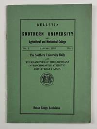
19384099Baton Rouge La: January 1938. Very good. 32pp. Original green printed wrappers stapled. Minor wear and dust-soiling. Pencil notations to a few pages otherwise internally clean. The rare first issue of the bulletin of Southern University in Baton Rouge. The issue was devoted to the Southern University Rally and printed rules and regulations for the tournaments of the Louisiana Interscholastic Athletic and Literary Association. These events included the state football championship basketball games music and literary contests the state dramatic festival and the state track meet. The work also includes the "Aims and Purposes of the Association" which are "adapted from the Texas Interscholastic League for Colored Schools" a history of interscholastic activities "among Negro Schools in Louisiana" and lists of the officers of the organization. The previous owner of the present copy of the bulletin had a keen interest in the section on the rules for music contests with numerous light pencil notes written in the outer margins of the first two pages of that section. January unknown
18116624AWien, Bauer, 1810/1811. 8°. Bde. 1 und 2 von 3 Bdn. 336, 360 Seiten. Mit 2 gestochenen Frontispizen. Pappbände der Zeit mit Rückenschildern. Rücken etwas angestaubt, sonst tadellos.
192041172Washington D.C.: Published by the United States Coast and Geodetic Survey 1920. Large folding nautical chart printed on heavy paper stock. Uncolored. A rare original coastal survey of Caillou Bay area and including Isle Dernieres.<br/> <br/> Established by President Thomas Jefferson in 1807 as the Survey of the Coast the U.S. Coast and Geodetic Survey was the United States' first civilian scientific agency. This agency has followed its mission to survey the U.S. coastline create nautical charts of the coast and help increase maritime safety since its founding and has often played fascinating roles in significant chapters of U.S. history. It served in all theaters of the Civil War in the service of the Union Army and Navy pioneered acoustic exploration in the wake of the sinking of the Titanic and during WWI it worked to detect enemy submarines. In addition this agency worked to survey and produce detailed maps and renderings of the U.S. coast. These nautical survey maps commonly referred to as "T-sheets" provide fascinating insights into the history of the United States coastline which has and will continue to shift. These maps are the most important data source for understanding the physical and ecological characteristics of the U.S. shoreline. The present map of the Louisiana coastline is notable for the inclusion of Isle Derniere which translates to "last island" the westernmost of a string of islands along the basin of the Mississippi. This 24 mile stretch of land was Louisiana's southernmost outpost of civilization: a resort island for the wealthy complete with hotels ballrooms carousels and summer homes until an unnamed hurricane in 1856 flattened the island killing hundreds and fragmenting Isle Dernier into five smaller islands: East Trinity Whiskey Raccoon and Wine. These new names are not noted on this map still notated as Isle Dernier. This map is a highly detailed and accurate sea chart of the Caillou Bay and an important historical view of the developing Louisiana. Published by the United States Coast and Geodetic Survey unknown
1991ESS22447New York. Crescent Books. 1991. 1. Auflage. 128 S. 4°. Hardcover mit Schutzumschlag. Zahlreiche farbige Abbildungen und Tafeln. Register. Widmung in englischer Sprache auf Vorsatz. Schutzumschlag berieben und eingerissen. Gebrauchsspuren. (fleckig und lichtrandig.). Kleiner Fleck im unteren Schnitt.
192041178Washington D.C.: Published by the United States Coast and Geodetic Survey 1920. Nautical chart printed on heavy paper stock. Uncolored. A rare original coastal survey of Calcasieu Pass in the Cameron area and includes Calcasieu Light.<br/> <br/> Established by President Thomas Jefferson in 1807 as the Survey of the Coast the U.S. Coast and Geodetic Survey was the United States' first civilian scientific agency. This agency has followed its mission to survey the U.S. coastline create nautical charts of the coast and help increase maritime safety since its founding and has often played fascinating roles in significant chapters of U.S. history. It served in all theaters of the Civil War in the service of the Union Army and Navy pioneered acoustic exploration in the wake of the sinking of the Titanic and during WWI it worked to detect enemy submarines. In addition this agency worked to survey and produce detailed maps and renderings of the U.S. coast. These nautical survey maps commonly referred to as "T-sheets" provide fascinating insights into the history of the United States coastline which has and will continue to shift. These maps are the most important data source for understanding the physical and ecological characteristics of the U.S. shoreline. The present map is notable for the inclusion of the Calcasieu Light the lighthouse in the pass which had been severely damaged in a hurricane in 1916. Thanks to a federal aid package this lighthouse was restored but in the year 1920 when this map was printed it was noted that the Calcasieu Light Station had rebuilt 1470 feet of walks boathouse and made numerous minor repairs to station. This map is a highly detailed and accurate sea chart of the Calcasieu Pass and an important historical view of the developing Louisiana. Published by the United States Coast and Geodetic Survey unknown
192041173Washington D.C.: Published by the United States Coast and Geodetic Survey 1920. Large folding nautical chart printed on heavy paper stock. Colored. A rare original coastal survey of the Texas-Louisiana border area from Sabine Pass to Calcasieu Lake and Pass and includes Mud Lake Holly Beach Johnson Bayou and Sabine National Wildlife Refuge.<br/> <br/> Established by President Thomas Jefferson in 1807 as the Survey of the Coast the U.S. Coast and Geodetic Survey was the United States' first civilian scientific agency. This agency has followed its mission to survey the U.S. coastline create nautical charts of the coast and help increase maritime safety since its founding and has often played fascinating roles in significant chapters of U.S. history. It served in all theaters of the Civil War in the service of the Union Army and Navy pioneered acoustic exploration in the wake of the sinking of the Titanic and during WWI it worked to detect enemy submarines. In addition this agency worked to survey and produce detailed maps and renderings of the U.S. coast. These nautical survey maps commonly referred to as "T-sheets" provide fascinating insights into the history of the United States coastline which has and will continue to shift. These maps are the most important data source for understanding the physical and ecological characteristics of the U.S. shoreline. The present map is a highly detailed and accurate sea chart of the Texas-Louisiana southern border and an important historical view of the developing Louisiana. Published by the United States Coast and Geodetic Survey unknown