Northwestern State College of LouisianaBiblio.com

1 546 résultats
0260087742.Ghardcover. Good. Access codes and supplements are not guaranteed with used items. May be an ex-library book. hardcover
2006LFA-126734971Hors-série N° 2H (2006) : 144 pages, format 215 x 270 mm, illustré, broché couverture couleurs, bon état
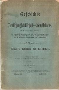
1897034853New Orleans: Selbstverlage 1897. First Edition. Original Wrappers. Very Good. pp: iv 136 folding table at back. Spine neatly repaired some edge wear to covers. Text in German. 9.25" x 6" The author of this history of the German society in New Orleans Louisiana has been described by scholars as the leader and "standard-bearer of culture for the German community of New Orleans. Selbstverlage unknown
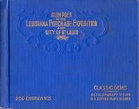
190434022Chicago: Laird & Lee Publishers 1904. Hardcover. Good. Oblong 12mo. unpaginated. Illustrated with 32 "Colorgraph Views" and 168 "Copper Plate Scenes". Blue cloth hardcover with blind stamped design and gilt embossed title on the front cover. Light shelf wear and soiling to the covers. Light edge wear to the cloth extremities. Interior contents clean and hinges in good condition. Laird & Lee, Publishers hardcover
47631843-nnew. unknown
47631843like new. unknown
2000mon0003734948Rowman & Littlefield Publishers 9/11/2024 12:00:01 A. hardcover. Like New. 0.6693 9.3307 6.1417. Rowman & Littlefield Publishers hardcover
026029103X.Gpaperback. Good. Access codes and supplements are not guaranteed with used items. May be an ex-library book. paperback
0331046288.Ghardcover. Good. Access codes and supplements are not guaranteed with used items. May be an ex-library book. hardcover
0428634915.Ghardcover. Good. Access codes and supplements are not guaranteed with used items. May be an ex-library book. hardcover
2001LFA-126731560Un ouvrage de 264 pages, format 120 x 220 mm, illustré, broché couverture couleurs rempliée, publié en 2001, Hachette, bon état
1391854896.Ghardcover. Good. Access codes and supplements are not guaranteed with used items. May be an ex-library book. hardcover
1391854772.Gpaperback. Good. Access codes and supplements are not guaranteed with used items. May be an ex-library book. paperback
190840737Washington D.C.: Published by the United States Coast and Geodetic Survey 1908. Large folding nautical chart printed on heavy paper stock. Colored. A rare original coastal survey of the Gulf coasts of Florida Alabama Mississippi and Louisiana including the Keys Fort Myers Sarasota Tampa Panama City Destin Pensacola Gulf Shores Mobile Biloxi Gulfport New Orleans and the Mississippi Delta.<br/> <br/> Established by President Thomas Jefferson in 1807 as the Survey of the Coast the U.S. Coast and Geodetic Survey was the United States' first civilian scientific agency. This agency has followed its mission to survey the U.S. coastline create nautical charts of the coast and help increase maritime safety since its founding and has often played fascinating roles in significant chapters of U.S. history. It served in all theaters of the Civil War in the service of the Union Army and Navy pioneered acoustic exploration in the wake of the sinking of the Titanic and during WWI it worked to detect enemy submarines. In addition this agency worked to survey and produce detailed maps and renderings of the U.S. coast. These nautical survey maps commonly referred to as "T-sheets" provide fascinating insights into the history of the United States coastline which has and will continue to shift. These maps are the most important data source for understanding the physical and ecological characteristics of the U.S. shoreline. The present map is a highly detailed and accurate sea chart of the coasts Florida Alabama Mississippi and Louisiana along the Gulf of Mexico and an important historical view of the developing states. Published by the United States Coast and Geodetic Survey unknown
191941193Washington D.C.: Published by the United States Coast and Geodetic Survey 1919. Large folding nautical chart printed on heavy paper stock. Colored. A rare original coastal survey of Gulf Coast from the Rio Grande to the Mississippi River and includes Mexico Corpus Christi Galveston and New Orleans.<br/> <br/> Established by President Thomas Jefferson in 1807 as the Survey of the Coast the U.S. Coast and Geodetic Survey was the United States' first civilian scientific agency. This agency has followed its mission to survey the U.S. coastline create nautical charts of the coast and help increase maritime safety since its founding and has often played fascinating roles in significant chapters of U.S. history. It served in all theaters of the Civil War in the service of the Union Army and Navy pioneered acoustic exploration in the wake of the sinking of the Titanic and during WWI it worked to detect enemy submarines. In addition this agency worked to survey and produce detailed maps and renderings of the U.S. coast. These nautical survey maps commonly referred to as "T-sheets" provide fascinating insights into the history of the United States coastline which has and will continue to shift. These maps are the most important data source for understanding the physical and ecological characteristics of the U.S. shoreline. The present map is notable for the inclusion of an international border at the Rio Grande River as well as for showing a miniature grid of the city of New Orleans with the Radio Station notated. It is a highly detailed and accurate sea chart of the Gulf Coasts of Mexico Texas and Louisiana and is an important historical view of the developing states along the Gulf of Mexico. Published by the United States Coast and Geodetic Survey unknown
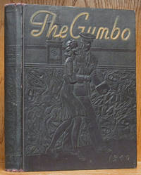
1940E3527Baton Rouge: Lousisiana State Univers 1940. 1st ed. . Hardcover. VG/No Jacket. 479 pages. Original 1940 LSU yearbook. In near-black maroon embossed cloth cover featuring a cadent walking with his girlfriend. VG/No Jacket. Slight wear at top/bottom of spine o/w a Near Fine solid clean unmarked copy. Item #: E3527. SAVE MORE Additional books in the same order ship for FREE via Standand Shipping. Lousisiana State Univers hardcover
194528944Boston:: Houghton Mifflin 1945. Later printing. A Near Fine copy in orange cloth binding in a Very Good dust jacket with some light edgewear and tape shadows to the front and rear flaps. Uncommon in dust jacket. Long considered the finest collection of Louisiana folktales and customs this anthology of short stories from Lyle Saxon Edward Dreyer and Robert Tallant chronicles the tales and legends that emerged from the bayou country more than seventy years ago.On every page are new delights: garlic hangs from the rafters the Loup Garou holds a convention on Bayou Goula spiders dwell in haunted houses and images of St. Rosalia are carried from church to church. All aspects of the bayou state's society are detailed in this wonderful album of Louisiana tradition. Even ghosts haunt the pages including the headless horseman of Natchitoches and the whimsical apparition who startled citizens of Monroe. Houghton Mifflin, hardcover
45459389like new. unknown
0265317754.Ghardcover. Good. Access codes and supplements are not guaranteed with used items. May be an ex-library book. hardcover
A9781015765047Hardback. New. hardcover
B9781015765047Hardback. New. hardcover
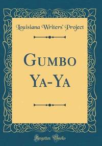
B7.GUMBOYAYA.12.3.16Forgotten Books. PAPERBACK. 1440071659 Book is in new condition. Customer service is our #1 Priority. We sell great books at great prices with super fast shipping and free tracking. . New. Forgotten Books paperback
1290024235.Gpaperback. Good. Access codes and supplements are not guaranteed with used items. May be an ex-library book. paperback
581p. Hardcover Very good condition good
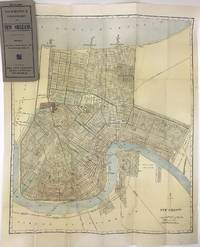
19081418New York 1908. Very good plus. Folding map 23 x 19 inches folded to 7.5 x 3.5 inches. Original grey printed card covers. Minor wear to covers a few small spots of foxing and wear to map. Handsome map of New Orleans printed in color with the canals railroads and electric street car lines highlighted. The map depicts the city from Lake Pontchartrain to the Mississippi showing minimal settlement south of the river primarily in the neighborhood of Algiers. Audubon Park Metairie Cemetery the city park and fair grounds are all highlighted as are many other smaller squares cemeteries and green spaces including the Oakland Driving Park today the New Orleans Country Club's golf course. At the time New Orleans was a city of about 300000 people. The present map shows that most of the neighborhoods along the Mississippi were traversed by "electric railways" with one line traveling north to the lake and terminating at West End while one line operated on the south side of the river. There are also numerous railroads delineated and several ferries crossing the river. A detailed look at the streets of New Orleans at the turn of the century. We locate fewer than ten copies in OCLC. unknown books