2 987 résultats
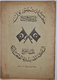
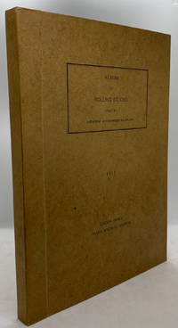
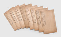
1902000110<p><strong>29 × 20 cm. Comprising 158 text plates including 95 photographs produced by the committee of which 42 photographs appear on separate plates measuring approximately 23 × 15 cm.</strong></p><p>The work documents the Photography Committee's journey from Istanbul to MaÊ¿Än in Transjordan. The accompanying text was compiled from articles originally published without illustrations in various issues of the newspaper <em>Vakit</em> "Time" in 1902.</p><p>This is a unique work prepared for publication with photographs taken by a private committee that included prominent figures such as the German general Karl Auler Pasha who served as an adviser on Hejaz affairs until the fall of Medina in 1918.</p> hardcover
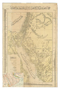
1904ABC_47091Constantinople: Matba a-i Bahriye 1904. Colour-lithographed map 76.5 x 49.5 cm trimmed to neat line. A rare separately issued official railway map with the entire text in Ottoman Turkish depicting the route of the Hejaz Railway. Following a route proposed by the eminent Turkish engineer Mukhtar Bey and surveyed by the cavalry officers Umar Zaki and Hasan Mu'ayyin the epic project funded by subscriptions from the global Islamic faithful completed a rail link from Damascus to Medina by 1908. The present map shows the intended continuation to Mecca never completed. Although it went no further south than Medina the railway nevertheless briefly allowed many thousands of pilgrims to make the Hajj in relative comfort bringing them to Medina and within about 300 km of Mecca. It shows the northern half of the Red Sea the Sinai peninsula the southeast corner of the Mediterranean Sea and what were to become Palestine most of Jordan and parts of Lebanon and Syria.A contemporary Ottoman colour-lithographed map of the Arabian Peninsula has been pasted over the lower left corner below the key like an inset map hiding only a tiny bit of the main maps topographic image. Old folds and creases some small tears repaired tiny chips to neat line some light stains. Some remnants of tape and old private collector's stamps on the back. Still in good condition. Matba a-i Bahriye, unknown
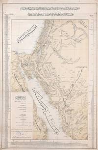
1903163825Constantinople: Matba'a-i Bahriye "The Press of the Navy" 1319 Rumi 1903. Mapping the great Hejaz Railway the embodiment of Hamidian Pan-Islamism A rare and important official map depicting the route of the Hejaz Railway based on a manuscript drafted under the supervision of the "brilliant Turkish engineer" Hadji Mukhtar Bey Maunsell p. 585 who served as chief of operations. It was issued in 1903 while the main line from Damascus to Medina was still under construction but after its final route had been established. This imposing and finely detailed large-format map depicts a very broad area extending from just north of Hama Syria all the way south a little way past Mecca in the Hejaz; it covers most of Syria all of Palestine the Sinai Peninsula the Suez Canal and all the north-western Arabian Peninsula. It clearly delineates those parts of the railway that are in place and those under construction employing a bold orange line land with each station labelled. Additionally it depicts the two alternative routes proposed for extending the line to Mecca employing broken lines while another line traces the proposed but unrealized route of a rail line from Mecca to the port of Jeddah. The map also labels important roads and caravan routes. In September 1907 four years after publication of this map the railway reached AlUla. Although AlUla is not marked here Mada'in Salih modern al-Hijr/Hegra is present which was a significant station responsible for the maintenance of locomotives. Today it is the site of one of two Hejaz railway museums the other being at Medina. Mada'in Salih was UNESCO's first World Heritage Site in Saudi Arabia and comprises "a major site of the Nabataean civilization in the south zone of its influence. The site is located at a meeting point between various civilizations of late antiquity on a trade route between the Arabian Peninsula the Mediterranean world and Asia. It bears outstanding witness to important cultural exchanges in architecture decoration language use and the caravan trade. Although the Nabataean city was abandoned during the pre-Islamic period the route continued to play its international role for caravans and then for the pilgrimage to Mecca up to its modernisation by the construction of the railway at the start of the 20th century" UNESCO. Construction of the Hejaz Railway began in 1901 and by 1908 had reached Medina 400 km short of Mecca where for various political reasons it had to be terminated. Nevertheless until the outbreak of the First World War it allowed hundreds of thousands of pilgrims to make the hajj in safety and with relative ease. Moreover for the first time branch lines provided a rapid link from Syria to Palestine. The moving figure behind this map was the veteran military engineer Hadji Mukhtar Bey who had conducted "military-scientific expeditions in east Africa Harrar and the Somali coast in the 1870s and early 1880s producing the first 'correct' cartographic maps of the region" El Shakry p. 42. It was he along with fellow officer Ali Rida al-Rikabi later first prime minister of modern Syria who originally assessed the route when they joined the 1900 hajj. Initial field surveys for the present map were conducted by two Ottoman cavalry officers Captain Umar Zaki and Lieutenant Hasan Mu'ayyin. In an interesting article in Jerusalem Quarterly Zeynep Celik and Zeinab Azarbadegan pay particular attention to this map and note that the Ottoman Navy "produced different versions of the map in Arabic and Ottoman Turkish pointing to the multiple purposes and audiences targeted within and beyond the empire. The mass production of maps demonstrates the Ottoman state's attempt to disseminate cartographic knowledge about the empire to the public. This speaks to the third and final aspect of analysis of the Hejaz Railway: its use as a tool of Ottoman state propaganda during the Hamidian era". There are at least two states of this map with slightly different titles. Colour lithographic map 800 x 520 mm coastal profiles of the Red Sea in left and right margins script in Ottoman Turkish. Light vertical creasing throughout minor foxing publisher's stamp in the cartouche marginal small tears repaired with old paper. A very good example. Zeynep Celik & Zeinab Azarbadegan "Late Ottoman Visions of Palestine: Railroads Maps and Aerial Photography" Jerusalem Quarterly 82 Summer 2020; Lieut.-Col. F. R. Maunsell "The Hejaz Railway" The Geographical Journal Vol. 32 No. 6 Dec. 1908; Omnia El Shakry The Great Social Laboratory: Subjects of Knowledge in Colonial and Postcolonial Egypt 2007. unknown
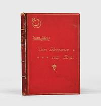
1905164559Leipzig & Istanbul: Otto Keil 1905. Western eyes on the Hejaz Railway First and sole contemporary edition of this eyewitness account of the opening of the Damascus-Ma'an section of the Hejaz Railway on 1 September 1904 four years before the line's official completion. It is the first such narrative published separately in the West. No copies are traced in Middle Eastern institutions; 13 are held worldwide. Eduard Mygind a Danish-born reporter for the Berlin Tageblatt served for a time as Tehran correspondent - his reports on Persian trade and oil attracting British official attention - before covering events in Ethiopia and the Adana massacres of 1909. Based in Istanbul from at least 1902 he was even accused of attempting to blackmail the Ottoman sultan with critical military reports an allegation that did not prevent continued access to Ottoman official circles. The book opens in a lightly humorous discursive mode recounting preparations in Istanbul and the journey to Damascus then turns to the railway's engineering achievement and its political meaning within pan-Islamic unification. Mygind emphasizes the role of German technical expertise and presents Sultan Abdulhamid II as the project's driving force describing the carefully staged inauguration at Ma'an attended by Ottoman elites and invited foreign officials and journalists whose travel and accommodation were funded by the empire. Octavo 220 x 150 mm. With half-tone frontispiece 8 half-tone plates illustrations in the text folding map of Hejaz Railway folding relief chart. Original red pebble-grain cloth red roan spine lettered in gilt gilt-lettered front cover with star-and-crescent motif gilt ornamental cartouche on rear cover white moiré endpapers top edge gilt. Housed in a custom red cloth flat-back box by the Chelsea Bindery. Spine rubbed head a little worn front joint cracked but holding slight red stain from cloth to fore edge of book block hygroscopically transferred from the cloth boards; yet this remains a very good copy the binding in bright condition. S. Chase Gummer The Politics of Sympathy: German Turcophilism and the Ottoman Empire in the Age of the Mass Media 1871-1914 doctoral dissertation 2010 available online; Murat Ozyuksel The Hejaz Railway and the Ottoman Empire: Modernity Industrialisation and Ottoman Decline 2014. hardcover
1913000166Very rare brochure printed in Armenian house in İstanbul 1913. In English Ottoman Turkish Arabic Russian and Urdu. 10 p. Text with 11 plates. In the printer wrappers. Archak Garoyan paperback
19069347London 1906. Edwardian station map approx 40 x 60 inches this example 101 x 150.5 cm printed in colours some restoration with small areas of loss along the folds made good blank verso. Un-titled undated and without a printer this exceptionally scarce early poster was created for display in stations but establishing which ones presents a challenge. We can date it with reasonable confidence to 1906 or perhaps a fraction earlier. Our map predates the western extension of the Central London Railway to Wood Lane which opened for the Franco-British Exhibition in 1908. Angel is still shown as the terminus of the City & South London Railway but the western extension to Euston which opened in May 1907 is under construction. The use of a green border appears to be a nod to the successful series of green-bordered UERL Underground Group maps but as those were introduced in 1907 it might be the other way around. Another unusual design feature is the two tone shading in line colours of the names of interchange stations such as The Bank. The Bakerloo Line which opened in March 1906 appears to be shown as a thin dotted black line but as it was owned by the rival UERL its use for dating purposes cannot be guaranteed: this is most emphatically not a UERL map. Just three underground lines are highlighted none of which was under the UERL umbrella in 1906: The Central London Railway the City & South London Railway and the Great Northern & City Railway the first two purchased by the UERL and the latter by the Metropolitan Railway all in 1913. Two mainline companies are featured: the Great Northern Railway with its terminus at Finsbury Park and the Great Western Railway which served Paddington. Of these two the GWR is far more prominent with an inset showing the route to Reading. The map promotes travel across London using the highlighted routes at the expense of all others including the UERL: all are razor thin black and unobtrusive with no further differentiation between underground mainline and suburban services and seemingly haphazard naming of stations. It seems likely that our map was a joint response by three of the independent underground railway companies to the growing power of the UERL possibly in co-operation with the GWR and was created for display in any of their stations. We have been unable to locate another example. Map unknown
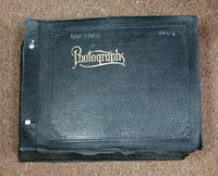
194441488New York 1944. Ca. 1910 - 1944. Contemporary flexible embossed black calf post binder gilt "Photographs" lettered to front cover along with title of "New York State" in white ink to front cover nickel-plate posts at gutter margin. Minor edgewear with some rubbing and chipping to both album and leaves. Some lifting to the photos many of the leaves have wear to fore-edges. 1 of the nickel posts has snapped due to the weight of the textblock a few leaves detached. Withal a G/VG remarkable album. Unpaginated though 346 pp. 1111 real photographs tipped-in to thick black paper mounted with corners. Two colored postcards 2 maps 1 large folding brochure for the Jamestown Westfield & Northwestern Railway many with photographers notes stamped in ink many in pencil including some copy photos from magazines newspapers and trade magazines ranging in size from 2-1/4" x 3-1/4" all the way up to 9" x 11" including many panoramic photos and even some real photo postcards. Thick oblong format: "10-1/4" x 13-1/4" x 5" <br/><br/>A massive photo album brimming with over 1100 images of street cars trolleys motor cars locomotives service trains interurban railway lines and railroads across New York from the 1890s up to WWII. With neatly handwritten captions photographer's notes often on verso and even some typed text. The compiler has traced the development of the New York transit system before WWII including many short lines and trolley lines that have become defunct and most absorbed into the modern New York railway system. This tremendous photograph album supplies one of the most lavishly illustrated visual archives of New York Interurban Railways Street Cars Trolleys and the development of mass transit in the Northeastern United States before WWII we have ever seen. Included within the album are images of over 60 different Interurban lines Trolley Lines and Short Line railways including the Albany Southern RR Albany & Hudson Railway Batavia Traction Co. operated 1914-1927 Bennington & Hoosik Valley Railway Co. 1989-1927 the Coney Island and Brooklyn Railroad which was the first railroad of any kind to reach Coney Island and after 1923 became part of the Brooklyn-Manhattan Transit Corporation along with the Brooklyn & Manhattan Transit Brooklyn & Queens Traction Co. and the Brooklyn Rapid Transit. In addition there are substantial sections devoted to the Empire State Railroad the Fonda Johnstown & Gloversville RR - significant for showing the ultra modern art deco Bullet interurban cars acquired in 1932 to boost ridership; the Schenectady Railway Company which connected Schenectady -Albany -Troy -Saratoga and was one of the most extensive trolley lines in the Northeastern US; as well as the New York Elevated Railroad the New York Railways Co. which operated trolleys and streetcars from 1911 until 1925 when their lines were replaced with buses the Rochester & eastern Rapid Railway which operated from 1901 until 1930 when the line was dismantled; the Steinway Lines Co. which began as the Steinway Railway Company and would become part of the New York & Queens County Railway until 1932 when it broke free and operated as a trolley line until 1939 when they were replaced with buses. This album is filled with trolleys electric trolleys electric motor cars and electric locomotives which were built by numerous different companies including J. M. Jones & Sons Interurban Car Builders Wason Manufacturing Co. Jackson-Sharp Manufacturing Baldwin-Westinghouse Sheffield Car Co. and many others. The photographers stamps on the versos of some images include Howard Humes of Balston Spa NY Fred Abele of Albany NY Charles A. Brown of Chicago IL and many others. The photos provide a vivid picture of New York in the first part of the 20th century depicting the advertising signage the architecture fashions civic movements the impact of Pearl Harbor with trolleys outfitted to look like Navy Recruiting posts and much more. Of particular interest are many of the images showing abandoned trolleys and motor cars in wrecking yards sideyards others showing accident damage from being hit by trucks some being sold at auction and others being burned for scrap as much of the Interurban system was being scrapped for buses at the outbreak of World War II. unknown books
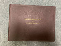
191048451Boston: Tudor Press n. d. ca 1910. 1910. RAILROAD WYOMING COLORADO UTAH. First and only edition. A special deluxe limited edition for presentation this being copy no. 479. Original oblong maroon boards with titles stamped in gilt on the front cover decorated front and rear endpapers n. p. 210 pp. 115 full-page photographs 85 pages of text one in-text map showing the route of the railroad and an elephant folio map coded in color showing the route from Laramie to Coalmont laid-in the front of the volume. The large folding map measures 65.4 x 90 cm 25 3/4" x 35 1/2" with a scale of about 14 miles for 1 inch. This large and handsomely produced volume was likely published for the purpose of luring potential investors into view the Company's operations. Having also the recipient's name in autograph and presented with the compliments of the railroad. This unusual and most remarkable album amounts to what can honestly be described as an extensive visual history of the development of the Laramie Hahns Peak and Pacific Railway System with much material on the region through which it passed including photographs of the people the industries the immense natural resources available to them the construction of dams and canals farming mining ranching lumbering etc. The text and captions emphasize the prospects for further development with much important information both textual and visual on Laramie Steamboat Springs Hayden Vernal Meeker etc. We find no note of this edition nor even the title of this edition in Howes or Graff. The Eberstadts had a so-called trade edition with no mention of the splendid map nor the presentation leaf. Overall an album of immense importance beauty and rarity especially having the large folding map. Minor wear to the corners else a near fine tight copy housed in a cloth slipcase with leather spine label and titles stamped in gilt. Map fine. Tudor Press, n. d. (ca 1910). hardcover
19392091502135500430Geumgangsan Electric Railway Co. Cheolwon-gun Gangwon-do Korea 1939. Soft Cover. Fine. Number of pages: Many photographs 181 text pages Size: 19 x 26 cm Geumgangsan Electric Railway Co., Cheolwon-gun, Gangwon-do, Korea paperback
19112092902138301906Not Available 1911. Soft Cover. Fine. Number of pages: 8242p Size: 23cm Not Available paperback
19352091502135500494Not Available 1935. Soft Cover. Fine. Number of pages: Photographic version 40p 19.5x27.5 cm Complete box Size: Uncollected materials of the National Diet Library Not Available paperback
1901166570Istanbul: 1901-07. An astounding feat of engineering Eight issues of this popular Ottoman magazine documenting the construction of the Hejaz Railway accompanied by a blank export declaration designed for the transportation of goods. The images focus on Tall al-Shahab on the Haifa branch Muzayrib near Dar'a' and the town of Ma'an. A view over the valley at Tall al-Shahab is followed by additional images showing the line snaking between the hills and a bridge in the same location with particular care taken to emphasize the technological achievement of blasting a route through the rock. Pictures from Muzayrib show workmen and locomotives on the track including a larger picture of a carriage with the railway's logo emblazoned. The photographs taken near Ma'an show the town's station and bridges. There are also two pictures of tunnels near Haifa each of which is an engineering achievement. The ultimate vision for the railway was to link Istanbul with the holy cities of Mecca and Medina and thereby consolidate Ottoman military control over the Arabian Peninsula. However only the section of the main line from Damascus to Medina was ever constructed becoming fully operational in 1909. Eight issues quarto each issue 4 pp. Photographic illustrations in the text. Two instalments in original wrappers as issued. Four issues with postal stamps some only partial. Two issues uncut some wear and toning as expected loss to a few characters of text expert repairs with Japanese tissue paper and archival tape. A very good collection of a fragile publication. unknown
19972080502106907340Not Available 1997. Soft Cover. Fine. The book is in fine condition. Not Available paperback
19902091202133206396Kuresushuppan 1990. Soft Cover. Fine. Number of books: 9 books in total Kuresushuppan paperback
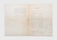
1914164836Istanbul: May 1330 Rumi / 1914 CE. North Arabia and the First World War First and only printing of this rare decree by the Ottoman Chamber of Deputies written in the opening months of the First World War which outlines the state's commitment to constructing a 23-kilometre railway connection between the towns of Jenin and Nablus in what is today the West Bank as an extension of the Jerusalem branch of the Hejaz railway. The decree states that the government will spend 1200000 Kuru from the budget for 1329/1913-14 and 4800000 Kuru from the budget for 1330/1914-15 and that it will complete the track within a period of two years. It also lays out the assembly's assent and an analysis of how the budget for the project will be balanced. A list of the committee members who had signed off on the project is appended. The railroad was a key piece of infrastructure in supplying Ottoman troops in the Sinai hence the decision of the Ottoman government to spend large amounts of money on its expansion as the war began. The ultimate vision for the railway was to link Istanbul with the holy cities of Mecca and Medina and thereby consolidate Ottoman military control over the Arabian Peninsula. However only the section of the main line from Damascus to Medina was ever constructed becoming fully operational in 1909. Single bifolium with text in Osmanl Turkish printed across three pages. Light folds old pale stain at left edge a few light pencil annotations otherwise in good condition. unknown
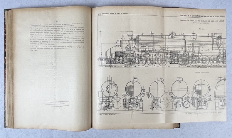
191042977Paris, Imp. de G. Goury,, 1910. 2 vol. in-folio de 202-(1) pp. et (4)-64 planches, chagrin brun, dos orné à nerfs, titre et tomaison frappés or, filet doré sur les coupes et dentelles dorées sur les chasses, super libris frappé or en pied des plats, première de couverture illustrée conservée (reliure de l'époque).
19478964Osaka: Liason Office Osaka Railway Division Japanese Government Railways 1947. First Edition . Hardcover. Fine. Quarto 66pp. illustrated with 89 mounted photographs. A fresh clean example sharp and bright with the only visible flaw being some waviness throughout due to the mounting glue. The prints themselves are universally in excellent condition; overall fine. An absolutely extraordinary visual collection of the rolling stock locomotives and all sorts of freight cars used by the Japanese Government Railways in the immediate post-war period. The prints are each about 4" x 6" and the developer cropped the exposiure to jst the immediate area around the trains leaving large white borders which give the trains themselves a real "pop."<br/> <br/> Int he mid-19th century Japan was an extremely isolated society both from the rest of the world and also to some extent internally with different regions of the main island quite distinct culturally. The railway system which began construction in 1872 facilitated movement throughout Japan and helped to create a more interconnected society. The railways were nationalized in 1906 and they remained under direct imperial control until 1949 when the Japanese National Railways corporation took over management of the system.<br/> <br/> This extremely well-illustrated album complete with details and specifications for all pictured models is undoubtedly the most extensive record of Japanese trains for the period of World War II and at the dawn of the post-war period. In the decades since Japan has become an undisputed world leader in train technology particularly in terms of human rather than freight transportation.<br/> <br/> OCLC records a single holding at the Army Logistics University library. Liason Office, Osaka Railway Division, Japanese Government Railways hardcover
19322091502135500223Not Available 1932. Soft Cover. Fine. Number of pages: 204p Size: 13x18.5㎠Not Available paperback
1927172731Likely Beijing: Jinghan tielu guanli ju before 1927. From bustling Beijing to historic Hankow First edition first printing of this guide to the towns and counties traversed by the Peking-Hankow railroad China's first long-distance railway line and the lifeblood of the country's modernizing economy. Aimed at the armchair traveller and tourist alike the parts discuss scenery local customs important historical events and matters of cultural interest The Peking to Hankow railway was built as a co-operative venture between the Imperial Chinese Railway Company and the Belgian China Railway Survey Company. The German engineer Heinrich Hildebrand was engaged to survey the 1500-mile route and in June 1898 the contract was awarded to a Belgian syndicate. Bonds worth 112 million Francs were issued to French investors to raise the necessary finance. Construction began at both ends of the line and progressed at a rate of 500 metres per day. The first trains began to run on sections of the track in 1901 and in 1902 the Empress Dowager Cixi made her triumphant return to the capital using part of the line. Four years later construction was finally completed. An engineering triumph the project facilitated unprecedented levels of commercial and leisure travel between north and central China. The title evokes the long history of the Beijing and Hankow regions by referring to them as "Yan" and "Chu" the names of their equivalent Zhou dynasty states. This guide was issued the Peking-Hankow Railway Administration Chinese: Jinghan tielu guanli ju. In 1927 Chiang Kai-Shek's government established its capital at Nanjing and the name of the route was changed to "Beiping-Hankow Railway" providing a terminus ante quem for the date of publication. Copies are recorded at Berkeley Chicago Harvard Princeton Columbia Stanford the University of Hong Kong and Bukkyo. 20 parts in 8 vols octavo 253 x 149 mm. Original brown paper wrappers white thread xianzhuang stitching front covers lettered in black. With original blue cloth folding case contemporary manuscript title label bone toggles. Contemporary Beijing bookseller's ink stamp on final page of first volume contemporary red ink stamp on rear wrapper of same volume. Covers with a few small closed tears and chips rear wrapper of volume I soiled contents toned a few leaves browned. A near-fine copy in like case. hardcover
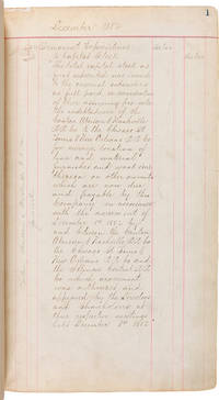
1944WRCAM55833N.p. likely Chicago 1944. 190pp. Folio. Contemporary black pebbled cloth boards with later red leather corners and backstrip gilt title on front board. Endpapers renewed. Minor rubbing and soiling to boards. Light thumb-soiling to text. Very good. An extensive and informative company ledger listing the assets properties profits losses and other business activities of the Canton Aberdeen & Nashville Railroad a subsidiary of the Illinois Central based in Chicago maintained over a period of more than sixty years. This ledger offers a rare glimpse into the economics of the railroad industry in the American South over a vast period of development from the immediate post-Reconstruction era to the requirements of the American war effort during World War II. <br> <br> The Canton Aberdeen & Nashville Railroad was incorporated on February 17 1882 as a subsidiary of the Illinois Central to acquire the branch already built in 1874 from Durant to Kosciusko Mississippi and extend it to Aberdeen and eventually to Nashville Tennessee. The line was completed as far as Aberdeen in 1888. A short disconnected section was also built from Winfield to Brilliant Alabama to serve several coal mines. The railway was officially dissolved and absorbed into the Illinois Central Railroad on August 21 1953. The current ledger records company activity for the great majority of the life of the Canton Aberdeen & Nashville Railroad. <br> <br> The ledger begins in December 1882 the year of incorporation of the railroad and is written in at least five distinct but highly readable hands. The early pages detail the "permanent expenditures" such as stock commitments construction costs equipment and interest; the construction costs are broken out into thirty-three line items including bridges cross ties grading iron rails right of way section houses stationery almost $50000 worth telegraph lines water stations and much more. This is followed by earnings statements profit and loss reports land costs mortgages additional permanent expenditures "sundries" to the Illinois Central and capital stock officers' and clerks' salaries bond payments advertising costs and other types of regularly-reported accounting through December 1944. Railroad accounting here is often reported as "Gross Receipts" balanced against "Operation Expenses" every quarter or six months and is later encapsulated as periodic "Additions and Betterments" and "Profit and Loss" statements in the latter two decades of the ledger. <br> <br> As the 20th century proceeds the ledger records business transactions between the Illinois Central and the Chicago St. Louis and New Orleans Railroad. The latter was based in Kentucky but was also working to build railroad lines in Mississippi and Tennessee during this time. The Illinois Central apparently made occasional "capital advances" to the Chicago St. Louis and New Orleans starting in 1913 which the latter then repaid in December 1919. The Illinois Central continued to make capital advances to the Chicago St. Louis and New Orleans throughout the time period recorded here. The Illinois Central would buy the Chicago St. Louis and New Orleans outright in 1951 absorbing its operations in Kentucky Tennessee and Mississippi. <br> <br> Other activities beyond the normal operations of the company include additional tracks and rail services provided to mining and manufacturing companies in the late 1930s and early 1940s. In December 1939 the Illinois Central agreed to construct "tracks to industry" located on property belonging to the American Colloid Company in Aberdeen Mississippi. The American Colloid Company appears to have been mining bentonite in Aberdeen and was in need of spur tracks to move their product to market or perhaps manufacturing plants. The Illinois Central also constructed further "tracks to industries" in December 1941 namely to the Nickles Lumber Company in Aberdeen and Moeller & Vandenboom also a lumber company in Ethel Mississippi. Depreciation "retirement or abandonment of nondepreciable property" "service value of nondepreciable" retired property and other "property retirements" occupy the latter few pages of the ledger. <br> <br> A dense and useful record of a southern railway's business activities for over half a century. Records for railroads operating in the American South are scarce especially for such a vast span of time. hardcover books
1939132636Paris, Dunod 1939 37 volumes. In-4 32 x 22 cm. Reliures demi-toile bordeau, environ 400 pp. par volume, nombreux plans, schémas, illustrations, tables, analyses des matières par ordre alphabétique.
19332091502135500210Not Available 1933. Soft Cover. Fine. Number of pages: 250p Size: 11x17 cm Not Available paperback
19372092902143300235South Manzhou Railway 1937. Soft Cover. Fine. Size: non-uniform South Manzhou Railway paperback
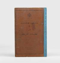
1960174179Amman: "Cooperative Society Press for the Jordanian Ministry of Transport" 1960. Rare operational guide for the Hejaz Jordan Railway First edition of this manual of regulations for railway workers comprising numerous technical terms and train-driving and handling instructions and procedures. We have traced no other copies. After the dissolution of the Ottoman Empire in 1922 the famous Hejaz Railway which connected Istanbul to Mecca via Damascus and Amman was split into branches one being the narrow-gauge Hejaz-Jordan Railway HJR from Jaber al-Sirhan to al-Mudawwara. This was the main passenger-carrying railway in Jordan. In 1960 the year of publication "talks between Syria Jordan and Saudi Arabia about rebuilding the railway began in 1948 but it was not until 1960 that a contract was drawn up with an unlikely consortium of Arabian Japanese and Spanish companies. This was cancelled in 1962" Lambert p. 91. This manual which replaced the instructions of 1934 was issued by the Jordanian Ministry of Transport and it is signed off by Abd al-Karim al-Aqla Director General of the Jordanian Hejaz Railway. Copies were to be distributed "to each competent employee". It includes guidance on conditions of service shift work official clothing and badges distribution of bulletins operational instructions and much more. In addition to the names of several kinds of trains and manual signals to be used at day or night in different situations examples include "don't open the doors of the carriages when the train is moving" nor let passengers on or off outside stations; "fire extinguishers"; "types of traffic lights" illustrated with diagrams; and "sirens" long and short and what specific numbers of repetitions mean. Some final sections address specific issues such as if a train or carriage is suddenly out of control the duties of the train conductor and those of workers using push-trolleys. The later note in German on the flyleaf says that the book was to be used by the Aqaba Railway Corporation ARC the organisation running the freight Aqaba Railway line from 1979 to 2018. Quarto 322 x 210 mm. Lithographed on rectos only small in-text diagrams. Text in Arabic. Original printed brown cloth blue cloth spine lettered in black on front cover and with the coat of arms of the Hashemite Kingdom of Jordan within a decorative border. Note in German pencilled to flyleaf. Binding rubbed and somewhat lightly stained hinges weakening short closed tear at foot of first leaf couple of minor tears or creases to endpapers contents toned unobtrusive repair to long clean tear on one leaf just touching a few letters: a very good clean copy. Anthony Lambert Lost Railway Journeys 2018. hardcover
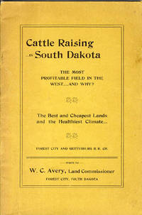
190432964N.P.: Forest City & Gettysburg R.R. Co. n.d. Ca. 1904. 1904. Printed wrappers 3-311p. plates map tables. 23.2 cm. Last page advertisements extremely fine copy of one of those rare promotional booklets issued by the various railroads in the early days. Ownership signature of Dorothy and Clint Josey. A very well-assembled promotional extolling the merits of the region for cattle-raising outlining the improvements the railroad was undertaking a water works and promising more a line from Forest City to Deadwood in the Black Hills. The plates show such things as "branding scene on Timm's Ranch Potter County South Dakota." One plate however seems a trifle out of place in such a work: "A number of Indians in a Council of War after the shooting of one of their number by a white man.near Forest City." Rare. Forest City & Gettysburg R.R. Co., [n.d.] [Ca. 1904]. unknown