468 résultats
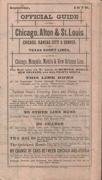
1876022682Chicago IL: RAND McNally & Co. Very Good with no dust jacket. 1876. Railroad Timetable. Railroad timetable unfolds into a 23 1/2 x 35 inch map of two-thirds of the United States. Light soiling and chipping to edges slight separation at one or two folds. Contains a very pleasing hand-colored map showing the myriad of short line railroads throughout the eastern two-thirds of the United States. Includes timetables for the Chicago Alton & St. Louis RR the Chicago Kansas City & Denver RR various Texas Short Lines and the Chicago Memphis mobile & New Orleans line. Aslo has striking vignettes of Pullman Palace Sleeping Cars and the Reclining Chairs in said cars the Great Steel Bridge and Great Iron Bridge across the Mississippi River in two locales. This particular timetable not found in OCLC as of April 2021. A wonderful example of an ephemeral railroad artifact. . RAND, McNally & Co. unknown books
503718ca. 1920 by Aerograph Co. Los Angeles with blindstamp in lower left corner. Framed in a black wooden frame with white mat. Framed size: 13 1/2" x 26". F. Soft cover. paperback books
1871761New York 1871. Good plus. Folding pamphlet 6 x 17 inches. Separated along one fold. A few later pencil annotations. Light wear and tanning. A scarce advertisement for bond investment in the Northern Pacific Railroad issued in 1871 during the first great construction push on the line. Although the company was founded in 1865 ground was only broken on construction in 1870 after considerable backing by Jay Cooke. This pamphlet outlines the plans for the railroad to be built from St. Paul to Portland and Seattle the prospects for passenger and freight business upon completion and the extent of the land grants afforded the railroad by the federal government. The text goes on to describe the financial instruments on offer their advantages over Treasury bonds chiefly a greater yield at 7-8% vs. 5-6% and their security against the commercial and financial assets of the railroad as well as its land grants. With a map of the proposed route on the rearmost panel. A scarce call for investment in the Northern Pacific from its early history. unknown books
186841514New York 1868. 1st printing thus i.e. of this June schedule. No copies found on OCLC though one each of the 1864 & 1866 are recorded. Printed self-wrappers. Age-toning. Old tape reinforcement along folds. A couple short edge tears. Very Good. One sheet printed both sides and fold thrice to form a pocket-sized brochure. Full sheet map of the "Great Broad Gauge -- Double Track Route". Unfolded: 10-7-8" x 13-3/4". Folded: 5-1/2" x 3-1/2" <br/><br/> unknown books
186924607NY: The railway; Phair & Co. Printers 1869. First edition. 8vo.; 7 5 36pp. Large folding map separated along one fold 34 by 29 inches with some outlines colored. Original printed wrappers front wrapper chipped and detached else very good. A circular and special report on the Burlington Cedar Rapids & Minnesota Railway Company including its articles of incorporation. <br/><br/> The railway; Phair & Co., Printers unknown books
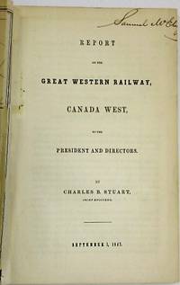
184727881Ontario 1847. 47 1 blank pp plus two folding maps as issued: 'Map and Profile of the Great Western Railway Canada West' 48 1/2 cm x 32 cm; 'Map of the Route of the Great Western Railway Shewing its Connection with other Public Works' 35 1/2 cm x 29 cm. Versos with expertly repaired closed tears short margin tear else Very Good.<br/><br/> The railroad is "on the precise ground that will enable it to control the trade and travel of such a vast portion of the Canadas and the prosperous American States." <br/>TPL 2850. Sabin 28478n. unknown books
185331456Davenport: Sanders & Davis 1853. 24pp. Stitched lightly foxed. Very Good. <br/><br/> This pamphlet provides "elaborate details of the projected road across the State from Davenport to Council Bluffs" 130 Eberstadt 311. The incorporators included the well known civil engineer John Jervis of New York. <br/>130 Eberstadt 312. Graff 2828. OCLC 11478920 10 as of January 2021. Not in Sabin Moffit Decker or BRE. Sanders & Davis unknown books
19087623Near Cambridge MD 1908. Seven volumes in all. Receipt Books: oblong quartos 29.5 x 22.5 cm. approximately 500 pages in all. Receipt books and bills of lading for a shipping agent specialized in oysters and other seafoods. The bills of lading indicate that the shipments originated with L.B. Phillips & Co. in or near Cambridge MD and that most shipments were sent on the Empire Line. The Bills of Lading indicate that the shipments originated with L.B. Phillips & Co. in or near Cambridge MD and that most shipments were sent on the Empire Line. The five Receipt Books are dated: Sept. 28 1905 - Nov. 23 1905; Nov. 24 1905 - Dec. 21 1905; Dec. 22 1904 - Jan. 24 1905; Mar. 20-1906 - April 13 1906; Nov. 27 1906 - Dec 21 1906. Individual sheets show a single day's shipments to various customers and a grid provides space for recording shipment in quantities measured in Cases Tubs Kegs Barrels Crates and Baskets. For example a single sheet from March 20 1908 indicates some 570 cases and partial barrels and kegs of oysters to eight clients in cities including Denver Kansas City Washburn Wisc. Bay City Mich. Mitchell South Dakota Kankakee Ill. Johnstown NY and DeKalb Ill. Most of the accounts are in the Midwest but Toronto Livingston Manor NY Alexandria Virginia and other are also included. The two volumes of Bills of Lading: oblong quartos 20 x 22.5 cm. approximately 200 pages in all. Dates of the Bills of Lading: Aug. 21 1905 - Sept. 4 1905; Dec. 13 1907 - Jan. 2 1908. The Bills of Lading also list Shrimp shipped in 200lb. barrels. Pages brittle and a few leaves are chipped or torn. Receipt Books are bound in marbled boards backed in tan cloth with printed paper labels to front boards. Bills of Ladings are in pale blue paper boards backed in tan cloth with printed paper title labels. Overall near very good. hardcover books
185976593Washington DC.: Beverley Tucker Printer. Very Good. 1859. First Edition. Hardcover. Ex-library with the usual markings. This volume is hard-bound in blind-stamped brown cloth with faded gilt stamping to the spine. The binding has been repaired / reinforced at some point with some type of lacquer covering the spine and so the volume is sound and tight. There is edge-wear and rubbing to the corners and spine-ends. There is some wear/chipping to the joints. Some modest light foxing but overall the work is bright and fresh. This work is complete with plates of reptiles fishes frogs birds snakes and mammals and 28 beautifully hand colored engravings of birds. . Beverley Tucker, Printer hardcover books
1880102313<p> Folding time table and schedule unfolded 7" x 25 1/2" folded 3 1/2" x 7" reverse side shows map of route. Some splits at folds a couple of chips and folds at corners some browning aging and occasional soiling or staining; otherwise about very good. Somewhat scarce railroad time table OCLC locates one copy that provides time table information for trips from Chicago to San Francisco. Includes a map of the routes and stops made along with railroad announcements and advertisements. OCLC. </p> Spalding & La Monte, books
1946242N.p. 1946. Near fine. Poster 18 x 24 inches. Minor wear. A handsome poster advertising travel on the Santa Fe Railroad featuring several Navajo Indians in the foreground and a pueblo in the background. One of the men in the foreground stands drumming while the others are seated behind him chatting. The vibrant colors are washed out slightly by the fierce New Mexican sun softening the view. The railroad produced numerous promotional posters in the 1940s many of them -- such as this one -- quite striking. No artist is identified on this work. unknown books
1948240N.p. 1948. Near fine. Poster 18 x 24 inches. Minor wear. Advertising poster for the Santa Fe Railroad featuring a Native American child etching the slogan "Santa Fe All the Way" in the sand with a stick. The stylish Santa Fe locomotive is barreling past in the background its engine a sleek red. The railroad produced numerous promotional posters in the 1940s many of them -- such as this one -- quite striking. No artist is identified on this work. unknown books
1946243N.p. 1946. Very good. Poster 18 x 24 inches. Minor wear a few minor chips and tears at edges. A handsome poster advertising travel on the Santa Fe Railroad painted in the bold teals and earth tones associated with the Southwest. The poster features a Hopi dancer performing the Buffalo Dance. He fills almost the entirety of the image with a crowd of people gathered around the pueblo in the far background. The poster was designed by Don Perceval who did several such works for the railroad. Born in Britain Perceval 1908-1979 whose mother was also an artist moved to Los Angeles as a child and became enamored of the Southwest. He specialized in images of Hopi and Navajo Indians a subject he began sketching in the 1920s. That knowledge and interest is certainly applied here in the inclusion of culturally correct costuming for the event. In addition to his art he also did commercial work for the Santa Fe Railroad such as the present piece bringing his vibrant style to the company's advertising. unknown books
1880658Cincinnati 1880. Very good. Folding brochure eight panels to each side. Minor wear and soiling. Contemporary ink stamp on two panels. Promotional brochure for the land grants of the St. Louis Iron Mountain and Southern Railway. The brochure outlines the benefits of the climate the resources and agriculture in the region ease of transport and access and other features: "People from all sections of the country who desire to better their condition are cordially invited to come to Arkansas and secure cheap homes. All classes of citizens without regard to political opinions join to build up the material interests of the state and develop its extraordinary resources. The colored people constitute only one-fourth of the population." The usual "Bound for the Happy Lands" circular woodcut of the railroad adorns two panels and a small map highlights the Texas Short Line from St. Louis to Texarkana. With the ink stamp of Henry H. Hannan land agent in Swan Creek Ohio. unknown books
187537686St. Louis: The railway Jno. McKittrick & Co. printers St. Louis 1875. Broadside 21 x 7 inches three paragraphs of promotional material ticket office addresses and fare rates set in many typefaces and sizes including display type and illustrated with a circular bird's-eye view map below the heads. Some old staining mostly in margin; "Henry Hannan Land Agent" stamp else very good. Advertising ticket fares and lands for sale to customers in Ohio Michigan Indiana Illinois and Kentucky. OCLC locates two copies Yale Truman State University. <br/><br/> The railway (Jno. McKittrick & Co., printers, St. Louis) unknown books
187129188New York: Samuel French 1871. Original green printed wrappers wrapper title: 'The First Mortgage Land Grant Sinking Fund Seven Per Cent Gold Bonds Principal and Interest Payable in Gold Free of Government Tax. Of the West Wisconsin Railway'. Stitched. 14 2 blanks pp. Folding 'Map of Wisconsin Rail Road and Its Connections' @14" x 16". Tear at bound edge of folding map repaired with short piece of scotch tape. Very Good. <br/><br/> The Map by Henry Seibert of New York prominently shows the West Wisconsin line from St. Paul MN to Tomah WI; tracks other railroads in Minnesota Wisconsin and Iowa; and depicts Lakes Michigan and Superior and Green Bay. The Road is described and the investment recommended. A rare item OCLC locating only the copy at the University of Missouri. <br/>FIRST EDITION. OCLC 41200220 1 as of June 2021. Not in Eberstadt Decker Sabin Soliday Graff Modelski. Samuel French unknown books
1867100112Pamphlet original printed wrappers 8vo 35 pp. with lithographic map as frontispiece. Old ink ownership signature on front cover along with small rubber stamp of library on front cover too. Library stamp on back of title page some soiling to wrappers corners nicked and a slight vertical crease. Otherwise very good. Scarce pamphlet offering a view of the building of the transcontinental railroad and some of the challenges it faced including those related to the crossing the Sierra Nevada. The map shows most of the U.S. excluding the southern fringe with the Central Pacific and Union Pacific Railroads connecting just north of Salt Lake City. The map also shows the proposed Southern Pacific Railroad from St. Louis to Southern California. The pamphlet talks about the need for the railroad because of the gold discoveries and the unlimited agricultural potential of the region. The author speculates that California could handle a population of ten million people. Also includes facts and figures about the cost of the railroad. George Brown, Printer, books
69768Hardcover. Good. Holograph. Includes Charles River Branch Railroad Company pages 1-116 covering June 20 1849-Oct. 24 1853; Charles River Railroad Company pages 119-133 covering Dec. 8 1852-Oct. 12 1853; and United Charles River Railroad Company pages 139-209 covering Nov. 9 1853-Aug. 30 1855. Ruled ledger. Leather. 26cm. Covers sound but scuffed and rather worn. <br/><br/> hardcover books
1857040173Chicago: Illinois Central Rail Road Office 1857. First Edition. Softcover. Very Good. 80pp. Bound in at front: Outline Map of Illinois; Railway Guide to the Illinois Central Rail Road Lands double-page map; woodcut frontispiece "Prairie Scene in Illinois." Six woodcuts in the text. Bound in at back: four pages of broadside-style ads printed in diaplay type on lavender stock. 1 "Passengers for St. Louis Jacksonville Naples Kansas and Nebraska should procure their tickets via Illinois Central R. Road." 2 "Great Western and Michigan Central Railway Line only direct route via Niagara Falls and Suspension Bridge." 3 Great Reduction of Fare! For St. Paul! Great Western Mail Route. Galena and Chicago Union Rail Road." 4 "Passengers for St. Paul should be particular and call for tickets via Dunleith . Having Twelve Splendid Steamers." Bound in printed wrappers with prairie scene on cover. 9" x 5.5" Byrd Illinois Imprints 2683. Buck Travel and Description 559. <br/><br/> Illinois Central Rail Road Office paperback books
1869288969New York: American Photolithographic Company 1869. paperback. very good. Map: lithograph. 16" x 28.5". In very good condition. <br><br>Pamphlet: Thin 8vo. 31 pages. Staple-bound stain to paper cover binding fragile. Washington: Government Printing Office. In very good condition.<br/><br/> Map is tipped in at back cover of pamphlet and shows Northern & Southern Pacific Trunk Lines railways completed and railways projected. The majority of the committee that wrote this report included W.M. Stewart Chas D. Drake John Conness Alexander Ramsey J.C. Abbott B.F. Rice<br/><br/> American Photolithographic Company unknown books
184939429Boston: Redding & Co.; New York:Clark Austin & Co 1849. States outlined in colors. 1 vols. 20 1/2 x 24 3/4 inches overall. Folding engraved map 16 ca. 5 x 6 inch panels Four rows of four panels backed on linen engraved ornamental bordersmall engraved paper label on back. Some browning or soiling generally light cloth darkened with some spotting on verso of map else a very good copy. States outlined in colors. 1 vols. 20 1/2 x 24 3/4 inches overall. Each of the railroad lines is identified. Redding & Co.; New York:Clark, Austin & Co unknown books
1873403707Jay Cooke & Co 1873. 8vo. 51 4 pp. Folding map of the railroad and its inter-oceanic connections. Original printed wrappers the rear wrapper with map of the railroad. Wrappers separated along spine last two text leaves loose. FIRST EDITION. The map shows the northern half of the U.S. from the Pacific to Lake Superior and Lake Michigan. The proposed railroad extends from the Missouri River near Fort McKean westward to the towns of Olympia Portland Seattle and terminating at Whatcom just north of Bellingham. The route splits into a northern and southern branch just above Coeur d'Alene Lake. The publisher Jay Cooke was the famous financier of the Civil War; his private bank financed the construction of the railroad. This promotional pamphlet was used to gain investors. <br/><br/> Jay Cooke & Co unknown books
1884100459Folding train schedule 4 1/2x 9 20 panels large folding map in color. Some browning and aging some separation at the middle fold two of those separations are a few inches three other smaller tears at the middle fold these are repairable a few chips and tears at edge folds. Nice piece of railroad memorabilia with substantial information about rates and schedules. Most of the trains are geared toward the west which gives an idea on the process of opening up this still relatively new part of the country.The map has its flaws but it is sound enough to get a feel for the lines of the Union Pacific. Rand McNally & Co. books
1876102314<p> Folding railroad time table unfolded 16" x 28" folded 4" x 8" illustrated with route map and engravings. Some minor chips and tears at folds and extremities some browning and aging and a little soiling; otherwise about very good. Attractive Erie Railroad time table and map. Includes large illustration of the inside of a Pullman car and two additional illustrations of a dinning car and part of Niagara Falls. The time table and schedule has considerable detail. # 102314</p> books
1904106398<p>Small 8vo soft red covers numerous illustrations from photographs; map on inside of rear wrapper 160 pp. Light wear top corner slightly bent normal aging; very good or better condition. Descriptions of the numerous locales accessible by the California Northwestern Railway running from Tiburon north to Willits with branches to Guerneville Sebastopol and a few other places. Includes interesting famility type pictures of places like Oleander's Farm Ridgewood Sonoma Creek and Greenwood Park. There is a map of California Northwestern Railway and Connections on the inside of the rear cover. The railroad was formed in 1898 and merged into the Northwestern Pacific Railway in 1907. Seems to be rather rare the OCLC/WorldCat lists only the copies at Stanford and UCLA. OCLC. </p> California Northwestern Railway, books