Wisconsin Central RailroadBiblio.com

377 résultats
188510975Milwaukee WI: The Corbitt & Skidmore Co. Printers 1885. Single sheet poster 61 cm x 14 cm / 24" x 5.5" Several horizontal folds. Image and text are sharp. Fun advertisement from this short-lived railroad. The original Wisconsin Central Railroad Company 1871-1879 was a major early railroad that operated throughout northern Wisconsin. It built lines up through the forested wilderness and opened large tracts to logging and settlement. It established stations which would grow into a string of cities and towns between Stevens Point and Ashland including Marshfield and Medford and it connected these places to Chicago and St. Paul. It also played a major role in building Chicago's Grand Central Station. Despite these successes it struggled financially from the start and was bankrupt by 1879. It was leased to the Northern Pacific Railway from 1889 to 1893 and was finally reorganized from bankruptcy in 1897 as the Wisconsin Central Railway. The Corbitt & Skidmore Co. Printers unknown
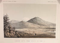
185714424Washington DC: A. O. P. Nicholson Printer 1857. First Edition. Very Good. 8.25x11in Four litho tinted illustrated plates I II VIII and XII; Some age-toning along edges one with large stain along right edge not affecting neatline of illustration. These plates are from from Volume VI of the quarto edition of twelve volumes were published from 1855 to 1861 as exploration and survey reports became available. These volumes contained not only the survey maps and elevations but a monumental collection of scientific reports on geography geology zoology botany and ethnology of the Native American tribes. The surveys also included 11 artists to record the landscape and indigenous peoples of the west. <br /> <br /> The plates were drawn in 1855 by John J. Young 1830-1879 a staff artist for the War Department. He was assigned in 1855 as a draftsman for the Lt. Williamson railway survey to connect California's Sacramento Valley with Oregon's Columbia River.Young's views of the Cascade Range included 14 landscape scenes one geologic scene and 10 drawings of trees in there habitat from Samuels p 545 <br /> <br /> The Illustrations are: Plate 1 - Lassens Butte From Vicinity of Camp 18 Plate II Mouth of Fall River near Camp 20 Plate VIII Canon of Psuc-See-Que Creek near Camp 41A Plate XII Shasta Butte and Shasta Valley from a point near Camp 70A.<br /> <br /> The twelve volumes were disorganized in publication with no overall all arrangement or indexing. Some of the plates and maps referred to in volumes were published in other volumes various reports were also published out of sequence relating to the four routes. Preliminary reports published were updated in latter volumes. From Wagner-Becker-Camp In 1853 Senator Gwin of California lead the inclusion of Congressional funding for 1853-54 of a series of surveys to determine the best and most economical railroad routes from the Mississippi River to the Pacific coast. The act directed the Secretary of War Jefferson Davis to plan and direct Army topographical engineers to conduct surveys of four routes. The first was between the 47th and 49th parallels generally along the Lewis and Clark route to the Pacific. The Second route between the 37th and 39th parallels was promoted by Senator Thomas Hart Benton of Missouri. The Third route was along the 35th parallel. The Fourth route was promoted by Secretary Davis along the 32nd parallel that followed Emory's 1846-47 reconnaissance. A. O. P. Nicholson, Printer unknown
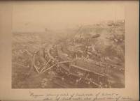
190042650Miles City Montana: Wiley Bros. Photographers Successors to L. A. Huffman 1900. Photograph. Very Good. Large format photograph 18.5 x 24 cm on a tan mount 25 x 30 cm. Wiley Bros. backstamp "Wiley Bros. Photographers Successors to L. A. Huffman. Miles City - Montana.". Mount edges are lightly bumped and chipped. Photograph is gently rubbed and lightly faded but still showing good detail and contrast. Shows many workers constructing the bridge with Northern Pacific Railroad cars visible in the background. Photograph taken from above looking down. In ink by hand on the front of the mount "Progress showing detail of bench walls of Culvert detail of brick arch; also general view of Coulee Bridge 148. Yellowstone Riv. River. Wiley Bros., Photographers, Successors to L. A. Huffman unknown
1836016450Boston: Dutton & Wentworth Printers 1836. Book. Very good condition. Hardcover. First Edition. Octavo 8vo. A bound volume containing a collection of ten publications relating to the Western Rail-Road Corporation from the incorporation in 1836 to 1840. The First Annual Report from 1836 is included twice. Bound in contemporary original three quarter leather which is moderately to heavily worn with the front board nearly detached. There is minor to moderate foxing and the final half of the text is lightly stained at the top corner. The 1836-37 Reports of the Engineers is complete with two fold-out maps which were printed on very thin onion-skin paper. These two maps have been detached and are misfolded with minor tearing as well as some foxing. A ready-made collection of the founding documents of this railroad company which starts in Boston winding its way across the state where it enters New York State at West Stockbridge. Dutton & Wentworth, Printers Hardcover
187129188New York: Samuel French 1871. Original green printed wrappers wrapper title: 'The First Mortgage Land Grant Sinking Fund Seven Per Cent Gold Bonds Principal and Interest Payable in Gold Free of Government Tax. Of the West Wisconsin Railway'. Stitched. 14 2 blanks pp. Folding 'Map of Wisconsin Rail Road and Its Connections' @14" x 16". Tear at bound edge of folding map repaired with short piece of scotch tape. Very Good. <br /> <br /> The Map by Henry Seibert of New York prominently shows the West Wisconsin line from St. Paul MN to Tomah WI; tracks other railroads in Minnesota Wisconsin and Iowa; and depicts Lakes Michigan and Superior and Green Bay. The Road is described and the investment recommended. A rare item OCLC locating only the copy at the University of Missouri. <br /> FIRST EDITION. OCLC 41200220 1 as of June 2021. Not in Eberstadt Decker Sabin Soliday Graff Modelski. Samuel French unknown
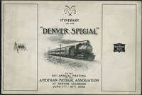
189824652American Medical Association 1898. Wraps. Very good condition. Unrecorded guide to the railway trip and preliminary program for the 1898 American Medical Association meeting in Denver by way of the Wabash Railroad St. Louis to Kansas City and the Chicago Rock Island & Pacific Railway Kansas City to Denver.<br /> <br /> The guide includes description of the train accommodations round trip fare St. Louis to Denver $26.50 special cars the train schedule with illustration of the new Union Station in St. Louis a preliminary program of meeting events and points of interest including the trans Mississippi and International Exposition in Omaha.<br /> <br /> Oblong 8vo 10 x 7" 26pp. Printed pictorial paper wrappers with route of Denver Special at rear wrapper. Front wrapper faintly dusty; bright and clean copy. American Medical Association unknown
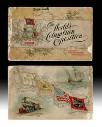
18924739Chicago IL: Wabash Railroad Passenger Department 1892. Souvenir Edition. Paperback. About Good. Promotional Pamphlet w. bird's-eye view of the Chicago World's Fair copyright 1892 by F. Chandler and printed by Poole Bros. in Chicago. String bound printed paper wraps oblong 16mo size 5-5/8 inches tall pp. 56 illustrated throughout w. color halftones. Volume covers w. small chips and rubs spine strip about half gone p.o. name in smudged ink to upper cover text with some tears and light damp staining to top edges. Upper cover w. "Compliments Passenger Department Wabash Railroad" printed at bottom corner. A complete but Good Only copy. The World's Columbian Exposition also known as the Chicago World's Fair was a world's fair held in Chicago from 5 May to 31 October in 1893 to celebrate the 400th anniversary of Christopher Columbus's arrival in the New World in 1492. wiki. Wabash Railroad Passenger Department paperback
1852100861A. Hart Philadelphia 1852. Pamphlet. Collectible. Philadelphia: A. Hart 1852. 40 pages. Engravings. 9.5 x 6" printed wrapper. "J Ravenscroft Jones'. Compares costs of plank macadam roads upkeep advantage to farmer property value New York road usage. Wrap rubbed edges chipped lower wrap detached foxed few stains fair. A.. Hart, Philadelphia unknown
1852253109Montpelier: E. P. Walton 1852. First. paperback. good. 45 pages. 8vo original brown printed wrappers spine worn wrappers chipped at corners wrappers lightly soiled dampstained throughout. Montpelier: E. P. Walton 1852. First Edition.<br/> <br/> Josiah Quincy Jr. had been treasurer of the Vermont Central Railroad. He disagreed with the railroad's financing plans for the railroad's expansion. Quincy wrote a pamphlet critical of the railroad's finances. This pamphlet is the board of directors reply to Quincy's criticisms.<br/> <br/> E. P. Walton unknown
1851251091Boston: W. S. Drummond 1851. First. pamphlet. very good-. and the issue of mortgage bonds. Presented to the directors November 14th 1851. 16pp. 8vo pr. wrs. wrappers lightly soiled most pages lightly creased in middle. Boston: W. S. Drummond 1851. First Edition<br/> <br/> W. S. Drummond unknown
1873263531St. Albans: Messenger Printing 1873. First. hardcover. good. Adopted at the Biennial Session 1872. Thick 8vo original black cloth paper label spine ends and edges of corners worn ex-lib boards lightly soiled endpapers front flyleaf and last blank page all lightly soiled. St. Albans: Messenger Printing 1873. First Edition<br/> <br/> Widespread public reports of payoffs by the railroad to legislators to influence legislation led to an investigation of the legislature by itself. Ex libris from the University of Vermont.<br/> <br/> Messenger Printing unknown
185748219Albany New York: Printed By C. Van Benthuysen 1857. 1857. RAILROAD NEW YORK. First Edition. Tall 8vo. Blind-stamped cloth titles stamped in gilt on the front cover 2 large folding maps; 44 plates including 16 folding of bridges locomotives tunnels rail sections and more. Mostly details the state of New York but also information on Pennsylvania Vermont Massachusetts New Hampshire and Connecticut. A bit of cosmetic touch up to the corners and foot of spine internally clean and tight for a very good copy. Printed By C. Van Benthuysen, 1857. hardcover
186612391Utica 1866. 16pp stitched untrimmed. Old obtrusive pencil notes Good. <br /> <br /> Despite its great early promise "Today Utica is the largest town in the United States with so few railroad facitlities. She lost by railroads and neglected to use them as means of recuperation and growth." The pamphlet urges that Uticans repent their mistakes and embrace the proposed railroad. <br /> Not in Sabin Eberstadt Decker BRE. unknown
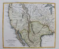
1861M9549New York: Thomas Ford c.1861. Very Good. Notes: Detailed map of the western United States and Mexico. Size : 180x208 mm 7.09x8.19 Inches Coloring: Hand Colored Category: Maps Central America Mexico; Maps United States; Thomas Ford unknown
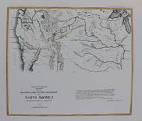
1861M9550New York: Thomas Ford c.1861. Very Good. Notes: Map of the Western United States. Size : 178x205 mm 7.01x8.07 Inches Coloring: Hand Colored Category: Maps United States West; Thomas Ford unknown
1856120572Washington D. C. A. O. P. : Nicholson Printer 1854-1856 1856. First Edition. Hardback. Very good copy in the original gilt-blocked cloth. Professionally recased with the original spine laid back; very impressively finished. Remains particularly well-preserved overall; tight bright clean and strong. Scans and additional detail on request. ; 1 pages; Physical desc. : 1 vol. various pagings : ill ; 30 cm. Subjects; Natural history - West U. S. . Indians of North America - West U. S. . Geology - California. Washington, D. C. , A. O. P. : Nicholson, Printer [1854-1856] hardcover
1869ZB386909Washington 1869. 40th Cong. 3rd Sess. Senate Rep Committee No. 219 3 pp. ex library good. - If you are reading this this item is actually physically in our stock and ready for shipment once ordered. We are not bookjackers. Buyer is responsible for any additional duties taxes or fees required by recipient's country. Washington unknown
186716461Philadelphia: H. G. Leisenring's Steam House. Very Good. 1867. First Edition. Soft Cover. Peach colored paper covers with black titles. Interior of booklet is tight clean & intact. United New Jersey Railroad and Canal Co. Includes a history of the formation of the joint companies monopoly. First Joint Report. New Jersey Canals ; 8vo 8" - 9" tall; 24 pages . H. G. Leisenring's Steam House paperback
189430071St. Louis: Woodward & Tiernan 1894. Seventh edition. Paperback. 124pp. Duodecimo 20 cm Peach and black printed wraps. Good. The wraps are foxed and faded. The rear wrap is partially detached. The wraps have perhaps been discreetly glued to the spine. There are numerous losses from the paper of the spine and there are also some small losses from the edges of the wraps. In addition there are several short closed tears in the edges of the wraps. There are several very light moisture stains on the front wrap and there is a thin 1 and 1/4 inch tall light moisture stain on the fore edge of the rear wrap. The edges of the pages at the beginning are chipped and have small light stains in the bottom corners. The pages are browned. Compliments of the Passenger Department Union Pacific The Overland Route. Flake 9078. With a map on the inside of the front wrap. Woodward & Tiernan paperback
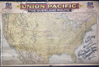
189649745Chicago: Rand McNally & Co. 1896. 1896. RAILROAD MAP. Oblong atlas folio. 37 x 56 in. One large color lithograph map mounted on linen showing the routes of the Union Pacific and subsidiary railroads in red with red yellow & black banner style lettering at upper fore-edge Union Pacific shields with mentions of subsidiary Railways mounted to upper & lower wooden rods as issued some minor lifting & creasing from being rolled over the years minor tide mark at left fore-edge upper fore-edge minor fraying and darkening still nice complete example of this map. First Rand McNally & Co. edition thus of this uncommon First Rand McNally & Co. edition thus of this uncommon Union Pacific Railroad route map intended to be used by travel agents and passenger agents in Union Pacific stations across the West. The map demarcates the Overland Route and connections with the Oregon Short Line RR Co. Oregon RR & Navigation Co. and the Southern Pacific in bold red stretching West from Kansas City Leavenworth St. Joseph Omaha Council Bluffs Sioux City & Fort Worth. A version of this map was initially released in 1892 by Reeves with the Knight Leonard & Co. and a little larger by a couple inches as it included insets for Sandwich Islands and Alaska whereas this version focuses only on the Continental United States. Rand McNally & Co., 1896. unknown
1894ZB326378Washington: GPO 1894. 37 pp issued as 53d Congress 2d Session HED 194; light extraction roughness at spine now in self wrappers; concerns the company going into receivership. - If you are reading this this item is actually physically in our stock and ready for shipment once ordered. We are not bookjackers. Buyer is responsible for any additional duties taxes or fees required by recipient's country. Washington: GPO, unknown
1894ZB326377Washington: GPO 1894. 11 pp issued as 53d Congress 2d Session HED 203; light extraction roughness at spine now in self wrappers; concerns the company going into receivership. - If you are reading this this item is actually physically in our stock and ready for shipment once ordered. We are not bookjackers. Buyer is responsible for any additional duties taxes or fees required by recipient's country. Washington: GPO, unknown
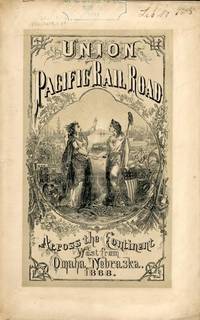
186854323New York: Published by the Company 1868. 1868. TRANSCONTINENTAL RAILROAD. First edition. Pamphlet edition. 8vo. Pictorial wrappers 40 pp. frontispiece Map of the Union Pacific Rail Road and its Connections introduction illustrated frontispiece map advertisement on rear cover for "First Mortgage Bonds at 102 principal and interest payable in gold with an annual income of "between eight and nine percent." This is an investment and advertising booklet for the first transcontinental railroad in the United States which was built by the Union Pacific Railroad and the Central Pacific Railroad in order to connect the Atlantic and Pacific coasts by rail for the first time. Begun in July of 1865 and built primarily by Civil War veterans the construction and completion of the Union Pacific line was one of the most significant technological and economic accomplishments of the 19th century creating the vital connection for commerce trade and travel and literally joining the eastern and western halves of the United States. Contents include the formation of the Union Pacific Railroad Company progress natural resources construction branch and connecting roads construction resources anticipated business & profits actual earnings and sale of first mortgage bonds. A list of officers of the company is provided. Top of front cover displays that this copy is mildly ex-library with stamp and number appearing at the upper right side a faint vertical fold to the center of the booklet tiny chips to bottom corner of front cover and a few preliminary pages. Overall a very good copy of an important railroad report. Published by the Company, 1868. unknown
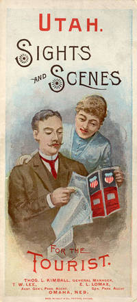
188852275Chicago: Rand McNally & Co. Printers 1888. 1888. UTAH RAILROAD. First Edition. 8vo. 21.5 x 10 cm. 8 1/2" x 4" color pictorial wrappers. 48 pp. illustrated from photographs fold-out map 'Tourist Map of Union Pacific and Connecting Lines' 20.5 x 59 cm. 8 1/4" x 23 1/2" present at the rear. The map is in nice condition and provides an excellent panorama of the Union Pacific Railway. Lines in red and run from Kansas City Atchison and Omaha to Denver and south to Gunnison or west through Cheyenne Granger and onto Portland with a spur up to Helena or west through Ogden and onto San Francisco with a spur down to Los Angeles. Blue shaded illustrations surround the lines which include a plowing scene Union Depot Salt Lake City Garfield Beach a mining scene Falls of the Yellowstone a ranching scene etc. Union Pacific produced guide for the would-be tourist of Salt Lake City including a description of the Mormons and their customs. Illustrated with nine full-page engravings from photographs by C.R. Savage. Also provided are List of Agents. Pullman Palace Car rates. Information on Salt Lake City tours Salt Lake City and the area surrounding "The Temple City" Beck's Hot Springs the Great Salt Lake Giant's Cave at Garfield Beach Echo Canon Weber Canon the Devil's Gate Ogden Ogden Canon etc. Detailed information on 9 different tours touting what the tourist might see and do. Covers lightly used light wear to fore-edges else a very good copy. Rand, McNally & Co., Printers, [1888]. unknown
186895331868. <p>The Transcontinental Railroad made possible the winning settlement and development of the American West. It led to a revolution in interstate and international trade opening the markets of the west coast and Asia to the east and Europe while bringing products of eastern or European industry to the growing populace west of the Mississippi and beyond. The railroad caused a great production boom and was in a sense America’s first technology corridor. As it encouraged the growth of American trade and business so too did the railroad impact the nation's public discourse and intellectual life by making it possible to come and go across the length of the continent in just over a week. Now for the first time the beauties and riches of the central part of the continent could be accessed any anyone in days. Nothing was the same afterwards. Many people consider the Transcontinental Railroad the greatest technological feat of the 19th century and one of the most consequential major construction projects ever undertaken.</p><p>Before the advent of the Transcontinental Railroad a journey across the continent to the west coast meant months of careful preparation and acquisition of a conveyance and supplies then a dangerous six month trek over rivers deserts and mountains all the way risking the loss of necessities and encounters with blizzards and Indians. Alternatively a traveler could hazard a three to six month sea voyage around ferociously stormy Cape Horn which proved a graveyard to many ships or sail to Central America and cross the Isthmus of Panama through the jungle in part by pack animal and in part by rail which took five or six weeks risking exposure to any number of deadly diseases in the crossing. So it is no surprise that interest in building a railroad uniting the east and west coasts of the continent began soon after the advent of the locomotive.</p><p><strong>Early Trains in the US and the Idea to Build a Train Connecting East and West Coasts</strong></p><p>The first trains began to run in the U.S. in the 1830s along the East Coast and by the 1840s the nation's railway networks extended throughout the East South and Midwest. The annexation of the western territories including California following the Mexican War the almost immediately subsequent discovery of gold in the region in 1848 the resultant Gold Rush starting in 1849 and statehood for California in 1850 brought momentum to the idea of building a railroad across the nation to the Pacific. Meanwhile thousands of immigrants and miners sought their fortune in the West. During the 1850s Congress sponsored numerous survey parties to investigate possible routes for a transcontinental railroad. No particular route emerged as a clear favorite as the project became yet one more point of contention between the North and South before the Civil War with each wanting the railroad to go through their section.</p><p>Theodore Judah was a civil engineer who helped build the first railroad in California and he became obsessed with the idea of a transcontinental railroad running through Nebraska Wyoming Utah Nevada and California. In 1859 he drew up letters of incorporation for the Central Pacific Railroad Company. Judah surveyed the route creating maps that he used to bolster a presentation of the scheme he made to Congress in October 1861. Many Congressmen were leery of beginning such an expensive venture especially with the Civil War underway but President Abraham Lincoln a long-time supporter of railroads saw in the proposal an important additional opportunity: to help knit California and the West to the Union. He agreed with Judah and on July 1 1862 Lincoln signed the Pacific Railway Act authorizing land grants and government support which amounted to $32000 per mile of track laid to two companies the Central Pacific Railroad and the Union Pacific Railroad. The Central would start at California’s eastern rail point in Sacramento cross the Sierras go through Nevada and into northern Utah where it would meet up with the Union Pacific. The Central Pacific Railroad spiked the first rail on October 26 1863 and its construction crews began building the line east from Sacramento.</p><p>At the eastern end of the project Gen. Grenville Dodge and his assistant Peter Dey surveyed the potential route the Union Pacific would take. They recommended a line that would follow Nebraska’s Platt River along the North Fork would then cross the Continental Divide at South Pass in Wyoming and continue along to Green River then head into Utah. President Lincoln favored this route and made the decision that the eastern terminus of the Transcontinental Railroad would be Council Bluffs Iowa across the Missouri River from Omaha Nebraska.</p><p><strong>The Union Pacific</strong></p><p>Thomas Durant a medical doctor turned businessman gained control of the Union Pacific Railroad Company in July 1863. Though Durant took the office of vice president he was the actual leader of the railroad. In 1864 Congress passed the second Pacific Railway Act which doubled the size of the land grants and allowed the railroads to sell their own bonds. The Union Pacific began to lay tracks at Omaha Nebraska in July 1865. But Durant's management of the actual building of the rail line was sub par and lacked both organization and people with sufficient knowledge and skills to accomplish its ambitious task.</p><p>So as 1866 dawned Durant hired Grenville Dodge as chief engineer of the railroad Dodge began advising Durant immediately although he would not leave the service until May and Dodge insisted up front that Jack Casement and his brother be hired to lay the track and actually construct the Union Pacific line. John S. Jack Casement had worked as a railroad contractor on the Ohio Railroad prior to the Civil War. During the war he rose to the rank of General and Brigade commander and was admired for his bravery management skills and railroad experience. Jack and his brother Daniel had formed the firm of J.S. & D.T. Casement; “General Jack†was construction leader while Daniel handled financial matters.</p><p><strong>Jack and Dan Casement Build the Railroad</strong></p><p>The Casements came to an understanding with Durant and they agreed upon a proposal letter dated February 6 1866. That letter provided that the Casement firm would ""lay and fill the track on the Union Pacific Rail Road for seven hundred fifty dollars per mile on the following terms and conditions. The Rail Road Company to furnish motive power cars wood and water and tracks for boarding cars and pay for delays of over three consecutive days caused by want of material motive power or other default or neglect of Company. The track to be laid in a good and workmanlike manner and filled and surfaced with material taken from the side of the road the whole to be subject to the approval and acceptance of the Engineer of the Company in charge of the work and the track to be accepted on the completion of every twenty miles and approximate estimates to be made by the Engineer in charge and paid monthly. We will lay the track as fast as required not to exceed one mile per day and will at the option of the Company on ten days notice reduce our gang to a force sufficient to lay one half mile per day. We will furnish engineer men and all other help for the trains used in distribution of material and take the materials for track at any point on the Rail Road within one hundred feet of the track and we will furnish oil waste etc for trains in our employ. All trains used in construction or for any purpose by us are to be run subject to the regulations & schedule time of the Company & under the general control of the Superintendent of the Company. We will make no extra charge in cutting and filling in leveling ties unless it exceeds six inches. No extra charge for putting in frogs and switches for all necessary sidings. And we will place the labor of all our men at the disposal of the Company whenever the delays exceed three days and charge for their time as per our payroll. We will commence as soon as the Company requires & will lay track during the whole of the present season and longer if the Company requires.†This proposal was signed “J.S. & D.T. Casement.†Durant responded to the Casements two days later on February 8 1866. His letter stated: “J.S. & D. T. Casement Painesville Ohio. Gentlemen: Your proposition to the Union Pacific Railroad Company under date of Feb. 6 1866 in relation to track-laying is received and has been considered. The Company decides to regard your proposition and this acceptance as the agreement upon the subject. The Company reserves the right to terminate this arrangement in case you do not perform the agreement on your part. Yours truly Thomas C. Durant V. P.""</p><p>Jack Casement was responsible for all matters relating to building the Union Pacific. He hired the workers many of whom were former military personal gathered the materials and supplies and went into the field. As during the war his post was at the front in the construction camps which he ran like an army at the end of the line where the work was being done or in his car at the tail of the work train. Scrappy and hard-working he oversaw not just the laying but the grading of the track as well. As one of the necessities of his job to get to and from the work sites the Union Pacific presented him with annual passes to use their cars.</p><p><strong>Jack Casement’s engraved Union Pacific pass for 1868</strong> used by him to manage and supervise work on the Transcontinental Railroad signed by Company President John D. Perry. This pass was retained by Casement’s descendants until recently when we obtained it directly from them.</p><p>Under Casement’s leadership the Union Pacific laid 1087 miles of track from Fremont Nebraska west to Utah where the Central Pacific and Union Pacific Railroads met to form the transcontinental railroad. His was a magnificent achievement that compares well with the Central Pacific Railroad which laid 690 miles.</p><p>On April 9 1869 with construction work nearing a conclusion and both the Union Pacific and Central Pacific needing a meeting point Congress established it as Promontory Summit north of the Great Salt Lake in Utah. Less than one month later on the morning of May 10 1869 locomotives from the two railroads met nose-to-nose to signal the joining of the two lines. At 12:57 p.m. local time at a ceremony planned to connect the railroads Leland Stanford Governor of California and president of the Central Pacific and Durant as vice-president of the Union Pacific were to pound in the golden spike with silver hammers. Both men proved unable to hit the spike so Jack Casement stepped up to do the job accompanied by much cheering from the workers surrounding him. Telegraphers announced the completion of the Pacific Railway. Canons boomed in San Francisco and Washington. Bells rang and fire whistles shrieked as people celebrated across the country. The nation was indeed united.</p> unknown