377 résultats
189355261Pittsburgh PA: Pittsburgh Locomotive Works 1893. 8vo. 41 1 pp. Blue tinted photogravure frontisp. 9 blue-tinted photogravure plates 4 w/ two images. Brown decorated publisher’s cloth black lettering & borders on front cover decorated endpapers slight shelfwear rear inner hinges starting slightly shaken still VG copy from the library of Herman S. Chalfant 1881-1957 longtime Pennsylvania paper wholesaler and manufacturer based out of Pittsburgh PA. First edition of this nicely illustrated catalogue touting the steam locomotives produced and exhibited by the historic Pittsburgh Locomotive Works during the Columbian Exposition. The locomotives featured included an experimental large Passenger Compound Locomotive the Mogul Compound Freight Locomotive for the Columbus Hocking Valley & Toledo Railway; a Freight Locomotive and Tender for the Cincinnati Hamilton & Dayton RR as well as a narrow gauge four-wheel saddle tank locomotive engine. Founded in 1865 by Andrew Carnegie and Thomas Miller the company quickly grew supplying quality large locomtovies for the Bltimroe & Ohio Acheson Topeka & Santa Fe Manhattan Elevated and the Union Pacific thriving until 1901 when it was consolidated into the American Locomotive Co. Pittsburgh Locomotive Works, hardcover
18501008148vo pamphlet later paper wrappers two folding maps 117 2 pp. Minor foxing and browning a bit of staining in the margins mostly maps also have the staining in margins but are in great condition otherwise; overall very good. The goal of this bill in the House of Representatives was to connect the Atlantic and Pacific with a railroad. Specifically this undertaking was to construct a railroad and electric telegraph from the Mississippi to the Pacific Ocean. Whitney seems to have played a critical role in this process and started to work on the railroad project as early as 1841. The pamphlet contains a lot of information on early railroad issues especially imports and exports.
1887038377New York: American Bank Note Co 1887. First Edition. Very Good. Broadsheet printed in black ink on buff stock opens to 12.25" x 25.5". Includes an inset map 5.75" x 8.75" and a long paragraph of text on Chautauqua Lake. Folds to 6" x 3.25" with different illustrations of Niagara Falls on both cover panels. Dated "August 21 1887. Corrected to Sept. 18." Not found in OCLC nor WorldCat. American Bank Note Co unknown
185738128NP: Privately printed1857. 1857. 11" x 7" printed yellow broadside. One side has a map entitled "PLAN OF THE NEW-YORK AND ERIE RAIL-ROAD WITH ITS CONNECTIONS." The map is of the northeast as far west as St. Paul and St. Louis. "Meals and Berths Extra on M.C. & M.S. Steamers." "Meals Extra on Cleveland Steamers." The other side includes fares to Illinois Ohio Wisconsin New York Michigan Kentucky to name a few. Includes the name of the General Eastern Agent. Both sides legible light chipping else a good copy. Privately printed,1857. unknown
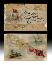
18924739Chicago IL: Wabash Railroad Passenger Department 1892. Souvenir Edition. Paperback. About Good. Promotional Pamphlet w. bird's-eye view of the Chicago World's Fair copyright 1892 by F. Chandler and printed by Poole Bros. in Chicago. String bound printed paper wraps oblong 16mo size 5-5/8 inches tall pp. 56 illustrated throughout w. color halftones. Volume covers w. small chips and rubs spine strip about half gone p.o. name in smudged ink to upper cover text with some tears and light damp staining to top edges. Upper cover w. "Compliments Passenger Department Wabash Railroad" printed at bottom corner. A complete but Good Only copy. The World's Columbian Exposition also known as the Chicago World's Fair was a world's fair held in Chicago from 5 May to 31 October in 1893 to celebrate the 400th anniversary of Christopher Columbus's arrival in the New World in 1492. wiki. Wabash Railroad Passenger Department paperback
1890024769Concord NH: Concord and Montreal Railroad 1890. Unknown . Oblong Wraps. Near Fine. Octavo. Light creamy green colored stiff wraps faux leather lightly soiled/rubbed with gilt titles. App 80 pages of town area hotel mountain views from Nashua Junction and on through the White Mountains and Crawford House. Very nice photos most are unique to this scarce view book. Full-page map in the rear showing all the stops and trunk lines from Boston through West Stewartstown. Near Fine to fine contents condition very nice! <br/> <br/> Concord and Montreal Railroad paperback
1890024770Concord NH: Concord and Montreal Railroad 1890. Unknown . Oblong Wraps. Good. Octavo. Light creamy green colored stiff wraps faux leather lightly with gilt titles. App 80 pages of town area hotel mountain views from Nashua Junction and on through the White Mountains and Crawford House. Very nice photos most are unique to this scarce view book. VG condition with the rear cover missing and spine tated with old black tape. NOTE: we do have another example of this scarce RR photo book in NF very nice condition. Just ask. Thanks Mat <br/> <br/> Concord and Montreal Railroad paperback
1869ZB386909Washington 1869. 40th Cong. 3rd Sess. Senate Rep Committee No. 219 3 pp. ex library good. - If you are reading this this item is actually physically in our stock and ready for shipment once ordered. We are not bookjackers. Buyer is responsible for any additional duties taxes or fees required by recipient's country. Washington unknown
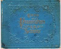
1880040522Portland Maine: Chisholm Brothers 1880. First Edition. Hardcover. Very Good. 12 panels of views. Accordion-fold leporello format. Views include: Pennsylvania R.R. Station Jersey City showing birds eye view of the Hudson River New York City etc.; Pennsylvania R.R. Ferries plying between Jersey City & New York; Bridge Crossing the Raritan River; Broad St. Station.Philadelphia Grandest R.R. Depot in America; New Public Building Philadelphia Cor. Broad & Market Streets Built of Marble.; Bryn Mawr Hotel; Bryn Mawr Station; Bridge Crossing the Susquehanna River 6 Miles West of Harrisburgh; Lewiston Narrows; Jacks Narrows; Horse Shoe Curve; Near Bolivar on the Conemaugh; Spruce Creek Tunnel; View of Pittsburgh & Allegheny City Pa.; &c. Bound in embossed blue boards gilt cover title. Edges of boards lightly rubbed; internally fine. 5" x 6" The views here are very detailed and in sharp focus. WorldCat locates three holdings of this viewbook: N-Y Hist Soc Hagley Museum Duke University. Chisholm Brothers hardcover
1870354323New York: E. & H.T. Anthony & Co 1870. Single stereocard 3½ x 7 inches. Stereo image mounted onto printed orange cardstock. Slight wear at edges. Very good. Single stereocard 3½ x 7 inches. An appealing stereocard image showing several long stretches of railroad track heading into the small town of Ogden Utah. It is a view of an important point crossing point in American railroad history as Ogden is the point at which the Union Pacific Railroad ends and the Central Pacific begins. A train can be seen on the tracks in the far distance as well as a few clapboard buildings. The New York photographic firm of E. & H.T. Anthony & Co. produced several stereoscopic views for the Central Pacific Railroad though few are known today. A nice image of an important railroad intersection. E. & H.T. Anthony & Co unknown
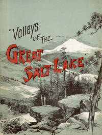
189046818Chicago: R. R. Donnelley and Sons Company 1890. 1890. UTAH. First Edition. 56 pp. Octavo 22 cm Gray illustrated wrappers. Illustrations. Offers a short history of the settlement and growth of Utah and includes profiles of Salt Lake Ogden and the Great Salt Lake. Illustrations include the tramway in Little Cottonwood "The vast improvements wrought by the industrious and frugal pioneers of Utah the great natural resources of the territory the balm of its health giving and invigorating climate the wonders of the majestic mountains the sylvan beauties of its unrivaled valleys the new relations of amity and progress that have sprung into life between all the religious sects of the territory and especially in Salt Lake City the enterprise of energetic railroads the building of great irrigating canals the establishment of manufactories the growth of mining in short all those great strides towards absolute preeminence which Utah has made have been to a great extant ignored in the past." - from the Preface. A small bump to the fore-edges along the upper portion of the front cover and diminishing in size inward very light foxing to the first few pages else a very good tight copy. Not in Flake/Draper. R. R. Donnelley and Sons Company, 1890. unknown
1894125669St. Paul Minn: Office of General Passenger and Ticket Agent 1894. Softcover. Good. 94 p. 20 cm. B&w photos and sepia line drawings. Grey paper covers with gold print. Lower spine chipped with pages separating. Some soiling to covers including white marks on rear. Stain on margin of p. 20. <br/><br/> Office of General Passenger and Ticket Agent paperback
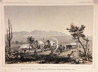
185714427Washington DC: Bevery Tucker Printer 1857. First Edition. Very Good. A.H Campbell. 8.25x11in One litho tinted illustrated plate Part I plate V; Light age-toning along edges with several light spots in margin. Samuels p. 81 Taft p. 265. This plate is from from Volume VII of the quarto edition of twelve volumes were published from 1855 to 1861 as exploration and survey reports became available. These volumes contained not only the survey maps and elevations but a monumental collection of scientific reports on geography geology zoology botany and ethnology of the Native American tribes. The surveys also included 11 artists to record the landscape and indigenous peoples of the west. <br /> <br /> <br /> <br /> Albert Henry Campbell 1826-1899 was a Railway survey artist-explorer civil engineer and surveyor. He was one of the more important artist of the surveys and participated in several survey expeditions across the west from 1853 to 1854. In the fall of 1854 he joined the Parke survey expedition for a coastal railroad route from San Francisco to San Diego and the survey along the 32nd parallel to Arizona. All eight of the full-page illustrations are credited to Campbell in the report three of California and five of Arizona scenes After the surveys he was assigned to Washington as Superintendent of Pacific wagon roads to 1860. During the Civil war he was a map maker for the Confederate Army and chief engineer of railroads based in West Virginia. from Samuels <br /> <br /> The twelve volumes were disorganized in publication with no overall all arrangement or indexing. Some of the plates and maps referred to in volumes were published in other volumes various reports were also published out of sequence relating to the four routes. Preliminary reports published were updated in latter volumes. From Wagner-Becker-Camp In 1853 Senator Gwin of California lead the inclusion of Congressional funding for 1853-54 of a series of surveys to determine the best and most economical railroad routes from the Mississippi River to the Pacific coast. The act directed the Secretary of War Jefferson Davis to plan and direct Army topographical engineers to conduct surveys of four routes. The first was between the 47th and 49th parallels generally along the Lewis and Clark route to the Pacific. The Second route between the 37th and 39th parallels was promoted by Senator Thomas Hart Benton of Missouri. The Third route was along the 35th parallel. The Fourth route was promoted by Secretary Davis along the 32nd parallel that followed Emory's 1846-47 reconnaissance. Bevery Tucker, Printer unknown
1884100459<p>Folding train schedule 4 1/2x 9 20 panels large folding map in color. Some browning and aging some separation at the middle fold two of those separations are a few inches three other smaller tears at the middle fold these are repairable a few chips and tears at edge folds. Nice piece of railroad memorabilia with substantial information about rates and schedules. Most of the trains are geared toward the west which gives an idea on the process of opening up this still relatively new part of the country.The map has its flaws but it is sound enough to get a feel for the lines of the Union Pacific.</p> Rand McNally & Co.
186849559New York: Published by the Union Pacific Railroad Company 1868. 1868. RAILROAD. First edition. 8vo. Original pictorial printed wrappers 32 pp. frontispiece Map of the Union Pacific Rail Road and its Connections introduction. Details the formation of the company and the progress of the work including the topography character of the country and distances along the line. Much information is provided regarding agricultural resources timber minerals etc. Branches and connecting roads along with the needed resources for construction are discussed as is information on actual earnings anticipated earnings and the issuance of the company's first mortgage bonds. A wonderful advertisement on the rear cover panel offers First Mortgage Bonds at par principal and interest Payable In Gold. A faint vertical crease and very lightly toned at the cover edges else a near fine bright copy. Published by the Union Pacific Railroad Company, 1868. unknown
18997555Very Good. 1899. Non-Book. This handwritten letter is toned but clean and in very good condition. . . unknown
189071195San Francisco: Southern Pacific Co. ca. 1890. Two original albumen photographs taken by a staff photographer for the Southern Pacific Railroad Company. Each photograph is 8 1/8 x 5 7/8 inches. Both are captioned and mounted on original boards with gilt edges. The first entitled 'Rotary Snow Plow in Action' and the second 'Snow Shovelling at Cascade'. Each photo shows a large group of men working on removing snow from the tracks. The Cascade mentioned is probably Cascade Trestle near Truckee although it is conceivable that it is Cascade Summit Oregon. Southern Pacific Co. hardcover
18518220Boston: Eastburn's Press 1851. Sewn binding. Good. Octavo 29pp. A good copy in the publisher's yellow sewn wraps. Front wrap detached but present otherwise a clean bright example with mild chipping to wrapper extremities. Very faint flattened vertical crease throughout. Scarce and ephemeral volume loaded with forensic accounting of this railroad; one of the earliest commercial rail systems in the US. OCLC notes a single physical holding naturally at AAS. Eastburn's Press unknown
185130447Baltimore: John Murphy 1851. 50pp small printed addendum note tipped in at pp.42-43. Several folding tables charts large folding map "Exhibiting the Railway Route between Baltimore & St. Louis; Together with the Other Principal Lines in the Eastern Middle and Western States." Plain rear wrapper present. Stitched. Scattered foxing light edgewear. Good with the map in Very Good condition. <br /> <br /> The Report of this important early railroad contains financial information and material on coal transportation the extension of the Ohio River the Washington branch the Northwest Branch and more.<br /> Not located in Modelski. John Murphy unknown
187742208St. Louis: A. Gast & Co. Lith. 1877. 1877. IOWA NEBRASKA. First edition. 8vo. 21.6 cm x 13.3 cm. Original printed yellow wrappers 31 1 pp. illustrated from two full-page pictorial plates three maps on verso of front cover and recto and verso of rear cover. Front map is of the great South Platte region. Map on inside rear cover is a map of Southern Iowa showing lands of the Chicago Burlington & Quincy Railroad Company that are available for sale Map on outside of rear cover is a map showing the leading through routes to the West and the land grants in Iowa & Nebraska of the Chicago Burlington and Quincy R. R. and Burlington & Missouri River Railroad in Nebraska. A scarce and interesting promotional for the sale of 1000000 acres of land owned along the routes of the Burlington and Missouri River Railroad. The Burlington and Missouri put out some of the most interesting and compelling railroad land promotionals in the genre nicely illustrated with maps and plates and this example is no exception. The maps show the lands for sale along the line of the railroad from Monroe Iowa to Omaha; lands in Nebraska from Omaha to Kearney along the South Platte; and a map showing railroad routes from Chicago. The plates are entitled "Looking Southwest from Lincoln Neb." and "Valley of the Big Blue South of Seward Neb." The text is devoted to detailed descriptions of the land including natural resources soil climate stock raising and homesteading opportunities and prices for land and for goods. This publication enjoyed some success; another promotional issued the next year advertised only 750000 acres of land left for sale indicating that the Burlington and Missouri had sold off a quarter million acres of land the previous year. Laid into this copy is a four-page "Circular of Rates on Tickets and Freight" for several railroads including the Burlington & Missouri. Not in Railway Economics nor in the Eberstadt or Decker catalogues. OCLC locates three copies at the American Antiquarian Society Harvard Business School Library and the DeGolyer Library. There is also a copy at Yale. This scarce promotional booklet has covers lightly soiled small chips to the covers covers holding but loose internally quite serviceable. Overall a very good copy. A. Gast & Co. Lith., [1877]. unknown
189650-14124National Railway Publication Company 1896-01-01. Paperback. New. In shrink wrap. National Railway Publication Company paperback
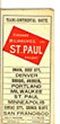
189330730Chicago: Keogh & Schroeder Co. Printers 1893. 1893. 16 1/2" x 22 folded to 24 panels. 15 panels offer time tables; 1 panel offers information on the sleeping car routes to include rates. 6-panel black and white system map showing the Chicago Milwaukee and St. Paul Railway and its connections from Chicago to the West Coast. Brief mention of the Columbian Exposition on one panel. 1/2" split to two folds along with 1/2" closed tear to edge of one panel. Very good copy. Keogh & Schroeder Co., Printers, [1893]. unknown
1895250835Chicago: Poole Brothers 1895. Denoted the "thirteenth edition two hundredth thousand" on title page. With illustrations. Plus folding map. 56 pp. 8vo. Original pictorial wrappers. Wrappers worn along spine. Some neat early pencil marginalia. Very good. In a half morocco and cloth folding case spine gilt. Denoted the "thirteenth edition two hundredth thousand" on title page. With illustrations. Plus folding map. 56 pp. 8vo. A useful turn of the century tourists' guide for places along the railroad's routes. This copy has pencil marginalia beside entries for five cities including Salt Lake City giving the impressions of a traveller in 1898. <br/><br/> Poole Brothers] hardcover
184119688np 1841. Folded folio sheet. 3 1 address page in ink to Hon. D.B. Appleget pp. Several old folds spotted and moderately worn. Good. <br /> <br /> Expenses exceeded estimates. "The country through which the Road passes being densely populated and the lands especially in the neighborhood of the cities and towns highly cultivated and valuable great difficulty and expense were incurred in procuring the right of way." The document is signed at the end in type by J. Worthington Treasurer. Not located in Felcone American Imprints Sabin or on OCLC. unknown
189824215St. Louis Missouri: Woodward & Tiernan 1898. Staplebound. Very good condition. A guide book aimed at the summer tourist inclined to visit the resorts around the Great Lakes on the Wabash Railroad's expanded "Cool Northern Route" Detroit Niagara Falls and Buffalo. Starting in Detroit and ending in Quebec the book describes cities en route particular resorts and hotels: Mt. Clemens St.Clair Springs Port Huron Hotel Windermere and many more. 8 3/4 x 5 3/4" 100pp b&w ills staplebound. White illustrated card covers with a sailboat on front map of the complete line on verso. Front cover creased on one corner clean and bright. We could find no other copies. Woodward & Tiernan unknown