3 640 résultats
1983RO70161613DU LOMBARD. 1983. In-4. Cartonné. Très bon état, Couv. convenable, Dos satisfaisant, Intérieur frais. 46 pages - Augmentées de nombreux dessins en couleurs dans et hors-texte.. . . . Classification Dewey : 843.061-Albums BD
1975RO70153422DARGAUD. 1975. In-4. Cartonné. Bon état, Coins frottés, Dos satisfaisant, Intérieur frais. 46 pages - Augmentées de nombreux dessins en couleurs dans le texte - Coins légèrement frottés.. . . . Classification Dewey : 843.061-Albums BD
1977RO70153423DARGAUD. 1977. In-4. Cartonné. Bon état, Coins frottés, Dos satisfaisant, Intérieur frais. 46 pages - Augmentées de nombreux dessins en couleurs dans le texte - 1er contre-plat déchiré en surface en pied.. . . . Classification Dewey : 843.061-Albums BD
1965RO70153421DU LOMBARD / DARGAUD. 1965. In-4. Cartonné. Etat d'usage, Coins frottés, Dos abîmé, Intérieur frais. 62 pages - Augmentées de nombreux dessins en couleurs dans le texte - Coins émoussés - Mors fendus - Coiffes abîmées - Corps de l'ouvrage en très bon état - 2 PHOTOS DISPONIBLES.. . . . Classification Dewey : 843.061-Albums BD
2002R320023142LE LOMBARD. 2002. In-4. Cartonné. Bon état, Couv. convenable, Dos satisfaisant, Intérieur frais. 46 pages illustrées de nombreux dessins en couleurs dans le texte - 1er plat illustré d'un dessin en couleurs.. . . . Classification Dewey : 843.06-Bande dessinée
199812551BBMünchen, Nymphenburger, 1998. 8°, 270 S., original Pappband mit illustr. original Schutzumschlag, Neudruck sehr schönes, sauberes Exemplar mit ebensolchem Schutzumschlag.
197139436ABKonstanz, Christliche Verlagsanstalt, 1971. 8°, 151 S., original Pappband mit illustr. original Schutzumschlag, (Hardcover), deutsche Erstausgabe (1. - 3. Tsd.) der Umschlag nur minimal altersspurig, sonst ein schönes, sauberes Exemplar
197610247CBGenf, Artou (= Artou Reiseführer), 1976. 8°, 92 S. mit s/w-Abbildungen, illustr. original Kartonage (Paperback), Einband leicht berieben, Buchrücken minimal aufgehellt und an oberer Kante des Rückens etwas bestoßen.
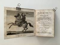
181115798AB1811. 10th year. Leipzig Fleischer 1811. 13 : 9 cm. XIV pages 1 leaf 315 pages 2 leaves with 10 off 12 partly folded cooper-plates. Contemporary boards. This volume of the well known and estimated series treats extensivly with Tibet. Besides also with Burma a.o. The plates show views animals people etc. - A bit stained; binding rubbed spine demaged. hardcover
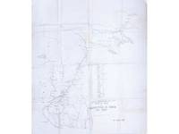
1904177840Simla: Intelligence Branch Topographical Division June 1904. The race for Lhasa A rare intelligence map produced during a spectacular move in the later stages of the "great game" showing Younghusband's route as far as the fortress at Gyantse. The map incorporates both existing information gathered by pundits and also the fruits of surveys undertaken by British cartographers during the advance. We have traced a single copy held by the British Library shelf number 57690.1. The Younghusband Expedition under a pretext of bringing the Tibetans to heel aimed at closing a Russian backdoor to the Raj. Departing in winter 1903 Younghusband and his force crossed the Tibetan border on 12 December and began the push to Lhasa. Reaching Guru in March 1904 British forces massacred Tibetan troops blocking their path the Massacre at Chumik Shenko and following a protracted effort to seize control of the fort at Gyantse in May and June they swept along the eastern road reaching Lhasa in early July. "Some fifteen years earlier as a young subaltern Francis Younghusband had dreamed of entering Lhasa alone disguised as a Yarkandi trader. Now in full diplomatic regalia and with a small armed escort he rode into the holy city. The Tibetans their morale broken offered no resistance" Hopkirk p. 183. In addition to its geopolitical goals the expedition was tasked with surveying the Tibetan interior. Captain Charles Ryder an experienced Survey of India cartographer joined the expedition as the mapping officer and information gathered by his team was fed back to Intelligence Branch in Simla and incorporated into field maps. This example dated June 1904 charts the expedition's course from its December 1903 departure point of Siliguri up to Gyantse where Younghusband was still bogged down and gives known elevations and the course of alternative routes into Tibet to be followed by troops advancing in Younghusband's wake. Along the route there are markings for the expedition's camps lines representing the journeys of detachments from the main expedition and a delineation of the makeshift telegraph line running up to Kang Ma. A pair of crossed swords and a date note the site of the Massacre of Chumik Shenko. The northern and north-east portions covering Lhasa and the territory to the west are sketched according to the valuable information gathered in the 19th century by pundits such as Nain Singh Rawat and Kishen Singh. Rawat the first non-European to win a gold medal of the Royal Geographical Society was also the first member of the Survey of India to reach Lhasa. His cousin Kishen Singh made four surveying expeditions of Tibet and Central Asia the fourth producing a detailed map of Lhasa and its environs. The map shows the course of the Tsangpo and Nyang Chu and some of the geographical features of Younghusband's planned route east to Lhasa including the pass at Karo-La and the large lake of Yamdok Tso both of which were explored in detail by Kishen Singh in 1880. The expedition and the more detailed surveys by Ryder and others that followed its success built on the achievements of the pundits giving Britain an unparalleled cartographic knowledge of the Tibetan interior. Heliozincograph printed on cloth 780 x 670 mm. Traces of couple of contemporary purple ink annotations. Clean and bright barring couple of minor stains old folds and creasing: very good. Peter Hopkirk Trespassers on the Roof of the World: The Race for Lhasa 1983. hardcover
200617507Wiesbaden, White Star Verlag, 2006.
1734o.J. Ein Tibeterleben. München, Otto Wilhelm Barth Verlag 1940. 263 Seiten m. Abbildungen a. Tafeln. Orig. Leinen, 8°. Gut erhalten. gebundene Ausgabe, guter Zustand
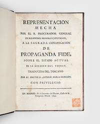
1744175883Madrid: Imprenta del Reyno 1744. One of three copies traced in commerce in 100 years First edition in Spanish expanded from the equally rare Italian edition of 1738 from the library of the distinguished historian-collector Sir Charles Ralph Boxer. Reporting on the 18th-century Capuchin missions to Tibet this text records some of the earliest European impressions of Tibet's cosmopolitan society and religious traditions. Members of the Order of Friars Minor Capuchin travelled to Tibet in the early 18th century and had a presence in Lhasa for several extended periods over four decades until the collapse of the mission in the 1740s. Although published anonymously this report was written by Francesco Orazio della Penna 1680-1745 the leader of the mission and a skilled linguist who studied the language intensively for four years in a monastery and compiled the first Italian-Tibetan dictionary. He focuses on religious life reporting on the position and privileges of the Dalai Lama as well as on processions temples and holy law. For this edition the translator the Spanish polymath Antonio Maria Herrero added material including a report of Capuchin efforts to introduce moveable type printing in Tibetan. The type 1306 different pieces was cast in Rome and conveyed in 1741 to Lhasa where several books were successfully printed. Also of note is a reference on page 106 to Samuel van der Putte the Dutch explorer who resided in Lhasa in the 1730s and was the only lay westerner known to have been in Tibet during the 18th century. Boxer 1904-2000 "possessed an internationally known rare book collection which was seized by the Japanese in 1941 for the Imperial Library in Tokyo. After the war he was able to recover most of his books including the jewel of his collection the sixteenth-century 'Boxer codex' a manuscript with seventy-five drawings by an unknown Japanese or Chinese artist depicting the peoples of the China Sea" ODNB. He continued to add to his library and embarked on an academic career spanning two decades during which he wrote numerous works on Dutch and Portuguese maritime expansion especially in relation to East Asia. His distinctive red seal is found on the title page and his 23 December 1957 ink ownership signature is the front binder's blank. His ink notes on both binder's blanks including a reference to the sale of another copy for $250 in 1965 by the American bookdealers Lathrop Harper and the fact that the 1738 Italian edition had only 70 pages. Boxer recognized both the appeal and rarity of this edition: the Lilly library holds another example from his library perhaps that sold by Harper's. Provenance: a Maggs Brothers Bibliotheca Asiatica et Africana Part V Catalogue 521 1929 with its pencilled catalogue code "728-521" on the front free endpaper verso recorded as bound in half morocco. b Maggs Brothers Voyages and Travels Vol. 5 Part VIII Catalogue 847 1957 with its pencilled catalogue code "2715 Vol V" on the front free endpaper verso. c Bought from Maggs by C. R. Boxer with his ownership signature seal and notes. d Sotheby's "Atlases Maps Travel and Topography Natural History Science and Medicine" 8 May 1986 lot 410 sold for £2200. e Sotheby's "Atlases Travel and Natural History" 20 October 1988 lot 278 bought post-sale by Ad Orientum. Octavo 195 x 143 mm pp. iv 120. Binder's blanks after endpapers. Early 20th-century brown half morocco raised bands compartments ruled in gilt gilt devices spine lettered direct in gilt brown cloth sides boards ruled in gilt marbled endpapers edges gilt. Contents expertly cleaned most leaves with professional tissue repairs at top edge text only slightly affected: a very good copy. Cordier 2906; not in Löwendahl or Lust. hardcover
195763373Stuttgart 1957. (8), 207 Seiten. Farbig ill. Originalbroschur. (Einband fleckig. Rechte untere Ecke gestaucht). 24x17 cm
1909148617Gutenberg-Verlag. Hamburg 1909. 479, (1) Seiten u. eine mehrfach gefaltete, mehrfarbige Karte im Anhang. Mit Buchschmuck u. vier Kunstdrucktafeln. Original-Halbleinwand-Einband. (Einband gebräunt. Papier teils durch rostige Klammern im Falz etwas fleckig) 22x15 cm
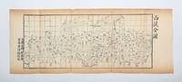
1886153413China: c.1886. Qing China's final frontier A late-Qing map of Tibet incorporating the research of the scholar-official Huang Peiqiao whose Xizang Tukao 1886 is one of the most detailed 19th-century Chinese sources on the geography and culture of Tibet. The map represents recent Chinese advances in scientific cartography the grid marking the longitudinal layout of this important part of the Qing frontier. This example is closely related to the four-page map found in Huang's study but is engraved here as one continuous block and likely represents one of the trial versions executed during the book's preparation. Provenance: exhibited in "The World on Paper: From Square to Sphericity" Hong Kong Maritime Museum December 2019 - March 2020. Woodblock-printed map 193 x 461 mm on single sheet 232 x 584 mm engraved by Han Xian Chinese title outside neatline. Vertical creases where sometime folded small closed tears repaired with tissue on verso toning: a very good copy. unknown
2011148357(Privatdruck. Copyright. Buddhistischer Studienverlag Berlin). 2011. 325, (2) Seiten. Rote Originalbroschur. (Namenseintrag a. d. Titelblatt. Teils mit geringeren Gebraquchsspuren). 23x16 cm
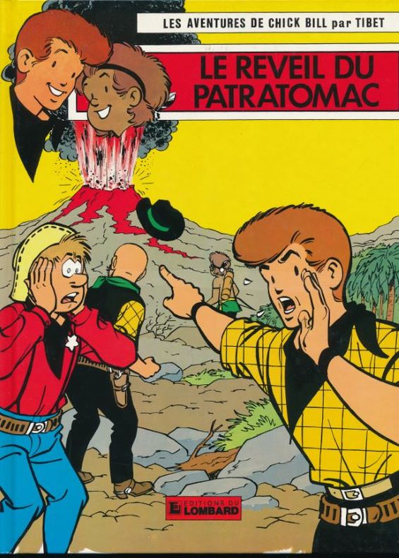
1983137008Editions du Lombard Editions du Lombard 1983, In-4 cartonnage éditeur, 48 pages. Parfait état.
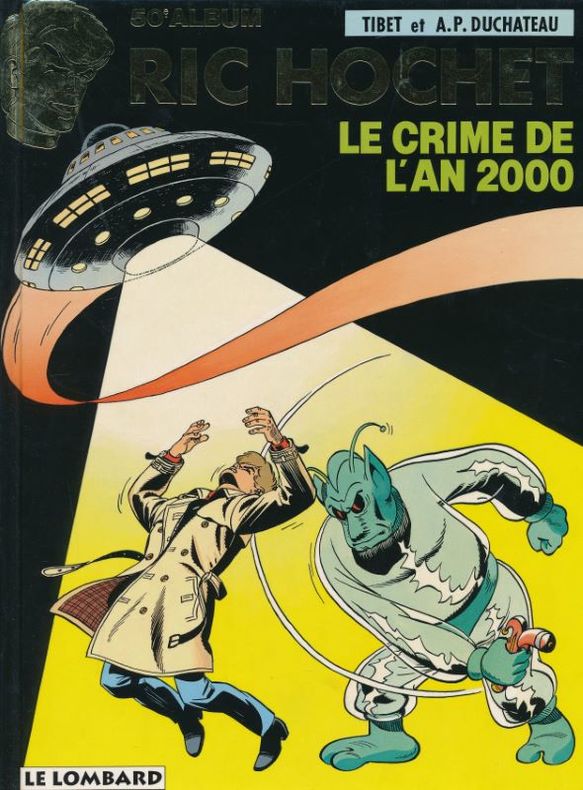
1993134475Le Lombard Le Lombard 1997, In-4 cartonnage éditeur illustré. 46 pages. 50eme album. Très bel état.
1983171313Le Lombard Le lombard, 1983. In-4 relié cartonnage éditeur. Très bon état
1983171321Le Lombard Le lombard, 1983. In-4 relié cartonnage éditeur. Très bon état
1982171295Le Lombard Le lombard, 1982. In-4 relié cartonnage éditeur. Très bon état
1987171267Le Lombard Le lombard, 1987. In-4 relié cartonnage éditeur. Très bon état
1983171316Le Lombard Le lombard, 1983. In-4 relié cartonnage éditeur. Très bon état
1991171282Le Lombard Le lombard, 1991. In-4 relié cartonnage éditeur. Très bon état