[South East Asia]Biblio.com
3 résultats
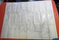
192523052s.l.: s.n. Very Good with No dust jacket as issued. c1925. Softcover. Group of 4 large folding black and white maps. No date c1925. No publisher or place of printing. No individual titles on maps. All maps with the same scale bar which is about 4 Inches to 55 Miles or about 1:871200. The 4 maps are: 1 southern part of Borneo. 960 x 738mm. 2 most of eastern Borneo. 960 x 735mm. 3 western part of Java. 890 x 735mm. 4 eastern part of Java with Bali and Lombok. 964 x 610. . [s.n.] paperback
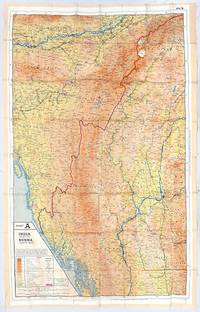
1940162561London: War Office early 1940s. An example of an escape map covering South-east Asia produced for POWs and RAF personnel during the Second World War. These maps were issued as part of escape kits or smuggled into the camps. On 23 December 1939 MI9 was established to aid in and oversee the escape of British prisoners of war in both Europe and Asia. This involved keeping in communication with POWs training soldiers and pilots in evasion techniques and developing escape tools. As part of this "MI9 took an early decision to embark on a mapping programme and determined that those maps should be on silk. There were good reasons: silk is flexible and durable in a way that paper is not and it is noiseless when hidden about one's person" Bond. They were printed with arbitrary sheet numbers and at a variety of scales and at least 1.75 million copies of 243 maps were produced. This example covers the north of Burma now Myanmar and some parts of the surrounding countries with maps 44A and B printed back-to-back on one sheet. It was likely issued during the Burma Campaign of 1944-45. The maps mark out many important and useful locations for someone escaping a POW camp such as telegraph offices regional military headquarters and freshwater lakes. One sheet of rayon 976 x 625 mm colour map on recto and verso key on Sheet B. Old folds edges slightly frayed fabric thinning along one fold maps bright: a very good copy. Barbara A. Bond "Escape and evasion maps of World War II" The British Library 2016. unknown
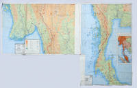
1940162557London: War Office early 1940s. Two copies stitched together for easy use on operations An unusual customized example of an escape map covering south-east Asia likely issued during the Burma Campaign of 1944-5. These maps were produced for POWs and RAF personnel during the Second World War issued as part of escape kits or smuggled into the camps. The maps covers the south of Burma now Myanmar and some parts of the surrounding countries with sheets 44C and D printed back-to-back on one sheet. This example is made up of two copies of the same map stitched together along one edge. The verso of one has been stitched to the recto of the other such they can be viewed simultaneously. The overlapping regions have been trimmed to create a complete map of southern Burma. On 23 December 1939 MI9 was established to aid in and oversee the escape of British prisoners of war in both Europe and Asia. This involved keeping in communication with POWs training soldiers and pilots in evasion techniques and developing escape tools. As part of this "MI9 took an early decision to embark on a mapping programme and determined that those maps should be on silk. There were good reasons: silk is flexible and durable in a way that paper is not and it is noiseless when hidden about one's person" Bond. Over 240 different maps were printed with arbitrary sheet numbers and at a variety of scales. Two sheets of rayon each 918 x 580 mm sometime stitched together along one edge retaining the needle colour map on recto and verso key on Sheet D. Rubbed with minor loss of colour sometime folded and creased edges lightly frayed: a very good example. Barbara A. Bond "Escape and evasion maps of World War II" British Library 2016. unknown