237 résultats
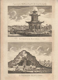
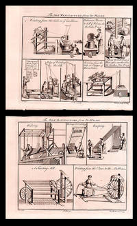
1779178310London. circa1779. A pair of engravings on a single sheet of laid paper each 14 x 15 cm including captions; 37 x 23 cm sheet the sheet with scattered spotting and toning mainly affecting the margins but in very good condition. This engraving appeared in Middleton's "New & Complete System of Geography" 1779 and is an example of the demand for publishers to supply views of the East and exotic "New Worlds". The late-seventeenth and eighteenth centuries had seen a dramatic increase in the publication of voyage accounts and compilations and collections on the London book market. <br> <br>From the Estate of the late collector and scholar Arthur Hacker. . unknown
1779178311London. circa1779. A pair of engravings on a single sheet of laid paper each 13 x 16.4 cm including captions; 37 x 23 cm sheet the sheet with scattered spotting and toning mainly affecting the margins in original uncoloured state as issued in very good condition. This engraving appeared in Middleton's "New & Complete System of Geography" 1779 and is an example of the demand for publishers to supply views of the East and exotic "New Worlds". The late-seventeenth and eighteenth centuries had seen a dramatic increase in the publication of voyage accounts and compilations and collections on the London book market. <br> <br>From the Estate of the late collector and scholar Arthur Hacker. . unknown
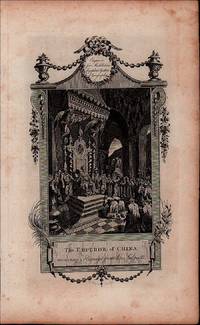
1779178306London. circa1779. Engraving on laid paper 29 x 17 cm platemark including caption; 37 x 22.7 cm sheet decorative border and title cartouche lower corner a little creased margins with scattered spotting and toning but in very good condition. This engraving appeared in Middleton's "New & Complete System of Geography" 1779 and is an example of the demand for publishers to supply views of the East and exotic "New Worlds". The late-seventeenth and eighteenth centuries had seen a dramatic increase in the publication of voyage accounts and compilations and collections on the London book market. <br> <br>From the Estate of the late collector and scholar Arthur Hacker. . unknown
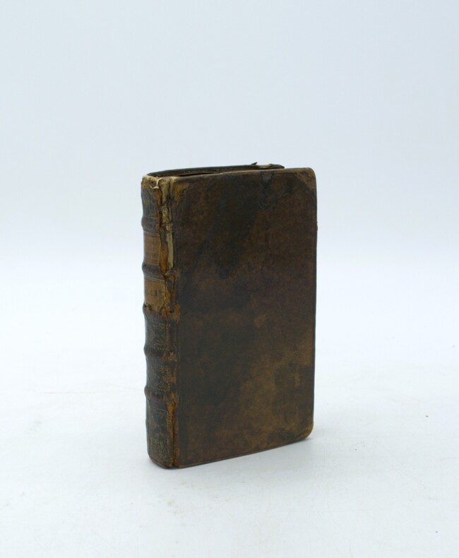
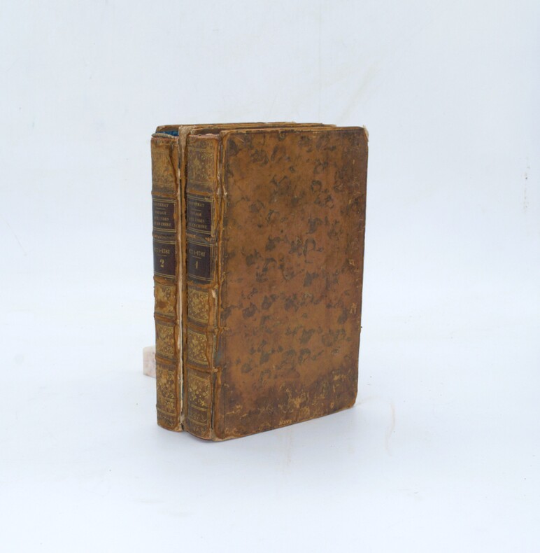
1773139211773 Berlin, chez G.J. Decker, imprimeur du Roi, 1773, 2 vol. in-18 (170 x 110 mm) reliure postérieure (ca 1830) 1/2 chagrin bleu marine, dos lisses richement ornés de fers romantiques, plats de papier marbré, de XX - 360 pp. ; 363 pp.Mors épidermés, très beaux exemplaires par ailleurs.
1750PHO-2245Paris, Quillau, Delorme, Leloup. 1 (4) volume in-12 (17x10cm), veau marbré époque, dos cinq nerfs, caissons dorés fleuronnés, pièces de titre et tomaison grenat, tranches rouges. Frottements, coins usés, coiffe sup. arasée, une planche volante. Illustré de 7 planches dépliantes dont une mappe monde indiquant la route de l’expédition et la Californie en Île.
1711PHO-2234Amsterdam, Chez la Veuve de Paul Marret, 1711, frontispice- 6ff.-340pp., veau époque, dos à nerfs orné avec titre et tomaison, cachet au titre, frottements, coins usés, coiffe arasé, début de fente
1777NWT41117Berlin, Joachim Pauli, 1777. 792 Seiten, ein Kupferstichporträt als Frontispiz, eine Titelvignette, 6 ausklappbare Kupfertafeln, Pappband der Zeit, Bibliotheksexemplar mit Stempeln und Signaturen, Einband etwas fleckig, berieben und bestoßen, Papier altersbedingt etwas gebräunt, sonst gut erhalten.
179627144London G. Nicol 1796 une gravure ancienne dessinée par William Alexander et gravée en noir par John HALL, Format : 38 x 31 cm, Plate. 28. : Punishment of the Tcha [le supplice de la La cangue (ou TCHA)], gravure tirée de : Lord Macartney's Embassy to China, Published in London by G. Nicol, 1796.
177521534Paris 1775. Very good condition. Detailed copper engraved map of northeast Asia and Siberia from Lake Baykal sic Partie du Siberie in the north Pays des Kalkas at the center as well as Desert de Sable and down to Chine and the Golphe de Lyau-tong. From Prevost's "L'Histoire Generale des Voyages".<br /> <br /> Bellin 1703 - 1772 one of the most noted French mapmakers of the 18th century was named the hydrographer chief cartographer to the French Navy and later the Official Hydrographer to the French King. <br /> <br /> 12 3/4 x 9 1/4" original center fold. Strong impression very clean. unknown
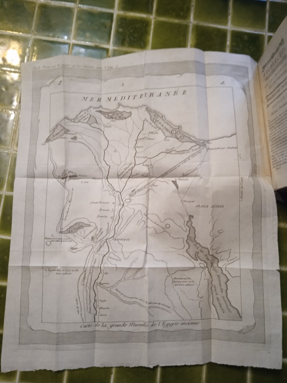
1773H25A Berlin, Chez C. J. Decker, 1773. 2 tomes en 1 volume in-12 (10,5 x 17,5 cm), reliure demi-cuir moderne, dos à nerfs, pièce de titre maroquin, de 347 et de 345 pages, parfois des traces de mouillure. Carte dépliante de la Grande Muraille de l’Égypte ancienne placée en début d’ouvrage (une infime réparation).
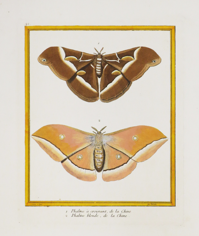
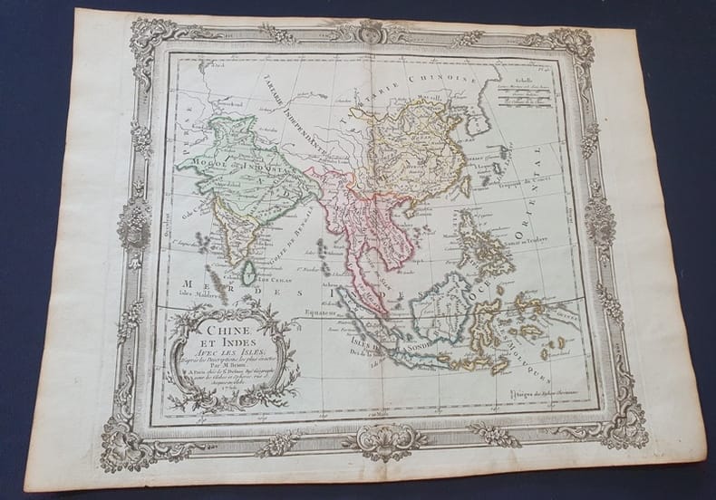
1771LBW-4389[Paris, 1771-1786]. 228 x 183 mm.
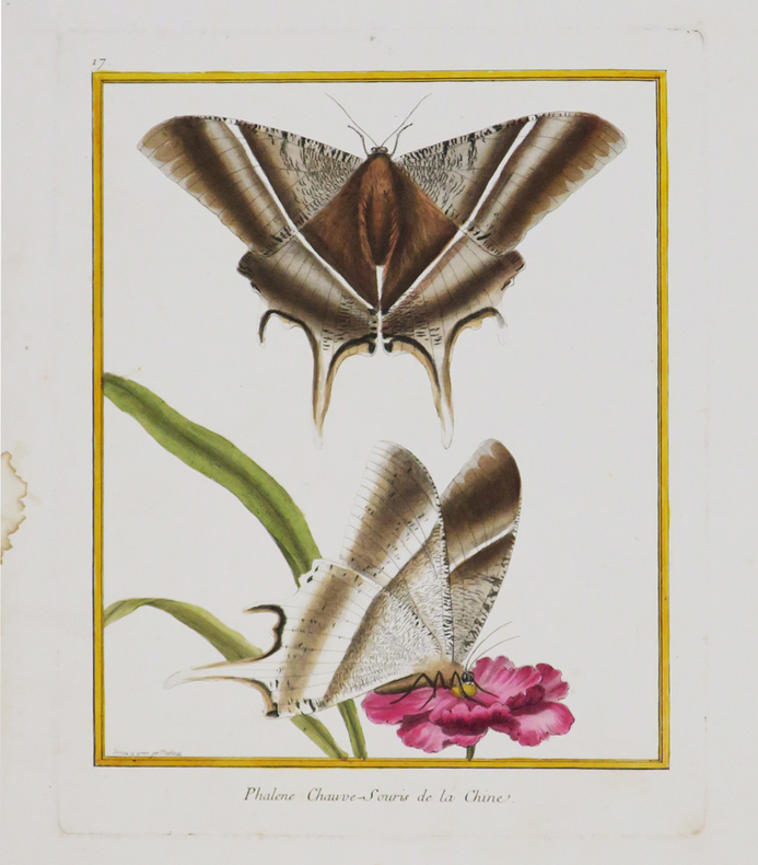
1771LBW-4390[Paris, 1771-1786]. 242 x 189 mm.
1782PHO-2465A Paris, Chez l'auteur & Froulé & Nyon, 1782, 2 volumes (sur 3) In-8 (150x215mm), xxij, 340pp. et (6) 376pp., Illustré de 2 planches (sur 9) dépliantes gravées par Poison d’après l’auteur, relié plein veau marbré époque, dos à nerfs avec pièces de titre et tomaison, dos frottés, coiffes et coins usés, plats détachés au tome 2 et fragiles au tome 1, manque page 375/376 au tome 2, manque au titre, exemplaire de travail.
1772Tir821772 Planche seule - dimensions 38 x 29 cm - planche aquarellée - Le pli du milieu existant déjà sera donc envoyée pliée en deux .
1772Tir821772 Planche seule - dimensions 38 x 29 cm - planche aquarellée - Le pli du milieu existant déjà sera donc envoyée pliée en deux .
1730171311730. Very good condition. An early copper plate engraved b&w map extending from Egypt and the Middle East to southeast Asia with Australia at the extreme lower right "New Holland" and below that "Incognita". To the northeast is Nova Guinea drawn attached to Carpentaria. A rather crude general map of southeast Asia. Heraldic shields with author and title at the lower left. Desing was a Benedictine monk from Ensdorff & member of the Bavarian Academy of Sciences. 5 1/4 x 4 1/2" unknown
175016021Paris 1750. Ca. 1750. Eighteenth century map of the eastern Chinese province of Chekiang with the island of Chusan and the islands of the Chusan archipelago. From Tome VI of Abbe Prevost's Historie Generale des Voyages. Includes 'Kimp-tong' island with the following note "Isles ou les Mandarins disgracies se retirent" island where disgraced Mandarins withdraw and the 'Ning-po' River. With north oriented to the right. Uncolored with compass rose. Size: 13 x 9". Very good. HK1300. unknown
173816720London: Edward Cave at St. John's Gate 1738. Very good overall. Copper engraving 8 1/2 x 13 1/4". Floorplans of two temples from the Edward Cave folio edition of this important encyclopedic work on Chinese culture history and society by a French Jesuit who specialized in China. Du Halde's work inspired great interest in China among Europeans and was a ground breaking work in geography. The book: Cordier BS 50; Löwendahl 409; Lust 15. Edward Cave, at St. John's Gate unknown
173816723London: Edward Cave at St. John's Gate 1738. Very good overall. Copper engraving 8 1/2 x 14 1/4" very good condition period folds. A series of walled cities. Plan from the Edward Cave folio edition of this important encyclopedic work on Chinese culture history and society by a French Jesuit who specialized in China. Du Halde's work inspired great interest in China among Europeans and was a ground breaking work in geography. The book: Cordier BS 50; Löwendahl 409; Lust 15. Edward Cave, at St. John's Gate unknown
173816726London: Edward Cave at St. John's Gate 1738. Very good overall. Copper engraving 11 x 8 3 3/4" with margins. From the Edward Cave folio edition of this important encyclopedic work on Chinese culture history and society by a French Jesuit who specialized in China. Du Halde's work inspired great interest in China among Europeans and was a ground breaking work in geography. The book: Cordier BS 50; Löwendahl 409; Lust 15. Edward Cave, at St. John's Gate unknown
1745199410London. 1745-1747. Copperplate engraving 20 x 33.2 cms image 25 x 43 cms sheet original folds a little age-toned but in very good clean condition. A striking view of Nanxiong in the province of Guangdong central to the tea route leading to Canton Guangzhou <br>The image is after the work of Johan Nieuhof 1618-1672 whose 17th century views were amongst the most influential European images of China. Nieuhof a German-born diplomat and adventurer was travelling in the service of the Dutch East India Company VOC eager to establish trade relations with China. This engraving was published in "A New General Collection of Voyages and Travels" published in London by Astley. . unknown
1745199414London. 1745-1747. Ten copperplate engravings arranged as storyboards on two leaves 21 x 16.5 cms border; 26 x 20 cms sheets including captions and platemark sheets a little age-toned with faint offsetting but in very good condition. Each of the ten engravings shows a stage in the production of silk. The two leaves of engravings Plates 25 and 26 were published as part of Du Halde's account of China included in an important 18th century compendium of travel writing: "A New General Collection of Voyages and Travels" known as the Astley Collection for its publisher. . hardcover
1750GITj495A Paris chez Quillau Père, Quillau Frère, Delormel, Le Loup 1750. In-12 4 feuillets 2-328pp. Basane havane, dos à nerfs orné de cadres de filets et pastilles dorées, pièces de titre et de tomaison, tranches marbrées, reliure de l'époque. Orné de 6 planches dépliantes (manque 1 planche et 2 cartes). Coiffes usées avec petit manque au bas du dos, coins émoussées, tache marginale, sans les 2 cartes et la planche "vaisseau chinois". 3e Livre du Tome III de la traversée depuis la côte du Mexique, jusqu'au voyage à Macao, Manille, Canton et le retour en Angleterre. (4933)
1785LBW-3662[1785]. 338 x 275 mm.
1785LBW-3659[1785]. 257 x 237 mm.