115 résultats
1797STLB0015Hamburg, Benjamin Gottlob Hoffmann 1797. 8°. Tit., X S. (Vorrede), 2 Bll. (Inh., diese verbunden), 246 S.; Tit., 347(1) S. Mit 1 Porträt-Frontispiz u. 3 (dav. 1 gef.) Tafel in Kupferstich. Neuerer Pappband m. maschinengeschr. Rüschi. Einbd. angestaubt u. abgegriffen, Kopfschnitt m. Tintenfleck, im Text stockfl. u. z. Tl. etw. angeschmutzt, mehrere Seiten an der oberen Ecke m. Knickspur. Vgl. Henze 1, 243; Wurzbach 1, 272 f. u. Hadamitzky/Kocks 81. Neuausgabe einer von drei konkurrierenden Übersetzungen der Jahre 1790/91. »Vieler gehaltvoller Zusätze, Berichtigungen u. Anmerkungen wegen ist diese ? Uebersetzung am meisten geschätzt« (Wurzbach). B. verfasste seine Aufzeichnungen in französischer Sprache und die erste gedruckte Ausgabe seiner Geschichte war eine Übertragung ins Englische (»translated from the original manuscript«. London 1790). Die Tafeln zeigen Kleidung und Waffen der Einwohner Madagaskars und die gefaltete Karte mit 3 Abbildungen zeigt den Lauf des Flußes Tingballe, einen Plan der Stadt Louisbourg und einen Plan des Forts Augustus. ? Der Soldat, Abenteurer, Reiseschriftsteller und selbsternannte König auf Madagaskar Moritz August Benjowski (1746???1786) kämpfte 1786 auf der Seite Polens gegen Rußland. Er geriet 1769 in russische Gefangenschaft und wurde nach Kamtschatka verbannt. Mit anderen Verbannten plante er einen Aufstand, bei dem der Gouverneur ermordet und die Kronkasse geplündert wurde. Die Aufständischen fuhren über Japan und Formosa nach Macau und auf zwei französischen Schiffen über Mauritius und Madagaskar weiter nach Frankreich. Im Auftrag Frankreichs machte B. später Kolonisationsversuche auf Madagaskar.
179061511ABWeißenfels,Leipzig. Severin, 1790. 2 Bände in Einem. 280 S. / 278 S. (2 letzten Seiten Band 2 fehlen) Or.-Kart., stärker berieb. sonst guter Zust.
175016021Paris 1750. Ca. 1750. Eighteenth century map of the eastern Chinese province of Chekiang with the island of Chusan and the islands of the Chusan archipelago. From Tome VI of Abbe Prevost's Historie Generale des Voyages. Includes 'Kimp-tong' island with the following note "Isles ou les Mandarins disgracies se retirent" island where disgraced Mandarins withdraw and the 'Ning-po' River. With north oriented to the right. Uncolored with compass rose. Size: 13 x 9". Very good. HK1300. unknown
177521534Paris 1775. Very good condition. Detailed copper engraved map of northeast Asia and Siberia from Lake Baykal sic Partie du Siberie in the north Pays des Kalkas at the center as well as Desert de Sable and down to Chine and the Golphe de Lyau-tong. From Prevost's "L'Histoire Generale des Voyages".<br /> <br /> Bellin 1703 - 1772 one of the most noted French mapmakers of the 18th century was named the hydrographer chief cartographer to the French Navy and later the Official Hydrographer to the French King. <br /> <br /> 12 3/4 x 9 1/4" original center fold. Strong impression very clean. unknown
177521532Paris 1775. Very good condition. Detailed copper engraved map of northeast Asia and Manchuria showing the island "Sagallan Anga Hata" or "Isle de Bouche Noire". From Prevost's "L'Histoire Generale des Voyages".<br /> <br /> Bellin 1703 - 1772 one of the most noted French mapmakers of the 18th century was named the hydrographer chief cartographer to the French Navy and later the Official Hydrographer to the French King.<br /> <br /> 12 1/2 x 8 3/4" original center fold. Strong impression very clean. unknown
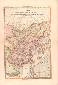
1780180203Paris. circa1780. Engraved handcoloured map 31.3 x 20.5 cm; 37.8 x 25.5 cm sheet central fold slight toning one spot of discolouration to the upper border in very good crisp condition. Attractive map showing China the Korean peninsula the Philippines Japan and Chinese Tartary/Mongolia Vietnam and Central Asia. Also shows the wind direction vital to traders at the time. Rigobert Bonne 1727-1794 was an influential French cartographer of the late-eighteenth century succeeding Jacques Nicolas Bellin as Royal Hydrographer at the Depôt de la Marine in 1773. This map was prepared for Abbe Raynal’s famous "Atlas de Toutes Les Parties Connues du Globe Terrestre." 1780. . unknown
1750160201750. Bellin's chart of the islands "at the mouth of the Canton River" Pearl River Delta. From the atlas Histoire Generale des Voyages. <br /> <br /> Showing parts of Lantau island Macao Isle de Macao and Ville de Macao both shown and the southeast coast of Guangdong Province Province de Quang Tong to Shangchuan and Xiachuan Islands with names of villages fresh water supplies and the tomb of St. Francis Xavier shown on the Isle de Sanciam sic. To the east are islands "Yong Ngao "que l'on appelle Les Isles des Voleurs" 'Islands of Thieves' or present day Mariana Islands. <br /> <br /> With a compass rose and an elaborate title cartouche at the lower right. 13 x 8 1/2" HK2300. unknown
177632115BBBresslau, bey Johann Ernst Meyer, 1776. 8°. 8 n.n. Bl., 311 S. Blauer Pappband der Zeit mit 2 verschiedenfarbenen goldgeprägten Rückenschildern. Erster Theil (von 2).
173816698London: Edward Cave at St. John's Gate 1738. Very good overall. Copper engraving 11 x 8 3 3/4" with margins. Map from the Edward Cave folio edition of this important encyclopedic work on Chinese culture history and society by a French Jesuit who specialized in China. Du Halde's work inspired great interest in China among Europeans and was a ground breaking work in geography. The book: Cordier BS 50; Löwendahl 409; Lust 15. Sml. closed tear repaired into print at top. Edward Cave, at St. John's Gate unknown
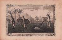
1782178309London. circa1782. Engraving on laid paper 19 x 28.8 cm platemark including caption; 24.5 x 37 cm sheet decorative border edge tears and toning and occasional spotting but in very good condition. This engraving appeared in Millar's "New complete & Universal System of Geography" and is an example of the demand for publishers to supply views of the East and exotic "New Worlds". The late-seventeenth and eighteenth centuries saw a dramatic increase in the publication of voyage accounts and compilations and collections on the London book market. <br> <br>From the Estate of the late collector and scholar Arthur Hacker. . unknown
1750900104AG[Leipzig:, Arkstee und Merkus, 1750]. Kupferstich, Blattmaß: 24 x 19 cm. Bildmaß: 19 x 14 cm.
1750900109AG[Leipzig:, Arkstee und Merkus, 1750]. Kupferstich, Blattmaß: 24 x 19,5 cm. Bildmaß: 19 x 14 cm.
1750900112AG[Leipzig:, Arkstee und Merkus, 1750]. Kupferstich, Blattmaß: 24 x 19 cm. Bildmaß: 19 x 14 cm.
1750900103AG[Leipzig:, Arkstee und Merkus, 1750]. Kupferstich, Blattmaß: 24 x 19,5 cm. Bildmaß: 19 x 14 cm.
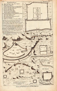
1738206300London. 1738. Five engraved architectural plans and a key together 36 x 21.6 cms; 40.2 x 25.3 cms sheet age-toning small tide-mark affecting an upper corner but overall in very good condition. Attractive group of engravings depicting walled cities of the Chinese Qing dynasty province of Pe-Che-Li today Zhili province. The engravings show a plan of Peking with a key at left; Yung-ping-fu Guangfu; Long-men-hyen Luoyang; Chin-ting-fu; and a "Plan of part of the great wall on the Side of Yung-ping-fu flank'd by several fortresses." This is a plate from an English edition of Jean Baptiste Du Halde's encyclopedic compendium of the written accounts of some 27 Jesuits in China documenting the history and customs of the country. . unknown
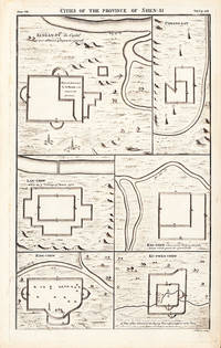
1738206290London. 1738. Six engraved architectural plans together 36 x 21.6 cms; 40.2 x 25.3 cms sheet age-toning short edge tear at lower corner soft creasing at upper left corner very good condition. An attractive suite of engravings depicting six walled cities of the Chinese Qing dynasty province of Shen-si now Shaanxi in northwestern China : Si-ngan-fu Xi'an Chwang-lan Zhuanglang Lan-chew Lanzhou Kan-chew Ing-chew and Ku-ywen Chew. This is a plate from an English edition of Jean Baptiste Du Halde's encyclopedic compendium of the written accounts of some 27 Jesuits in China documenting the history and customs of the country. . unknown
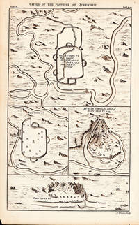
1738206287London. 1738. Five engraved architectural plans together 36 x 21.6 cms; 40.2 x 25.3 cms sheet age-toning small repaired edge tear overall very good condition. Suite of 18th Century engravings from an English edition of Jean Baptiste Du Halde's encyclopedic compendium of the written accounts of some 27 Jesuits in China documenting the history and customs of the country. <br>The engravings show the four walled cities of the Chinese Qing dynasty province of Quey-Chew present Guizhou in Southwest China: Quey-Yang Fu Guiyang Ping-Ywen Fu Pu-ngan Chew and Chin-Ywen Fu. . unknown
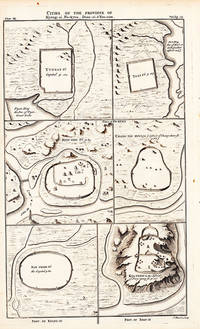
1738206291London. 1738. Six engraved architectural plans together 36 x 21.6 cms; 40.2 x 25.3 cms sheet age-toning inner margin with paper loss to plate mark not affecting the engravings overall very good condition. An attractive suite of engravings depicting six walled cities of Chinese Qing dynasty provinces: Yun-nan Fu Ta-li Fu Dali Kyen-ning Jian'ou Chang-tay Hyen Nan Chang Fu Nanchang and Kya-chew Pingyao. This is a plate from an English edition of Jean Baptiste Du Halde's encyclopedic compendium of the written accounts of some 27 Jesuits in China documenting the history and customs of the country. . unknown
173816717London: Edward Cave at St. John's Gate 1738. Very good overall. Copper engraving 8 1/2 x 14 1/4" very good condition. A series of walled cities. Plan from the Edward Cave folio edition of this important encyclopedic work on Chinese culture history and society by a French Jesuit who specialized in China. Du Halde's work inspired great interest in China among Europeans and was a ground breaking work in geography. The book: Cordier BS 50; Löwendahl 409; Lust 15. Edward Cave, at St. John's Gate unknown
173816723London: Edward Cave at St. John's Gate 1738. Very good overall. Copper engraving 8 1/2 x 14 1/4" very good condition period folds. A series of walled cities. Plan from the Edward Cave folio edition of this important encyclopedic work on Chinese culture history and society by a French Jesuit who specialized in China. Du Halde's work inspired great interest in China among Europeans and was a ground breaking work in geography. The book: Cordier BS 50; Löwendahl 409; Lust 15. Edward Cave, at St. John's Gate unknown
173816718London: Edward Cave at St. John's Gate 1738. Very good overall. Copper engraving 9 x 15" very good condition with slt. loss on lower left corner as inserted in the book. A series of walled cities. Plan from the Edward Cave folio edition of this important encyclopedic work on Chinese culture history and society by a French Jesuit who specialized in China. Du Halde's work inspired great interest in China among Europeans and was a ground breaking work in geography. The book: Cordier BS 50; Löwendahl 409; Lust 15. Edward Cave, at St. John's Gate unknown
173816701London: Edward Cave at St. John's Gate 1738. Very good overall. Copper engraving 8 3/4 x 15" very good condition. A series of walled cities. Plan from the Edward Cave folio edition of this important encyclopedic work on Chinese culture history and society by a French Jesuit who specialized in China. Du Halde's work inspired great interest in China among Europeans and was a ground breaking work in geography. The book: Cordier BS 50; Löwendahl 409; Lust 15. Edward Cave, at St. John's Gate unknown
173816716London: Edward Cave at St. John's Gate 1738. Very good overall. Copper engraving 8 1/2 x 14 1/4" very good condition. A series of walled cities. Plan from the Edward Cave folio edition of this important encyclopedic work on Chinese culture history and society by a French Jesuit who specialized in China. Du Halde's work inspired great interest in China among Europeans and was a ground breaking work in geography. The book: Cordier BS 50; Löwendahl 409; Lust 15. Edward Cave, at St. John's Gate unknown
173816715London: Edward Cave at St. John's Gate 1738. Very good overall. Copper engraving 8 1/2 x 14 1/4" very good condition. A series of walled cities. Plan from the Edward Cave folio edition of this important encyclopedic work on Chinese culture history and society by a French Jesuit who specialized in China. Du Halde's work inspired great interest in China among Europeans and was a ground breaking work in geography. The book: Cordier BS 50; Löwendahl 409; Lust 15. Edward Cave, at St. John's Gate unknown
173816719London: Edward Cave at St. John's Gate 1738. Very good overall. Copper engraving 8 1/2 x 14 1/4" very good condition overall with slt loss to title at top due to plate positioning on paper. A series of walled cities. Plan from the Edward Cave folio edition of this important encyclopedic work on Chinese culture history and society by a French Jesuit who specialized in China. Du Halde's work inspired great interest in China among Europeans and was a ground breaking work in geography. The book: Cordier BS 50; Löwendahl 409; Lust 15. Edward Cave, at St. John's Gate unknown