China's Sustainable Use of Natural Resources
2021x-1032236345Routledge 2021. Paperback. New. 26 pages. 9.18x6.12x0.63 inches. Routledge paperback
Revaluation Books · Royaume-Uni61,63 £GB≈ 70,37 €
3 141 résultats
196616839Taipei Taiwan: Ch'eng-Wen Publishing Company 1966. Reprint of 1938 edition. Hardcover. Good/no dust jacket. Thick small octavo standard size. Some wear to edges and corners of boards. Head and heel bumped. Spine faded but very legible. Some soiling to top of textblock. Flyleaves darkened a bit. Slightly musty. 775 pgs w/ footnotes index and numerous appendices. A survey of China's Tariff history with a very large part of the history of the Chnese Customs Service. <br/><br/> Ch'eng-Wen Publishing Company hardcover
2021x-1032236345Routledge 2021. Paperback. New. 26 pages. 9.18x6.12x0.63 inches. Routledge paperback
2020x-0367434520Taylor & Francis 2020. Hardcover. New. 256 pages. 9.21x6.14x0.75 inches. Taylor & Francis hardcover
ria9780367434526_inpHardcover. New. New Book; Fast Shipping from UK; Not signed; Not First Edition; This book examines the financing of China’s health system argues that present arrangements are not adequate and proposes an increased role for commercial health insurance as a way of overcoming the difficulties.The book goes on to co hardcover
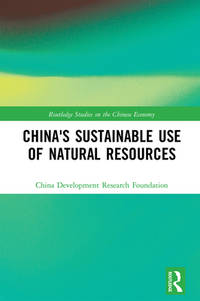
ria9781032236346_inpPaperback. New. New Book; Fast Shipping from UK; Not signed; Not First Edition; This book examines China's resource endowment and the country's current exploitation and use of resources and analyzes the main challenges and potential opportunities facing the country. It then discusses how to improve the efficiency w paperback
38720692-nnew. unknown
44019715-nnew. unknown
38720692like new. unknown
44019715like new. unknown
2005DADAX0367434520Routledge 2020-05-06. 1. hardcover. New. 6.14x0.69x9.21. Buy with confidence. Excellent Customer Service & Return policy. Routledge hardcover
A9781032236346Paperback / softback. New. paperback
A9780367434526Hardback. New. hardcover
1032236345.Gpaperback. Good. Access codes and supplements are not guaranteed with used items. May be an ex-library book. paperback
231911054Oxford University Press China Ltd. GF590 2009 hardcover with dust jacket good copy Oxford University Press (China) Ltd hardcover
20108242232Oxford University Press 2010. This is an ex-library book and may have the usual library/used-book markings inside.This book has hardback covers. In good all round condition. Dust jacket in good condition. Please note the Image in this listing is a stock photo and may not match the covers of the actual item3300grams ISBN:9780198008972 Oxford University Press hardcover
2015x-1138795151Routledge 2015. Hardcover. New. 580 pages. 9.25x6.25x1.50 inches. Routledge hardcover
#[38163]Haarlem H.D. Tjeenk Willink & Zoon 1900. 4to. Original printed frontwrapper with illustration margins sl. dam.; back wrapper missing. With printed title-page with vignette and 60 illustrations. 40 pp. - Scarce. unknown
2019x-981132705XSpringer 2019. Hardcover. New. 212 pages. 9.25x6.10x0.67 inches. Springer hardcover
ria9780367875435_inpPaperback / softback. New. New Book; Fast Shipping from UK; Not signed; Not First Edition; Positioned in a social constructivist framework that emphasizes mutual perceptions and socialization the book draws analytical leverage from two core concepts – national identity and national interest – to form the basis of the res paperback
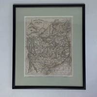
2g11158-Schweinfurter Geograph. Graviranstalt des Bibliographischen Instituts Hildburghausen um 1850. Maße: ca. 21 x 26 cm im Passepartout hinter Glas im schwarzen Holzrahmen ca. 332 x 387 cm. - sauber gerahmt - unknown
19451206T043London: Jonathan Cape Ltd 1945. 1st Edition . Hardback. Printed pages: 175. Very Good Plus. 5.5 x 8 inches 14 x 20.5 cm. Red cloth binding with red dyed top page edge. A little light rubbing to covers. A few spots of light foxing to page edges slight red stain to lower page edge. Very clean text throughout. Illustrated. The fold-out map is present and in excellent condition. Overall condition is Very Good Plus. International postage will be less than the stated rate. Actual costs are Europe £11.00; USA £15.00; Oceania £16.00; Rest of World £18.00. A postage refund will be made after the order has been placed. Size: 5.5 x 8 inches 14 x 20.5 cm. Jonathan Cape Ltd hardcover
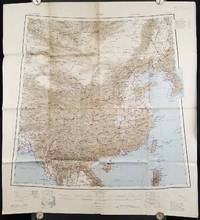
1945206545Calcutta: Compiled and drawn by the Survey of India. Second Edition. 1945. Large folding colour map 77.5 x 80cm; 95.5 x 86.2cm sheet including legend and small inset showing adjoining maps light toning and wear to upper margins and at corners and folds; but in very good condition. Very large clear map of China printed in 1945. The projection is noted as the "Lambert Conical Orthomorphic" a polyconic projection employed by the exhaustive Survey of India and the map includes surrounding countries: Taiwan Korea French Indo-China with a small inset key to Korean place-name abbreviations. As is typical of maps of this period Arunachal Pradesh is shown as Tibetan territory.The legend lists borders and provinces railways roads and canals with topography indicated with colouration. . Compiled and drawn by the Survey of India. unknown
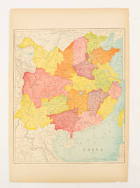
1900174904circa1900. Map printed in colour text in English provinces shaded in colour 28.3 x 23.2 cm central fold paper toned a small edge tear confined to the outer margin but in good condition. . unknown
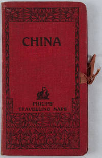
1920161936no date. circa1920. Linen backed colour folding map of China insets of Peking and Environs and Hongkong and Canton in lower left corner. 54 x 63.8cm. Table of place names at upper left gives the cities that "By a recent ordinance of the Republic all 'Fu' 'Chow'' and 'Ting' cities have been nominally reduced to the rank of 'Hsien'. The following parallel list gives the 'Fu' cities the names of which have been officially changed together with the new form adapted." Map folds into a red cloth covered case with ribbon ties 19 x 10.3cm. Title and decoration printed in black on upper cover. Trifle foxed on linen backing a little insect damage case in a few small places otherwise a very good clean map. . hardcover
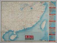
1944195577New York.: Army Information Branch. 1944. Very large folding colour map main map 85 x 95.5 cm plus 6 sidebar maps together 85 x 14.1 cms; sheet 88 x 118 cms several fold splits archivally sealed in good condition. Large colour wartime map issued by the U.S. Army Information Branch in 1944 the main map showing Shanghai to French Indochina with the islands of Formosa and Hainan scale 7 inches to 200 miles. At the right edge are inset maps of Shanghai Wenchow Foochow Swatow Canton and Hong Kong. Map issued to accompany Newsmap Volume III No. 51B. . Army Information Branch. unknown