66 résultats
193848<p>694p 38.23cm Photo plates tables etc. In Japanese. Good bind tight a little wear. Very rare NO Worldcat/OCLC record printed: "Not-for-selling" on copyright page. Involving hospital plagues disaster etc. WITH PICTURES</p> Manchuria Committee of Japanese Red Cross hardcover
19382091502135500850Not Available 1938. Soft Cover. Fine. Number of pages: 1135 pages of thick text 35 pages 50 pages of index Size: 19 x 27 cm Not Available paperback
19922080502106402950Green Shadow Book 1992. Soft Cover. Fine. The book is in fine condition. Green Shadow Book paperback
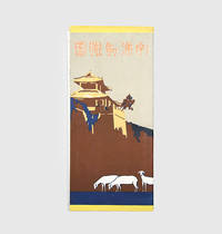
1923188890Perhaps Tokyo: Mantetsu tetsudobu c.1923. The backbone of Japan's overseas empire A large and colourful tourist map of the mainline running from Jilin and Changchun to Lushun Port Arthur recording stations branchlines rivers and the belt of mountains skirting the mainline's south side. The text on the verso provides essential information on major destinations along the route. This map was issued during a period when Japan both consolidated its economic and political hold over South Manchuria but also faced heightened Chinese opposition in the form of strikes and protests. Tourist traffic however flowed unabated. Colour map formed from 2 joined sheets each 750 x 250 mm text and tipped-on errata slip on verso. Folding away into original illustrated wrappers. General creasing 55 mm split at head of first fold archival tape repair to wrappers: very good. unknown
19402091502135701770Manmon Materials Association 1940. Soft Cover. Fine. The book is in fine condition. Manmon Materials Association paperback
19782110502150905045Kaimei shoin 1978. Soft Cover. Fine. Number of books: 12 Kaimei shoin paperback
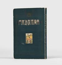
1917156891Dalian: Minami manshu tetsudo 1917. A rare guide to the South Manchuria Railway with 13 well-preserved maps First edition first printing of this scarce and profusely illustrated handbook for business and tourist travellers on the South Manchuria Railway the economic powerhouse of Japan's East Asian empire. WorldCat records only three copies all in Japanese institutions. The South Manchuria Railway Company was founded in 1906 under the direction of Goto Shinpei 1857-1929 to manage railway lines seized from Russia in the wake of the Russo-Japanese War. By the end of 1907 it already had 9000 Japanese and 4000 Chinese employees and during its first decade of operations the company invested in a range of industries including coal mining including the major mine at Fushun natural gas extraction shipping and hotels and hospitality. In 1917 the company took over management of the entire railway network in Japanese-controlled Korea cementing its position as the backbone of Japan's imperial expansion between the wars. This guide focuses on major stops along the railway including Dalian Fengtian Changchun and Yingkou together with descriptions of and directions to notable visiting spots. The maps and plans show the extent of the network the layout of important destination cities and the course of key battles in the Russo-Japanese war. A selection of the plates stress the vibrancy of Japanese economic development. Octavo. With 54 plates 11 colour 13 folding maps and plans 6 colour folding table of fares colour pagoda vignette on title page vignettes in text. Original illustrated green stiff card wrappers spine and front cover lettered in white pictorial endpapers. Covers bright extremities rubbed small closed tear to penultimate map professionally repaired with Japanese tissue maps otherwise exceptionally well-preserved small loss to p. 7 of table of contents slightly affecting text contents clean. A near-fine copy. Institutional holdings: National Diet Library Waseda and International Research Center for Japanese Studies. unknown
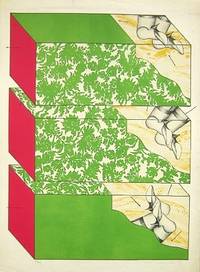
196965213Milano: Grafica Uno 1969. Molto buono Very Good. Litografia originale a colori. cm 535x72. . Molto buono Very Good. . Grafica Uno, unknown
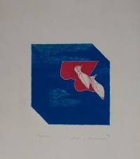
196989904Milano: Grafica Uno 1969. Molto buono Very Good. Acquaforte acquatinta originale a colori. Cm 22x21 Foglio 53x40. . Molto buono Very Good. . Grafica Uno, unknown
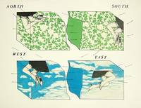
196965212Milano: Grafica Uno 1969. Molto buono Very Good. Litografia a 5 colori. cm 76x545. . Molto buono Very Good. Bruniture leggere ai margini del foglio Some light browning and spotting. Tiratura 42. Grafica Uno, unknown
19402091502135500733Shinkyo Daido Plaza Manshu Central Bank 1940. Soft Cover. Fine. Number of pages: book size: 25cm Shinkyo Daido Plaza Manshu Central Bank paperback
19242091502135501228South Manchuria Railway Co. Ltd. Harbin Office Investigation Section 1924. Soft Cover. Fine. Number of pages: 23 Standard size: 22x32cm South Manchuria Railway Co., Ltd. Harbin Office Investigation Section paperback
19382080502106906007Not Available 1938. Soft Cover. Fine. The book is in fine condition. Not Available paperback
19392110502150410819South Manzhou Railway 1939. Soft Cover. Fine. Volume: 1 South Manzhou Railway paperback
19302091502135501278Osaka Mainichi Shimbun 1930. Soft Cover. Fine. Number of pages: 446p Map size: 16x23cm Osaka Mainichi Shimbun paperback
1940234221940. Chinese prisoner execution photo archive from Japanese-occupied Manchuria circa 1940s recording the custody restraint killing and aftermath of Chinese prisoners under Japanese military control. Japan's occupation of Manchuria followed the Mukden Incident of September 18 1931 when Japanese forces used an explosion along the South Manchurian Railway as the pretext for military conquest; in 1932 Japan established Manchukuo a puppet state that drew international condemnation through the League of Nations' Lytton Commission. By the 1940s Manchuria remained a central zone of Japanese military power in northeast China where occupation authority puppet-state policing and anti-guerrilla campaigns produced summary punishments prisoner shootings and public terror against local Chinese populations.<br /> <br /> Photo archive of 7 silver gelatin photographs each 4" x 6.5" Manchuria circa 1940s. Japanese soldiers in field uniforms and peaked caps surround blindfolded Chinese captives seated in open ground near an earthen bank; in one scene soldiers level rifles toward bound or blindfolded prisoners at close range. Several men lie face down or on their sides at the base of the embankment with soldiers and civilian onlookers standing above them; plain wooden boxes or planks sit nearby suggesting prepared burial or removal. Another scene records a prisoner being physically restrained in a courtyard or village setting with tiled rooflines uniformed soldiers and civilian men crowded around him. The sequence moves between armed custody execution ground bodies on the earth and prisoner handling under guard giving the group a direct evidentiary relationship to Japanese military violence in occupied Manchuria.<br /> <br /> Manchuria was not a peripheral theater in Japan's war in China; it was the region where the Kwantung Army transformed a railway-security pretext into territorial occupation state building under Manchukuo and a long-running military presence that helped bring international crisis in the 1930s and full-scale war in Asia. The scenes preserved here are not battlefront combat views but close-range records of prisoners controlled by armed soldiers making the archive especially significant for the study of occupation violence Japanese military practice wartime China and the fate of Chinese civilians or irregular fighters labeled enemies under Japanese authority. Light edge wear and minor fading to some areas; images remain primarily clean; overall very good condition. The archive preserves a compact but stark record of military force in Japanese-occupied Manchuria grounded in the physical proximity between guards prisoners rifles and bodies. unknown
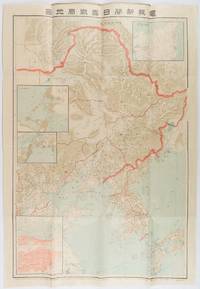
1904216818東京. Tokyo.: 電報新聞社. Denpō Tsūshinsha. Fifth Edition. Meiji 37 1904. Colour folding map with four inset maps 78.2 x 54.5cm folds into light card covers measuring 21 x 14cm. Very good copy. This the fifth edition of this map was published on 7th June 1904 reflecting the high level of public interest in receiving up-to-date information on the war particularly while the siege of Port Arthur continued without a decisive Japanese victory. The map includes four inset maps among them detailed views of Port Arthur and Vladivostok. It also records distances between key ports in Japan Korea and China. . 電報新聞社. [Denpō Tsūshinsha]. unknown
2091502135500715Not Available N.A. Soft Cover. Fine. The book is in fine condition. Not Available paperback
2111902154800499Kawade Shobo Shinsha N.A. Soft Cover. Fine. The book is in fine condition. Kawade Shobo Shinsha paperback
19382091502135409279South Manzhou Railway 1938. Soft Cover. Fine. Number of books: 1 South Manzhou Railway paperback
19262091502135501301South Manzhou Railway Beijing Office Laboratory 1926. Soft Cover. Fine. Number of pages: 169p Standard size: 15x22cm South Manzhou Railway Beijing Office Laboratory paperback
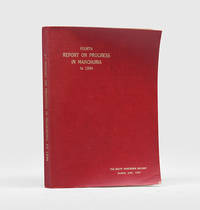
1934180943Dairen: South Manchuria Railway 1934. First edition of this comprehensive statistical and narrative report including a large folding map of Manchuria a map of road construction and plans of the ports of Rashin and Dairen. Sections convey the expansion of the railway's administrative structure and business interests into all aspects of governance. Quarto. With 24 plates 2 colour diagrams 4 maps and plans 2 colour. Original red cloth over limp card spine and front cover lettered in gilt. Covers and some text bowing rear endpaper lifting from cover spotting to edges plans at rear creased where incorrectly refolded: very good. hardcover
19362091502135702789Manzai Observation Team Journal Editing Department 1936. Soft Cover. Fine. The book is in fine condition. Manzai Observation Team Journal Editing Department paperback
19362091502135501308South Manzhou Railway 1936. Soft Cover. Fine. Number of pages: 264p Standard size: B6 size 15x23cm South Manzhou Railway paperback
19242091502135417045South Manchuria Railway KK 1924. Soft Cover. Fine. Number of books: 1 South Manchuria Railway KK paperback