[JAPAN AND KOREA - MAP]. MEYERS, JOSEPHBiblio.com
725 résultats
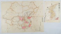
1902174898Leipzig.: Bibliographisches Institut. 1902-1908. Map printed in colour 27.2 x 21.4 cm inset colour key to territorial administration by country inset "western continuation of the main chart" including the Gulf of Tschili and Tsientsin and two insets at the foot of the map to the Kuril and the Ryuku Islands text in Geman central fold slight edge toning but in very good condition. Attractive map text in German prepared for Meyers Großes Konversations-Lexikon. . Bibliographisches Institut unknown
19860055911986 Special expedition postcard with Nepal R.3 stamp postmarked Kathmandu 29 May 1986. Signed by six team members. A near fine copy. Signed by the Expedition Team. First Edition. unknown
38009901Korea late 18th-early 19th century 1780-1810. Eight color gouache pastel tinted maps ca. 57.5 x 90.1 cm.contemporary re-backing very solid clean examples complete set of all provinces hand-painted gouache manuscripts. RARE & OBSCURE . . . . A RARE & COMPLETE SET OF ANTIQUARIAN MANUSCRIPT KOREAN . . . YI PERIOD PROVINCIAL MAPS . . "P'ALTO CHIDO" OR "EIGHT PROVINCES MAPS" . . . DELUXE ELEPHANT FOLIO SIZE SHEETS . . . HAND-COLORED GOUACHE PASTELS . This is a very RARE & COMPLETE set of eight Korean provincial manuscript maps. Drawn circa 1780-1810 by an unsigned Korean cartographer. These maps are of historical importance giving place names isolating the time frame. . Painted on very thin finely hand-made mulberry-fiber tissue paper contemporary re-backed with a stiff hand-made paper. Beautifully hand-painted & colored in gouache pastels. . The record shows several reliable verities of manuscript maps showing the eight ancient Korean provinces. . Commonly these maps had no title cartographer's name date or other critical bibliographic colophon data. This is a common theme with Korean manuscript maps. . Political divisions of Korea are by and large mostly stable making name comparisons easier. . PROBABLE MAP TITLES INCLUDE: . a. The "SINJUNG-TONGGUK-YOJI-SUNGNAM:" "EIGHT SEPARATE MAPS EACH SHOWING ONE COMPLETE PROVINCE OF THE EIGHT KOREAN PROVINCES similar in intention to the "P'ALTO CHIDO." . The eight provinces were established during the Chosen dynasty 1392-1910 alternately and commonly called the Yi dynasty. . The eight provinces are from the north to south: . 1. Hamgyong 2. P'yong'an 3. P'yongyang 4. Kangwon 5. Hwanghae 6. Kanghwa 7. Kyongsang 8. Cholla'ungch'ong . During the Sejo reign 1455-68 Yang Songji made the first "P'Alt-do "P'ALTO CHIDO" type maps of the eight provinces this type and style became the "standard" for future examples. There after his style and format were copied by others for centuries. . b. A second version and style of the above eight provinces maps is called "TONGGUK CHIDO: MAP OF THE EASTERN COUNTRY i.e. KOREA" showing a compressed northern frontier along Manchuria the characteristic "CHONG CH'OK" style. . c. A third similar map: "P'ALDO-CHONGDO: A SINGLE MAP SHOWING THE EIGHT PROVINCES OF KOREA." . These maps are pictorially beautiful and artistically drawn in detail. Graphics expressing a primitive naive folk charm depicts prominent geological landscape features. Mountain ranges hills forests in green streams/rivers blues political district seats distinctively painted cartouches box-like in various differing colors for each province. Roads paddy coastal shore line & islands in blue tints with other features nicely colored. . There are a large number of name throughout each map all written in Hanzi traditional Chinese characters called "Hanja" in Korean as was the common practice at that time for Koreans. There are no Hangul characters at all. The Hanja identify navigational directions names of surrounding ocean harbors beaches geographical names city towns villages mountains rivers roads and the like. . Each of the eight maps illustrates a complete single province. Within each of the various political divisions and boundaries outlined and named. . RARITY OF KOREAN ANTIQUITIES: Antiquarian Korean examples are sparse when compared to items of the same period in China and Japan. Korean works are less than 10% of those created elsewhere. . Fewer Korean items were made survived and preserved. The attrition rate: bad weather unstable ancient mud building structures fires natural disasters earthquakes war and other factors diminished the remaining examples. . Those the numbers that come to marked are steadily reduced while the value continues to appreciate. Many never return to market when acquired by institutions or private collectors who eventually donate to museums. . DATING THESE MAPS: These were mostly undated. . There are three possible methods of dating. . a. BY PLACE NAME: there are details in the reference books about county seat names being colored or put in various kinds of 'boxes' on the map depending on that according to the resources approximate dates can be derived. . b. PAPER TECHNOLOGY & FIBERS: Koreans have been using hand-made mulberry bark and fiber paper from the Zhenguan period AD 627-649 printing Buddhist sutras by woodblocks on similar kinds of paper. . These two technologies papermaking and woodblock printing was transmitted to Japan around 700 AD. . Since that time both Koreans & Japanese have utilized mulberry paper Washi in Japanese to woodblock print and paint a large variety of items including maps books and single page works. . By comparing the paper of these maps with known dated printed Japanese books a very close approximate date can be derived. . These Korean map papers are nearly identical to dated woodblock-printed Japanese examples we have. It is therefore highly possible these maps were painted on hand-made mulberry paper from circa 1780-1810 period. . In ancient times sheet size was limited to a small size then joined to other sheets to create a large size single sheet. These maps are of that format. See McCune below where he states the kind of paper used which matches our examples. . CONDITION: Per McCune we summarize: as usual these maps were folded several times from their creation time so they could be safely stored and carried in small 'book' format in covers with a tied string. See McCune below. . Being painted on very fine & thin hand-made mulberry paper most all examples were eventually re-backed. Ours as typical have period re-backing using the same character hand-made mulberry fiber paper of a thicker quality. . They are well preserved however nevertheless as usual there remains some old original wear at the folds the expected light water stains dustiness with other typical very minor flaws for an item of this grand size being 200 years old. These do not detract from the overall excellent impression and stunning appeal. . RARITY: . The complete set is RARE! The work is nicely executed in a firm hand with artistic value illustrating artistically hills mountains and other features of the map pictorially. It is not only a map but a work of art. Tastefully colored in subtle pastels nice representation of water rives and sea. . Such early and beautifully artistic examples seldom come to market. . A RARE AND FRESH EXAMPLE NEVER BEEN ON THE MARKET IN THE LAST 120 YEARS ! . PROVENANCE: These items were acquired from a former missionary's estate who was stationed in Korea from circa 1900-1930's. They have been in this private collection since and have never been on the market. . Color scans are posted to our website. . REFERENCES: . TOOLEY Ronald V. et al.: Article: Shannon McCune: SOME KOREAN MAPS pp.70-102 with illustrations. McCUNE Shannon.: KOREAN MAPS OF THE YI DYNASTY KOREAN CULTURE Korean Consulate General L.A. Ca. Sept. 1983 pp.21-31 34 back cover color plate color & b.w. illustrated. . He discusses "P'ALTO CHIDO""EIGHT PROVINCES MAP" origins maps without scale and were copies of a Korean scholar named Won his title was: Haksaeng works based on Chong Ch'ok's 1390-1475 TONGGUK CHIDO MAP OF THE EASTERN COUNTRY then modified by Won to be the more typical "P'ALTO CHIDO" "EIGHT PROVINCES MAP" but in his new style. This new style clearly resembles our maps in layout format color of county seats and similar boxes around them and other critical details. KOREAN CONSUL GENERAL KOREAN CULTURE September 1983 pp.21-31 34 color map on back cover color and b.w. illustrated. . It was from these maps that the later versions similar to ours eventually emerged mostly by Imperial Order by the ".Yi Dynasty court specifically decreed that both magistrates and governors should prepare up-to-date maps of their territories udder their supervision." p.25. HARLEY J.B. ed. et al.: CARTOGRAPHY IN THE TRADITIONAL EAST AND SOUTHEAST ASIAN SOCIETIES. Ahead of Title: THE HISTORY OF CARTOGRAPHY Vol. 2 Book 2 an excellent article by Gari Ledyard: CARTOGRAPHY IN KOREA pp. 235-345239 figures 10.23 10.24 et al. NAKAMURA Hiroshi.: EAST ASIA IN OLD MAPS. . --. NIHON KO CHIZU TAISEI: GREAT COLLECTION OF OLD JAPANESE MAPS MONUMENTA CARTOGRAPHICA JAPONICA . --. OLD CHINESE WORLD MAPS PRESERVED BY THE KOREANS. Article in IMAGO MUNDI IV 1958. LEE Chan. CH'AN Yi.: OLD MAPS OF KOREA. Han'guk ko chido. By: Ch'an Yi Hong-gyu Che Han'guk Tosogwanhak Yon'guhoe. He discusses and illustrates a good number of similar examples. On pp.226-27 he outlines an early Yi Dynasty example of: THE MAP OF EIGHT provinces found in TONGGUK YOJI SUNGNAM Chong Sang-gi's Tongguk Chido. These manuscripts were on large paper one province per sheet. Many other fine related examples are illustrated & discussed. . --. OLD MAPS OF KOREA: HISTORICAL SKETCH. He traces the early origins of Early Yi dynasty1392-1910 Eight Provinces Map origins and progressions excellent lucid article with illustrations and references to Yi HOE's MAP OF EIGHT PROVINCES. Excellent essay on provincial maps. SHIN Michael D. ed.: KOREAN HISTORY IN MAPS: From Prehistory to the Twenty-First Century. British Museum similar examples cited: commons-wikimedia-org/wiki/Category:Room_67_British_Museum# /media/File:Map_of_the_Jeolla_Province_British_Library_c.27. f.14_fol.12_n02.jpg Library of Congress: Young Il Kim: dong-kookyu-do: A RECENTLY DISCOVERED MANUSCRIPT OF A MAP OF KOREA. Imago Mundi vol.21 1967 pp.31-49 illustrated. . . unknown
1902220266Japan. No date. Circa1902. Two very attractive colour folded manuscript maps one showing China and the other Korea. <br> <br>Map of China: Watercolour map 48 x 63.5cm. Closed tear now professionally repaired. <br> <br>Map of Korea: Finely detailed watercolour map a few tiny holes very neatly repaired on the verso with archival washi. 33 x 24.5cm Two delicate hand-painted maps one of China and one of Korea produced by a Japanese student cartographer named Koike Tokushige 小池徳重. <br> <br>The undated map of China appears to have been produced in the first five years of the twentieth century: a time when Japan had recently colonized Taiwan and when Japanese economic and political interest in the region was rapidly expanding. The inscription on the map suggests that it was a third year college project. But the high level of detail suggests that the artist had considerable experience of map making. The map of China shows the main provinces rivers major transport routes the Great Wall and the location of key cities although the names of the cities are not included. It also shows outlines of the Korean Peninsula Taiwan and the Japanese island of Kyushu but not the rest of Japan. <br> <br>The map of Korea is more detailed. It provides an accurate outline of the Korean Peninsula with careful hatching indicating changes in elevation. Rivers and major road routes are shown on the map and the locations of major towns are marked though only Busan and Incheon are named. Dotted lines show coastal sea routes and routes between Kyushu and Busan and between Incheon and China. The map shows the Gyeongin railway line between Seoul and Incheon which was completed in 1899 and route of the Gyeongbu railway line between Busan and Seoul whose construction started from both ends in 1901. But the map depicts only small sections of this line close to Seoul and Busan as being completed with the rest more lightly outlined to show the projected route implying that the map was drawn around 1901-1902 and certainly before the Gyongbu line was opened in 1904. <br> <br>Inserted text gives the land area and population of Korea. Rather strangely though the figure given for the Korean population is vastly underestimated. Ikeda gives this as 5.7 million when in fact at that time is was around 18 million. . unknown
191744452London: Thos. Cook & Son 1917. 8vo. 181 xxiii pp. 3 large folding maps numerous maps numerous photo illusts. Green cloth blk lettrng & insignia on frnt cvr blk lettrng on spine mnr rubbng edgewear still a VG copy. Third edition revised & expanded of this excellent Cook travel guide for travel through China Manchuria and Korea during World War I. There are detailed sightseeing instructions for Peking visiting the Great Wall Tientsin Tianjin Port Arthur in Manchuria and more. Of particular interest is the extensive section on Chosen Korea nice folding map of Seoul photo illustrations etc. Thos. Cook & Son, hardcover
19892091502135408964Not Available 1989. Soft Cover. Fine. Number of books: 1 Not Available paperback
19792111902156002142Ethnological Society of Japan 1979. Soft Cover. Fine. The book is in fine condition. Ethnological Society of Japan paperback
a76224Washington 1965 Defense Mapping Agency. Oblong 4to. 370pp. original illustrated wraps. Light non-circulating library marks no spine numbers no pocket no bookplate. VG. . paperback
a76229Washington 1982 Defense Mapping Agency. 4to. 598pp. original decorated wraps. Light non-circulating library marks no spine numbers no pocket no bookplate. VG. . paperback
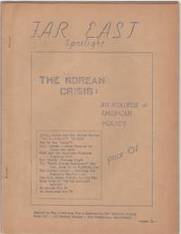
1950206875San Francisco: Committee for a Democratic Far Eastern Policy 1950. Evenly toned; rear cover leaf loose; very good. 22 mimeographed pages 8-1/2 x 11 in. with mimeographed cover stapled. In-depth eleven part essay. Though unsigned this was certainly the work of Maud Russell British-born American activist who devoted much of her life to China and the far east. At this time when the war in Korea was just underway Russell was executive director of the Committee for a Democratic Far Eastern Policy. Far East Spotlight was a precursor to her later self-published magazine Far East Reporter which she began in 1953 and continued for many years afterward. Committee for a Democratic Far Eastern Policy unknown
19932092902141205827Peking University 1993. Soft Cover. Fine. Volume: 1 Peking University paperback
20212081502111904698commercial stamp office 2021. Soft Cover. Fine. The book is in fine condition. commercial stamp office paperback
19942092902141206323social studies literature 1994. Soft Cover. Fine. Volume: 1 social studies literature paperback
20222081502111905065Shanghai science and technology literature 2022. Soft Cover. Fine. The book is in fine condition. Shanghai science and technology literature paperback
a40311Seoul 1965 National University. In Korean. Hardcover. 4to. 405pp. paper covered boards. Ex university library. Good. . hardcover
a61459Seoul 1965 Institute of Asian Studies. In Korean. 3 parts in one volume. Hardcover. 4to. 691pp. 105pp. 115pp. cloth. VG. . hardcover
a403061967. 4 volumes of railroad statistics for the Korean National Railroad in 1967. These volumes are numbered 4-6 8 9 10-12 presumably referring to months. In Korean and English. 4to. about 150-300p. per volume wraps. Good plus light wear. Set of 4 volumes: . paperback
37501One page of text in Japanese and English. 105 plates on 45 pages many in color. 1 vols. Small Folio. Loose in cloth portfolio. Minor wear to portfolio plates fine. One page of text in Japanese and English. 105 plates on 45 pages many in color. 1 vols. Small Folio. unknown
a52708Seoul 1966 Business Management Research Center Korea University. 4to. 311pp. hardcover. Good Plus some minor cover wear . Text clean; binding secure. . hardcover
2000H8045Korea: Kyungpook National University Museum 2000. Paperback. Fine. 4to wraps 117 pp color photos throughout documenting findings from the site of Hwangseong-dong Kyongju in Korea. Very rare one copy on OCLC in the Korean National Library. Text entirely in Korean and the title we used is just an approximation not a literal translation. Kyungpook National University Museum paperback
a405211969 Yeungnam University. In English. Lg.8vo. 79pp. wraps. Good light wear. Binding secure; no owner marks. page extreme tips curled. . paperback
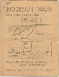
1950206874San Francisco: Communist Party of California Educational Department 1950. Folded; a touch of edge wear; some light doodles on front. 15 mimeographed leaves 8-1/2 x 11 in. on rectos only with mimeographed cover with a map of Korea stapled. Domestic communist perspective on the war which had begun the previous month. Communist Party of California, Educational Department unknown
a406331959-1965. 7 years of this semi-annual journal 14 issues. Vol. 4 No. 1 through Vol. 10 No. 2. Bound in 3 blue buckram volumes with original wraps. Articles mostly in Korean a few in English possibly summaries of Korean articles. 4to. VG. Set of 3 bound volumes 14 issues: . hardcover
a404361971 Korean National Railroad. Mostly tables of data in English and Korean. Sm.4to. 1007pp. limp vinyl cover. VG light wear. . unknown
193874971N.p.: South Manchuria Railroad. ca. 1938. This map has no date that we can see but history would likely place it at the end of the 30s. It is a full color and artistic panorama measuring 40 1/2 x 8 inches. The color map is on the recto and the verso is filled with text and illustrations of all the desirable and holy sites that the train's path goes through. The eight panels show the area of Kongosan or the Diamond Mountains. Some soiling to front panel and a recurring 1 inch tear to top border of each panel. Very bright and attractive.In 1910 Japan formally annexed Korea as a colony although in actuality Japan had been ruling Korea in some manner since 1876. The Japanese felt that their growing empire needed a buffer zone between the other two powers in the regions; China and Russia. Manchuria was also rich agricultural land with vast fields of soy. The laying out of a railway is a godd method of establishing borders so the Japanese were quick to lay down tracks. The Diamond Mountain or the Kumgang Mountains are a mountain/mountain range with a 1638-metre-high 5374 ft Birobong peak in Kangwon-do North Korea. It is about 50 kilometres 31 mi from the South Korean city of Sokcho in Gangwon-do. It is one of the best-known mountains in North Korea. The area often called "12000 Peaks" is one of the most revered sites for natural beauty on the Korean penisula. Koreans have perceived Kumgangsan as their muse since well before the Middle Ages. Practically every poet and artist who lived during the Joseon dynasty 1392-1910 made a pilgrimage to Kumgangsan. Among other well-known works are the Geumgang jeondo and the Pungaknaesan chongramdo painted in the 1740s by Jeong Seon. It was an area of religious interest as well and there were as many as 400 monasteries in the area. South Manchuria Railroad. unknown