Antiquariat.de

941 résultats
198624226(Seoul), Seoul Computer Press, (1986). Mit sehr zahlreichen, z.T. farbigen Abbildungen. Hrsg von Korean National Commission for Unesco. 24/24,4 cm. 102 S. OPappband mit gering gebrauchtem Schutzumschlag.
198473054BBLondon, British Museum Publications, 1984. Lex.-8°. 224 S., zahlreiche zum Teil farbige Abbildungen, broschiert (Einband leicht berieben; gut erhalten)
1996Khe03884Göttingen ( Edtion Peperkorn) 1996 (= Erste deutsche Ausgabe). 8°, Originalkarton mit illustriertem Originalumschlag (Hardcover), 198 S, ISBN 392918110x 1
198426635S. l. : DKKV, Dt.-Korean. Künstlervereinigung, 1984. 65, [10] S. : überw. Ill. Gr. 8°. Ill. OBroschur.
1948LFA00856N° 159 - 30 octobre 1948 - Une revue de 32 pages, format 380 x 280 mm, nombreuses illustrations
193874971N.p.: South Manchuria Railroad. ca. 1938. This map has no date that we can see but history would likely place it at the end of the 30s. It is a full color and artistic panorama measuring 40 1/2 x 8 inches. The color map is on the recto and the verso is filled with text and illustrations of all the desirable and holy sites that the train's path goes through. The eight panels show the area of Kongosan or the Diamond Mountains. Some soiling to front panel and a recurring 1 inch tear to top border of each panel. Very bright and attractive.In 1910 Japan formally annexed Korea as a colony although in actuality Japan had been ruling Korea in some manner since 1876. The Japanese felt that their growing empire needed a buffer zone between the other two powers in the regions; China and Russia. Manchuria was also rich agricultural land with vast fields of soy. The laying out of a railway is a godd method of establishing borders so the Japanese were quick to lay down tracks. The Diamond Mountain or the Kumgang Mountains are a mountain/mountain range with a 1638-metre-high 5374 ft Birobong peak in Kangwon-do North Korea. It is about 50 kilometres 31 mi from the South Korean city of Sokcho in Gangwon-do. It is one of the best-known mountains in North Korea. The area often called "12000 Peaks" is one of the most revered sites for natural beauty on the Korean penisula. Koreans have perceived Kumgangsan as their muse since well before the Middle Ages. Practically every poet and artist who lived during the Joseon dynasty 1392-1910 made a pilgrimage to Kumgangsan. Among other well-known works are the Geumgang jeondo and the Pungaknaesan chongramdo painted in the 1740s by Jeong Seon. It was an area of religious interest as well and there were as many as 400 monasteries in the area. South Manchuria Railroad. unknown
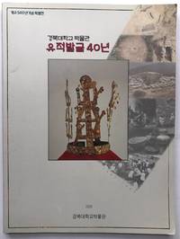
2000H8045Korea: Kyungpook National University Museum 2000. Paperback. Fine. 4to wraps 117 pp color photos throughout documenting findings from the site of Hwangseong-dong Kyongju in Korea. Very rare one copy on OCLC in the Korean National Library. Text entirely in Korean and the title we used is just an approximation not a literal translation. Kyungpook National University Museum paperback
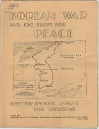
1950206874San Francisco: Communist Party of California Educational Department 1950. Folded; a touch of edge wear; some light doodles on front. 15 mimeographed leaves 8-1/2 x 11 in. on rectos only with mimeographed cover with a map of Korea stapled. Domestic communist perspective on the war which had begun the previous month. Communist Party of California, Educational Department unknown
19942092902141206323social studies literature 1994. Soft Cover. Fine. Volume: 1 social studies literature paperback
19932092902141205827Peking University 1993. Soft Cover. Fine. Volume: 1 Peking University paperback
1950206875San Francisco: Committee for a Democratic Far Eastern Policy 1950. Evenly toned; rear cover leaf loose; very good. 22 mimeographed pages 8-1/2 x 11 in. with mimeographed cover stapled. In-depth eleven part essay. Though unsigned this was certainly the work of Maud Russell British-born American activist who devoted much of her life to China and the far east. At this time when the war in Korea was just underway Russell was executive director of the Committee for a Democratic Far Eastern Policy. Far East Spotlight was a precursor to her later self-published magazine Far East Reporter which she began in 1953 and continued for many years afterward. Committee for a Democratic Far Eastern Policy unknown
19792111902156002142Ethnological Society of Japan 1979. Soft Cover. Fine. The book is in fine condition. Ethnological Society of Japan paperback
19892091502135408964Not Available 1989. Soft Cover. Fine. Number of books: 1 Not Available paperback
191744452London: Thos. Cook & Son 1917. 8vo. 181 xxiii pp. 3 large folding maps numerous maps numerous photo illusts. Green cloth blk lettrng & insignia on frnt cvr blk lettrng on spine mnr rubbng edgewear still a VG copy. Third edition revised & expanded of this excellent Cook travel guide for travel through China Manchuria and Korea during World War I. There are detailed sightseeing instructions for Peking visiting the Great Wall Tientsin Tianjin Port Arthur in Manchuria and more. Of particular interest is the extensive section on Chosen Korea nice folding map of Seoul photo illustrations etc. Thos. Cook & Son, hardcover
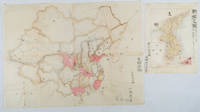
1902220266Japan. No date. Circa1902. Two very attractive colour folded manuscript maps one showing China and the other Korea. <br> <br>Map of China: Watercolour map 48 x 63.5cm. Closed tear now professionally repaired. <br> <br>Map of Korea: Finely detailed watercolour map a few tiny holes very neatly repaired on the verso with archival washi. 33 x 24.5cm Two delicate hand-painted maps one of China and one of Korea produced by a Japanese student cartographer named Koike Tokushige 小池徳重. <br> <br>The undated map of China appears to have been produced in the first five years of the twentieth century: a time when Japan had recently colonized Taiwan and when Japanese economic and political interest in the region was rapidly expanding. The inscription on the map suggests that it was a third year college project. But the high level of detail suggests that the artist had considerable experience of map making. The map of China shows the main provinces rivers major transport routes the Great Wall and the location of key cities although the names of the cities are not included. It also shows outlines of the Korean Peninsula Taiwan and the Japanese island of Kyushu but not the rest of Japan. <br> <br>The map of Korea is more detailed. It provides an accurate outline of the Korean Peninsula with careful hatching indicating changes in elevation. Rivers and major road routes are shown on the map and the locations of major towns are marked though only Busan and Incheon are named. Dotted lines show coastal sea routes and routes between Kyushu and Busan and between Incheon and China. The map shows the Gyeongin railway line between Seoul and Incheon which was completed in 1899 and route of the Gyeongbu railway line between Busan and Seoul whose construction started from both ends in 1901. But the map depicts only small sections of this line close to Seoul and Busan as being completed with the rest more lightly outlined to show the projected route implying that the map was drawn around 1901-1902 and certainly before the Gyongbu line was opened in 1904. <br> <br>Inserted text gives the land area and population of Korea. Rather strangely though the figure given for the Korean population is vastly underestimated. Ikeda gives this as 5.7 million when in fact at that time is was around 18 million. . unknown
1952LFA-126730536Revue de 87 pages, format 145 x 195 mm, brochée, publiée en 1952, bon état
19860055911986 Special expedition postcard with Nepal R.3 stamp postmarked Kathmandu 29 May 1986. Signed by six team members. A near fine copy. Signed by the Expedition Team. First Edition. unknown
1996LFA015daRevue trimestrielle de l'Institut international de géopolitique : environ 100 pages, format 210 x 280 mm, illustrée, brochée couverture couleurs sous jacquette illustrée
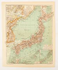
1902174898Leipzig.: Bibliographisches Institut. 1902-1908. Map printed in colour 27.2 x 21.4 cm inset colour key to territorial administration by country inset "western continuation of the main chart" including the Gulf of Tschili and Tsientsin and two insets at the foot of the map to the Kuril and the Ryuku Islands text in Geman central fold slight edge toning but in very good condition. Attractive map text in German prepared for Meyers Großes Konversations-Lexikon. . Bibliographisches Institut unknown
193325597Tokyo: Japanese Government Railways 1933. Wraps. Good overall. Large folding map of Japan which unfolds to 32 panels 8 panels wide by 4 panels deep with many insets including Taiwan; General Map of Japan showing China and Manchoukuo; Osaka and Cities Near By; Tokyo and Vicinity; Hokkaido; and Karafuto Saghalien. <br /> <br /> Verso of map with printed text titled "Principal Cities and Noted Places in Japan"; includes Yokohama Tokyo KamakuraYokosuka Hakone Atami Mt. Fuji Nikko Karuizawa Matsushima Lake Towada Hokkaido Karafuto Nagoya Kyoto Amano Hashidate Nara Osaka Kobe Miyajima Shimonoseki Kyushu Nagasaki Unzen Beppu Mt. Aso and Kagoshima.<br /> <br /> Orange Art Deco style printed wrappers with some loss at lower front cover which only affects the map at the lower left side in an area of ocean slightly rubbed at wrapper edges owner name in ink Benjamin Riegel at top of front wrapper otherwise very good condition. Japanese Government Railways paperback
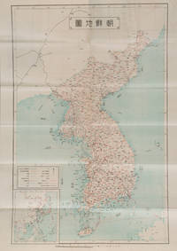
1927159846Korea: Chōsen Sōtokufu 朝鮮総督府 Office of Governor eGeneral of Korea. Reprint. Shōwa 2. 1927. Japanese language travel brochure for Korea single folded sheet with colour map of Korea Scale 1:2500000 on one side attractive colour cover and descriptive text with black and white photographic illustrations in 12 panels on the reverse. Map includes a small inset map of East Asia. Measures 53.8 x 38.4cm folded 9.6 x 19.5cm. This travel brochure was published in Korea by the Office of Governor-General of Korea in 1927 with the aim of attracting Japanese visitors to Korea. The text describes Korea's geography weather and transportation; major cities such as Busan and Seoul; and industry including agriculture commerce and manufacturing. Accompanying photos are those of Seoul Kunsan Port a ginseng field Moran Fortress in Pyongyang and Mt. Kumgang. . Chōsen Sōtokufu 朝鮮総督府 [Office of Governor eGeneral of Korea] unknown
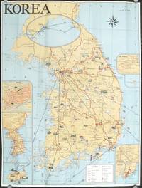
1960207712Seoul Korea.: Ministry of Transportation Republic of Korea. circa1960. Folding colour pictographic / pictorial map inset maps of Seoul Chejudo Mt. Sorak Kyongju Pusan and map showing air routes to various Asian cities and to the California coast 67.5 x 51 cms; 22.5 x 10 cms folded small fold tear without loss index and five distance tables printed on the verso in very good condition. Uncommon pictorial map of the Korean Peninsula showing wildlife natural wonders numerous temples hotsprings seaports and railways many sights designated "National Treasures". Printed for the tourist market one of the inset maps shows the flight routes from key Southeast Asian ports to Seattle and San Francisco. . Ministry of Transportation Republic of Korea. unknown
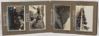
1923220274Taisho 12 1923. Over fifty black and white photographs annotated laid down in concertina style cloth covered photograph album 18 x 26.5cm most photographs measure 9.3 x 13.5cm nine measure 10 x 7cm. Some silvering of photographs but most are in very good condition. A fascinating concertina-folded album of high-quality photos dating from 1923 and showing Japanese military training exercises in northeastern Korea as well as scenes of everyday life in the surrounding region including the Ranam Cheongjin Hoeryong and Gando areas. Many of the photos appear to have been produced by a professional photographer but acquired by the soldier who has created this album who has added his own annotations based on personal experience. <br> <br>The first photo shows an inset portrait of a soldier named Takuuchi next to the flag of the Japanese Imperial Army's 75th Infantry Division. This is followed by a series of photos of Japanese colonial buildings in Korea including the military base of the 75th Infantry Base an overview of the city of Hoeryong on which the owner has placed a cross in ink marking the location of the recently contructed Hoeryong Shinto Shrine Heoryong's hospital and railway station and a street in the city centre an overview of Cheongjin and a panoramic overview of Ranam City also with the Ranam Shinto Shrine marked with a cross. The attention paid to these shrines which were crucial symbols of Japanese colonial rule emphasises the album creator's nationalist sentiment. There are two images of the landscape of the Tuman River and a photo of sacks of soy beans being unloaded in Gando. Other photos show scenes of everyday life including women washing clothes and grinding grain and two photos of a Korean wedding ceremony. A few of these photos including one of a village of thatched-roofed houses are in a smaller format than the images in the rest of the album and may have been taken by the album's owner himself. Twenty of the photos show 1923 training exercises conducted by the 75th Infantry Division in the Ranam area. These have also been annotated with the album owner's comments providing extra information about the content of the photos. The album concludes with two striking images of thick ice on a river probably the Tuman and of the Hoeryong Shinto Shrine in late evening. . hardcover
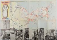
1937178598Korea.: 朝鮮総督府鉄道局. Chosen Sotokufu Tetsudokyoku. Showa 12 1937. Folded travel brochure featuring a large colour map of Korea black and white photographic illustrations 53 x 38 cm folded. Small holes and a little worn along folds a good copy. 18.2 x 9 cm. Attractive folding map and travel guide to Korea produced by the colonial government's Railway Bureau. The cover illustration shows a Korean woman carrying a water jug on her head. The map shows the Korean Peninsula with main towns. The map is surrounded by a set of black-and-white photos of landmarks including a cityscape of Seoul and a flock of sheep in northern Korea. The photos are set in a design showing Korean figures in traditional costume. The text on the reverse of the map provides information including various railway lines in the country and possible itineraries to cover major sites. There is also a more detailed explanation of the sights to be seen along five major rail routes: from Busan to Seoul Keijo; from Seoul to Andong; from Daejeon to Mokpo from Seoul to Wonsan and from Wonsan to Hoeryong. . 朝鮮総督府鉄道局. [Chosen Sotokufu Tetsudokyoku]. unknown
199843469Seoul Korea: Pandacom Press 1998. Sml. 4to folding out in accordion style folds to 1 large double-sided broadside w/ photos & directions for solving the book with the images. NF copy from the collection of Dr. Rochelle Martin. First edition of this fascinating artist’s book providing random views and yet connections and instructions to scenes and places in Seoul. Pandacom Press, unknown