[MEKONG DELTA - VIETNAM WAR MAPS]Biblio.com
1 résultat
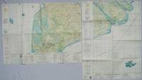
1967203840Washington D.C.: Army Map Service. 1967. Two printed colour adjoining maps 73 x 55.6 cms and 55.6 x 73 cms original folds inked operational annotations to the Quan Long sheet multiple marginal legends noting aerodromes and radio facilities roads railroads and boundaries glossary of terms much of the text is in both English and Vietnamese in very good condition. Detailed U. S. Army maps of the Mekong Delta and Southern Vietnam extending from Rach Gia in the north to the area just south of Quan Long Ca Mau in the south and east including BacLieu and CanTho. The island of Con son is at lower right of the Khanh Hu'ng sheet. Operational notes are inked around Quan Long are marked and the U Minh Forest the impenetrable "forest of darkness" is noted in ink. <br> <br>. . Army Map Service. unknown