922 résultats
1954032716London: Hodder & Stoughton 1954 VG-/VG-. 4to. original blue boards gilt rubbed & marked with small fraying at spine ends inscription & prev. owner's address label to FFE tape marks to pastedowns occ. leaf edge fray else internally clean in dustwrapper priced £2 2s. net rubbed & frayed some staining and spotting; pp. unpaginated with numerous colour photos. A very good copy. Neate G62. Inscribed to FFE by the author 'Best wishes Alfred Gregory' and additionally flatsigned by four team members including first ascensionist Ed Hillary George Lowe Michael Westmacott and Jan Morris. Signed by Five Team Members. First Edition. Hard Cover. VG-/VG-. Hodder & Stoughton hardcover
1908ZB657436London: The Royal Society 1908. first edition; folio leaves slightly shorter than 30.5 cm. v 1 192 pp. 21 plates with one folding and including six plates of aurora observations in muted grey blue and brown also a double page color map of Laurie Island; hardcover ex library spine worn hinges reinforced with tape else text clean & binding tight; five articles viz. Tidal Observations in the Antarctic Regions 1902-1903 Pendulum observations Earthquakes and other Earth Movements recorded in the Antarctic Regions 1902-1903 Antarctic Observations of Aurora 1902-1903 and Antarctic Magnetic Observations 1902-1904. - If you are reading this this item is actually physically in our stock and ready for shipment once ordered. We are not bookjackers. Buyer is responsible for any additional duties taxes or fees required by recipient's country. Photos available upon request. London: The Royal Society, hardcover
195421020New York: E.P. Dutton 1954. Hardcover. Very good/near fine. First American edition signed on the front free endpaper by expedition members Edmund Hillary George Lowe and Charles Evans and the London Times correspondent James Morris now Jan Morris who accompanied the party. xx 300 pp with index photographic illustrations. Two-tone cloth boards have some old inert mildew spotting internally clean and sound. Original owner's name at top of front free endpaper well above the signatures. Dust jacket has minor creasing to top of front panel and one 1/4 inch closed tear. Original $6.00 price present. Account of the 1953 British Mount Everest Expedition which when Edmund Hillary and Tenzing Norgay reached the summit on May 29 was the first confirmed complete ascent. Hunt led the expedition with physician Charles Evans as his deputy. Evans was the leader of the first expedition to summit Kangchenjunga the world's third highest peak in 1955. George Lowe directed an Academy Award-nomnated documentary during the Everest expedition and went on to join the Commonwealth Trans-Antarctic Expedition--the first to reach the South Pole by land since Amundsen 1911 and Scott 1912--and to participate in many other notable mountaineering expeditions. Neate H135. E.P. Dutton hardcover books
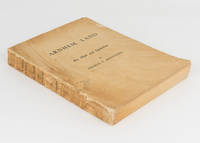
1956110549Carlton: Melbourne University Press 1956. First Edition. Paperback. Very Good. Carlton Melbourne University Press 1956. Quarto xxx 513 pages with 68 figures and 157 plates plus 2 colour plates. Original textured card covers with the title 'Arnhem Land. Art Myth and Symbolism' and the author's name on the spine and front cover; spine sunned cracked and chipped with minor loss; minimal expert conservation to the front joint; front and rear covers marked and unevenly discoloured with a few minor surface blemishes; edges a little marked and foxed with occasional foxing elsewhere; a decent copy internally in very good condition. The first and most important of the four volumes in the series published between 1956 and 1964. This copy is inscribed on the front free endpaper 'To Mr and Mrs W. McCaffrey with all good wishes from Charles P. Mountford 1960'. The standard binding is green cloth with a dustwrapper. We have handled a number of presentation copies of the first volume in wrappers and presume these less-expensive versions were provided to the author for this purpose. Melbourne University Press paperback
192561378New York and London: Longmans Green & Edward Arnold & Co 1925. First American edition from British sheets. Large thick 8vo. xi 372 pp. Illustrated from photographs plates some in color double-page panorama large folding map at rear. With a commemorative stamp celebrating this expedition mounted on the front endpaper and signed by N.E. Odell one of the members of the expedition and a contributor of several chapters to this work underneath also underneath his ink inscription written in a local language Nepali or Hindi perhaps "The noblest lore of frontiers". Neate 573: "Norton climbed to a height of about 28100 feet without oxygen." Very good. Original gilt-stamped blue cloth. #8425. <br/><br/> Longmans, Green & Edward Arnold & Co hardcover books
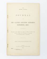
190225076Perth: Wm. Alfred Watson Government Printer 1902. First Edition. Paperback. Very Good. Perth Wm. Alfred Watson Government Printer 1902. Foolscap folio 62 pages with 4 illustrations plus a very large folding map 625 × 865 mm. Title-wrappers relatively recently bound in half calf and cloth lettered in gilt on the spine; title leaf slightly marked with trifling loss to the bottom corner-tip; minimal signs of age and use; an excellent copy. Western Australian Parliamentary Paper Number 46 of 1902; only 1200 copies were printed. The 'expedition was fitted out to explore the remaining unknown regions of Australia on similar lines to the Elder expedition'. Lawrence Allen Wells third in command on the ill-fated Elder expedition of 1891-92 was leader. The party set out from Mullewa east of Geraldton on 13 June 1896; lack of water and the gruelling conditions brought the official expedition to an end on 6 November at Noonkanbah Station on the Fitzroy River with two men unaccounted for. It was not until late May of the following year that Wells located the bodies of the missing men his cousin Charles Wells and George Lindsay Jones nephew of the explorer David Lindsay. The detailed accounts of the three search expeditions undertaken by Wells accompanied by Nat Buchanan George Keartland and Sub-Inspector Ord respectively are included. Not least strong on contemporary race relations. Wm. Alfred Watson, Government Printer paperback
190431978Kjøbenhavn Reitzel 1904-11. Ubeskårede og delvist uopskåret i originale bogtrykte omslag bagomslaget til første bind mangler. 12372;446;463;XIII431 pp. talrige tekstillustrationer 7 litograferde foldekort 32 plancher heraf flere i farvelitografi. <br/><br/><em>Ekspeditionens resultater var meget omfattende både de geografiske opmålinger de zoologiske og botaniske men særligt må nævnes de betydningsfulde etnografiske samlinger som hjembragtes og som er beskrevet her Thalbitzer og Amdrup. - Meddelelser om Grønland Bd. 27-30. </em> unknown
19737695AMünchen, 1973.
197561484Graz, Akademische Druck- u. Verlagsanstalt, 1973-1975. Fol. bzw. (Bd. 4) Gr.-Fol. Mit zahlr. tlw. farb. bzw. ganzs. Abbildungen im Text u. auf 207 Tafeln. Zus. ca. 375 S., Illustr.-OLwd.-Bde.
19105059ACa. 1910. Quer 8°. 24 Orig. Fotografien und 4 Beigaben. Pappalbum der Zeit mit Kordelheftung. [4 Warenabbildungen]
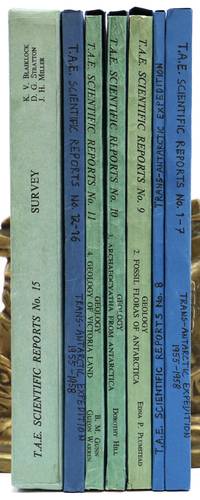
1960144913London: The Trans-Antarctic Expedition Committee 1960-1. Large quarto. 14 volumes. Original printed wrappers string-bound. Edges of wrappers slightly sunned. Fifteenth part comprises 15 folding maps and the written report housed in a slipcase. Front board of slipcase bowed-in with a few creases to the spine. All volumes complete tightly-bound and clean internally. Most parts in modern blue card slip cases. A beautiful set. Spence 1213. The complete scientific reports from the Commonwealth Trans-Antarctic Expedition 1955-1958 lead by Dr. Vivian Fuchs who was knighted for his efforts and Sir Edmund Hillary. The TAE was the first complete overland crossing of Antarctica and the third expedition ever to reach the South Pole overland after Amundsen in 1911 and Scott in 1912. The expedition conducted a variety of oceanographic glacial geological meteorological and biological sampling the results of which are presented here and illustrated by hundreds of figures from photographs folding maps and tables. Although the reports were issued in 15 parts #6 was never printed. Uncommon to find this set complete and in fine condition. 1960 The Trans-Antarctic Expedition Committee unknown
1928000893SAN PEDRO CALIFORNIA CA. Good. 1928. On offer is a fascinating vintage collection autograph materials an ALS clippings and maps of Congressional Medal of Honor winner Admiral Richard Byrd's First Antarctic Expedition 1928-30. Included are original newspaper clippings from The New York Times including a full page from May 19 1929 headline "What Byrd's Men Do In The Antarctic Night" with photographs of one of Byrd's planes his two ships the Headquarters Hut the setting sun and radio equipment and antennas. Also included; an 8pp rotogravure section from May 4 1930 illustrating "Admiral Byrd's Great Adventure in the Antarctic" with numerous photographs of Little America including the expedition members landscapes polar life and much more; also a column-length article relating to his second expedition headlined "Byrd's Ship Bear To Sail Tomorrow" 1933-35; two color maps approx 28"x20" one a 1930 Geographic Society detailed lithograph of the "Antarctic Regions" with insets of "Byrd's South Pole Flight" "King Edward VII Land" "Part of Marie Byrd Land" and "Antarctic Archipelago" indicating routes of various explorers including Admunsen and Shackleton; and the other a 1933 "Little America Aviation and Exploration Club Map Used by Admiral Byrd exclusively on both of his Antarctic Expeditions" courtesy of "The Tide Water Oil Co." Also present is letterhead of the Freeport NY Order of Elks signed by eight members of both the first and second expeditions with second page penned in another hand adding further information; plus an ALS by expedition member ARTHUR B. CREAGH San Pedro CA Sep 28 1930 to Albin Johnson "Part Exalted Ruler" of the Order of Elks in Freeport. Creagh thanks him "for the wonderful time you and your brother Elks gave us that night at Freeport Long Island on our return from the Byrd's South Pole Expedition " accompanied by original mailing envelope. Lastly a lengthy printed Washington Bureau biographical printed pamphlet 4pp 7"x8½" by Ruth Robertson entitled "A Brief Account of Read Admiral Byrd's Flights Over the North and South Poles and Other Achievements". The newspaper clippings are generally toned and brittle the photogravure in particular is fragile. All evidence usual folds with occasional partial fold separations with only small paper loss. Letter is in excellent condition. All have been preserved in large vintage envelope. This period collection of historic content remains an important reflection of the early exploration of Antarctica by America's foremost explorer of the time. G.; English; 4to - over 9¾" - 12" tall; ANTARCTIC EXPLORATION TRAVEL CONGRESSIONAL MEDAL OF HONOR EXPLORER AMUNDSEN SHACKLETON ELKS HANDWRITTEN MANUSCRIPT DOCUMENT LETTER AUTOGRAPH WRITER HAND WRITTEN DOCUMENTS SIGNED LETTERS MANUSCRIPTS HISTORICAL HOLOGRAPH WRITERS AUTOGRAPHS PERSONAL PERSONAL HISTORY RELIGION ROYALTY NOBILITY CALLIGRAPHY PAPAL VATICAN CATHOLIC ROMAN CATHOLIC ECCLESIASTICantiquité contrat vélin document manuscrit papier Antike Brief Pergament Dokument Manuskript Papier oggetto d'antiquariato atto velina documento manoscritto carta antigüedad hecho vitela documento Manuscrito . unknown
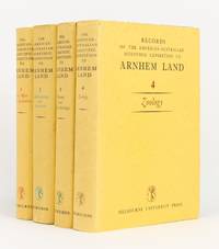
1956144270Carlton: Melbourne University Press 1956. First Edition. Hardcover. Very Good/Very Good. Carlton Melbourne University Press 1956 1960 1958 and 1964 all first - and only - editions. Quarto four volumes xxx 513 pages with 68 figures and 157 plates plus 2 colour plates; xiv 515 pages with 7 graphs 281 maps and illustrations and 47 plates plus a colour plate; xvi 522 pages with 81 maps and illustrations and 17 plates; and xviii 533 pages with a map and 100 plates plus 5 colour plates. Cloth; minimal signs of age and use; an excellent set with the lightly used dustwrappers. Charles Mountford was the leader of the expedition; he was also the author of the first volume the editor of the second and co-editor of the third with R.L. Specht who edited the fourth volume. 4 items. Melbourne University Press hardcover
1918880611918. SIBERIAN EXPEDITION. Teikoku Gunjin Kyoiku-kai editors. SHIBERI JIHEN KINEN SHASHIN-CHO. Tokyo Taisho Tsushinsha Taisho 7 1918 Oblong folio bound western-style in cloth gilt. Illustrated throughout in collotype. Photos and cations on the International Siberian Expedition in support of the Whites against the Red Army in which the Japanese played a prominent role. 4 page folding panorama of Vladivostok harbor and views of the cities the countryside troops inhabitants diplomats war preparations etc. etc. One can feel the Winter coming. Very good condition throughout. Very scarce. unknown
1918880611918. SIBERIAN EXPEDITION. Teikoku Gunjin Kyôiku-kai editors. SHIBERI JIHEN KINEN SHASHIN-CHÔ. Tôkyô Taishô Tsûshinsha Taishô 7 1918 Oblong folio bound western-style in cloth gilt. Illustrated throughout in collotype. Photos and cations on the International Siberian Expedition in support of the Whites against the Red Army in which the Japanese played a prominent role. 4 page folding panorama of Vladivostok harbor and views of the cities the countryside troops inhabitants diplomats war preparations etc. etc. One can feel the Winter coming. Very good condition throughout. Very scarce. unknown books
191384790May 24 1913. The Sphere. London. 1913. May 24. The Complete Magazine including original coloured cover and all adverts. Folio. Pagination: Coloured front cover iv 1 - b/w second cover with portrait of Scott publishing details of this issue - see second photo. 182 182a - 220 v- xxii. Includes double page photo 182b-183 of Captain Scott in his Antarctic Home by Herbert Ponting taken at Cape Evans. This famous portrait shows the space allotted to Scott and you can see all the photos of Lady Scott and baby Peter that he put up on the wall above his desk. This issue contains very good prints of many photographs not previously seen and also of a much higher quality than when reproduced in future publications. There are also diary entries. This publication predates the Strand Magazine which used some of the same photos. Front cover creased and worn and lacks small portions along spine. Close tears to edges of rear cover. VERY SCARCE. unknown
190755717BBWien, In Kommission bei Alfred Hölder, 1907-1908. Groß-8°. 24,5 cm. XXIII, 443, XII, 343, X, 299 und XV, 550 Seiten. Schwarze und dunkelbraune Halblederbände mit goldgeprägten Rückentiteln.
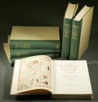
1957E0551<p><strong>From the Spanish discovery to the opening of the Civil War</strong><br /><br />5 volumes in 6. Volume One: The Spanish Entrada to the Louisiana Purchase 1540-1804 xiv264 pages with color frontispiece map and 275 maps many folding and index; Volume Two: From Lewis and Clark to Fremont 1804-1845 xiii281 pages with colored frontispiece map 143 additional maps some folding and index. Volume Three: From the Mexican War to the Boundary Surveys 1846-1854 xiii349 pages with colored frontispiece map 322 additional maps and index; Volume Four: From the Pacific Railroad Surveys to the Onset of the Civil War 1855-1860 xiii260 pages with color frontispiece map an additional 127 maps some folding and index; Volume Five From the Civil War to the Geological Survey Part One: xviii222 pages with color frontispiece map and an additional 152 maps; Volume Five From the Civil War to the Geological Survey Part Two: 223-487 pages with 124 maps and index. Folio 14 1/2" x 10 1/2" bound in quarter green leather with gilt lettering to spines. volume I printed by the Grabhorn Press; volumes II-V printed by Taylor & Taylor and James Printing based on the designs of Edwin and Robert Grabhorn. First edition limited to 1000 copies.<br /><br />Carl Wheat's Mapping of the Trans-Mississippi West is a comprehensive and readable cartographic history of the American West. The first three volumes of the work are by necessity bulky and out sized to accommodate the many maps contained with their covers. These beautifully printed books present a truly graphic picture of the exploration and peopling of the vast unknown land west of the Mississippi. The author does not merely present a catalog of significant maps of each era but tells the exciting story of many facets of history that resulted in their making-of the hard journeys the hazardous exploits the motivation the mysticism the misunderstandings and the strange blend of fact imagination false geographic concept and political necessity which were consummated in the engraver's work. These volumes will provide exciting text for the casual reader and have become eminent source book for the student and scholar.<br /><br /><strong>Condition:</strong><br /><br />A near fine set. Due to the size and/or weight of this lot extra shipping and/or handling charges may apply.</p> Institute of Historical Cartography hardcover
1957E0551<b>From the Spanish discovery to the opening of the Civil War</b><br /><br />5 volumes in 6. Volume One: The Spanish Entrada to the Louisiana Purchase 1540-1804 xiv264 pages with color frontispiece map and 275 maps many folding and index; Volume Two: From Lewis and Clark to Fremont 1804-1845 xiii281 pages with colored frontispiece map 143 additional maps some folding and index. Volume Three: From the Mexican War to the Boundary Surveys 1846-1854 xiii349 pages with colored frontispiece map 322 additional maps and index; Volume Four: From the Pacific Railroad Surveys to the Onset of the Civil War 1855-1860 xiii260 pages with color frontispiece map an additional 127 maps some folding and index; Volume Five From the Civil War to the Geological Survey Part One: xviii222 pages with color frontispiece map and an additional 152 maps; Volume Five From the Civil War to the Geological Survey Part Two: 223-487 pages with 124 maps and index. Folio 14 1/2" x 10 1/2" bound in quarter green leather with gilt lettering to spines. volume I printed by the Grabhorn Press; volumes II-V printed by Taylor & Taylor and James Printing based on the designs of Edwin and Robert Grabhorn. First edition limited to 1000 copies.<br /><br />Carl Wheat's Mapping of the Trans-Mississippi West is a comprehensive and readable cartographic history of the American West. The first three volumes of the work are by necessity bulky and out sized to accommodate the many maps contained with their covers. These beautifully printed books present a truly graphic picture of the exploration and peopling of the vast unknown land west of the Mississippi. The author does not merely present a catalog of significant maps of each era but tells the exciting story of many facets of history that resulted in their making-of the hard journeys the hazardous exploits the motivation the mysticism the misunderstandings and the strange blend of fact imagination false geographic concept and political necessity which were consummated in the engraver's work. These volumes will provide exciting text for the casual reader and have become eminent source book for the student and scholar.<br /><br />Condition:<br /><br />A near fine set. Institute of Historical Cartography hardcover books
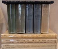
1955E01069 volumes including the three atlas volumes and portfolio volume. Volume I: <i>The Voyage of the Endeavour</i> cclxxxiv696 pages with 20 maps 25 illustrations including color frontispiece appendix and index. Reprinted with addenda and corrigenda. Volume II: <i>The Voyage of the Resolution and Adventure 1772-1775 </i>clxx1028 pages with 19 maps 63 illustrations appendixes and index. Half-title gives II as number within the set. Reprinted with addenda and corrigenda. Volume III parts 1 and 2: <i>The Voyage of the Resolution and Discovery 1776-1780</i> Part One ccxxiv718 pages with 17 maps and 64 illustrations. Half-title gives III as number within set. Admiralty instructions and the journal of the Third Voyage with supplementary extracts from journals or logs by James King Charles Clerke James Burney Richard Gilbert Thomas Edgar. Part 2: viii723-1647 with 2 maps 10 illustrations appendixes and index. Volume IV: <i>The Life of Captain James Cook</i> xi760 pages with 11 maps 38 illustrations bibliography and index. Written by J. C. Beaglehole. First separately published by A. and C. Black 1974 then for the Hakluyt Society. These volumes in royal octavo 9 1/2 x 6 1/2" bound in original publisher's deep blue cloth with blind stamped silhouette of Cook in gilt on front boards and gilt lettering to spines. Portfolio <i>Charts & Views</i> Drawn by Cook and his Officers and reproduced from the Original Manuscripts edited by R. A. Skelton. Pages viii with 58 loose maps charts plans profiles views and other illustrations some folding folio 15 3/4" x 10 1/2" in original blue cloth portfolio with gilt pictorial of cook on front in original jackets except for portfolio volume. <i>The Charts & Coastal Views</i>. Volume One: <i>The Voyage of the </i>Endeavour<i> 1768-1771</i> With a Descriptive Catalog of all the known original surveys and coastal views and the original engravings associated with them. Together with original drawings of the <i>Endeavour</i> and her boats lxiv328 pages with color frontispiece 480 half-tone plates and index. Volume Two: <i>The Voyage of the </i>Resolution<i> and </i>Adventure<i> 1772-1775</i> c332 pages with color frontispiece 23 color plates 320 half-tone plates and appendixes. Volume three: <i>The Voyage of the</i> Resolution<i> and </i>Discovery<i> 1776-1780</i> . together with the running journal of James King 1779-80 cxxxvi319 pages with color frontispiece 22 color plates 298 half-tone plates and appendixes. Volumes chief editor Andrew David. Assistant Editors for the Views Rudiger Joppien and Bernard Smith. Folios 17 1/4" x 11" bound in original publisher's deep blue cloth with gilt lettering to spine and pictorial representation of the ship <i>Victoria</i> embossed in gilt on front covers. Hakluyt Society Extra Series 34a 34b 35 36a 36b 37 43 44 and 46. First printings. Condition: Lacks jacket for portfolio volume and the spine head is bumped. Jackets: Volume one volume three part two price clipped some jackets spines toned Charts & Coastal Views with some edge wear and closed tears else a near fine set in like jackets. Hakluyt Society hardcover books
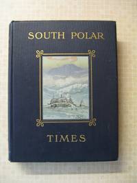
191440Smith Elder London 1914. First Edition. Hardcover Original Cloth. Very Good Condition/No Dust Jacket. 1st Edition; This copy is 243 of a limited edition of 350. Volume 1 & 2 were Scott's 1st "Discovery Expedition" whilst this Volume 3 is from his 2nd "Terra Nova" Expedition. Although often sold as a set Volume 3 is a complete book in its' own right. The original broadsheets were produced at Cape Evans to amuse the men on the 'Terra Nova' Expedition. It was designed to be published separately from Volume 1 & 2. Cherry-Garrard was the Editor and typist and Wilson the main illustrator. The 1st issue was presented on Midwinter's Day 1911 the 2nd on 8th September and the 3rd on 15th October. Content included poetry humorous articles illustrations of sledging flags and caricatures. Includes Wilson's moving poem 'The Barrier Silence' and Ponting's hilarious tongue twister 'The Sleeping Bag'. Original covers all page edges gilt. Copiously illustrated drawings in the text and full-page plates from sketches and paintings by E. Wilson H. Ponting and others. Ex Library with stamps on some pages Croydon Library. Spine shaken gutta-percha binding delicate some pages loose as is usual with the 1st Edition. Gutta Percha was used as the binding glue in many early books it is not a difficult job to remove and reback using modern glues The South Polar Times was a magazine written and printed by the members of Antarctic Expeditions during the various voyages they undertook. In 1907 the batches were printed and issued in some 250 copies. The South Polar Times form what is perhaps the most personal of the printed documents to have come out of that most remarkable of periods of Antarctic adventures revealing so many often contradictory aspects of these men's various personalities. It contains a diary of the events of each month a record of the proceedings of the local Debating Society a monthly acrostic humorous notes besides articles of a more solid nature as well as stories sketches of various kinds and poems. One of the corner stones of an Antarctic collection. PLEASE NOTE: This book will incur extra postage and insurance charges. Please contact us for a quote. Limited Edition. Quantity Available: 1. Shipped Weight: Under 5 kilogram. Category: Arctic & Antarctic; Antarctic; 1900-1920; Exploration. Pictures of this item not already displayed here available upon request. Inventory No: 40. . This book is extra heavy and may involve extra shipping charges to some countries. Smith Elder hardcover
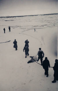
1948new11<p><strong> POLAR EXPEDITIONS COMMANDANT CHARCOT 19481950 </strong><br /><strong> ANTARCTICA ADÉLIE LAND PAUL-ÉMILE VICTOR </strong><br /><strong> EXCEPTIONAL ARCHIVE OF 415 PHOTOGRAPHIC NEGATIVES </strong></p><p><strong> Albums of Negatives <em>Commandant Charcot</em> </strong><br />France Atlantic Oceania Antarctica 19481950.</p><p>Five albums and one binder containing <strong>415 photographic negatives</strong>.</p><p>Comprising:</p><ul><li><p>3 albums 15 x 8.5 cm faux-leather covers with snap closures index pages negatives 6.5 x 11 cm; 5 x 9 cm stored in glassine sleeves.</p></li><li><p>2 albums 15.5 x 10.5 cm cardboard covers negatives 6.5 x 11 cm in tied glassine envelopes with annotations in black pencil.</p></li><li><p>1 binder 27 x 15.5 cm oblong format cardboard covers index sheets pasted inside rear board negative strips 18.8 x 3.5 cm some cut stored in three rows of stapled oblong glassine envelopes.</p></li></ul><p>The albums and binder show signs of wear. With the exception of a very few fogged images the negatives are in excellent condition.</p><p>An <strong>exceptional ensemble</strong> of five albums and one binder comprising 415 photographic negatives including 32 strips documenting the <strong>first two expeditions of the vessel <em>Commandant Charcot</em> to Adélie Land in Antarctica 19481950.</strong></p><p>These unofficial photographs come from the private collection of one of the expedition members clearly taken as personal keepsakessome are even intermingled with unrelated family or holiday shots.</p><p>Adélie Land is a coastal region of Antarctica discovered in 1840 by naval officer Jules Dumont d'Urville who named it after his wife. Claimed by France but neglected for over a century this 432000 km² territory only regained strategic interest in the aftermath of WWII and renewed geopolitical rivalries.</p><p>In 1946 three young mountaineersJ.A. Martin Robert Pommier and Yves Valletteconcerned by Norway's claims to Adélie Land sought to land there to reaffirm French sovereignty. They turned to their illustrious elder explorer and scientist <strong>Paul-Émile Victor 19071995</strong> already famed for his Greenland expeditions. To this end the <em>Expéditions Polaires Françaises Missions Paul-Émile Victor EPF</em> was founded in 1947 to organize new scientific ventures in Greenland and Adélie Land.</p><p>Although Paul-Émile Victor did not personally participate he coordinated the mission which combined territorial reassertion with scientific research including the establishment of a permanent base. In 1948 the French Navy acquired an American warship refitted at Saint-Malo and renamed it <strong>Commandant Charcot</strong> in honor of polar explorer Jean-Baptiste Charcot 18671936.</p><p>The ship sailed on <strong>26 November 1948</strong> carrying 62 crew members including expedition leader André-Franck Liotard Commander Max Douguet and twelve scientists among them Martin Pommier and Vallette. After stops in Casablanca Durban and Hobart the <em>Commandant Charcot</em> attempted to reach Adélie Land but heavy pack ice in February 1949 forced it to turn back only 35 miles from the coast. The ship returned to Brest in June.</p><p>A <strong>second expedition</strong> departed in September 1949 with nearly the same crew and an onboard seaplane. During the voyage J.A. Martin died suddenly of an aneurysm; his body was laid to rest in Cape Town. The ship reached Adélie Land on <strong>20 January 1950</strong> where a basenamed <strong>Port-Martin</strong> in his memorywas established. The <em>Commandant Charcot</em> departed on 8 February leaving the scientific team to winter over and returned to Brest on 10 June 1950.</p><p>This remarkable photographic archive documents both expeditions in detail from the ship's refitting at Saint-Malo in 1948 to the historic landing at Adélie Land nearly two years later. The photographs were likely taken by one of the expedition members for personal remembrance. They may be compared with those by <strong>Luc-Marie Bayle 19142000</strong> naval painter and future director of the Musée de la Marine who took part in both voyages. Bayle's prints from these expeditions are preserved today in the collections of the Musée National de la Marine and were featured in the 2008 exhibition <em>De Brest en Terre Adélie</em>.</p><p>Bayle also published a humorous illustrated account of these expeditions: <em>Le Voyage de la Nouvelle Incomprise</em> Paris Ozanne 1953 and produced two documentary films on his journeys to Adélie Land.</p><p><strong>Selected Bibliography:</strong></p><ul><li><p>Bayle L.-M. <em>Le Voyage de la Nouvelle Incomprise</em> Paris Ozanne 1953.</p></li><li><p>Bayle L.-M. Dubard P. <em>Le Charcot et la terre Adélie</em> Paris France-Empire 1951.</p></li><li><p>Douguet G. <em>Cap sur la terre Adélie. Premières expéditions polaires françaises 19481951</em> Brest Le Télégramme 2007.</p></li><li><p>Liotard A.-F. Pommier R. <em>Terre Adélie</em> Paris Arthaud 1952.</p></li><li><p>Tabuteau M. "La 'Saga' antarctique et la terre Adélie. II Expéditions françaises actuelles" <em>L'Information géographique</em> vol. 15 no. 3 1951 pp. 104109.</p></li></ul><p><strong>Inventory</strong></p><p><strong>Album titled "Charcot A. Nos. 1133. From St. Malo. First Campaign":</strong><br />126 negatives format 6 ½ x 11 cm.</p><ul><li><p><strong>Negs. 110 11 negatives two housed in the same sleeve:</strong> Reinforcement work on the hull of the <em>Commandant Charcot</em>then named <em>L'Atiette</em> see no. 1in the port of Saint-Malo JuneAugust 1948.</p></li><li><p><strong>Nos. 1128:</strong> Taken in the port of Brest in the Pontaniou dry docks where equipment and thirty sled dogs were loaded see nos. 2627.</p></li><li><p><strong>Nos. 2934:</strong> Probably at Casablanca where the vessel stopped Dec. 13 as suggested by faint pencil annotations on some sleeves. Includes a fine photograph of crew members at rest no. 33.</p></li><li><p><strong>Nos. 3537:</strong> Construction of a structure on deck around Dec. 4.</p></li><li><p><strong>Nos. 3842:</strong> Sled dogs on board at sea around Dec. 8.</p></li><li><p><strong>Nos. 4347:</strong> Portraits of crewmen. The ship's captain Max Douguet seems recognizable nos. 4647.</p></li><li><p><strong>Nos. 4853:</strong> Ashore likely Durban South Africa where the ship stopped Dec. 2831 1948. Mainly photographs of the dogs.</p></li><li><p><strong>Nos. 55120 sleeve 54 empty:</strong> At sea from Durban to Hobart Tasmania. Daily life onboard: a man napping no. 55 a sailor cutting another's hair no. 79 others building what seems to be a shelter for the dogs nos. 8083 possibly André Paget construction officer no. 83. Many images devoted to the dogs. No. 59 captures dolphins swimming alongside the ship. Also views of the sea small boats and a sail hoisted no. 119.</p></li><li><p><strong>Nos. 121125:</strong> Portraits of crew members.</p></li><li><p><strong>Nos. 126127:</strong> Ashore likely Hobart. Group portraits of sailors posing with a <em>bachi</em> hat inscribed "Commandant Charcot."</p></li><li><p><strong>No. 128:</strong> Monument to world expeditions.</p></li><li><p><strong>Nos. 129133:</strong> In polar seas. First photographs of pack ice.</p></li></ul><p><strong>Album titled "Charcot B. 134250":</strong><br />101 negatives format 6 ½ x 11 cm.</p><ul><li><p><strong>Nos. 134167:</strong> Series documenting the failed attempt to cross the pack ice toward Adélie Land before returning to Franceor possibly from the second voyage. Photographs include Adélie penguins 134135; 137 seals no. 144 pack ice and icebergs frost on the ship 149155.</p></li><li><p><strong>Nos. 168174:</strong> Seal hunt. Images close to those in Luc-Marie Bayle's documentary <em>Le Commandant Charcot dans l'Antarctique</em> 1950. Seals shot and hoisted aboard by pulley to feed both dogs and men. Negatives show sailors reaching the ice by boat and hauling carcasses.</p></li><li><p><strong>Nos. 175189:</strong> Views of pack ice icebergs and a group of penguins no. 176.</p></li><li><p><strong>From sleeve 190 onward:</strong> Negatives taken during the second expedition leaving Brest Sept. 1949.</p><ul><li><p><strong>Nos. 190193:</strong> Coasts of Madeira and Tenerife.</p></li><li><p><strong>Nos. 194195:</strong> Views of the seaplane carried on the second voyage.</p></li><li><p><strong>Nos. 196204:</strong> Views of the ship's bow and distant coast likely St. Helena.</p></li><li><p><strong>Nos. 205216:</strong> Ashore at Cape Town from Oct. 22. No. 210 shows the Waverley Hotel built 1897 Sea Point and a Forsdick Motors building. Cape Town is where J.A. Martin who died onboard Oct. 20 was buried. Expedition leader André-Franck Liotard appears in nos. 207208. Other photographs from the port where the ship was docked.</p></li><li><p><strong>Nos. 217241:</strong> At sea. Sailors working on deck 221222 or observing rough seas 227229; multiple images of the <em>Commandant Charcot</em> from port and starboard 237241 and from the crow's nest 218; 236.</p></li></ul></li></ul><p><strong>Album titled "K1100 Charcot. 19491950":</strong><br />96 negatives format 6 ½ x 11 cm.</p><ul><li><p><strong>Nos. 138:</strong> At sea. Numerous views of icebergs 4; 612; 1516; 3338 and pack ice 18; 2530; photographs of the ice from the crow's nest 2023; 31; seals 19 and penguins 23; sailors at work on deck 3.</p></li><li><p><strong>Nos. 3940:</strong> Portraits of expedition members including Robert Pommier no. 39 in charge of sled transport atmospheric optics and photography during the wintering. The second negative may include hydrographer François Tabuteau.</p></li><li><p><strong>Nos. 4143:</strong> Crewman stepping onto the ice roped for safety.</p></li><li><p><strong>Nos. 4448:</strong> Penguins.</p></li><li><p><strong>Nos. 49100:</strong> Photographs of icebergs 5051 and pack ice 6276 sometimes with seals 57; 60; 7778 and side views of the ship 49; 5556; 58; 61; 83; 9596. From no. 96 onward the pack is less dense.</p></li></ul><p><strong>Album titled "L101L200 Charcot. Airplane. 19491950":</strong><br />82 negatives format 6 ½ x 11 cm and 7 negatives format 5 x 9 cm.</p><p>An important album containing photographs taken in Adélie Land and a series shot from the seaplane in flight.</p><ul><li><p><strong>Nos. 17 5 x 9 cm:</strong> Pack ice views from the seaplane.</p></li><li><p><strong>Nos. 101118:</strong> Views of the sea and distant pack ice. No. 113 shows crewmen on the bow watching an explosion on the ice in the distance.</p></li><li><p><strong>From no. 119 onward:</strong> Photographs in Adélie Land during construction of the wintering base. Many negatives show unloading cargo building the camp and erecting the base 119120; 124; 126; 134; 145146; 147; 166168. Nos. 135 and 137 depict a manpossibly meteorologist Henri Boujonposing by the camp; further portraits in 172174. Dogs unloaded onto barges 165. A mast being raised 176. Views of the <em>Commandant Charcot</em> from Adélie Land 121; 143; 164 Adélie coastlines 127129; 138141; 150151 and Adélie penguins 144; 148149; 151; 170; 177. Two men pose with a seal 173.</p></li><li><p><strong>Nos. 152160:</strong> Views of an islet archipelago numbered 112. May not correspond to the Adélie landing.</p></li><li><p><strong>Nos. 178192:</strong> Coastlines or glacial islets possibly marking the ship's departure from Adélie Land.</p></li></ul><p><strong>Oblong binder:</strong><br />32 negative strips.</p><p>The annotated index on the inside back cover indicates by dates and place names that these negatives were taken during the first expedition 19481949. Some entries match visible images in strips 2122 and 2934.</p><ul><li><p><strong>Nos. 16:</strong> Crew portraits. Captain Max Douguet clearly identifiable strip 2.</p></li><li><p><strong>Nos. 911:</strong> Expedition dogs.</p></li><li><p><strong>Nos. 1213:</strong> Albatrosses.</p></li><li><p><strong>Nos. 1528:</strong> Ashore. Likely Hobart Tasmania where the ship stopped Jan. 25Feb. 5 1949 and again March 20 on the return. Includes a plaque honoring French explorer Antoine Bruny d'Entrecasteaux strip 20 unveiled at Gordon in 1938. Strips 2122 show reproductions of Dumont d'Urville and his ship <em>L'Astrolabe</em> matching the index entry "Hobart reproductions of engravings relating to Dumont d'Urville." Other negatives: country outing with women and children 1719; 2426 a car beach bystanders 15 rocky plain and coast 16 and the <em>Commandant Charcot</em> moored in port 21; 23; 27.</p></li><li><p><strong>Nos. 2931:</strong> At sea. Albatrosses and heavy seas ship rolling. Likely taken between Fremantle Australia and Aden Yemen late Aprilmid-May 1949.</p></li><li><p><strong>Nos. 3234:</strong> At sea same route. Mainly group or individual crew portraits including possibly André Breton strip 32 third negative and Paul Tchernia scientific officer in charge of oceanographic research. Strip 34 may show him sampling.</p></li><li><p><strong>No. 35:</strong> Portraits of a crewman perhaps Lieutenant-Commander Jacques-Gilbert Guillon Douguet's second-in-command.</p></li></ul><p><strong>A major photographic record of one of the last great French polar maritime adventures.</strong></p>