7 résultats
17114847London: James Knapton 1711. Hardcover. Fair. 12mo panelled calf covers detached; x-libris Society of Biblical Archaeology London. <br/><br/>Folding maps. James Knapton hardcover
17571443Utrecht Paddenburg 1757. 1st Edition . Print. . ~ ~ NOTE: THE PRICE OF THIS BOOK IS CURRENTLY REDUCED! ~ ~ . Original single-sheet map in copperplate engraving of fine quality. Overall size ca. 400 x 510 mm. Plate mark ca. 365 x 445 mm. Image size ca. 340 x 420 mm. Engraved illustration at lower right corner. Handsome illustrated cartouche encloses engraved title and colophon. Scale within illustrated frame. Fine strong impression on heavy handmade paper with ample margins all round. First original state unaltered by later colouration. Preserved flat in acid-free pH-balanced buffered archival paper. In fine condition. A touch of browning to centrefold. ~ FIRST EDITION. Willem Albert Bachiene 1712-1783 Dutch clergyman later a professor of geography and astronomy at the Illustere School Maastricht. Well known cartographer. The 3-volume "Heilige geographie of aardrijkskundige beschryving van het Joodsche land alsmede andere landen in de H. Schrift voorkomende" is considered among his most important works. It was published in Utrecht between 1763-1768 and included a suite of 12 fine geographical maps of the Holy Land and its neighbouring lands which Bachiene made during a period of ten years the first in as early as 1758. The map offered herewith is taken from this suite. Other important cartographic works of the Holy Land by Bachiene were included in the so-called "Jehovah Bible" i.e. "De Gansche H. Schrift Vervattende alle de regelmatige Boeken des Ouden en Nieuwen Testaments . Gods Gedenk-Naam Jehovah onvertaald gehouden" published in 1762 by N. Goetzee of Gorinchem shortly before the present map first appeared in book form. Whereas other single-sheet maps by Bachiene are in relative abundance the works from "Heilige geographie of aardrijkskundige beschryving van het Joodsche land" are very scarce seldom found in any state practically unavailable in their original uncoloured state. FOLIO <br/> <br/> Utrecht, Paddenburg unknown
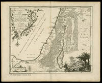
17682187Utrecht Paddenburg 1768. 1st Edition . Print. . ~ ~ NOTE: THE PRICE OF THIS BOOK IS CURRENTLY REDUCED! ~ ~ . Original single-sheet map in copperplate engraving of fine quality. Overall size ca. 400 x 800 mm with 2 flapped wings. Image size within plate mark ca. 340 x 740 mm. Handsome ornate cartouche encloses engraved title and colophon. Fine strong impression on heavy handmade paper with ample margins all round. First original state unaltered by later colouration. Preserved flat in acid-free pH-balanced buffered archival paper. In fine condition. - - FIRST EDITION. Willem Albert Bachiene 1712-1783 Dutch clergyman later a professor of geography and astronomy at the Illustere School Maastricht. Well known cartographer. The 3-volume "Heilige geographie of aardrijkskundige beschryving van het Joodsche land alsmede andere landen in de H. Schrift voorkomende" is considered among his most important works. It was published in Utrecht between 1763-1768 and included a suite of 12 fine geographical maps of the Holy Land and its neighbouring lands which Bachiene made during a period of ten years the first in as early as 1758. The map offered herewith is taken from this suite. Other important cartographic works of the Holy Land by Bachiene were included in the so-called "Jehovah Bible" i.e. "De Gansche H. Schrift Vervattende alle de regelmatige Boeken des Ouden en Nieuwen Testaments . Gods Gedenk-Naam Jehovah onvertaald gehouden" published in 1762 by N. Goetzee of Gorinchem shortly before the present map first appeared in book form. Whereas other single-sheet maps by Bachiene are in relative abundance mostly with added colouration for purely decorative purpose the works from "Heilige geographie of aardrijkskundige beschryving van het Joodsche land" are very scarce seldom found in any state. They are practically unavailable in their original unaltered uncoloured state. FOLIO <br/> <br/> Utrecht, Paddenburg unknown
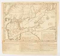
1739174921London.: The Gentleman's Magazine. circa1739. Engraved map 22.2 x 31.4 31.1 x 33 cm sheet size elaborate explanatory key in three columns at the foot original folds sealed 2 cm tear to the lower part of the inner margin one other small fold tear no loss inner margin of the key trimmed with some loss an original fault paper browned and spotted on the verso but an historic map in good condition. . [The Gentleman's Magazine]. unknown
17581444Utrecht Paddenburg 1758. 1st Edition . Print. . ~ ~ NOTE: THE PRICE OF THIS BOOK IS CURRENTLY REDUCED! ~ ~ . Original single-sheet map in copperplate engraving of fine quality. Overall size ca. 400 x 510 mm. Plate mark ca. 360 x 445 mm. Image size ca. 345 x 425 mm. With Inset Map "Der Verdeelinge van Israels Land" measuring ca. 150 x 110 mm presented by two finely engraved cherubs. Engraved illustration depicting Joshua's men about to embark on the entry into the Promised Land. Illustrated cartouche encloses engraved title and colophon. Fine strong impression on heavy handmade paper with ample margins all round. First original state unaltered by later colouration. Preserved flat in acid-free pH-balanced buffered archival paper. In a very fine condition. - - FIRST EDITION. Willem Albert Bachiene 1712-1783 Dutch clergyman later a professor of geography and astronomy at the Illustere School Maastricht. Well known cartographer. The 3-volume "Heilige geographie of aardrijkskundige beschryving van het Joodsche land alsmede andere landen in de H. Schrift voorkomende" is considered among his most important works. It was published in Utrecht between 1763-1768 and included a suite of 12 fine geographical maps of the Holy Land and its neighbouring lands which Bachiene made during a period of ten years the first in as early as 1758. The map offered herewith is taken from this suite. Other important cartographic works of the Holy Land by Bachiene were included in the so-called "Jehovah Bible" i.e. "De Gansche H. Schrift Vervattende alle de regelmatige Boeken des Ouden en Nieuwen Testaments . Gods Gedenk-Naam Jehovah onvertaald gehouden" published in 1762 by N. Goetzee of Gorinchem shortly before the present map first appeared in book form. Whereas other single-sheet maps by Bachiene are in relative abundance the works from "Heilige geographie of aardrijkskundige beschryving van het Joodsche land" are very scarce seldom found in any state practically unavailable in their original uncoloured state. FOLIO <br/> <br/> Utrecht, Paddenburg unknown
178157461a Paris: chez Moutard, 1781. 8 (200x13,50 mm), xvi-576 pages / (4)-591 pages / (4)-566 pages / (4)-555 pages / ++++ Volume 5 fehlt (4)-560 pages +++ / (4)-605-(3) pages. Gebundene Ausgabe, marmorierter Hardcover/Pappeinband Rücken aufgehellt, Besitzerstempel auf Titelblatt ( Bibliotheca Monasterii Einsidlensis), Seiten alters- und papierbedingt gebräunt, sonst guter Zustand
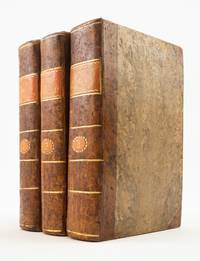
1717ST20754Lyon: Chez Anisson et Posuel 1717. Second Edition. 197 x 125 mm. 7 3/4 x 5". Three volumes. <br/> Pleasing contemporary half calf over paper boards painted to resemble tree calf smooth spines with gilt rules and two citron morocco labels. Attractive woodcut head- and tailpieces throughout WITH 153 ENGRAVED PLATES depicting the scenery flora fauna dress and architecture of locations described. Contemporary ink ownership inscription of De St. George on title page. Brunet V 903; Graesse VII 180. Corners slightly bumped and rubbed joints with just a hint of flaking but the period bindings solid and still extremely attractive survivals. Internally with a handful of quires faintly browned other trivial defects BUT AN UNUSUALLY WELL-PRESERVED SET inside and out.<br/> <br/> This lively narrative of travel at the turn of the 18th century includes a wealth of illustrations and a pleasing period bindings. A professor at the Jardin des Plantes in Paris Joseph Pitton de Tournefort 1656-1708 developed a system of botanical classification that became the standard method until it was superseded by Linnaeus in 1753. He made numerous collecting trips throughout his career; the present work is the record of his most significant voyage through Greece Turkey and along the Black Sea to Armenia and Georgia. The expedition which took place between 1700-02 had been proposed by the Comte du Pontchartrain then Secretary of State in 1699 as both a botanical and commercial endeavor. Tournefort's observations include a wealth of botanical detail but are also a rich source of information about the landscapes and peoples he encountered. He was accompanied on this voyage by German botanist Andreas Gundelsheimer and by the painter Claude Aubriet ca. 1665-1742 who had collaborated with Tournefort on his previous work "Eléments de Botanique." The work of Aubriet a botanical illustrator at the Jardin des Plantes was long appreciated by botanists and laypeople alike for its beauty and accuracy. The detailed depictions of plants here are accompanied by illustrated maps and engravings depicting zoological specimens archaeological sites and the costumes and cultures of the areas visited. The account was published posthumously in 1717 first in Paris and then shortly afterward in the present Lyon edition. The bindings here were never meant to be showy but they have come down to us in a remarkable state of preservation given their pedestrian construction and expected use. Chez Anisson et Posuel unknown