(SAUDI ARABIA).Biblio.com
41 résultats
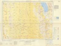
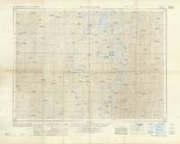
63348Washington D.C.: Printed by Army Map Service Corps of Engineers 1960. Original colour-printed map of Ra's al Mihrad Saudi Arabia 59 x 75 cm with descriptive legend to right margin. Compiled by photogrammetric methods. Generally very good. Series K502 Sheet NF 39-7 Edition 1-AMS Washington, D.C.: Printed by Army Map Service, Corps of Engineers, 1960. unknown
63344Washington D.C.: Printed by Army Map Service Corps of Engineers 1958. Original colour-printed map of Salwah Saudi Arabia 56 x 75 cm with descriptive legend to right margin. Compiled by photogrammetric methods. A very good copy. Series K502 Sheet NG 39-14 Edition 1-AMS Washington, D.C.: Printed by Army Map Service, Corps of Engineers, 1958. unknown
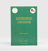
a44043Rome 1980. Proceedings of a Symposium held in Riyadh 9-13 October 1976. Translated into English. 8vo. 606pp. wraps. Good spine edges rubbed head of spine and wraps a bit worn. paperback
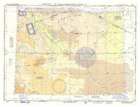
1958L6DAZGHLUF3GWashington DC: USAF aeronautical chart and information service 1958. Colour printed map 56 x 73.5 cm with a legend printed on the back. Scale 1:1000000. Pilot's map of Wadi Sirhan in the border region of Iraq Saudi Arabia and Jordan. The map shows the concave and zigzagging border between Saudi Arabia and Jordan before it revision in 1965. The indefinite nature of the borders is clearly visible on the map in the changed and crossed-out borderlines and the notations "boundary approximate" and "boundary approximate". Several areas are marked as "danger area" or "prohibited area". Stamped "obsolete for use in aviation" otherwise in excellent condition. USAF aeronautical chart and information service, unknown
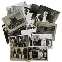
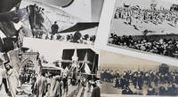
1930ABC_485971930. Kept in a brown kraft paper envelope. With 13 gelatin silver prints various sizes. A collection of thirteen press photographs from the 1930s showing Saudi Arabian leaders during diplomatic visits to Europe. The beautifully sharp and clear photographs give a good impressions of what these events must have been like at the time. Most of the photographs come with the text that would have accompanied them when they were published in a newspaper and are stamped on the back by the press agency that had the rights for publication. We have not been able to find any of these photographs in online archives.Four of the images show Faisal bin Abdulaziz Al Saud 1906-1975 during a diplomatic visit to Great Britain. Faisal was the third son of King Abdulaziz the founder of modern Saudi Arabia. Faisal was very intelligent and was given numerous important duties as a result. He was sent on a five-month long diplomatic visit to Great Britain and France when he was just 13 and achieved his first military successes when he was 16. He succeeded his half brother as king of Saudi Arabia in 1964 and became a well-loved ruler. The present photographs however show his visit to Great Britain in 1939. In particular his visit to the Royal Air Force stations in Middlesex and Northolt where he viewed the Hawker Hurricane planes which he considered to buy for the Royal Saudi Air Force. After his return however he decided against it.The other photographs show Fuad Bey Hamza 1899-1951 the Saudi ambassador in France and Fakry Pacha dates unknown the Egyptian ambassador in France during an Eid al-Fitr celebration in Paris in 1939 a portrait of Sheikh Sir Abdullah al-Salim al-Sabah 1895-1965 the 11th ruler of the Sheikhdom of Kuwait and the Kaaba in Mecca during hajj.Some of the photographs are slightly discoloured or creased around the corners. Mostly in very good condition. unknown
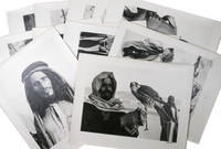
1954ABC_48728Saudi Arabia or Kuwait 1954. Ca. 28.8 x 22.8 cm sheet size: ca. 35.3 x 27.8 cm. Kept in clear plastic folder. Twelve photographic prints all signed and dated. 12 photographs. Remarkable collection of twelve photographs showing daily life of a community in Saudi Arabia or Kuwait in a time before oil wealth. The photographed people are likely all members of the same family. The moving images show the children engaged in wool spinning playing music on homemade instruments or posing in front of a wooden shed with their mother. The men are shown playing music and engaged in falconry. The beautifully captured portraits truly offer a glimpse into the lives and personalities of these people. All photographs are signed and dated by hand. They must have been made by a skilled photographer but the signature is unfortunately unclear. The corners of some of the photographs are very slightly creased otherwise in excellent condition. ABE CAT Anthropology & Ethnography ABE CAT Middle East Arabian Peninsula unknown
1950ABC_487261950. Kept in a clear plastic sleeve. Various sizes. Four postcards and one press photograph. Collection of four postcards and one press photograph all relating to hajj. Every image shows a different aspect of the pilgrimage. The photograph shows a group of Moroccan men awaiting their turn to board the plane to Mecca and the postcards show the covered Kaaba both from further away and from up close and the arrival of the holy carpet in Alexandria. The final postcard depicts the public execution of two men.The postcard of the holy carpet has been used and has a black stamp on the front and a message and an address on the back the left margin has been cut slightly affecting the image and the handwritten text the corners of the photographs are somewhat creased. Otherwise in good condition. unknown
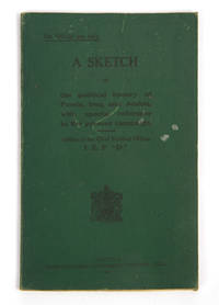
120370Calcutta Superintendent Government Printing 1917. . First edition; small 8vo 18 x 13 cms; publisher's original green printed cloth wrappers black lettering to upper cover a few marks to upper cover else a very good copy internally clean; 43 pp.<br /> This scarce intelligence pamphlet includes significant chapters on the neighbours of Iraq namely 'The Bakhtiari' the 'Pusht-i-Kuh' Pot-e Kuh and 'Central Arabia and the Shamiyah'. Scattered throughout are extensive references to the history of Arabia and Saudi Arabia with the 'Central Arabia' chapter including an account of Ibn Saud and Wahhabism as well as mentions of relations with Bahrain Oman and Kuwait. It was only five years later that the borders of Saudi Arabia with Iraq and Kuwait would be agreed under the Uqair Protocol.<br /><br />Sir Arnold Talbot Wilson 1884-1940 was a critical figure in the British administration of Iraq and its relations with its neighbours. He was deputy chief political officer under Sir Percy Cox and then acting commissioner when Cox transferred to Persia in 1918. The pamphlet describes itself as being 'prepared to meet the request of certain Officers of Indian Expeditionary force "D" for some account of the political status of Mesopotamia and neighbouring countries' and was likely commissioned as part of the broader reaction to the British disaster at Kut in requiring up-to-date intelligence on the region.<br /><br />Scarce with only 6 copies known in institutions.<br /> Calcutta, Superintendent Government Printing, 1917. hardcover
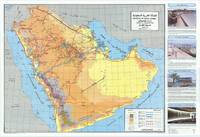
64107Riyadh: Designed and Printed by the National Offset Printing Press 1986. Original colour-printed map of the Arabian Peninsula 60 x 88.5 cm showing all manner of streets and roads. Verso printed with additional descriptive text and with photographs of Prince Abdullah bin Abdulaziz al Saud and King Fahd bin Abdulaziz al Saud. Text in Arabic map in English and Arabic. Folding between original pictorial covers. A very good copy. The legend specifies freeways and/or dual carriageways completed and under construction existing main roads designed to be dual carriageways completed and under construction asphalted main highways asphalted feeder or secondary roads main roads under construction and railways. The map is flanked to the right by a column of text con telegraphs public transport shipping and railways. Riyadh: Designed and Printed by the National Offset Printing Press, 1986. unknown
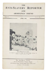
1961ABC_45244London: Anti-slavery and Aborigines Protection Society 1961. Original pictorial wrappers. Vol. 2 no. 7 April 1961. Pamphlet journal which includes obituaries articles reports news and reviews. Cover photo shows Nigerian children boarding a plane for Saudi Arabia where a story on page 73 states that they are to be sold as slaves to cover the costs of pilgrimage. A vertical crease some slight wear. Otherwise in good condition. Anti-slavery and Aborigines Protection Society, unknown
44410637-nnew. unknown
1971890335Coconut Grove Miami Florida.: Field Research Projects. 1971. Card covers. Covers little scuffed and marked pages edges little foxed else Very Good. Field Research Projects. unknown
2001Star-9783540672722Springer 2001. Hardcover. New. Springer hardcover
2001Star-9783540672722Springer 2001. Hardcover. New. Springer hardcover
ria9780443314780_inpPaperback / softback. New. New Book; Fast Shipping from UK; Not signed; Not First Edition; Smart Functional Hybrid Nanocomposites: Fundamentals and Applications for Environmental Sustainability and Energy introduces readers to the fundamental principles behind these materials covering their chemical and physical properties paperback
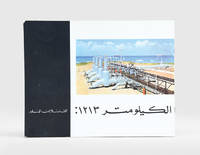
1960187923Beirut: Matba'at al-sharq al-'awsat li-l-tasdir c.1960. First edition of this well-illustrated pamphlet unrecorded institutionally on the 1213-km Trans-Arabian Pipeline Tapline which operated between Qaisumah Saudi Arabia and Sidon Lebanon especially in the years 1950-76. It provides an overview of its operations managed by four US oil companies with an initial output of 350000 barrels which increased to 450000 after a structural upgrade in 1958. Landscape octavo. With half-tone and colour photographic illustrations. Text in Arabic. Original pictorial wrappers wire-stitched as issued. Extremities a trifle rubbed rear wrapper a bit soiled contents clean: a very good copy. unknown
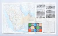
1969179167Dammam: Ministry of Information c.1969. An early map of Saudi Arabia's developing road network printed on one side in English and the other in Arabic. It shows surfaced roads those under construction and proposed highways. It also promotes the nation's medical and communications infrastructure agriculture and education. After the discovery of oil in the 1960s the Saudi government began to invest heavily in the road network. The Ministry of Planning created a series of five-year road programmes to execute these initiatives building 3221 kilometres of new roads from 1970 to 1975 and a further 21452 kilometres from 1975 to 1980. This example doubles as a promotional pamphlet featuring photographic illustrations of landmarks such as the Holy Mosque at Mecca Jeddah International Airport and the ruins of Mada'in Salih Hegra. It was likely printed in 1969 as the section introducing communications infrastructure references the future expansion of Dammam port in 1970. Single sheet 479 x 840 mm folding to 242 x 110 mm maps printed recto and verso. Six half-tone photographic illustrations small colour vignettes; text in Arabic and English. Inscribed by one Muhammad Jukhdar on front panel. Maps bright outer panels a little scuffed and toned small hole at fold intersection: a very good copy. unknown
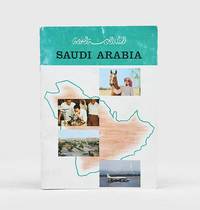
1963182391Saudi Arabia: 1963. First edition of this pamphlet detailing Saudi Arabia's history and development. It features portraits of Ibn Sa'ud King Sa'ud and King Faisal along with illustrations of hospitals schools agriculture oil refineries and the Ka'aba. The pamphlet also includes data on the country's economic resources including both its revenue from oil and its annual budget. Quarto. Half-tone photographic illustrations and maps throughout some in colour. Original colour wrappers front wrapper lettered in black rear wrapper decorated with emblem of Saudi Arabia in black and white. Wrappers rubbed and a little creased contents clean: a very good copy. unknown
1982182093Riyadh: King Abdulaziz Foundation Publications 1982. First edition of this rare comparative study of the natural and human geography of the Western Saudi coast published by Darah and illustrated with numerous colour maps. We have traced only two copies in OCLC. The work sought to establish unified institutional research and scientific independence in the field of environmental studies as well as to provide reference works in Arabic on ports and harbours in Saudi Arabia. It discusses the development and uses of natural harbours in pre-Islamic and Islamic times; geographical historical and economic factors in their development; their subdivision into historic strategic and economic harbours; as well as their uses past and present the types of professional employment they have traditionally fostered and the morphology of port cities. The illustrations include maps of ancient and modern harbours and of the historical phases of urban development in Rabigh Duba al-Wajh and al-Lith. Octavo. With 13 colour maps and plans errata leaf tipped-in. Original pale blue printed wrappers. Minor wear to wrappers contents slightly yellowed: a very good copy. unknown
1998188302Riyadh: Maktabat al-malek 'abd al-'aziz al-'amma 1998. Second edition of this well-illustrated history of communications and telecommunications in Saudi Arabia during the first half of the 20th century. The study begins with the most traditional modes of communication and transport - the use of camels and horses across the desert - with a map of the main routes from Damascus to Mecca and Basra. The second part examines the modernization of roads and the introduction of motor and rail transport under King Abdulaziz with particular emphasis on the Hijaz Railway and considers Aramco's central role in developing Saudi road and rail infrastructure. The third section is devoted to maritime communications with old photos of the Jeddah and Dammam ports and the earliest travel from the airports of Jeddah and Hofuf. The last section offers an overview of wired and wireless communications including the telegraph the postal service and the telephone. Octavo 240 x 160 mm. With half-tone photographic illustrations and maps. Text in Arabic. Original pictorial wrappers wire-stitched as issued. Extremities a little rubbed: a very good copy. unknown
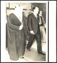
1960144431960. Wirephoto Showing the King of Saudi Arabia and other Arab leadesr. From the Historic Archives of the Baltimore titled Sun Arab Summit Conference Size: 8.3" x 9.1" This WIREPHOTO is straight from The Baltimore Sun's historical photo archive. Wirephotos are different than traditional photographic prints! This print is the result of what used to be breakthrough technology now completely obsolete that allowed a photographic image to be scanned transmitted over "the wire" telegraph phone satellite networks and then printed at the receiving location. They are often on thinner slick paper. Long removed from commercial use these artifacts represent an important era in the history of news media. Circa 1960-1970's. unknown
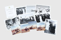
190830Saudi Arabia and Bahrain: 1979. The first trip to the Gulf by a British sovereign An interesting archive with the original confidential printed programme issued by the Master of the Household of Queen Elizabeth II and Prince Philip's two-week visit to Saudi Arabia in 1979. It was the first-ever visit to the Gulf by a female head of state. The official printed programme for internal circulation only given to each participants includes detailed information on the composition of the party. It also features arrangements for the Concorde flight cabin and room arrangement on H.M.Y. Britannia and the Nasiriya Palace in Riyadh and the full logistics of the royal tour with a schedule of the commitments and visits in Kuwait Bahrain Saudi Arabia Qatar Abu Dhabi Dubai and Oman travel protocols and mail delivery to the royals on tour. The photographic images include the landing of the British Airways Concorde in Bahrain the welcome delegation led by Sheikh Isa bin Salman Al Khalifa of Bahrain and the Saudi royal welcome by King Khalid Prince Fahd and Prince Abdullah. Together 11 items: with 7 monochrome photographs 167 x 122 mm H.M.Y. Britannia's red ink stamp "Royal Navy Official Photograph Crown Copyright Reserved" on verso of all but one; booklet 161 x 98 mm original printed wrappers gilt monograph "ER II" embossed on upper wrapper; and 3 colour photographs 89 x 85 mm. Traces of adhesive on versos of photographs two small light water stains on rear wrapper colour photographs a trifle faded: very good exemplars. unknown
156758Saudi Arabia: Royal Saudi Armed Forces 1983. Destroy when no longer needed First editions of this extensive and institutionally rare set of large aerial charts produced for the Royal Saudi Air Force covering northeastern Saudi Arabia the Arabian Gulf region Iraq and Iran. Strictly confidential they bear the legend: "For distribution to Royal Saudi Defence Forces only. Destroy when no longer needed". The year of their publication saw the first joint military exercises of the Gulf Cooperation Council headquartered in Riyadh. Saudi Arabia relied on significant foreign assistance to augment its military during the 20th century as it sought to increase its influence in the Middle East. US involvement within the country was formalized through the establishment of a Military Training Mission in 1951. By the mid-1980s when these charts were produced a "45000-strong Saudi army received training and logistical support from some 38000 advisors of US British and French origin" Cronin. Based on extensive maps produced by the British Geographical Services General Staff GSGS the charts contain updated indices of elevations populated places roads railroads boundaries terrain elevations hydrography and vegetation and an Arabic-English glossary. The collection comprises: 1. NG38-2445 Saudi Arabia. 2. NG38-2645 Saudi Arabia. 3. NG39-2448 Saudi Arabia & Qatar. 4. NG39-2648 Saudi Arabia. 5.NG40-2454 Oman United Arab Emirates. 6.NG40-2657 Iran. 7. NH38-2845 Saudi. 8. Arabia Kuwait Iraq. 9. NH38-3045 Iran Iraq Kuwait. 10. NH39-2848 Saudi Arabia Iran Kuwait Iraq. 11. NH39-2851 Iran. 12. NH39-3048 Iran Iraq Kuwait. 13. NH39-3051 Iran. 14. NH40-2854 Iran. 15. NI38-3242 Iraq. 16. NI38-3245 Iraq Iran. 17. NI39-3248 Iran. 18. NI39-3251 Iran. 19 colour charts each 890 x 1230 mm. Some pencillings to the margins. A few small creases occasional finger soiling large section excised from centre of NH39-3048. Overall in excellent condition. Stephanie Cronin "Tribes Coups and Princes: Building a Modern Army in Saudi Arabia" Middle Eastern Studies vol. 49 no. 1 2013. unknown
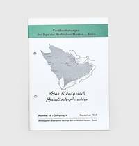
1961178445Bonn: Delegation der Liga der Arabischen Staaten November 1961. First edition first printing of this introduction to Saudi Arabia. It contains biographies and photographic illustrations of Ibn Sa'ud and other members of the royal family. We have traced no institutional copies outside of Germany Austria and Denmark. This pamphlet was produced by the Arab League's delegation in Switzerland as part of a series introducing its members their economies political systems and histories. The introduction opens by emphasizing Saudi Arabia's importance among the Arab states both for its oil resources and religious significance. The chapters then go on to cover geography infrastructure education oil and industry. Octavo. Half-tone photographic illustrations throughout; text in German. Original white printed wrappers wire-stitched and hole-punched as issued front wrapper lettered and decorated in black and green Wrappers lightly toned at edges a few scuff marks minor offsetting internally contents bright: a very good copy. Philipp 796. unknown
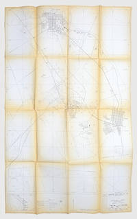
1976171424Dhahran: Arabian American Oil Co. Exploration Department 1976. A scarce map showing the locations of oil wells pipelines and refineries in the region surrounding Aramco's headquarters. We have traced only one copy US Library of Congress. The discovery of commercial quantities of oil in Dhahran at the Dammam Number 7 well in 1938 kick-started the industry in Saudi Arabia. The city is now one of the major centres of oil production in the region and has been the centre of Aramco's now Saudi Aramco's activities since the early 1950s. This map shows the Abqaiq-Dhahran Dhahran-Ras Tanura and Saudi Arabia-Bahrain pipelines. It also maps the road network airport powerlines and drainage systems. Six different types of wells are marked from observational to structural suspended and abandoned examples. It was drawn by Aramco employee Kei Inouye and first released in December 1975 with revisions published on 20 September 1976. The 1:1000000 scale key shows the connections between Dhahran and other major cities such as Dammam Safwa and al-Khobar. Large map 1366 x 845 mm key on recto. Folds toned edges a little nicked one small hole neatly repaired: a very good copy. unknown