NAVIGATION IN CHINABiblio.com
87 résultats
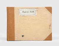
1928174745Likely Shanghai: 1928-34. Mariners are warned to exercise due caution when approaching and when in the waterways A collection of otherwise untraced notices to mariners compiled by a civilian captain who plied the lower Yangtse during the late 1920s and early 1930s. Yangtse shipping was regulated by the Maritime Customs Service which issued around 100 navigational advisories per year. During the late 1920s shipping traffic on the Yangtse rebounded after several years of decline during the Warlord Era. Low water however continued to pose problems for navigators and increased the need for effective river management. The 39 notices are technical directions concerning specific parts of the channel. They specify when vessels may and may not enter stretches of water warning of the persistent presence of Chinese craft not subject to the same notices offer guidance for navigating buoyed channels provide optimum bearings and relay a change to the position of the Bend and Gravener Island beacons due to the erosion of the channel. The majority date from 1929. The identify of the "Captain Smith" referenced on the front cover has proved elusive but he may be the individual pictured in photograph Sw13-045 G. Warren Swire collection SOAS. Landscape octavo. Contemporary brown half cloth binder with metal clasp spine lettered in gilt buff paper sides front board with manuscript label "Captain Smith" boards lined with pink paper typescript list of charts on inner front cover 39 sheets each typed one side only in black or blue most duplicate typescript a few top copy. Boards lightly soiled clasp rusted sheets generally well preserved a few creased or with holes near clasp legibility unaffected typescript list with a few losses to text: a very good example. hardcover
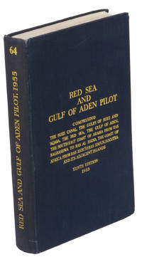
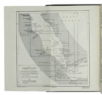
1955ABC_47446London 1955. 8vo. Published for the Hydrographic Department Admiralty Original blue cloth with yellow lettering on the spine and the front board the supplement is loosely inserted at the end of the volume: original printed paper wrappers stapled. With a folding map printed on both sides 2 coloured plates with diagrams printed on both sides 28 plates showing coastlines and occasionally a map many printed on both sides and many some illustrations in text. 2 LI = LIII: II plus 1 1 blank 1 blank 518 1 1 blank pp; Supplement: 20 pp. The essential standard sailing directions for the Red Sea and Gulf of Aden corresponding with zone NP64 on the official Admiralty charts. These nautical works - pilot guides and charts - were published by the United Kingdom Hydrographic Office which provides the necessary hydrographic and marine geospatial data to all kinds of maritime organisations across the world. The publications are not only used by the British Royal Navy but can also be found on board the majority of international merchant ships. The data provided in the pilot guides and other publications are compliant with SOLAS the Safety of Life at Sea treaty guidelines and are updated constantly in weekly "Notices to mariners" and supplements to and new editions of the pilot guides whenever necessary.The present copy is the 10th edition 1955 of the pilot guide with sailing directions and other information on the weather currents radar ranges etc. relating to the Red Sea and Gulf of Aden including the supplement issued in 1957. It includes an erroneous "advertisement to the eight edition" by the Hydrographer of the Navy Rear-Admiral Kenneth St Barbe Collins 1904-1982. The advertisement states that with the publication of "the ninth edition" presumably this volume the previous edition and its supplements are cancelled since the most up-to-date information has been compiled in the new edition and the weekly "Notices to mariners" that appeared after the publication of the 11th edition. The 10th edition of 1955 and its 1957 supplement were made redundant with the publication of the 11th edition in 1967. Each subsequent edition of the pilot supersedes the last which have appeared infrequently depending on newly available information from the mid-19th century until the present day.The front paste-down and recto of the first free endpaper contain a "caution" notice and room for the notation of "supplements and annual summaries of notices to mariners relating to this book" the first two pages are printed on red-pink paper. The binding shows minor signs of wear around the spine and corners of the boards the gutter after page II is somewhat weakened the head edge of the wrappers of the supplement are very slightly browned. Otherwise in very good condition. hardcover
1955K3CC18ANEAK3London: published by the Hydrographic Department Admiralty 1955. Original blue cloth with title on spine and front board; supplement with original printed paper wrappers. 8vo. With a folding map printed on both sides 2 coloured plates with diagrams printed on both sides 28 plates showing coastlines and occasionally a map many printed on both sides and many some illustrations in text. Including: Supplement no. 1-1957 relating to the Red Sea and Gulf of Aden pilot tenth edition . Tenth edition of a work "comprising sailing directions for the Suez canal the Gulf of Suez and the central track for power vessels through the Red sea Straits of Bab-al-Mandab and Gulf of Aden ." p. III and more areas. Besides navigation it deals with the climate weather and ocean streams of the area. The first chapter also gives and "general description of countries bordering the Red sea and Gulf of Aden" p. V. Including two copies of the supplement. Spine slightly discoloured otherwise in very good condition. published by the Hydrographic Department, Admiralty, hardcover
1967ABC_46470London: United Kingdom Hydrographic Office 1967. Grey-blue back wrapper; the two quires map and back wrapper held together by two metal staples. Blue cloth with title information in yellow on front cover and spine the supplement loosely inserted at the end of the volume. Large 8vo. The main work with 3 maps including 2 folding and 82 views of coastal profiles on 52 plates. The supplement with 2 folding maps on the two sides of a single folding leaf and 4 views of coastal profiles on 3 pages. With: NAVIGATION - RED SEA - PILOT GUIDE. Supplement No. 7 - 1977 to Red Sea and Gulf of Aden pilot eleventh edition 1967 corrected to 4th March 1977 Whenever reference is made to the pilot this supplement must be consulted.London United Kingdom Hydrographic Office 1977. The essential standard sailing directions for the Red Sea and Gulf of Aden corresponding with zone NP64 on the official Admiralty charts. These nautical works - pilot guides and charts - were published by the United Kingdom Hydrographic Office which provides the necessary hydrographic and marine geospatial data to all kinds of maritime organisations across the world. The publications are not only used by the British Royal Navy but can also be found on board the majority of international merchant ships. The data provided in the pilot guides and other publications are compliant with SOLAS the Safety of Life at Sea treaty guidelines and are updated constantly in weekly "Notices to mariners" and supplements to and new editions of the pilot guides whenever necessary.The present copy is the 11th edition 1967 of the pilot guide with sailing directions and other information on the weather currents radar ranges etc. relating to the Red Sea and Gulf of Aden including the supplement issued in 1977. The first two pages are printed on red-pink paper. Binding slightly rubbed and faded board edges very slightly soiled fore-edge of the supplement slightly frayed. Overall in good condition. United Kingdom Hydrographic Office, hardcover
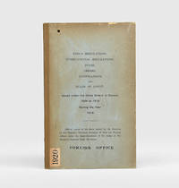
1920185017Likely Shanghai: no stated publisher 1920. Held in only one institutional library First edition the majority of the 31 notices concerning pilotage harbours and port sanitation. Accompanying the text are two anchorage plans and the full bilingual text of the 1918 Ningbo harbour regulations which were formally propagated in 1919. The ports and harbours covered include Shanghai Wenzhou Chefoo Tianjin Hankou Fuzhou Amoy Swatow Santuao and Canton. While some notices merely repeal or tweak existing orders 14 provide substantial new directions for navigators and shipping often extending across multiple pages. This and one other copy were sometime deaccessioned from the Foreign Office Library. The library's retained copy held in the FCDO Historical Collection at King's College London is the only other example we have traced. Octavo. With folding plans of Ningbo and Zhenhai anchorages 4 folding text sheets with Ningbo harbour regulations in English and Chinese. Original buff boards brown cloth backstrip front cover lettered in black. Ex-Foreign Office Library with its date label and stamps on boards bookplate accession notation and withdrawal stamp. Volume hole-punched top left throughout contents unaffected save for numerical code at head of first page boards toned folding matter well preserved: very good. hardcover
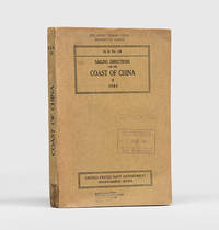
1943172166Washington DC: United States Navy Department Hydrographic Office 1943. First edition first printing pleasingly with all the printed supplement tickets still present and the detailed maps well preserved. Updated chapters offer information on general subjects such as pilotage storm and weather signals quarantine regulations and ocean currents as well as detailed discussion of stretches of river and ocean along China's east coast down to Hong Kong and up the Yangtze. While common institutionally as expected copies are now seldom encountered in commerce. Octavo. With 2 folding maps 2 diagrammatic plates illustrations in text. With all 8 leaves 4 blank of printed supplement tickets bound in at front as issued. Original brown card wrappers spine and front cover printed in black. Ex-Civil Affairs Training School University of Chicago with its ink stamps on front cover and "discard" noted in pencil. Wrappers well preserved first map with stub tear just touching neatline second map split along one fold neatly repaired on verso with archival tape couple of small nicks and chips internally not affecting text: a very good copy. unknown
1924185018Likely Shanghai: no stated publisher c.1924. First edition. Alongside notices amending and repealing existing directions the volume includes the text of four newly propagated and substantial documents concerning the ports of Amoy Yingkou Newchwang Wuhu and Qingdao as well as several non-maritime orders. This copy now deaccessioned was one of at least two sent to the Foreign Office Library in August 1924 by Judge Skinner Turner 1868-1935 the chief justice of the British Supreme Court for China from 1921 to 1927 Skinner's bequest is noted on the bookplate. The library's retained copy held in the FCDO Historical Collection at King's College London is the only other example we have traced. Octavo. Original buff boards brown cloth backstrip front cover lettered in black. Ex-Foreign Office Library with its date label and stamps on boards bookplate accession notation and withdrawal stamp. Covers and contents toned: very good. hardcover
1939RiverPilot<p>HUDSON RIVER NAVIGATION <strong>Godfrey's river and canal pilot</strong>: <strong>useful information for masters pilots mates and yachtmen navigating the Hudson River New York State Barge Canals and Long Island Sound. Compiled by Daisy M and Frank H Godfrey. Rome NY: Republican Printing Company 1939. 8vo 33pp; blue textured paper covers lettered in silver a fine copy overall.</strong></p><p><strong>First and apparently only printing OCLC locating only two copies. Extensive listing of magnetic compass courseCayuga Ls including the Hudson River both North and South bound Oneida Lake Cayuga Lake Seneca Lake Erie Canal Oswego Canal Buffalo Harbor Long Island Sound and New Haven maint entrance to Stratford Point. </strong></p> Republican Printing Company paperback
1913DEMO016711INew York: Dodd Mead 1913. First American edition. Hardcover. Very Good. photos color plates maps. Octavos dark green cloth. 443 376 pages <br/><br/>Dogged by difficulties and beaten to the pole by Amundsen by a month then their luck turned Scott's second and last expedition to the Antarctic was to explore the Ross Sea area and to reach the South Pole. bad. There were no survivors of the polar party. Vol.1 is the Journals of Captain R.F. Scott. Vol.2 is the Reports of the Journeys and the Scientific Work Undertaken by Dr. E.A. Wilson and the Surviving Members of the Expedition. Abundantly illustrated the maps and plates are quite well done and deserve to be appreciated in the freshness and colors of the original. Dodd, Mead hardcover
193937919London: HMSO 1939. First Thus Printing. fair. 446 & 275 2-vol. set illus. some color diagrams maps index errata slip boards weak worn soiled and some edge tears. Ink notations and pencil erasures on front endpapers some page discoloration. This is an important snapshot of naval navigation practice at the eve of the Second World War. HMSO hardcover
19442005200040Houston : Gulf Publishing Co 1944. First Edition. Hardcover. Very Good. The Army Air Corps: A Rare and fine collection of the Army Air Forces in World War II. Log of Navigation. 7 issues bound as one. Bound in full blue cloth. Good binding and cover. Original pictorial wraps bound in. Clean unmarked pages. Numerous photographs maps comics. Heavily illustrated an interesting periodical. "The approved publication of the AAF Training Command." Includes: "A Camera Trip Through Army Air Forces School Hondo Texas" - a smaller photo-pamphlet; AND Log of Navigation issues: April 1944. Vol. 2 no. 4; May 1944. Vol. 2 no. 5; June 1944. Vol. 2 no. 6; July 1944. Vol. 2 no. 7; September 1944 Vol. 2 no. 9; March 1945. Vol. 3. No. 3. <br> From the former head of the U.S. Air Forces History Division. Houston : Gulf Publishing Co hardcover
19068656Portland Oregon: The Oregon Railroad & Navigation Co. Fine with no dust jacket. 1906. First Edition. Original Wraps. Map unfolds to about 1 1/2'x5'. Colored semi-topographical map of the Columbia River with towns etc. Really cool!; Map; 4 1/2x9 1/2" . The Oregon Railroad & Navigation Co. paperback
192059233Washington D.C.: Government Printing Office Hydrographic Office U.S. Navy 1920-1930. Seven vols. 8vo. 4 365 1; 584; v 1 4 447 1 pp.; 2 22; 1; 2 57 1; 1 36 2 leaves. With 3 large folding colour maps numerous photo plates elevation views. Three uniformly bound in blue publisher’s buckram gilt lettering stamped on front covers & spines edgewear dustsoiling very slight uniform toning bowing to covers on vol. III some scuffing supplements all w/ self-printed softcovers edgewear rippling toning to fore-edges some predation still a G set w/ maps in bright condition. First editions stated of these uncommon coast pilot guides to Australian waters drawing upon British Royal Navy coast pilots Australian and U.S. Navy reports. Prior to modern GPS systems and satellite navigation these regularly updated and revised navigation handbooks provided key sailing instructions. The maps outlines the available charts for the designated areas surrounding Australia as well as those for the East Indies Pilot. First editions of these Hydrographic Office pilots are quite scarce and seldom seen with the supplements. Government Printing Office, Hydrographic Office, U.S. Navy, paperback
19692082702114611746Shiroyama Do 1969. Soft Cover. Fine. Number of books: 1 Shiroyama Do paperback
192459232Washington D.C.: Government Printing Office Hydrographic Office U.S. Navy 1924; 1930. Two vols. 8vo. 608 pp.; 1 32 1 leaves. With1 large folding colour map. 1st vol. in light-green publisher’s buckram black lettering stamped on front cover & spines slight uniform toning darkening to spines shelfwear 2nd vol. w/ self-printed softcovers toning & minor predation minor chipping to fore-edges still VG- set w/ map in bright condition. Second edition of vol. 1 substantially revised & expanded 1st of 2nd of these very scarce coast pilot guides to waters of Indonesia drawing upon British Royal Navy coast pilots Australian Southeast Asian Polynesian and U.S. Navy reports. Prior to modern GPS systems and satellite navigation these regularly updated and revised navigation handbooks provided key sailing instructions. The map outlines the available charts for those covering the difficult sailing conditions through Java the Celebes Borneo Sumatra the Gulf of Siam the Celebes Timor and more. Worldcat locates only 4 copies of the first vol. Yale NYPL BN Mexico Stattsbibliotheck Berlin & 1 copy of the 2nd U of W. Government Printing Office, Hydrographic Office, U.S. Navy, paperback
192059229Washington D.C.: Government Printing Office Hydrographic Office U.S. Navy 1920;1929. Two vols. 8vo. vii 1 4 500 pp.; 2 32 2 leaves. With 1 large folding colour map. First in dark blue publisher’s buckram lettering stamped on front cover & spine minor soiling edgewear slight uniform interior toning 2nd vol. in self-printed softcovers oxidized toning & predation to outer fore-edges front chipped corner still VG- set. First editions of these very scarce coast pilot guides to waters off the West coast of India just after World War I drawing upon British Royal Navy coast pilots and U.S. Navy reports. Prior to modern GPS systems and satellite navigation these regularly updated and revised navigation handbooks provided key sailing instructions often drawing not only from British & Indian sources but also sailing reports from U.S. Navy vessels and those from merchant ships. The map outlines the available charts for the coastline off of Bombay down to Cape Comorin the Maldives and Sri Lanka. Worldcat locates only 2 copies of the scarce supplement. Government Printing Office, Hydrographic Office, U.S. Navy, paperback
19492082402113503178Not Available 1949. Soft Cover. Fine. Number of books: 14 Not Available paperback
192059237Washington D.C.: Government Printing Office Hydrographic Office U.S. Navy 1920-1940. Five vols. 8vo. vi 638; v 1 287 1; 8 390 pp.; 1; 2 17 1 leaves. With 5 large folding colour maps numerous plates showing elevations. Three volumes uniformly bound in blue publisher’s buckram gilt lettering front cover & spine darkening to spines fore-edges minor shelfwear dustsoiling slightly shaken Supplements in self-printed softcovers edgewear toning to fore-edges minor chipping still VG- set. Third editions revised & updated of vols. I & II second edition of vol. II and 1st editions of both scarce Supplements of these coast pilot guides to British Columbia including lower Alaska and upper Washington in the years between the World Wars. Prior to modern GPS systems and satellite navigation these regularly updated and revised navigation handbooks provided key sailing instructions often drawing not only from Brazilian Argentine and British coast pilots as well as sailing reports from U.S. Navy vessels and those from merchant ships. The first large map delineates the requisite coast pilots for sailing in B.C. waters and charts to be ordered from the Hydrographic Office while the second maps depict the sailing routes to Asia the Soviet Union and the Arctic across the Pacific. Both editions of Vol. II are offered here with the expanded 3rd edition featuring nearly double the material and extra map of the 2nd. Government Printing Office, Hydrographic Office, U.S. Navy, paperback
192759236Washington D.C.: Government Printing Office Hydrographic Office U.S. Navy 1927-1930. Three vols. 8vo. x 4 550; viii 4 560 pp.; 1 17 2 leaves. With 4 large folding colour maps 1 w/ toning at fore-edge from being improperly folded some edgewear numerous plates showing lighthouses. Two volumes uniformly bound in red publisher’s cloth gilt lettering front cover & spine darkening to spine fore-edges minor shelfwear dustsoiling minor paint drip at fore-edge 1 vol. Supplement in self-printed softcovers edgewear toning to fore-edges minor predation still VG- set. Third editions revised & updated of vols. I & II first edition of scarce Supplement of these coast pilot guides to South America and Antarctica in the 1920’s. Prior to modern GPS systems and satellite navigation these regularly updated and revised navigation handbooks provided key sailing instructions often drawing not only from Brazilian Argentine and British coast pilots as well as sailing reports from U.S. Navy vessels and those from merchant ships. The first large map delineates the requisite coast pilots for sailing in American waters and charts to be ordered from the Hydrographic Office while the second maps depict the sailing routes. The expanded 3rd edition is quite scarce with 1 copy located of both vols. in Worldcat NYPL. Government Printing Office, Hydrographic Office, U.S. Navy, paperback
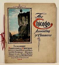
190922859Chicago: Chicago Association of Commerce 1909. First Edition. Quarto; 8pp. Four string-tied and stapled leaves with ten 3 1/2" x 5 1/2" mounted colored illustrations each titled in red along with a map of the route. Near Fine copy in grey cardstock titled and color photograph tipped to front cover. Rare promotional piece; we fine only 1 copy at University of Michigan. This booklet was prepared by the Oregon Railroad & Navigation Company the Oregon Short Line Railroad the Union Pacific Railroad and the Chicago & Northwestern Railway as an itinerary for the approximately 40 Chicago merchants' return trip ". calling your attention to a few of the points of interest in a country of marvellous scenes wonderful accomplishments and a still more wonderful future." Lists 38 members of the Chicago Association of Commerce making the return trip. Uncommon attractive & elaborate promotional piece. Chicago Association of Commerce unknown
19397103Np: Matson Navigation Company 1939. 1st. Paperback. First Edition. Folio. Vol. 1 No. 1 - 4 Jan. 1941-June 1941 Complete. Each issue 14pp. Numerous photo-illustrations; ads. Original photo-illustrated wrappers. Minor soiling and wear to extremities; front cover of No. 2 partially separated; otherwise near fine. Four numbers issued during the 4 day voyage on the Matson Line cruise ship from California to Hawaii California-Hawaii-Samoa-Fiji-New Zealand-Australia. Each number features a special theme-the first Hawaii's History; the second Scenic Attractions; the third Island Sports and Recreation; and fourth Native Life and Folklore. Matson Navigation Company paperback
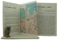
1962161834London: P&O Orient Lines 1962. Ten long single sheets folded into four five or six panels with text on one side and coloured maps on reverse the headings printed in blue & black; small cr. 8vo folded size; all numbered by hand near the top fore-corner of the upper panel with the number whited-out on number 2 Melbourne occasional slight soiling heavier on the Miami folder edges a trifle rubbed; P&O Orient Lines London 1962-1963. The folders were 'produced to assist passengers' and contain a brief history and description of each city including places of interest hotels shopping theatres currency information etc. P&O Orient Lines unknown
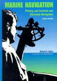
1990BN151395U S Naval Inst Pr 1990. 1990. Marine Navigation: Piloting and Celestial and Electronic Nagivation <br/><br/>Marine Navigation: Piloting and Celestial and Electronic Nagivation Marine Navigation - Hobbs Richard R. U S Naval Inst Pr unknown
192759226Washington D.C.: Government Printing Office Hydrographic Office U.S. Navy 1927-1928. Two vols. 8vo. 8 viii 424; 6 v 1 446 pp. With 4 large folding colour maps 1 double-sided elevation maps showing harbor entrances numerous photo plates. Beige publisher’s cloth black lettering front cover & spine darkening to spine fore-edges minor shelfwear dustsoiling still VG set. Third & Seventh editions revised & updated of these coast pilot guides to Central America and Mexico in the 1920’s. Prior to modern GPS systems and satellite navigation these regularly updated and revised navigation handbooks provided key sailing instructions often drawing not only from Mexican and West Indies sources but also governmental publications in the Panama Canal sailing reports from U.S. Navy vessels and those from merchant ships. The first large map delineates not only the requisite coast pilots for sailing in American waters but also the charts to be ordered from the Hydrographic Office. Government Printing Office, Hydrographic Office, U.S. Navy, hardcover
194539135Chatham: Shepherd Printing n. d. ca 1945. 1945. CANADA. 18" x 24" sheet one side opens to a half-sheet color map and numerous advertisements for lodging including the Joe Gawa Hotel one of Ontario's newest and finest hotels. The other side has 12 panels of promotional text regarding the various cruise packages of the beautiful Muskoka Lakes time tables and schedules and views of the inland waterways steamships R. M. S. Sagamo and the R. M. S. Cherokee. Some minor to light wear to the folds else a very good copy. Shepherd Printing, n. d. (ca 1945). unknown