87 résultats
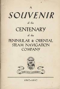
195540503City Not Stated: Peninsular & Oriental Steam Navigation Company P & O 1955. Each card: Folded small octavo 14 x 21 cm very good condition colour drawing front cover corner tips some cards little scuffed card 1 is slightly shorter at the top presumed as issued no text missing minor edgewear. Each card: 4 pp. A set of 11 of 12 in set menu cards designed by the artist Strom Gould. Card No. 1 Red-Crowned Pigeon & Purple-Crowned Pigeon. Card No 2 Fairy Wrens. Card No. 3 Gouldian Finch. Card No. 4 Pink Cockatoo. Card No. 5 Count Raggi's Bird Of Paradise. Card No. 6 Rainbow Bird. Card No. 7 Regent Bower-Bird. Card No. 8 Scarlet Honey-Eater. Card No. 9 Red-Capped Robin. Card No. 10 Laughing Kookaburra. Card No. 11 Rainbow Lorikeet Red-Winged Parrakeet & Green Leek Parrakeet. MISSING: Card No. 12 Kingfisher. The artist also known as Charles Sidebotham Gould was born in Letchworth England on 2/8/1910 and came to Australia in 1937. He was employed as the Sydney Morning Herald's first art director and he also drew its first comic strip in 1944. He died in 1992. No date but about 1955. Peninsular & Oriental Steam Navigation Company (P & O) unknown
192059238Washington D.C.: Government Printing Office Hydrographic Office U.S. Navy 1920; 1930. Two vols. 8vo. viii 4 577 1 pp.; 1 38 1 leaves. With 1 large folding colour map. 1st vol. in green publisher’s buckram gilt lettering stamped on front cover & spine darkening to spine shelfwear deep embossed circular indentation at gutter margin where brass weight held book open; 2nd vol. Supplement in self-printed softcovers toning chipping & tears to spine still G set. Second edition stated of vol. I 1st edition of Supplement vol. of these surprisingly scarce coast pilot guides detailing the sailing directions for the treacherous coasts of Norway & Sweden notoriously treacherous for sailing and powered vessels. Prior to modern GPS systems and satellite navigation these regularly updated and revised navigation handbooks provided key sailing instructions drawing upon British Norwegian Swedish & Danish coast pilots. Worldcat locates only 1 copy of the Supplement U of W. Government Printing Office, Hydrographic Office, U.S. Navy, paperback
191236542North Yakima: Yakima Commercial Club 1912. 1912. WASHINGTON. 10 1/2" x 7" in color pictorial wrappers. 64 pp. introduction illustrations. Very brief history followed by extensive information on the Yakima Valley to include geography topography climate the Indian Reservation irrigation products produced methods of orchard development live stock dairying transportation communities industries etc. Numerous black and white photographs many full page photos of scenery residential homes buildings agriculture industries public buildings etc. Wrappers disbound from text. Light bleeding to first and last page wrappers lightly soiled and with chipping to top of front wrapper and with tiny fold to tops of page corners. Yakima Commercial Club, 1912. unknown
1905100722Montreal: Desbarats & Co. 1905. Book. Good. Original Wraps. 8vo - over 7¾" - 9¾" tall. Title continued: With many illustrations of interesting places and scenes also a short description of the Ottawa River and points of interest to the tourist who may make the trip via the Grand River and Rideau Lakes through the most charming scenery in America between Montreal Ottawa and Kingston. 56 p. Folding map - Route of the Ottawa River Navigation Co. 35 illustrations. Covers worn with chips in spine. Top corner stained. A scarce guide book. Desbarats & Co. Paperback
1995281400PN. New. 1995. Soft Cover. Date is original print. This is a reprint edition . PN paperback
1994ZB650970The Institute 1994. volumes 19-40 lacking volume 25 and volume 34#1 else an uninterrupted run of complete volumes partly bound minor library markings else text clean & bindings tight PRICE IS FOR THE LOT. - If you are reading this this item is actually physically in our stock and ready for shipment once ordered. We are not bookjackers. Buyer is responsible for any additional duties taxes or fees required by recipient's country. Photos available upon request. The Institute unknown
1912164939Sydney: Edward Lee & Co. 1912. 1st edition. Very Good. tall octavo. pictorial boards cxxi 243pp. colour & b/w plates text ills. maps Inc. folded plate "Accommodation plan of KPM Steel Screw Steamer "Tasman" chipped & spotted with some loss. Great ads. Signs of use & boards reinforced at spine with tape o/w a very good complete copy Edward Lee & Co. hardcover
195514915AB1955. Sevilla 1955-1958. differentes damaños Con muchas ilustraciones en parte en color. Interesante conjunto de folletos de las lineas de navegacion Ybarra. Contiene: 'Plano de acomodaciones de los nuevos transatlanticos Cabo San Roque y Cabo San Vicente' 'Un billete de pasaje Tenerife - Barcelona en 1958 que costaba entonces Pts. 2.420-' 2 menus Coleccion Ybarra 3 minutas Cuidad de Sevilla de 1957; 2 ediciones de la revista 'Maripez' de Ybarra de 1958 contiene una reportaje de una visita de Brigitte Bardot a Picasso con foto; mapas de Lisboa y Barcelona. unknown
193390592Paris: Commission Internationale de Navigation Aeriennne 1933. Presumed First Edition First printing thus. Pamphlet. Good. The format is approximately 5 inches by 8 inches. TEXT IS IN FRENCH. 2 28 28 blank verso pages. Tabular Data. RARE SURVIVING COPY. The International Commission for Air Navigation ICAN was an international organization established by the Paris Convention of October 1919 which was the precursor to the current International Civil Aviation Organization ICAO . Its role was to establish international standards for managing air navigation. ICAN was truly active from 1922 to 1939 but ceased in 1947 when it was replaced by ICAO. In March 1919 an Aeronautics Commission of the Peace Conference was established at the initiative of President Clemenceau who rallied his allies and partners to his cause: President Wilson Alfred Milner United Kingdom and Vittorio Emanuele Orlando Italy. In less than four months the Commission and its military technical and legal subcommittees drafted the Convention regulating air navigation which was signed in Paris on October 13 1919 and which forms part of the treaties protocols and conventions of the Paris Peace Congress. The International Commission on Air Navigation was established by Article 34 of the Paris Convention. The convention entered into force on July 11 1922. It had been signed by fourteen states. At the first session held in Paris under the chairmanship of Raymond Poincaré he specified the role that the Commission was to play in the future and emphasized its innovative nature in the field of international law as it gave the Commission the power to make decisions binding on the contracting states by majority vote. Among the topics of this set of Aeronautical Instructions are Aerodromes Meterorological services phrases flight plans frontiers/boundaries Transportation and hazards to aviation. It addresses treaty/conventions and relevant Belgian legislation. Commission Internationale de Navigation Aeriennne unknown
192723896New Haven: Yale University Press 1927. Hardcover. Small 4to. Black cloth. xx 215pp. Frontispiece numerous illustrations. Very good. Slightest bit of edgewear and bit of "flecking" to the cloth but overall tight clean and attractive. First edition limited to 1000 copies. Interesting association copy for this belonged to the noted writer HAROLD BELL WRIGHT 1872-1944 one of the most popular novelists of the early 20th century author of such bestsellers as "The Shepherd of the Hills" 1907 "The Calling of Dan Matthews" 1909 and "The Winning of Barbara Worth" 1911 -- whose descendants parted with much of HBW's personal library in December 2005. Wright was a serious long-time boating enthusiast a fanatical follower of all things nautical whose hobby was designing and building from scratch his own sailboats. A rather uncommon title with an interesting provenance. Yale University Press hardcover
190139096Geneva: Press of W. F. Humphrey n. d. ca 1901. 1901. NEW YORK. First edition. 8" x 20" sheet folded to 10 panels pictorial black and yellow pictorial wrappers illustrated map. One side dedicates two panels to Watkins Glen and the Glen Mountain House Hotel and how to get there two panels provide description of the Glen Mountain House and its history and one panel tells of the Geneva Mineral Lithia Water Spring og Geneva N. Y. its discovery and introduction to the public. The other side dedicates two panels to the steamer trip on Seneca Lake one panel promotes the Nester Hotel in Geneva and its rates of $2.00 t0 $3.00 per day with information on how to reach Seneca Lake. The remaining two panels are the front and rear covers. An old water stain is at the upper portion and affects each panel to some degree and a tiny nick to bottom edge of front panel else a good copy Press of W. F. Humphrey, n. d. (ca 1901). unknown
193793014London: Riddle Smith & Duffus Ltd. 1937. 1st ed. octavo. pp.47 some light foxing to orig. wraps otherwise near fine condition. 1st edition. Riddle, Smith & Duffus Ltd paperback
199642091Alexandria VA: The Institute of Navigation 1996. First Edition. First Printing. good. 850 wraps illus. diagrams references index cover somewhat worn and soiled. The Institute of Navigation paperback
192659234Washington D.C.: Government Printing Office Hydrographic Office U.S. Navy 1926; 1930. Two vols. 8vo.viii 478 pp.; 1 22; 1 leaves. With 1 large folding colour map. First vol. in tan publisher’s buckram black lettering front cover & spine minor soiling spotting fore-edges of covers darkening to spine very slight uniform interior toning; 2nd. vol. w/ self-printed softcovers toning to fore-edges minor chipping still VG set. Second edition stated of vol. I and 1st edition of Supplement. These uncommon coast pilot guides to Eastern Mediterranean waters the Black Sea and the Sea of Azov draw upon British Royal Navy Ottoman Empire & Turkish coast pilots Russian & U.S. Navy reports. Prior to modern GPS systems and satellite navigation these regularly updated and revised navigation handbooks provided key sailing instructions. The maps outlines the available charts for the designated areas surrounding the Black Sea as well as detailing those for the extensive set of the Mediterranean Sea. Government Printing Office, Hydrographic Office, U.S. Navy, paperback
192259239Washington D.C.: Government Printing Office Hydrographic Office U.S. Navy 1922; 1930. Two vols. 8vo. v 1 4 397 1 pp.; 1 60 2 leaves. With 1 large folding colour map. 1st vol. in green publisher’s buckram gilt lettering stamped on front cover & spine darkening to spine shelfwear minor scuffing; 2nd vol. Supplement in self-printed softcovers toning chipping & tears to fore-edges minor creasing to corner still VG- set. Third edition stated of vol. I 1st edition of Supplement vol. of these surprisingly scarce coast pilot guides detailing the sailing directions for the treacherous coasts of Great Britain France Belgium Netherlands German & Denmark notoriously treacherous for sailing and powered vessels. Prior to modern GPS systems and satellite navigation these regularly updated and revised navigation handbooks provided key sailing instructions drawing upon British French German Dutch & Danish sailing directions and charts. Worldcat locates no copies of the Supplement. Government Printing Office, Hydrographic Office, U.S. Navy, paperback
192023894New York: D. Appleton and Company 1920. Hardcover. 12mo. Limp black leatherette. xxiv 740pp. Line drawings charts graphs. Very good. Mild edgewear but overall tight clean and fairly attractive. Third printing of this classic manual. This copy has a fine literary provenance having belonged to novelist HAROLD BELL WRIGHT 1872-1944 author of such bestsellers as "The Shepherd of the Hills" 1907 "The Calling of Dan Matthews" 1909 and "The Winning of Barbara Worth" 1911 -- whose descendants parted with much of HBW's personal library in December 2005. Wright was a serious long-time boating enthusiast. A printed statement signed by two descendants on behalf of the Harold Bell Wright Estate accompanies this volume specifying that it came from HBW's personal library. D. Appleton and Company hardcover
19752090202120403487Kaibundo shuppan 1975. Soft Cover. Fine. Number of books: 1 Kaibundo shuppan paperback
19822111902154600035Kaibundo shuppan 1982. Soft Cover. Fine. The book is in fine condition. Kaibundo shuppan paperback
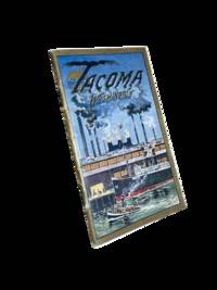
19118633Tacoma: Tacoma Commercial Club and Chamber of Commerce 1911. First edition. 14x8cm 32pp. Full color and sepia photographic illustrations throughout. Single map. Detachable post card/order form present at rear. Staple bound in color lithographed card covers. Some edge rubbing and light wear else near fine. <br /> <br /> Beautiful and scarce promotional booklet a joint effort of the Oregon-Washington Railroad and Navigation Company Bureau of Community Publicity and the Tacoma Commercial Club and Chamber of Commerce. Photos of prominent buildings factories the port Mount Rainier and Stadium High School among others. Includes information on industry and culture of the fast-growing city. <br /> <br /> <br /> OCLC cites 4 holdings only including just 1 in the state of Washington. . Tacoma Commercial Club and Chamber of Commerce unknown
19692092902137404777Kaibundo 1969. Soft Cover. Fine. Number of books: 1 book Kaibundo paperback
19612092902141103263Kaibundo 1961. Soft Cover. Fine. Volume: 1 Kaibundo paperback
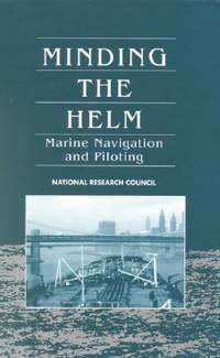
1994SONG030904829XNatl Academy Pr 1994-01-01. hardcover. Used: Good. 6.50x1.50x9.25. Buy with confidence. Excellent Customer Service & Return policy. Natl Academy Pr hardcover
1989142622Pilot Guide TNL 7900: The TA 7900 Omega/VLF Navigation System Pilot's Manual by Trimble Navigation is a TrimbleNavigation spiral bound publication. The book was published in 1989. Both the spiralbound book and the covers are in good condition with only a few small marks. This copy would make a special addition to any collection or library. "An in-depth explanation that is filled with diagrams!" This is an exceptional book and read. You can buy with confidence we have been selling books for over 45 years. Thanks for buying. TrimbleNavigation
1980BOOKS028140IShanghai:. VG unmarked 10 1/2" x 15" Hardback; DJ-G/VG 2 small taped. 1980. ISBN: tears. 85 Plates 56 color of Chinese paintings. Catalogs: CHINA. Keywords: CHINA YANGTZE RIVER CHINESE ART CHINESE PAINTING. hardcover
1995biblio617Bethesda Md: Defense Mapping Agency Hydrographic / Topographic Center pub no 9 1995. Fine. <p>4to 873p ill maps full red cloth</p> Defense Mapping Agency Hydrographic / Topographic Center, pub no 9 hardcover