1 048 résultats
19887773ABBielefeld, Delius Klasing Verlag, 1988. 19 cm, 140 Seiten, mit Illustrationen, Taschenbuch. minimale Gebrauchsspuren, sehr gut erhalten. Kleine YACHT-Bücherei 83.
197087068Wesselburen, Frank Wagner, 1970. 176 S. Mit 33 Fotos auf Taf. u. 26 Abb. im Text nach Federzeichn. von Alfred Grobe. Orig.-Engl.Brosch.
195710134Hamburg, Hans Christians, (1957). 154 S. Mit 29 Abb. a. Taf. u. 1 farb. Faltkte. als Beilage. (= Veröffentl. d. Wirtschaftsgeschichtl. Forschungsst., Hamburg, 19). 25 cm. OLn.
192779482(Berlin). 1892 bis 1927. 31, (1) Seiten. Mit mehreren teils faks. Abbildungen. Ill. Originalbroschur. 23x32 cm
1967V2478TIME-LIFE-Bücher 1967. 4°, illustrierter Originalkarton, 192 S., zahlreiche Abbildungen in Schwarz-weiß und Farbe
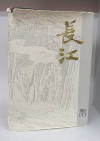
1980133049Shanghai 1980. First Edition. Hardcover. Good/Good. Unpaginated. 38 cm. 85 paintings of the Yangtze listed by author and described at rear. 56 are in colour. Blue hardcover in dustjacket. jacket has tears to edges. Book itself has shelf wear. Small ink notation on jacket flap. Ink inscription on brown front endpaper. Text in English and Chinese. <br/><br/> hardcover
1980BOOKS028140IShanghai:. VG unmarked 10 1/2" x 15" Hardback; DJ-G/VG 2 small taped. 1980. ISBN: tears. 85 Plates 56 color of Chinese paintings. Catalogs: CHINA. Keywords: CHINA YANGTZE RIVER CHINESE ART CHINESE PAINTING. hardcover
1989265234BBBlfd., Delius, Klasing, 1989. 6. Aufl. 4°. Mit Abb., Ill. u. 1 gef. Tab., 1 gef., beil. Kte. 310 S. OLwd. m. OU. - Sehr gutes Ex. 6
1980143784Bielefeld : Delius, Klasing, [1980]. 6. Aufl.; 308 S. mit zahlreichen Abbildungen, 1 mehrfach gefaltete Karte beiliegend; 4°; gebunden, Orig.-Leinen mit Orig.-Schutzumschlag;
198768980Bielefeld : Delius Klasing, 1987. 5. Aufl.; 316 S. mit zahlreichen Abbildungen; 1 mehrfach gefaltete Karte, 28 cm, gebunden, Orig.-Leinen mit Orig.-Schutzumschlag, Pappschuber;
1926yl842Société d'Encouragement pour la Navigation de Plaisance Broché 1926 In-8 (13,5x21cm), 142 pages, 21 planches couleurs (pavillons particuliers) et 2 planches noir et blanches (insignes) ; plats piqués de rousseurs, intérieur frais, assez bon état général. Livraison a domicile (La Poste) ou en Mondial Relay sur simple demande.
198891635Calligram 1988 Ouvrage collectif par Société d’encouragement pour la navigation de plaisance. In-8 cartonné, pleine toile 22 cm sur 15. 175 pages. Bon état d’occasion.
199691637V.Edition 1996 In-8 cartonné, pleine toile bleue22 cm sur 15. 230 pages. Très bon état d’occasion.
190624736Mailand. 1906. 420, (2) Seiten u. zahlr. Fototafeln. Original-Leinwand-Einband. (Bibl.-Exemplar. Einband teils fleckig) 24x17 cm
197219779Herford, Koehler, (1972). 144 S. mit zahlr. Abb. im Text und auf Tafeln. Gr.-8°. OLwd. (kl. Gebrssprn.) mit OU.
197276959Herford : Koehler 1972. 144 S. : Ill., graph. Darst., Kt.; ; 25 cm Pappe 0
1982145057Oldenburg ; Hamburg ; München : Stalling, 1982. 213 S. mit zahlreichen Abbildungen; 24 cm; gebunden, illustrierter Orig.-Pappband;
1982155385Oldenburg ; Hamburg ; München : Stalling. 1982. 213 S. : zahlr. graph. Darst. 23,5*19 cm. OPappband.
198220060Oldenburg ; Hamburg ; München : Stalling, 1982. 213 S. : zahlr. graph. Darst. u. Kt. ; 24 cm Pp.
192059229Washington D.C.: Government Printing Office Hydrographic Office U.S. Navy 1920;1929. Two vols. 8vo. vii 1 4 500 pp.; 2 32 2 leaves. With 1 large folding colour map. First in dark blue publisher’s buckram lettering stamped on front cover & spine minor soiling edgewear slight uniform interior toning 2nd vol. in self-printed softcovers oxidized toning & predation to outer fore-edges front chipped corner still VG- set. First editions of these very scarce coast pilot guides to waters off the West coast of India just after World War I drawing upon British Royal Navy coast pilots and U.S. Navy reports. Prior to modern GPS systems and satellite navigation these regularly updated and revised navigation handbooks provided key sailing instructions often drawing not only from British & Indian sources but also sailing reports from U.S. Navy vessels and those from merchant ships. The map outlines the available charts for the coastline off of Bombay down to Cape Comorin the Maldives and Sri Lanka. Worldcat locates only 2 copies of the scarce supplement. Government Printing Office, Hydrographic Office, U.S. Navy, paperback
1994606323University of Hawaï Press 1994 In-8, softcover, XXI-442 pp., illustr., maps, glossary, bibliogr.
190139096Geneva: Press of W. F. Humphrey n. d. ca 1901. 1901. NEW YORK. First edition. 8" x 20" sheet folded to 10 panels pictorial black and yellow pictorial wrappers illustrated map. One side dedicates two panels to Watkins Glen and the Glen Mountain House Hotel and how to get there two panels provide description of the Glen Mountain House and its history and one panel tells of the Geneva Mineral Lithia Water Spring og Geneva N. Y. its discovery and introduction to the public. The other side dedicates two panels to the steamer trip on Seneca Lake one panel promotes the Nester Hotel in Geneva and its rates of $2.00 t0 $3.00 per day with information on how to reach Seneca Lake. The remaining two panels are the front and rear covers. An old water stain is at the upper portion and affects each panel to some degree and a tiny nick to bottom edge of front panel else a good copy Press of W. F. Humphrey, n. d. (ca 1901). unknown
1973050352Oxford, Museum of the History of Science, 1973. University of Oxford - Museum ot the History of Science, Catalogue 2; 91 S.; mit zahlr. SW-Abb.; knickspurig Broschur 24 cm Ausstellungskatalog Noch befriedigend
1946342551946 Paris et Niort, Nicolas, 1946, grand in 8° broché, 152 pages ; très nombreuses illustrations ; couverture illustrée ; des rousseurs, surtout en début et fin de volume ; petits défauts mineurs à la couverture.
193418411934 Société d'Editions Géographiques, Maritimes et Coloniales, Paris, 1934. In-12 broché, couverture illustrée bicolore. 96 pages, nombreuses illustrations photographiques, 1 carte