[NAVIGATION - RED SEA - PILOT GUIDE].Biblio.com
87 résultats
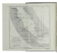
1967ABC_46470London: United Kingdom Hydrographic Office 1967. Grey-blue back wrapper; the two quires map and back wrapper held together by two metal staples. Blue cloth with title information in yellow on front cover and spine the supplement loosely inserted at the end of the volume. Large 8vo. The main work with 3 maps including 2 folding and 82 views of coastal profiles on 52 plates. The supplement with 2 folding maps on the two sides of a single folding leaf and 4 views of coastal profiles on 3 pages. With: NAVIGATION - RED SEA - PILOT GUIDE. Supplement No. 7 - 1977 to Red Sea and Gulf of Aden pilot eleventh edition 1967 corrected to 4th March 1977 Whenever reference is made to the pilot this supplement must be consulted.London United Kingdom Hydrographic Office 1977. The essential standard sailing directions for the Red Sea and Gulf of Aden corresponding with zone NP64 on the official Admiralty charts. These nautical works - pilot guides and charts - were published by the United Kingdom Hydrographic Office which provides the necessary hydrographic and marine geospatial data to all kinds of maritime organisations across the world. The publications are not only used by the British Royal Navy but can also be found on board the majority of international merchant ships. The data provided in the pilot guides and other publications are compliant with SOLAS the Safety of Life at Sea treaty guidelines and are updated constantly in weekly "Notices to mariners" and supplements to and new editions of the pilot guides whenever necessary.The present copy is the 11th edition 1967 of the pilot guide with sailing directions and other information on the weather currents radar ranges etc. relating to the Red Sea and Gulf of Aden including the supplement issued in 1977. The first two pages are printed on red-pink paper. Binding slightly rubbed and faded board edges very slightly soiled fore-edge of the supplement slightly frayed. Overall in good condition. United Kingdom Hydrographic Office, hardcover
1955K3CC18ANEAK3London: published by the Hydrographic Department Admiralty 1955. Original blue cloth with title on spine and front board; supplement with original printed paper wrappers. 8vo. With a folding map printed on both sides 2 coloured plates with diagrams printed on both sides 28 plates showing coastlines and occasionally a map many printed on both sides and many some illustrations in text. Including: Supplement no. 1-1957 relating to the Red Sea and Gulf of Aden pilot tenth edition . Tenth edition of a work "comprising sailing directions for the Suez canal the Gulf of Suez and the central track for power vessels through the Red sea Straits of Bab-al-Mandab and Gulf of Aden ." p. III and more areas. Besides navigation it deals with the climate weather and ocean streams of the area. The first chapter also gives and "general description of countries bordering the Red sea and Gulf of Aden" p. V. Including two copies of the supplement. Spine slightly discoloured otherwise in very good condition. published by the Hydrographic Department, Admiralty, hardcover
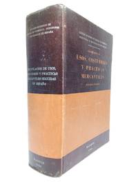
196448395Madrid: Consejo Superior de Cámaras de Comercio de España 1964.- 1391 p.; 4º 25 x 18 cm; Tela Ed.- RARO. HACIENDA DERECHO FISCAL MERCANTIL BOLSA BANCA SEGUROS. Libro en español Consejo Superior de Cámaras de Comercio de España hardcover
1995281400PN. New. 1995. Soft Cover. Date is original print. This is a reprint edition . PN paperback
199642091Alexandria VA: The Institute of Navigation 1996. First Edition. First Printing. good. 850 wraps illus. diagrams references index cover somewhat worn and soiled. The Institute of Navigation paperback
19397103Np: Matson Navigation Company 1939. 1st. Paperback. First Edition. Folio. Vol. 1 No. 1 - 4 Jan. 1941-June 1941 Complete. Each issue 14pp. Numerous photo-illustrations; ads. Original photo-illustrated wrappers. Minor soiling and wear to extremities; front cover of No. 2 partially separated; otherwise near fine. Four numbers issued during the 4 day voyage on the Matson Line cruise ship from California to Hawaii California-Hawaii-Samoa-Fiji-New Zealand-Australia. Each number features a special theme-the first Hawaii's History; the second Scenic Attractions; the third Island Sports and Recreation; and fourth Native Life and Folklore. Matson Navigation Company paperback
1989142622Pilot Guide TNL 7900: The TA 7900 Omega/VLF Navigation System Pilot's Manual by Trimble Navigation is a TrimbleNavigation spiral bound publication. The book was published in 1989. Both the spiralbound book and the covers are in good condition with only a few small marks. This copy would make a special addition to any collection or library. "An in-depth explanation that is filled with diagrams!" This is an exceptional book and read. You can buy with confidence we have been selling books for over 45 years. Thanks for buying. TrimbleNavigation
192659231Washington D.C.: Government Printing Office Hydrographic Office U.S. Navy 1926-1928. Two vols. 8vo. xxxii 4 788; ix 1 619 pp. With 5 large folding colour maps 2 double-sided. Uniformly bound in light-green publisher’s buckram gilt lettering stamped on front covers & spines slight uniform toning darkening to spines shelfwear still VG set w/ maps in bright condition. Third editions revised & expanded of these coast pilot guides to waters of the South Pacific Southeast Asia and Australasia encompassing New Zealand New Guinea the Gilbert Caroline Marshall Fiji Samoan Hawaiian New Hebrides and Indonesian Islands drawing upon British Royal Navy coast pilots Australian Southeast Asian Polynesian and U.S. Navy reports. Prior to modern GPS systems and satellite navigation these regularly updated and revised navigation handbooks provided key sailing instructions. The map outlines the available charts for the entire Pacific. Government Printing Office, Hydrographic Office, U.S. Navy, hardcover
1909782161909. P&O London. 1909. First Edtion. Paperback. All edges gilt. Frontis colour maps and flags. A very lovely clean and fresh copy that has not been filled in at all. paperback
191118041Portland Oregon: Oregon-Washington Railroad & Navigation Co. & Southern Pacific Lines. Good. 1911. First Edition. Softcover. Covers are soiled lightly worn. Some spots & staining inside. ; 12mo 7" - 7½" tall; 64 pages . Oregon-Washington Railroad & Navigation Co. & Southern Pacific Lines paperback
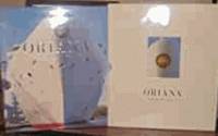
1995119301995. First edition. Hardcover. Near fine/Near fine. Near fine condition. Peninsular and Oriental Steam Navigation Company1995. First edition. Large format silver hardback silver lettering on the front cover and spine with Dj two small creases nicks and scratch on the edges of the Dj cover both in near fine condition with a slipcase small nicks dents and scratch on the edges of the slipcase front of the slipcase is slightly yellow and faded in VGC plus . Illustrated with many colourb/w photosdrawings. Nice and clean pages as new. Foreword by Lord Sterling including his printed signature.168pp including Oriana's facts and figures. Price un-clipped. Please note: This is oversized and heavy book approx. 1.6 Kg. hardcover
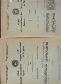
19734548Brussels Belgium: Permanent International Association of Navigation Congresses. Very Good. 1973. Softcover. Books are clean and tight some sunning on all books. Subject 1. Fixed or floating offshore structures in deep water. Spine bumped; Subject 2. Controlling littoral drift protecting beaches dunes etc. and artificial beaches. Corners shelf worn. Has supplement laid in; Subject 3. Structures in maritime access channels for large vessels. Corners and spine bumped. Has supplement laid in; Subject 5. Arrangement of navigable waterways for recreation and preservation of environment. Corners and spine bumped. Has supplement laid in; Subject 6. Consequences of the rapid evolution of transport techniques by specialized vessels. Has fold out table. Has supplement laid in. Spine bumped.; 10.63 X 7.64 X 1.26 inches . Permanent International Association of Navigation Congresses paperback
192259239Washington D.C.: Government Printing Office Hydrographic Office U.S. Navy 1922; 1930. Two vols. 8vo. v 1 4 397 1 pp.; 1 60 2 leaves. With 1 large folding colour map. 1st vol. in green publisher’s buckram gilt lettering stamped on front cover & spine darkening to spine shelfwear minor scuffing; 2nd vol. Supplement in self-printed softcovers toning chipping & tears to fore-edges minor creasing to corner still VG- set. Third edition stated of vol. I 1st edition of Supplement vol. of these surprisingly scarce coast pilot guides detailing the sailing directions for the treacherous coasts of Great Britain France Belgium Netherlands German & Denmark notoriously treacherous for sailing and powered vessels. Prior to modern GPS systems and satellite navigation these regularly updated and revised navigation handbooks provided key sailing instructions drawing upon British French German Dutch & Danish sailing directions and charts. Worldcat locates no copies of the Supplement. Government Printing Office, Hydrographic Office, U.S. Navy, paperback
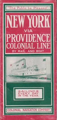
191521548New York: Colonial Navigation Company. 1915. Softcover. Very Good-. One page separated and with staple binding weakening.; A stapled illustrated brochure promoting the steam ships Concord and Lexington as well as the; Oblong 8vo 8" to 9" tall; 12 pages . Colonial Navigation Company paperback
1994ZB650970The Institute 1994. volumes 19-40 lacking volume 25 and volume 34#1 else an uninterrupted run of complete volumes partly bound minor library markings else text clean & bindings tight PRICE IS FOR THE LOT. - If you are reading this this item is actually physically in our stock and ready for shipment once ordered. We are not bookjackers. Buyer is responsible for any additional duties taxes or fees required by recipient's country. Photos available upon request. The Institute unknown
19822111902154600035Kaibundo shuppan 1982. Soft Cover. Fine. The book is in fine condition. Kaibundo shuppan paperback
19692092902137404777Kaibundo 1969. Soft Cover. Fine. Number of books: 1 book Kaibundo paperback
19612092902141103263Kaibundo 1961. Soft Cover. Fine. Volume: 1 Kaibundo paperback
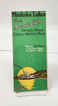
1941160265Gravenhurst Ont.: Press of Hugh C. MacLean Productions 1941. Very good. 24 cm flyer has b&w photos route charts boat info general info partial-colour map of area. Tear in horizontal fold and small holes in crease intersections. <br/><br/>"A Day of Interest of ever Changing Scenes of Enjoyment. Reached 180 Minutes or less from Toronto by Train or Motor." Press of Hugh C. MacLean Productions unknown
194539135Chatham: Shepherd Printing n. d. ca 1945. 1945. CANADA. 18" x 24" sheet one side opens to a half-sheet color map and numerous advertisements for lodging including the Joe Gawa Hotel one of Ontario's newest and finest hotels. The other side has 12 panels of promotional text regarding the various cruise packages of the beautiful Muskoka Lakes time tables and schedules and views of the inland waterways steamships R. M. S. Sagamo and the R. M. S. Cherokee. Some minor to light wear to the folds else a very good copy. Shepherd Printing, n. d. (ca 1945). unknown
19477378Milwaukee: Kalmbach Publishing Co 1947. Paperback. Oblong small 4to. Stiff pictorial wrappers plastic spiral binding. Ca. 22pp rectos only. Very good. Ownership name/city inkstamped inside front wrapper. First edition tight and clean and with plastic spiral binding intact. Number 1 in the "Ships and Sailing Albums" series. Housed in a modern heavy-duty clear mylar sleeve for protection. Kalmbach Publishing Co paperback
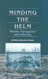
1994G030904829XI5N01Natl Academy Pr 1994. Hardcover. Acceptable. Missing dust jacket; Readable copy. Pages may have considerable notes/highlighting. ~ ThriftBooks: Read More Spend Less.Dust jacket quality is not guaranteed. Natl Academy Pr hardcover
1994SONG030904829XNatl Academy Pr 1994-01-01. hardcover. Used: Good. 6.50x1.50x9.25. Buy with confidence. Excellent Customer Service & Return policy. Natl Academy Pr hardcover
195540503City Not Stated: Peninsular & Oriental Steam Navigation Company P & O 1955. Each card: Folded small octavo 14 x 21 cm very good condition colour drawing front cover corner tips some cards little scuffed card 1 is slightly shorter at the top presumed as issued no text missing minor edgewear. Each card: 4 pp. A set of 11 of 12 in set menu cards designed by the artist Strom Gould. Card No. 1 Red-Crowned Pigeon & Purple-Crowned Pigeon. Card No 2 Fairy Wrens. Card No. 3 Gouldian Finch. Card No. 4 Pink Cockatoo. Card No. 5 Count Raggi's Bird Of Paradise. Card No. 6 Rainbow Bird. Card No. 7 Regent Bower-Bird. Card No. 8 Scarlet Honey-Eater. Card No. 9 Red-Capped Robin. Card No. 10 Laughing Kookaburra. Card No. 11 Rainbow Lorikeet Red-Winged Parrakeet & Green Leek Parrakeet. MISSING: Card No. 12 Kingfisher. The artist also known as Charles Sidebotham Gould was born in Letchworth England on 2/8/1910 and came to Australia in 1937. He was employed as the Sydney Morning Herald's first art director and he also drew its first comic strip in 1944. He died in 1992. No date but about 1955. Peninsular & Oriental Steam Navigation Company (P & O) unknown
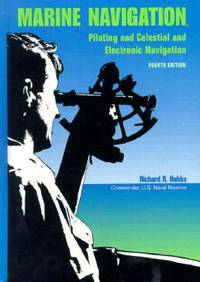
1990BN151395U S Naval Inst Pr 1990. 1990. Marine Navigation: Piloting and Celestial and Electronic Nagivation <br/><br/>Marine Navigation: Piloting and Celestial and Electronic Nagivation Marine Navigation - Hobbs Richard R. U S Naval Inst Pr unknown