Livre Rare Book
Antiquariat.de
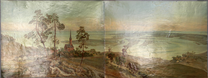
Das Stettiner Haff.
1880287DGo.J. (um 1880). Farbige Lithographie Bildformat: 158 x 60 cm. + Wichtig: Für unsere Kunden in der EU erfolgt der Versand alle 14 Tage verzollt ab Deutschland / Postbank-Konto in Deutschland vorhanden +, 287D-Gr

EOS Buchantiquariat Benz · CH - Zürich400,00 €