COOK (James), [HAWKESWORTH (John)].Livre Rare Book
1 884 résultats
178542677Paris, Hôtel de Thou, 1785. Ensemble de 18 vol. in-8 et 3 vol. d'atlas in-4 de 52-67-88 planches, demi-veau havane, dos lisse orné de filets dorés, pièces de titre et de tomaison en veau vert (reliure de l'époque).
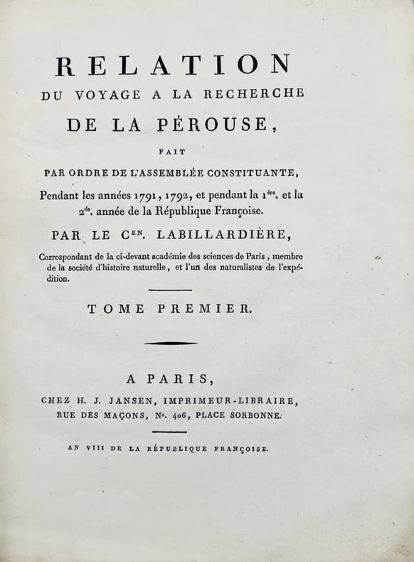
179842678A Paris, de l'Imprimerie de la République, 1798-1800. 5 vol. in-8 de (4)-VIII-(2)-CCI-(3)-294-(2) pp. ; VII-529 (1) pp., 3 tableaux dépliants ; (2)-VIII-474-(2) pp., 8 tableaux dépliants ; VIII-494-(2) pp.; XII-559-(4) pp. et 1 atlas in-folio de (2)-VIII-158-(2)- pp., 16 cartes dépliantes, basane racinée, dos lisse orné, pièces de titre et de tomaison en veau noir, tranches marbrées (reliure de l'époque).
In-4°, due volumi, XIV, 463pp; (2cc), 514pp; prima edizione originale senza le 7 carte pieghevoli della seconda edizione, pubblicata lo stesso anno. Legatura coeva in vitello francese marmorizzato, tagli rossi, con nervi e titolo in oro al dorso. Uno dei rari esemplari comprendenti le 7 carte supplementari nel secondo volume (437*-450*) intitolate Scoperte degli Olandesi nell’Australasia. Si tratta di uno delle più importanti opere consacrate alle prime spedizioni nel Pacifico del Sud. “Il suo studio fa epoca nella conoscenza dell’Oceania(...). De Brosses, raccogliendo tutti i testi conosciuti dai viaggiatori, chiama a raccolta tutti gli studiosi e aiutò a creare un clima favorevole alle esplorazioni scientifiche e alle installazioni coloniali” (O’Reilly 93). Si tratta di una raccolta di narrazioni della maggioranza dei più famosi viaggiatori nei Mari del Sud, cominciando dal secondo viaggio di Vespucci nel 1502 fino ai viaggi di Magellano, Drake, Schouten, Tasman, etc. (Pézennes, France). “Questa è un’opera estremamente importante e completa sui viaggi, e un’opera eccezionale sulla preistoria dell’Australasia (Hill, p.35). Sabin, 8388. In-4°, two volumes, XIV, 463pp; (2cc), 514; first original edition without the 7 folding cards of the second edition, published the same year. Contemporary fine French marbled calf binding, red edges with bands and golden title on the spine. One of the rare copies including the 7 additional leaves in the second volume (437 *-450 *) entitled Discoveries of the Dutch in Australasia. It is one of the most important works devoted to the first expeditions to the South Pacific. "His study made an epoch in the knowledge of Oceania (...). De Brosses, gathering all the texts known by travelers, summons all the scholars and helped to create a climate favourable to scientific explorations and colonial installations "(O'Reilly 93). It is a collection of narratives of the majority of the most famous travelers in the South Seas, starting from the second voyage of Vespucci in 1502 up to the journeys of Magellan, Drake, Schouten, Tasman, etc. (Pézennes, France). "This is an extremely important and complete work on travel, and an exceptional work on the early history of Australasia (Hill, p.35). Sabin, 8388.
180043698Paris, H.-J. Jansen, 1800 (an VIII). 2 vol. in-4 de XVI-442 pp. et 332-113 pp. pour les deux volumes de texte, et 1 atlas in-folio de 1 titre, 43 planches gravées hors texte et 1 grande carte dépliante, demi-basane verte, dos lisses ornés, entièrement non rogné, couvertures muettes conservées, l'atlas est en demi-veau à coins.
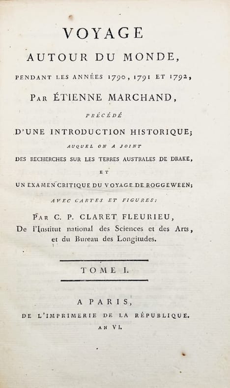
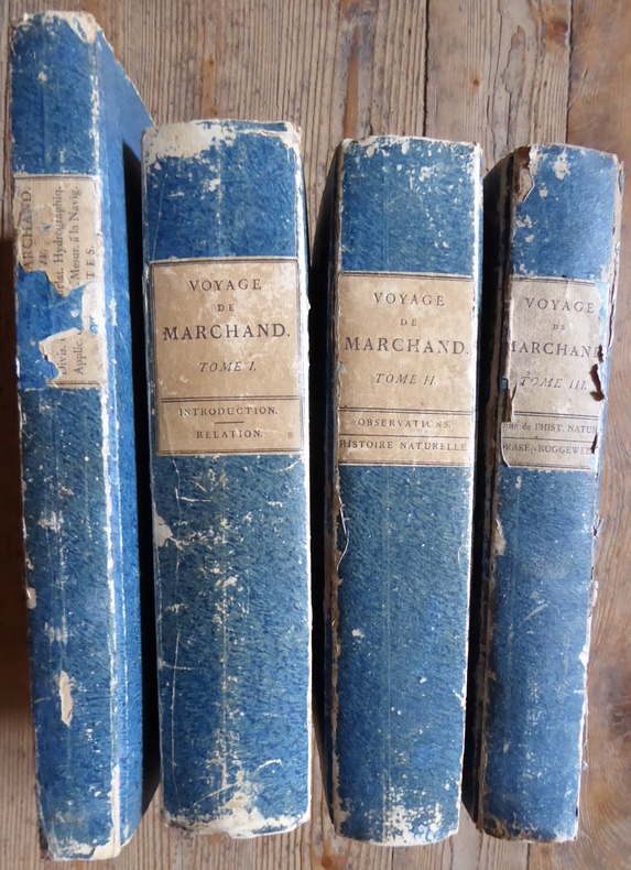
17982500Edition originale du récit de la deuxième CIRCUMNAVIGATION FRANÇAISE, la première expédition commerciale française dans le nord ouest du Pacifique, dans le très rare tirage in-quarto paru entre 1798 et 1800. Le présent ouvrage est extrêment important pour l’histoire des découvertes dans le Nord-Ouest du Pacifique et notamment des îles Marquises. 3 volumes de texte de format 20 x 30 cm (632, 678 et 434 pages) et 1 volume de format comprenant de texte et 16 planches gravées dont 15 dépliantes ( 15 cartes et 1 figure ) Cartonnages d'attente de l'époque aux plats frottés. Le volume 3 de texte présente de fortes mouillures sur les 10 premières pages et sur le premier plat à Paris, Imprimerie de la République An VI à An VIII Le but principal de cette circumnavigation était avant tout commercial : il s’agissait de la traite de fourrures de loutres de mer entre la côte Nord-Ouest de l’Amérique et la Chine. Dirigée par le navigateur français Etienne Marchand (1755-1793), l’expédition quitta Marseille à bord du Solide, un navire de 23 mètres de long (construit grâce aux frères Baux) en décembre 1790. Accompagné d’un équipage de 50 hommes, de ses Seconds Pierre Masse et Pierre Chanal ainsi que du chirurgien Claude Roblet, Marchand décide de contourner le continent sud-américain par le Cap Horn sans s’y arrêter, son but étant de se diriger vers les Iles Marquises dont la position est connue grâce au 2ème voyage de Cook (1774). Ayant atteint l’archipel en juin 1791, il en repart quelques jours plus tard, non sans avoir auparavant commercé avec les Marquisiens.Remontant vers le Nord, il «découvre» d’autres îles (au nord des Marquises) ne figurant sur aucune carte. Il décide d’en prendre possession au nom du Roi Louis XVI, et après leur avoir donné un nom à chacune, baptise l’ensemble Iles de la Révolution. Explorant la région tout en commerçant avec les Amérindiens, il poursuit sa route vers la Chine,traversant le Pacifique en 11 semaines seulement. Mais arrivé à Macao, il découvre qu’un accord a été conclu entre la Tsarine Catherine II et l’Empereur de Chine, donnant l’exclusivité aux Russes pour l’importation des fourrures. Marchand décide donc de rentrer en France avec sa marchandise. Après une escale à l’Ile de France pour réparations, il repart vers la France où il arrive en pleine Terreur. Malgré la confiscation des peaux, Marchand est reçu avec les honneurs. Il se retire à l’Ile Bourbon où il serait mort en 1793. Echec d’un point de vue financier, l’expédition fut cependant une réussite d’un point de vue géographique (connaissances géographiques accrues des Iles Marquises et de la côte nord-ouest des Amériques - cartographie plus précise de certaines îles) et scientifique (précieux renseignements sur la vie des Polynésiens et Amérindiens de l’époque grâce aux carnets de voyage de Chanal et Roblet). Charles Pierre Claret de Fleurieu (hydrographe français 1738-1810) édita le voyage en 1798 à l’aide des journaux de bord des Seconds Chanal et Roblet, y ajoutant ses propres commentaires.
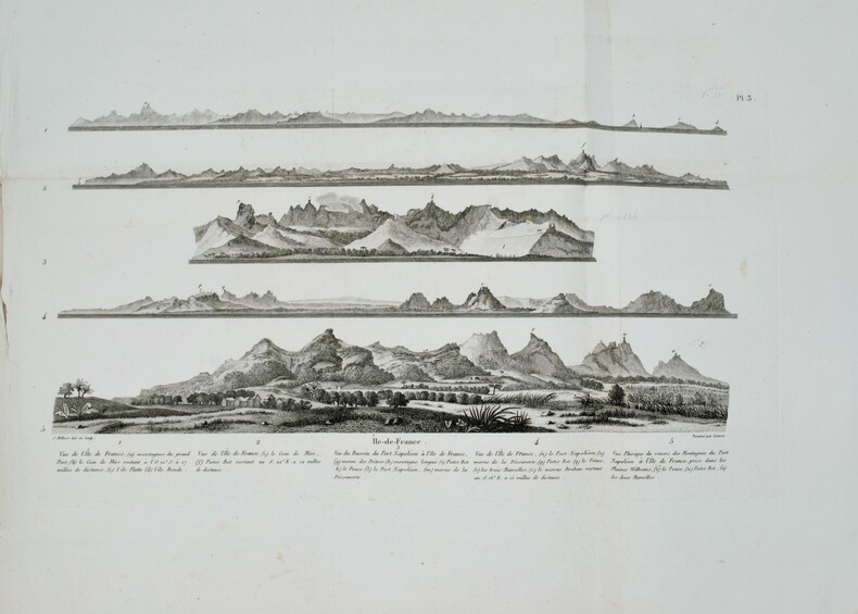
1812PHO-1228Paris, A. Nepveu, 1812. 2 volumes de texte in-8 (210x130), veau havane marbré, dos lisse orné, pièces de titre et de tomaison de maroquin rouge et tabac, roulette encadrant les plats, tranches mouchetées (reliure de l'époque) ,une coiffe usée, et un atlas in-folio oblong (420x280), demi-veau vert, dos lisse fileté or (reliure de l'époque) ,plats et dos frottés avec manques aux coins , début de fente . Première édition, illustrée de 3 tableaux dont 2 dépliants. L'atlas comprend 45 planches et cartes, dessinées et gravées la plupart par l'auteur ,certaines terminées par Coube, Hulk, Gossard ou Perdoux, (carte de l'île de France, vue de la ville du Port Napoléon, vue du Cap de Bonne-Espérance, etc.). L'ouvrage traite de l'histoire de l'île Maurice, de sa population et de son administration, de géologie et de sciences naturelles. Bon exemplaire. Mouillure très claire marginale à quelques planches, déchirure sans manque à la dernière avec réparation .
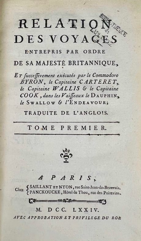
In-8 gr. (mm. 248x188), 4 volumi, elegante legatura in p. pelle bazana coeva (picc. spacchi alle cerniere), dorso a cordoni con ricche decorazioni e tit. oro su due tasselli, sottili cornici dorate ai piatti, tagli marmorizzati, pp. (4),IV,XVI,(2),XXXII,388; (8),536; (8),394,(2); (4),VIII,367; illustrati f.t., come da Indice, da 52 tavole inc. in rame di cui 30 carte geografiche, più volte ripieg., e 22 magnifiche tavole (anche a doppia pag.) che raffigurano usi e costumi degli indigeni, paesaggi, flora e fauna, scene storiche, tutte molto ben conservate. L’opera, tradotta dall’inglese, è così suddivisa: 1° vol. “Relation d’un voyage fait autour du monde, dans les années 1764, 1765 et 1766, par le Commodore Byron, Commandant le vaisseau du Roi le ‘Dauphin’ (segue) Voyage.. dans les années 1766, 1767, 1768 et 1769, par Philippe Carteret, Ecuyer, Commandant du ‘Swallow Sloup’ de Sa Majesté Britannique” - 2° vol. “Voyage.. dans les années 1766, 1767 et 1768, par Samuel Wallis, Commandant le vaisseau du Roi ‘le Dauphin’ (segue) Voyage.. dans les années 1769, 1770 et 1771, par le Lieutenant Jacques Cook, Commandant le vaisseau du Roi ‘l’Endeavour’” - 3° et 4° volumi “continuation et fin du ‘Voyage du Capitaine Cook”. "Prima edizione della versione francese". Cfr. The Hill Collection of Pacific Voyages (2004),782, per la prima ediz. inglese del 1773: “Important collection chronicling English maritime expeditions. John Byron visited the Tuamoto Islands and Nikunau in what would later be called the Gilbert Islands. Captain Wallis discovered the volcanic island of Tahiti and Morea.. Captain Carteret discovered Pitcairn Island and some remote atolls in the South Seas. The first voyage under the not-yet-famous Captain Cook’s command was primarly of a scientific nature. The expedition was to sail to Tahiti in order to observe the transit of Venus across the disk of the sun, to determine the earth’s distance from the sun, and also to carry on the geographical discovery that John Byron had started. Entering the Pacific around Cape Horn, Cook reached Tahiti in 1769 and carried out the necessary astronomical observations.. Leaving Tahiti in July, Cook discovered, named and charted the Society Islands, and then, heading southwest, explored New Zealand. Cook then headed towards Australia and discovered and charted the eastern coast for 2.000 miles, naming the area New South Wales. He nearly lost his ship on the Great Barrier Reef. Both Australia and New Zealand were annexed by Britain as a result of this voyage, which began in 1768 and ended in 1771. Cook’s discoveries won him prominence, promotion, and the opportunity to sail again. They also ensured J. Hawkesworth’s position in maritime literary history, as the official chronicler of Cook’s first voyage”. Pagine ingiallite per la qualità della carta, altrimenti esemplare ben conservato.
1755ABC_474521755. Manuscript of 24 pages 6 printed maps on cardboard. This wonderful logbook details the journey of a French captain from Manila to the Maluku Islands in todays Indonesia. The journey took place during the months of March to May of 1755. The captain of the ship recounted with great detail the events of every day of the journey with detailed daily accounts of the weather winds manoeuvres of the ship its departures anchorages and precise coordinates at every point of the journey. The captain furthermore had a keen eye for the geographical and nautical details along the journey. He recounted the exact locations of for example sandbanks and bays where ships and their crews can take provisions and fresh water. The accounts are detailed and captivating: "After our boats were back on board we set sail . in the afternoon to moor under the old Portuguese fort on the Solor island Indonesia the winds for the tide were fresh at 1:34 a.m. . sand and gravel and then I went back to mooring. The pavilion of the fort . the village is under the said fort at 3 cables from us .". The captain goes on to describe the geographical features of the islands as well as other places en route with great detail. Curiously we find inscriptions in Spanish and the names of one don Phelipe Qui who describes himself as el piloto and one Padre Don Estevan de Melo. The latter might be identical with Don Estevan Roxas y Melo a native of Lima Peru and secretary to the Archbishop of Manila Rodriguez since 1736. Roxas y Melo was part of the 1751 reconstruction of the Cathedral of Manila working under the auspice of the Italian architect Juan de Uguccioni.The logbook comes with six printed maps partly illustrating the journey of the captain pasted on contemporary cardboard. They depict the Bay of Sulavesi with the city of Bantang Pitcairn the coast of New Guinea the coast of Queensland the Santa Cruz Islands in the present-day Solomon Islands and Alejandro Selkirk Island. The plates stem from the French translation of James Hawkesworths An Account of the Voyages Hawkesworth Relation des voyages entrepris par ordre de sa Majesté Britannique actuellement regnante; pour faire des découvertes dans l'hemisphère meridional Paris 1774.Some holes on the first sheet not affecting the text. Small water damage some slighlty affecting the text. Remnants of seals on last page. Otherwise in good condition. unknown
177615746Ruault Paris 1776 1 vol. In-4 de XII 2 ff.n.ch. 206 pp. 1 f.n.ch., veau glacé porphyre de l'époque, dos à nerfs orné, pièce de titre de maroquin vert, triple filet doré en encadrement sur les plats, coupes filetées, tranches marbrées.
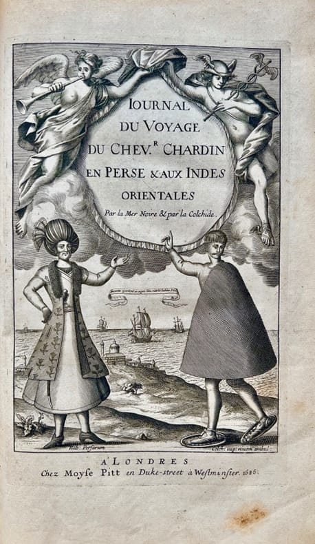
168642700Londres, Moses Pitt, 1686. In-folio de (10)-349-(5) pp., veau havane marbré, dos orné à nerfs, pièce de titre en maroquin rouge, tranches rouges (reliure de l'époque).
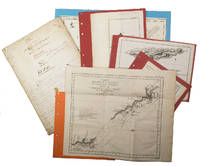
ORD-19801Paris. (Imprimerie Nationale, ca 1885-1892). 1 volume in-4 (250 x 308 mm) cartonnage dos et coins toile ocre jaune, plats marbrés, gardes satinées. Exemplaire sans page de titre contenant 61 planches, fac-similés de cartes et plans anciens, montés sur onglets soit 6 à double page dont 4 en couleurs, 15 simples en couleurs et 40 en noir et blanc. (Chadenat 4890, seule référence que j'ai pu trouver en donne 67). Dos et coins épidermés, mors intérieur faible, rares rousseurs, planches en excellent état. Ouvrage de toute rareté.
17788670Paris, de l'Imprimerie Royale, 1778. 2 volumes in-4 de [4]-389-[1]-XIX-[3]; [8]-500-XXXII pages, plein veau marbré brun, dos à nerfs ornés de filets et fleurons dorés, pièces de titre en maroquin rouge, tranches mouchetées, petits accrocs aux coiffes supérieures, épidermures, coupes et coins frottés, tampon sur les pages de titre, quelques pâles rousseurs.
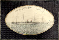
18972210164<p><i>Comprising two coloured map board 66 x 99 cm folding down to 32.5 x 49.5 cm one cloth hinge broken; 14 route cards; a barometer dial 19 x 19 cm with gilt metal spinning arrow some abrading from use; eight painted white metal playing pieces in the form of ships contained in the original small box one piece not original; 16pp booklet of instructions bound in original light green printed wrappers; all contained in the original box 35 x 52 x 5 cm; the hinged lid with a large coloured lithograph title label showing the 'Normandie' leaving port at full steam some minor abrasions but overall in good condition.</i><br /></p><p><i>Jue des Paquebots</i> was something new to games when it was published in 1897 as each player moves their boats on large maps exactly replicating the routes taken by two major French shipping lines. </p><p>The game includes two large folding boards designated 'Carte A' which illustrates the Atlantic shipping lines the other 'Carte B' with the shipping lines leaving Marseilles in the direction of the Black Sea the Indian Ocean and the Pacific. Rather pointedly the instructions state that the two maps include only the French shipping lines of the Messageries Maritimes and the Cie Générale Transatlantique the United Kingdom then the leading maritime nation is neither shown on the maps nor mentioned. </p><p>The players first decide which map they are going use and then select or bid one of the Itinerary cards 8 for map A and 6 for map B. The aim of each player is to complete the journey indicated by their itinerary and then make the return voyage; the first player to complete this double crossing wins. However the number of stopovers is not equal for each different itinerary in play. In order to equalise the chances of winning the players with the fewer ports of call have to repeat their journey a second or even a third time if necessary until the number of ports visited or passed by them in these different routes equates to the number of ports of the busiest route.</p><p>The routes all follow those which the two major French shipping companies plied. These include final destinations at Yokohama Australia New Zealand Zanzibar Odessa Buenos Ayres New York and the Antilles. </p><p>Each player places a ship playing piece at port at the beginning of their route. The first player now spins the Barometer Dial which has outer and inner instructions that allows them to advance out of port when their turn come around again the arrow is again spun and the player can read the inner line of instructions and so advance 1 2 or 3 ports along their route. However there are also stops on the Barometer Dial that include Damage - where you go back to the previous port and pay a token to the bank; Heavy Fog - where you are left stranded until the next round; Collision - this allows another turn of the dial but it the result is 50/50 chance of being sunk and thrown out of the game - you can pay for another ships so all is not lost; Call for Distress - also misses a turn; Shipwreck - something like collision although you can start out again with a new ship and no fine; Rescue - also causes the player to miss a turn; lastly and somewhat topical there is Quarantine - here the player misses a turn and also has a second spin of the arrow to determine if you can go into port or not.</p><p>The lid of the box illustrates the Cie Général Transatlantique liner La Normandie that plied the North Atlantic to New York in the summer and the south Atlantic in the winter - the ship sports a US flag on the foremast and the makers initials on the aft mast. Built in 1886 it was the largest and fastest liner of the company and was originally named 'Ville de New York.' It was also lit by electricity and could carry 1000 passengers and became the model for several sister ships built to the same plan.</p><p>The maker Charles Watilliaux succeeded the games manufacturer Coqueret in 1874 and for the next 35 years became a major publisher and manufacturer of board games and toys until their acquisition by Revenaz & Tabernat. His registered initials were 'W.X.' which is slightly modified for the flag on the box lid as C.W.X.</p> Watilliaux, éditeur.
Very Good Turkish, Ottoman (1500-1928) Original handsome brown quarter leather binding with Ottoman lettered gilt to spine. Five raised bands to spine, separated from each other with lined gilt. Slight stains on the title page. Else a fine copy. Roy. 8vo. (23 x 16 cm). In Ottoman script (Old Turkish with Arabic letters). 99 p. Hegira: 1313 = Gregorian: 1895. Extremely rare first printed edition of this one of the earliest travel accounts, of an Ottoman admiral's early expeditions to the Indian Ocean, Arabian Sea, Red Sea, and Persian Gulf to counter Portuguese piracy and attacks on Muslim pilgrim ships, which describes the lands he has seen during his voyage from India to Constantinople by Sidi (Seydi) Ali Reis (1498-1563) sent by Sultan Suleiman the Magnificent covering the years 1553-1556. During these naval wars, after two marine battles against the Portuguese fleet and a great storm named The Elephant Typhoon (Tufan-i Fil) by the locals, Reis' remaining six galleys drifted to India. The fleet was unserviceable, resulting in his return home overland with 50 men. Reis then arrived at the royal court of the Mughal Emperor Humayun in Delhi, where he met the future Mughal emperor Akbar, who was twelve years old at the time. He returned to the Ottoman Land over Muslim states in South Asia; Afghanistan, Central Asia, and Iran. But he delayed his return because of the war between the Ottoman and the Safavid Empires in Iran. Finally, following the treaty of Amasya in 1555, he was able to return home and present his book of this narrative journey to the Sultan in 1557. This work offers an extensive insight into the Muslim situation in 16th century South and Central Asia and the Middle East, Islamic navigation, and Turkish - Portuguese relations as well as Persian, Afghan, and Indian geography, naval routes, flora, and fauna. Seydi Ali Reis, formerly also written Sidi Ali Reis and Sidi Ali Ben Hossein, was an Ottoman admiral and navigator. Known also as Katib-i Rumi, Galatali, or Sidi Ali Çelebi, he commanded the left wing of the Ottoman fleet at the naval Battle of Preveza in 1538. He was later promoted to the rank of fleet admiral of the Ottoman fleet in the Indian Ocean, and as such, encountered the Portuguese forces based in the Indian city of Goa on several occasions in 1554. Seydi was able to unite several Muslim countries on the coast of the Arabian Sea (such as the Makran Kingdom, Gujarat Sultanate, and Adal Sultanate) against the Portuguese. He is famous today for his books of travel such as the Mir'ât ül Memâlik [i.e. The Mirror of Countries], and his books of navigation and astronomy, such as the Mir'ât-i Kâinât (Mirror of the Universe) and the Kitâb ül Muhit: El Muhit fî Ilmi'l Eflâk ve'l Buhûr [i.e. Book of the Regional Seas and the Science of Astronomy and Navigation] which contain information on navigation techniques, methods of determining direction, calculating time, using the compass, information on stars, sun and moon calendars, wind and sea currents, as well as portolan information regarding the ports, harbours, coastal settlements and islands in the various regions of the Ottoman Empire. His books are translated into numerous languages including English, French, Italian, German, Greek, Arabic, Persian, Urdu, Russian, and Bengali, and are considered among the finest literary works dating from the Ottoman period. "When Sultan Suleiman had taken up his winter residence in Aleppo, I, the author of these pages, was appointed to the Admiralship of the Egyptian fleet and received instructions to fetch back to Egypt the ships (15 galleys), which some time ago had been sent to Basrah on the Persian Gulf. But, 'Man proposes, God disposes.' I was unable to carry out my mission, and as I realized the impossibility of returning by water, I resolved to go back to Turkey by the overland route, accompanied by a few tried and faithful Egyptian soldiers. I traveled through Gujarat, Hind, Sind, Balkh, Zabulistan, Bedakhshan, Khotlan, Turan, and Iran
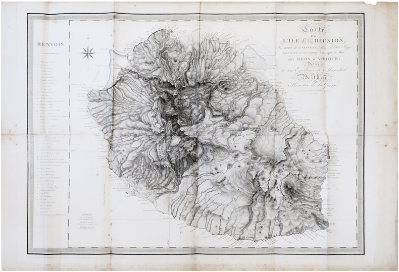
1804LBW-7306[Paris, F. Buisson, an XIII-1804]. 598 x 840 mm.
1812PHO-1644Paris, A. Nepveu, 1812. Atlas in-folio oblong (420x280), pleine toile moderne, auteur et titre au dos, rousseurs, cachet de librairie, petite mouillure en début d’ouvrage, déchirures sur 2 planches en marge sans manque. Première édition, l'atlas comprend 45 planches et cartes, dessinées et gravées la plupart par l'auteur, certaines terminées par Coube, Hulk, Gossard ou Perdoux, (vue de la ville du Port Napoléon, vue du Cap de Bonne-Espérance, etc.). L'ouvrage traite de l'histoire de l'île Maurice, de sa population et de son administration, de géologie et de sciences naturelles.
Very Good Turkish, Ottoman (1500-1928) Full morocco in Ottoman style. Large roy. 8vo. (25 x 18 cm). In Ottoman script (Old Turkish with Arabic letters). 62 p., 18 unnumbered b/w photos, and four b/w maps. Slight foxing on extremities. Otherwise a very good copy. First and only edition of this exceedingly rare first book on Muslims and Islam in the Comoro Islands of Africa, located in the Mozambique Channel to the north-west of Madagascar and facing Mozambique, including Ngazidja (Grande Comore), Ndzuwani (Anjouan), Mwali (Moheli) and Mayotte (Maore) Islands. The book gives detailed information about the races, customs, and traditions of the natives of the archipelago, the introduction of Islam to the islands, and how influential it was on the people as well as on their education, social structure and the population of the archipelago. The work carried out in the context of missionary activities is also discussed in detail, and such information is supported by photographs, statistical tables and chronology of the islands. According to the information given in the work, Muslims first came to Yuhana Island in 750 AD and began to settle on the island. Since 854, there are claims that the Ismailis, a Shiite community, and then the Fatimid prince came to the islands and ruled for a period. Especially Arabs, Iranians, and Indians, who came and settled on the islands mostly for trade or travel, introduced Islam to the islands' natives, strengthened their ties with marriages and thus increased the population and influence on the islands and became instrumental in the establishment of Islam. Okday also describes the process of French exploitation that started when Comoros fell into the hands of the French, each of whom was under the control of the Malagasy despite England and Germany, and got the support of their pirates. This book has rich and attractive photos of natives of the archipelago, and other peoples who lived on the islands like Arabs, traditional homes and streets, Sultan Ahmad of the Comodo, statesmen and clergies, Prince Said Mohammad, women, and a French ship named 'La Bourdonnaise' as well as four maps showing the African continent and each of the islands. Ismail Hakki Tevfik Okday was an Ottoman intellectual and military commander, who participated in the First Balkan War, the Great War, and the Turkish War of Independence. He was born in Athens as the son of Ahmet Tevfik Pasha, who was then the Ottoman Ambassador to Greece, and later became the last Grand Vizier of the Ottoman Empire. Only two printed copies in OCLC: 949523840 (Bogaziçi University and Stanford University Libraries).; Özege 131.
1837PHO-2280Paris, Arthus Bertrand, 1837, 2 volumes (3) grand in-4° (30x24,5cm), VIII pp., 742 pp., demi chagrin et coins époque, dos lisse avec auteur, titre et tomaison, frottements au dos, quelques rousseurs, défaut à la coiffe supérieure. Édition originale du texte du voyage du Bougainville autour du monde, manque l’atlas.
In-8 gr. (mm. 255 x 165), 5 volumi, tela editoriale, ricca decoraz. a secco ai piatti e al dorso (2 volumi restaur. per piccole manc. ai bordi), pp. LX,434; XVI,476; XVI,438; XVI,540; XVI,558; molto ben illustrati da numerose figg. inc. su legno nel testo e da 63 (su 64) belle tavole inc. su acciaio fuori testo: sono vedute, ritratti di indigeni, loro abitazioni e cerimonie; unite 13 cartine geografiche piu' volte ripieg. Resoconto di una importante missione scientifica di esplorazione, diretta dall'ufficiale di marina americano Charles Wilkes (1798-1877). Durante il lungo viaggio vennero visitati vari arcipelaghi del Sud Pacifico, toccata l'Australia, scoperte le coste dell'Antartico oggi chiamate "Wilkes Land" e percorse le isole Fidji, Hawaii e la costa nord-ovest degli Stati Uniti; ritornata fino al Borneo via Filippine, la spedizione fece definitivo rientro attraverso la Polinesia e il Capo di Buona Speranza. Esemplare uniformemente arrossato e con fioriture ma complessivamente in buono stato.
200877505Harry N. Abrams Distribution. New. 2008. Paperback. 1905711123 . FREE UPGRADE to Courier/Priority Shipping Upon Request - IN STOCK AND IMMEDIATELY AVAILABLE FOR SHIPMENT - Flawless copy brand new pristine never opened -- Text in English. 192 pp. With 218 ills. 211 col. . 24 x 20 cm. -- with a bonus offer-- . Harry N. Abrams (Distribution) paperback
177744433Amsterdam, et se trouve à Paris, chez Pissot, Nyon, 1777. In-8 de (4)-XIX-(1)-546 pp., veau havane marbré, dos orné à nerfs, pièce de titre en maroquin rouge, tranches rouges (reliure de l'époque).
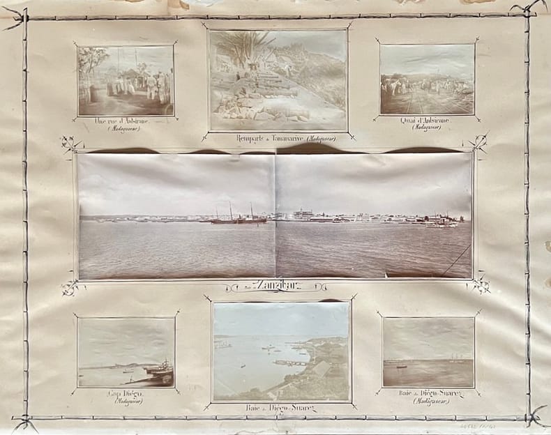
190144542, , 1901. 50 photographies en tirage original d'époque de formats divers (de 6 x 5 à 17 x 11 cm environ), disposées et contrecollées sur 4 planches ornées et légendées à la plume (63,5 x 49,5 cm).
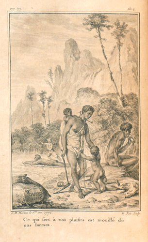
17730034671773 Amsterdam, et se trouve à Paris, Chez Merlin, 1773. Deux volumes in-8 (134 X 205 mm) veau fauve marbré, encadrement de filet à froid sur les plats, dos cinq nerfs, caissons dorés avec fleuron central, large dentelle en queue et tête, coupes et coiffes ornées, pièces de titre et de tomaison maroquin rouge, tranches rouges (reliure de l'époque). Tome I : (1) f. blanc, faux-titre, frontispice, titre, 328 pages, 3 planches et 4 tableaux dépliants, (1) f. blanc ; Tome II : faux-titre, titre, 278 pages, 2 planches, (1) f. blanc. Notice ancienne collée sur le premier contreplat du tome I. Les planches de Moreau sont brunies.
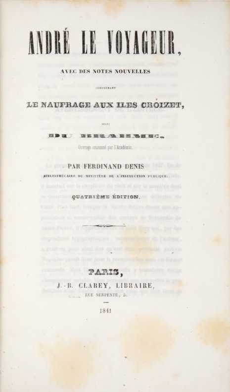
184139808Paris, Clarey, 1841. In-8 de (4)-III-259 pp. maroquin vert, dos orné à nerfs, triple filet doré d’encadrement sur les plats, dentelle intérieure dorée, tranches dorées sur marbrure, non rogné (Brany).
104239De l'Imprimerie Didot Jeune, An X (1801-1802), 5 volumes +1atlas in-8 de 220x140 mm environ, viij-341 pages - 384 pp., - 381 pp., - 368 pp.,- 438 pp., dernier volume-atlas contenant 17 vues sous serpentes et 9 cartes dont 8 dépliantes, cartonnage de l'éditeur portant titres et tomaisons dorés sur le dos. Feuillets non rognés. Dos insolés, frottements sur les coins et coiffes, petits défauts de marge sur quelques pages sans atteinte au texte, sinon bon état.