11 résultats
177521546Paris 1775. Very good condition. Detailed copper engraved map of Juan Fernandes islands in the South Pacific off the coast of Chile. The islands were the home of Alexander Selkirk a sailor marooned there in the early 1700s an event which may have served as the inspiration for 'Robinson Crusoe'. Selkirk was put off his vessel by a British captain and partner with Capt. William Dampier on a buccaneering expedition in search of Spanish vessels carrying gold. With an inset view of the northeast coast of the island at the top of the map. With compass rose rhumb lines and ornate cartouche.<br /> <br /> Bellin 1703 - 1772 one of the most noted French mapmakers of the 18th century was named the hydrographer chief cartographer to the French Navy and later the Official Hydrographer to the French King.<br /> <br /> One vertical fold 11 1/2 x 8 1/4". Strong impression very clean small chip to lower right edge only not affecting printed area. unknown
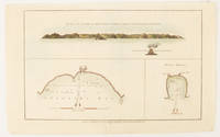
1784174896London.: Alexander Hogg at the King's Arms. circa1784. Engraved map in triptych on laid paper 20.1 x 32.7 cm three insets: cross section of the north side of Queen Charlotte's Islands Solomon Islands with detail of a volcano "6 leagues North"; Swallow's Bay Harbour; and Byron's Harbour early hand colour trimmed to the plate mark at the top edge neat sealed tear affecting the publisher's caption slight edge wear and paper toning but a most attractive map in very good condition. Attractive engraving of the Queen Charlotte's Islands Solomon Islands. The Islands were named for the consort of King George III by Philip Carteret the British naval officer and explorer who participated in two of the Royal Navy's circumnavigation expeditions in 1764–66 and 1766–69. His ship the Swallow gave her name to the Bay and Carteret's commanding officer on the first of his voyages John Byron to the Harbour depicted in this most attractive early chart. . Alexander Hogg at the King's Arms. unknown
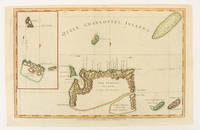
1784174895London.: Alexander Hogg at the King's Arms. circa1784. Engraved map on laid paper 21.4 x 33.7 cm inset of Gower's Simson's and Carteret's Island early outline hand colour trimmed to the plate mark at the top edge three small edge tears affecting the upper margin only slight paper toning but a most attractive map in very good condition. Fine impression of the Queen Charlotte's Islands Solomon Islands. It features the Swallow's track the ship's route taken by Captain Philip Carteret in 1767 the British naval officer and explorer who participated in two of the Royal Navy's circumnavigation expeditions in 1764–66 and 1766–69. . Alexander Hogg at the King's Arms. unknown
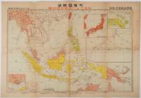
1719176771東京. Tokyo.: 日本放送出版会社. Nihon Hōsō Shuppan Kaisha. Showa 17 1942. Colour folding map scale 1:14500000 55cm x 80cm naval warship photographic illustrations on reverse. The wartime paper is browned and friable but small closed tears along fold lines and edges have been neatly repaired with archival washi on the verso. 79 x 53cm This colour map of Asia and the Pacific was published as a supplement to a magazine Hoso 放送 on January 1942 less than one month after the Pearl Harbor attack by the Japanese Forces. The war had just started but amazingly the map accurately predicted where the fighting would take place throughout the war. An inset map on upper right shows Singapore Borneo Sumatra and Java where battles took place in the area in early 1942. An inset chart on lower left shows various resources and their location including coal tin and iron ore clearly showing that the war was fought over securing resources. On reverse eleven photographic illustrations of war ships from Germany Britain the US and Japan are shown including the Prince of Wales and Enterprise. . 日本放送出版会社. [Nihon Hōsō Shuppan Kaisha]. unknown
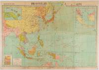
1719219230東京. Tokyo.: 日本放送協会. Nihon Hōsō Shuppan Kyōkai. Showa 17 1942. Colour folding map scale 1: 10000000 54.7cm x 79.5cm chronology of building the Greater East Asia Co-Prosperity Sphere on reverse. Some light browning a little darker at folds and reverse washi repairs to folds on reverse. This colour map of Asia and the Pacific published on 30 January 1942—just one month after Japan's attack on Pearl Harbor—offers a striking glimpse into wartime strategy and propaganda. Remarkably despite being produced at the war's outset it accurately anticipated key battlegrounds that would define the conflict. The main map is supplemented by two inset maps: one in the upper right highlighting Japan the Hawaiian Islands and Honolulu and another in the lower left focusing on Singapore with Darwin marked along the lower edge. <br> <br>The reverse side features a revealing chronological chart titled "Building Great East Asia" documenting Japan's military expansion from the 1931 Manchurian Incident through January 1942 as troops advanced across Southeast Asia. Notably two blank rows were intentionally left at the chart's end anticipating future victories to be recorded as the war progressed—a telling detail that underscores the map's dual role as both strategic document and propaganda tool. An interesting map which combines geographical precision with ideological messaging. . 日本放送協会. [Nihon Hōsō Shuppan Kyōkai]. unknown
177521548Paris 1775. Very good condition. Large detailed copper engraved map of Captain Cook's voyage in the Resolution of New Caledonia and the New Hebrides islands in the south Pacific with the tracks and the dates indicated. From Prevost's "L'Histoire Generale des Voyages".<br /> <br /> Bellin 1703 - 1772 one of the most noted French mapmakers of the 18th century was named the hydrographer chief cartographer to the French Navy and later the Official Hydrographer to the French King.<br /> <br /> Folding 19 x 15 1/4". Strong impression very clean. unknown
1721011121Lucca: Per Vicenzo Giuntini A spese di Gio: Riccomini 1721 Book. Good. Full vellum. 227 1 pages. In old full vellum the boards having worming but this only goes into the text block as far as page 4. Spine damaged by worming. Some pages browned. Armorial bookplate to the front pastedown of Sylvester Lord Glenbervie and armorial bookplate to the front free end paper of H.F. Davies Elmley Castle. Ink letter R to the upper outer corner of the front free end paper. Per Vicenzo Giuntini A spese di Gio: Riccomini hardcover
17512342048Venezia: Presso Francesco Pitteri Con Licenza de' Superiori e Privilegio 1751. Revised Edition. Hard Cover. Very Good/No Jacket. Revised edition. Rebound with new endpapers. Minor ink notes on flyleaves modern owner bookplate on front endpaper of each volume. 1751 Hard Cover. 12 310; 406 pp. 12mo. Cloth spines gilt titles paper over boards. Italian text. An 18th century guide to Venice by Pietro Antonio Pacifico with engraved illustrations including several fold-outs. Presso Francesco Pitteri, Con Licenza de' Superiori, e Privilegio hardcover
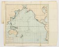
1790143934Paris: F. Dufart 1790. Very Good. Paris F. Dufart circa 1790. A hand-coloured engraved map printed surface 378× 415 mm sheet size approximately 420 × 540 mm. 'Gravée par Tardieu l'Ainé . Dessiné par Poirson . Ecrit par Beaublé'. Original folds as issued; some minor uneven tanning; in very good condition. An uncommon chart of the Pacific Ocean and Australia showing magnetic variation and dip drawing on observations made in the course of Pacific voyages after 1775 most notably Cook's third voyage. It is most likely from a duodecimo edition of Buffon's 'Histoire naturelle générale et particulière' around the end of the eighteenth century 'PL. III. Tome XVI' and 'Page 58' are printed in the top margin. It is based on a larger chart in four sheets attributed to Jean-Charles de Borda. The engraver Tardieu is one of half a dozen members of the family working as engravers at the period one of whom P.A.F. Tardieu would engrave the charts published in the official account of the Baudin voyage. F. Dufart unknown
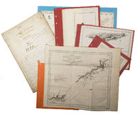
1755ABC_474521755. Manuscript of 24 pages 6 printed maps on cardboard. This wonderful logbook details the journey of a French captain from Manila to the Maluku Islands in todays Indonesia. The journey took place during the months of March to May of 1755. The captain of the ship recounted with great detail the events of every day of the journey with detailed daily accounts of the weather winds manoeuvres of the ship its departures anchorages and precise coordinates at every point of the journey. The captain furthermore had a keen eye for the geographical and nautical details along the journey. He recounted the exact locations of for example sandbanks and bays where ships and their crews can take provisions and fresh water. The accounts are detailed and captivating: "After our boats were back on board we set sail . in the afternoon to moor under the old Portuguese fort on the Solor island Indonesia the winds for the tide were fresh at 1:34 a.m. . sand and gravel and then I went back to mooring. The pavilion of the fort . the village is under the said fort at 3 cables from us .". The captain goes on to describe the geographical features of the islands as well as other places en route with great detail. Curiously we find inscriptions in Spanish and the names of one don Phelipe Qui who describes himself as el piloto and one Padre Don Estevan de Melo. The latter might be identical with Don Estevan Roxas y Melo a native of Lima Peru and secretary to the Archbishop of Manila Rodriguez since 1736. Roxas y Melo was part of the 1751 reconstruction of the Cathedral of Manila working under the auspice of the Italian architect Juan de Uguccioni.The logbook comes with six printed maps partly illustrating the journey of the captain pasted on contemporary cardboard. They depict the Bay of Sulavesi with the city of Bantang Pitcairn the coast of New Guinea the coast of Queensland the Santa Cruz Islands in the present-day Solomon Islands and Alejandro Selkirk Island. The plates stem from the French translation of James Hawkesworths An Account of the Voyages Hawkesworth Relation des voyages entrepris par ordre de sa Majesté Britannique actuellement regnante; pour faire des découvertes dans l'hemisphère meridional Paris 1774.Some holes on the first sheet not affecting the text. Small water damage some slighlty affecting the text. Remnants of seals on last page. Otherwise in good condition. unknown
1798205561798. Very good condition. Scarce copper engraved proof plate for a very early image of Canada's British Columbia coast depicting First Nations people and their village as encountered by Captain George Vancouver. This is a proof for plate IV Volume I of George Vancouver's Voyage 'A Voyage of Discovery to the North Pacific Ocean and Round the World; in which the Coast of North-west America has been Carefully Examined and Accurately Surveyed .'. <br /> <br /> Vancouver's voyage was intended to ensure Britain's hold on territory on the Northwest coast of North America and to search for the Northwest Passage. Vancouver who began his career sailing under Capt. Cook explored the mouth of the Columbia River Vancouver Island and Puget Sound. <br /> <br /> There were no commissioned artists on the voyage; Thomas Heddington 1776-1860 was one of four gifted crewmen who made drawings of the new territory. A midshipman on the ship Chatham Heddington's view shows a tree covered hill with the village at the top with wooden fish drying structures on the slope and with First Nation people in canoe on the water. Bute's Canal is now known as Bute's Inlet about 125 miles from Vancouver on the southwest coast of British Columbia. <br /> <br /> Vancouver describes the scene depicted here: ". fires of the natives had been observed on entering this canal; which I distinguished by the name of 'Bute's Canal'. Here was found an Indian village situated on the face of a steep rock containing about one hundred and fifty of the natives some few of whom had visited our party on their way up the canal and now many came off in the most civil and friendly manner with a plentiful supply of fresh herrings and other fish which they bartered in a fair and honest way for nails". <br /> <br /> The drawings were later revised by William Alexander to illustrate Vancouver's Voyage. The original ink and wash sketch for this proof plate sold in Vancouver in 2012 for $55000 Heffel Fine Art Auction House May 17 2012.<br /> <br /> The proof plate printed on tissue paper laid on to India paper. Image size 13 1/2 x 10 1/2". Full paper size 17 1/4 x 12". Two faint diagonal creases upper left side.<br /> <br /> with the printed edition of the print titled 'Village of the Friendly Indians at the entrance of Bute's Canal'. "W. Alexander del: from a Sketch taken on the Spot by T. Heddington" and "J. Landseer sculp" printed below the image. London published May 1st 1798 by R. Edwards New Bond Street J. Edwards Pall Mall & G. Robinson Paternoster Row. 11 1/2 x 9 1/4". Both images in very good condition. unknown