COOK (James) & BONNE (Rigobert);Livre Rare Book
74 résultats
1774LBW-17241774. 216 x 350 mm.
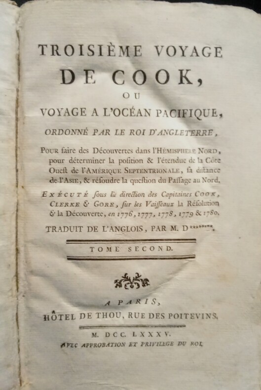
1785WOC-2668Ou Voyage à l'Océan Pacifique, Ordonné par le Roi d'Angleterre, Pour faire des Découvertes dans l'Hémisphère Nord, pour déterminer la position & l'étendue de la Côte Ouest de l'Amérique Septentrionale, sa distance de l'Asie, & résoudre la question du Passage au Nord. Exécuté sous la direction des Capitaines COOK, CLERKE & GORE, sur les Vaisseaux la Résolution & la Découverte, en 1776, 1777, 1778, 1779 & 1780. Traduit de l'Anglois, par M. D*********. Tome Second. Paris, Hôtel de Thou, rue des Poitevins, 1785. Fort in-8 (22x5,5x13,5cm) plein cartonnage d'époque, et une étiquette imprimée sur le plat supérieur du nom d'une ville en Suisse (Hellen à Yverdon). 512pp.
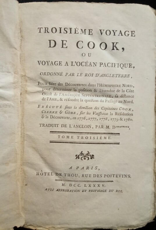
1785WOC-2669Ou Voyage à l'Océan Pacifique, Ordonné par le Roi d'Angleterre, Pour faire des Découvertes dans l'Hémisphère Nord, pour déterminer la position & l'étendue de la Côte Ouest de l'Amérique Septentrionale, sa distance de l'Asie, & résoudre la question du Passage au Nord. Exécuté sous la direction des Capitaines COOK, CLERKE & GORE, sur les Vaisseaux la Résolution & la Découverte, en 1776, 1777, 1778, 1779 & 1780. Traduit de l'Anglois, par M. D*********. Tome Troisième. Paris, Hôtel de Thou, rue des Poitevins, 1785. Fort in-8 (22x5,5x13,5cm) plein cartonnage d'époque, et une étiquette imprimée sur le plat supérieur du nom d'une ville en Suisse (Hellen à Yverdon). 592pp.
174021681740 rel. époque (mq. coiffe sup,; 1 mors fendu sur qq. cms). in-12, (10ff.), 409pp., (5ff.), Avignon Labaye 1740
1780LBW-968circa 1780 337 x 462 mm.
1782LBW-5810[1782]. 172 x 221 mm.
1785PHO-2103Paris, Hôtel de Thou, 1785, 1 volume in-4 (20x26cm), reliure d’attente, frottements, manque au dos, à grandes marges, tel que paru, sans les planches qui n’ont pas été relié dans cet exemplaire
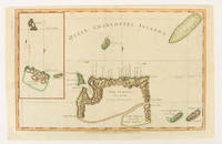
177521546Paris 1775. Very good condition. Detailed copper engraved map of Juan Fernandes islands in the South Pacific off the coast of Chile. The islands were the home of Alexander Selkirk a sailor marooned there in the early 1700s an event which may have served as the inspiration for 'Robinson Crusoe'. Selkirk was put off his vessel by a British captain and partner with Capt. William Dampier on a buccaneering expedition in search of Spanish vessels carrying gold. With an inset view of the northeast coast of the island at the top of the map. With compass rose rhumb lines and ornate cartouche.<br /> <br /> Bellin 1703 - 1772 one of the most noted French mapmakers of the 18th century was named the hydrographer chief cartographer to the French Navy and later the Official Hydrographer to the French King.<br /> <br /> One vertical fold 11 1/2 x 8 1/4". Strong impression very clean small chip to lower right edge only not affecting printed area. unknown
1749LBW-8991749 280 x 543 mm.
1785LBW-2857[1785]. 235 x 172 mm.
1785LBW-8758[1785]. 235 x 360 mm.
1774LBW-2672[1774]. 211 x 350 mm.
1774LBW-2850[1774]. 235 x 167 mm.
1774LBW-2853[1774]. 235 x 170 mm.
1778LBW-8800[1778]. 220 x 348 mm.
1719228651719 A Paris chez I. Chiquet A Paris 1719. - 25':.- Altkolorierter Kupferstich aus Le nouveau et curieux Atlas Geographique . b. Jacques Chiquet in Paris, dat. 1719, 17 x 22,5cm Tooley's Dic. of Mapm. Rev. Ed. A - D, S. 264 (Jacques Chiquet, c. 1673-1721; french cartographer, engraver and 'marchand d' estampes, rue St Jacques' in Paris). - Zeigt Asien zwischen Arabien und Japan. - Fine condition, good margins.bonnes marges
1784174896London.: Alexander Hogg at the King's Arms. circa1784. Engraved map in triptych on laid paper 20.1 x 32.7 cm three insets: cross section of the north side of Queen Charlotte's Islands Solomon Islands with detail of a volcano "6 leagues North"; Swallow's Bay Harbour; and Byron's Harbour early hand colour trimmed to the plate mark at the top edge neat sealed tear affecting the publisher's caption slight edge wear and paper toning but a most attractive map in very good condition. Attractive engraving of the Queen Charlotte's Islands Solomon Islands. The Islands were named for the consort of King George III by Philip Carteret the British naval officer and explorer who participated in two of the Royal Navy's circumnavigation expeditions in 1764–66 and 1766–69. His ship the Swallow gave her name to the Bay and Carteret's commanding officer on the first of his voyages John Byron to the Harbour depicted in this most attractive early chart. . Alexander Hogg at the King's Arms. unknown
176781061767 broché.(non rogné, quelques coins em.). in-12, VIII-132pp. (2ff.), Paris Desaint, Bourg-en-Bresse Comte 1767,
17502180[], [], [1750 ca]. In-4 de 8 pp., cartonnage moderne.
1785LBW-2858[1785]. 237 x 173 mm.
1774LBW-2851[1774]. 235 x 464 mm.
1784174895London.: Alexander Hogg at the King's Arms. circa1784. Engraved map on laid paper 21.4 x 33.7 cm inset of Gower's Simson's and Carteret's Island early outline hand colour trimmed to the plate mark at the top edge three small edge tears affecting the upper margin only slight paper toning but a most attractive map in very good condition. Fine impression of the Queen Charlotte's Islands Solomon Islands. It features the Swallow's track the ship's route taken by Captain Philip Carteret in 1767 the British naval officer and explorer who participated in two of the Royal Navy's circumnavigation expeditions in 1764–66 and 1766–69. . Alexander Hogg at the King's Arms. unknown
1767628Bourg, P.F. Bottier, sans date (1767), in-12, broché ; 143 pp. y compris la page de titre, (1) p. d’approbation par Alexis de Sainte-Susanne, Vicaire-Général des Augustins réformés (ordre de Rousselet) et De La Lande, Censeur Royal.
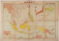
1719176771東京. Tokyo.: 日本放送出版会社. Nihon Hōsō Shuppan Kaisha. Showa 17 1942. Colour folding map scale 1:14500000 55cm x 80cm naval warship photographic illustrations on reverse. The wartime paper is browned and friable but small closed tears along fold lines and edges have been neatly repaired with archival washi on the verso. 79 x 53cm This colour map of Asia and the Pacific was published as a supplement to a magazine Hoso 放送 on January 1942 less than one month after the Pearl Harbor attack by the Japanese Forces. The war had just started but amazingly the map accurately predicted where the fighting would take place throughout the war. An inset map on upper right shows Singapore Borneo Sumatra and Java where battles took place in the area in early 1942. An inset chart on lower left shows various resources and their location including coal tin and iron ore clearly showing that the war was fought over securing resources. On reverse eleven photographic illustrations of war ships from Germany Britain the US and Japan are shown including the Prince of Wales and Enterprise. . 日本放送出版会社. [Nihon Hōsō Shuppan Kaisha]. unknown
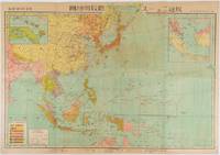
1719219230東京. Tokyo.: 日本放送協会. Nihon Hōsō Shuppan Kyōkai. Showa 17 1942. Colour folding map scale 1: 10000000 54.7cm x 79.5cm chronology of building the Greater East Asia Co-Prosperity Sphere on reverse. Some light browning a little darker at folds and reverse washi repairs to folds on reverse. This colour map of Asia and the Pacific published on 30 January 1942—just one month after Japan's attack on Pearl Harbor—offers a striking glimpse into wartime strategy and propaganda. Remarkably despite being produced at the war's outset it accurately anticipated key battlegrounds that would define the conflict. The main map is supplemented by two inset maps: one in the upper right highlighting Japan the Hawaiian Islands and Honolulu and another in the lower left focusing on Singapore with Darwin marked along the lower edge. <br> <br>The reverse side features a revealing chronological chart titled "Building Great East Asia" documenting Japan's military expansion from the 1931 Manchurian Incident through January 1942 as troops advanced across Southeast Asia. Notably two blank rows were intentionally left at the chart's end anticipating future victories to be recorded as the war progressed—a telling detail that underscores the map's dual role as both strategic document and propaganda tool. An interesting map which combines geographical precision with ideological messaging. . 日本放送協会. [Nihon Hōsō Shuppan Kyōkai]. unknown