Survey of India Offices:Biblio.com
2 832 résultats
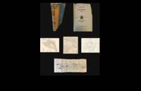
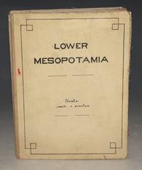
100094Calcutta Survey of India Offices May 1916 1st. Large folding map. Overall size 39.5 x 30 Inches. 32 cut sections mounted on cloth/linen. In very good condition. Some minor handling marks. A few minor spots to section section top row Baghdad. With colouring as stated. Some red colouring to linen on gaps between some sections. A couple of small splits to linen at centre fold and top fold 3rd section from left. Sections with some minor tanning. Some darkening and handling marks to title label on rear corner. In B&W with River Euphrates coloured blue. With green colouring to smaller rivers and canals and some pencil annotations around Baghdad area. Calcutta, Survey of India Offices, May 1916 1st hardcover
194571942black and white map Scale of 1;1000000 1 millimetre = 1 kilometre heights and depths are in metres and feet contains both english and french text double sided map scaling and formatting is the same on either side handwritten note on map detailing travel information dated 1945 Published by the Survey of India Offices paperback
0526280727.Ghardcover. Good. Access codes and supplements are not guaranteed with used items. May be an ex-library book. hardcover
1241094063.Gpaperback. Good. Access codes and supplements are not guaranteed with used items. May be an ex-library book. paperback
2025BIBLB0004327812025. Leather Bound. New. Size: 19.68 x 24.13 cms This book is available in 5 different Leather color without any extra cost. Explore More Options by Clicking on 'More Images' and Notify Us of Your Choice via Email within 24 hours of placing the order. Presenting an Exquisite Leather-Bound Edition expertly crafted by the prestigious organization Rare Biblio with Original Natural Leather that gracefully adorns the spine and corners. The allure continues with Golden Leaf Printing that adds a touch of elegance while Hand Embossing on the rounded spine lends an artistic flair. This masterpiece has been meticulously reprinted in 2025 utilizing the invaluable guidance of the original edition published many years ago in 1910. The contents of this book are presented in classic black and white. Its durability is ensured through a meticulous sewing binding technique enhancing its longevity. Imprinted on top-tier quality paper. A team of professionals has expertly processed each page delicately preserving its content without alteration. Due to the vintage nature of these books every page has been manually restored for legibility. However in certain instances occasional blurriness missing segments or faint black spots might persist. We sincerely hope for your understanding of the challenges we faced with these books. Recognizing their significance for readers seeking insight into our historical treasure we've diligently restored and reissued them. Our intention is to offer this valuable resource once again. We eagerly await your feedback hoping that you'll find it appealing and will generously share your thoughts and recommendations. Lang: - eng Vol:- Pages:- 206 If it is a multi-volume set then it is only a single volume. Product Disclaimer: Kindly be informed that owing to the inherent nature of leather as a natural material minor discolorations or textural variations may be perceptible. Explore the FOLIO EDITION 12x19 Inches: Available Upon Request. hardcover
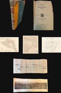
1921NL-02287<p><strong>Frontier warfare and colonial cartography: 1921 Survey of India "Confidential" atlas documenting the British campaign in Waziristan.</strong></p><p>This highly detailed 1921 confidential British-Indian general staff report produced by the Survey of India documents the Waziristan military operations of 19191920 along the volatile frontier of the Northwest Boundary. The publication includes a frontispiece 31 plates seven maps three of which are pocket-folded and eight folding panoramic illustrations that chronicle both the terrain and troop dispositions. The maps provide tactical clarity on routes native strongholds topographic obstacles and British positions. At the same time the accompanying text analyzes operational strategy lessons learned and the emergent use of air power in tribal warfare.</p><p>Waziristan now in Pakistan had long been viewed by the British as a strategically critical and persistently unstable frontier region inhabited by fiercely autonomous Waziri and Mahsud tribes. The 19191920 campaign followed the Third Anglo-Afghan War during which boundary tensions and local insurrections compelled renewed military intervention. This report presents not just the operational narrative but also the institutional mindset of early 20th-century colonial warfare combining detailed cartography with doctrinal reflection.</p><p>Cartographers:</p><p>The <strong>Survey of India</strong> established in 1767 under Major James Rennell and expanded during British rule served as the paramount cartographic and geodetic agency in India. By 1921 it had become central to mapping the subcontinent for both civil administration and military planning. In this instance the Survey's maps reflect the dual imperative of geographic precision and strategic control making this report an indispensable source for scholars of South Asian military history cartography and colonial frontier dynamics.</p><p>Condition Description</p><p>Good. Some wear on cover. Fold lines and some marginal imperfections on maps views and illustrations.</p> Survey of India
1921NL-02287a<p><strong>Frontier warfare and colonial cartography: 1921 Survey of India "Confidential" atlas documenting the British campaign in Waziristan.</strong></p><p>This highly detailed 1921 confidential British-Indian general staff report produced by the Survey of India documents the Waziristan military operations of 1919–1920 along the volatile frontier of the Northwest Boundary. The publication includes a frontispiece 31 plates seven maps three of which are pocket-folded and eight folding panoramic illustrations that chronicle both the terrain and troop dispositions. The maps provide tactical clarity on routes native strongholds topographic obstacles and British positions. At the same time the accompanying text analyzes operational strategy lessons learned and the emergent use of air power in tribal warfare.</p><p>Waziristan now in Pakistan had long been viewed by the British as a strategically critical and persistently unstable frontier region inhabited by fiercely autonomous Waziri and Mahsud tribes. The 1919–1920 campaign followed the Third Anglo-Afghan War during which boundary tensions and local insurrections compelled renewed military intervention. This report presents not just the operational narrative but also the institutional mindset of early 20th-century colonial warfare combining detailed cartography with doctrinal reflection.</p><p>Cartographers:</p><p>The <strong>Survey of India</strong> established in 1767 under Major James Rennell and expanded during British rule served as the paramount cartographic and geodetic agency in India. By 1921 it had become central to mapping the subcontinent for both civil administration and military planning. In this instance the Survey's maps reflect the dual imperative of geographic precision and strategic control making this report an indispensable source for scholars of South Asian military history cartography and colonial frontier dynamics.</p><p>Condition Description</p><p>Good. Some wear on cover. Fold lines and some marginal imperfections on maps views and illustrations.</p> Survey of India
0266553591.Ghardcover. Good. Access codes and supplements are not guaranteed with used items. May be an ex-library book. hardcover
0282849319.Gpaperback. Good. Access codes and supplements are not guaranteed with used items. May be an ex-library book. paperback
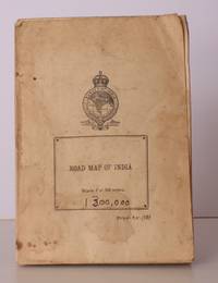
194642874Survey of India 1946. Folding coloured map on paper measuring 44 x 31 ins approx. 112 x 79 cms folding in 36 panels to 7.5 x 5.25 ins approx. 19 x 13 cms; printed wrapper covers mildly age-soiled but map itself remakably bright and clean a bright copy. A SCARCE SURVIVAL. Survey of India, unknown
1948018911India: Survey of India 1948. Book. VG. No Binding. 3rd Edition. Large folded colored map with minimal wear thus very good plus. . Survey of India unknown
2020DBS-9781774072509Society Publishing 2020. 1st. Hardcover. New. Society Publishing hardcover
2020DBS-9781774072509Society Publishing 2020. 1st. Hardcover. New. Society Publishing hardcover
2021AME_9781774076644Society Publishing 2021. UNKNOWN. Hardcover. New/New. Society Publishing hardcover
2021DBS-9781774076644Society Publishing 2021. 1st. Hardcover. New. Society Publishing hardcover
2021DBS-9781774076644Society Publishing 2021. 1st. Hardcover. New. Society Publishing hardcover
2020DBS-9781774071748Society Publishing 2020. 1st. Soft Cover. New. Society Publishing paperback
2020DBS-9781774071748Society Publishing 2020. 1st. Soft Cover. New. Society Publishing paperback
2021AME_9781774076248Society Publishing 2021. UNKNOWN. Hardcover. New/New. Society Publishing hardcover
2021DBS-9781774076248Society Publishing 2021. 1st. Hardcover. New. Society Publishing hardcover
2021DBS-9781774076248Society Publishing 2021. 1st. Hardcover. New. Society Publishing hardcover
2020DBS-9781774073209ARCLER PRESS 2020. 1st. Soft Cover. New. ARCLER PRESS paperback
2020DBS-9781774073209ARCLER PRESS 2020. 1st. Soft Cover. New. ARCLER PRESS paperback
2001mon0000251365OUP India 2001-04-12. Hardcover. Very Good. 1.5228 in x 27.6650 in x 27.1574 in. OUP India hardcover
1023975270.Ghardcover. Good. Access codes and supplements are not guaranteed with used items. May be an ex-library book. hardcover