837 résultats
Very Good Armenian Paperback. Demy 8vo. (21 x 14 cm). In Armenian. 40 p., b/w ills. [MELKONIAN EDUCATIONAL INSTITUTE - NICOSIA, CYPRUS] Melgonean Krt'akan Hastatut'iwn (Nikosia, Kipros): Ch'amarrot teghekatoi, 1966-1967. The Melkonian Educational Institute (MEI) was an Armenian boarding school of high academic standard located in Nicosia, Cyprus. Established in 1926 by the Melkonian brothers, it was the only remaining boarding school servicing students of the Armenian Diaspora from nearly 40 countries. Krikor Melkonian and Garabed Melkonian are widely regarded as the greatest benefactors of the Armenian nation. They were prominent tobacco traders from Egypt. In the aftermath of the Armenian Genocide they decided to establish this school in Cyprus. To that end, they liquidated all their assets and established the Melkonian Fund and entrusted the management (and not the ownership) of the Melkonian School to the AGBU. Both brothers are buried at the School grounds, at the open space between the two main buildings. A beautifully designed marble monument with intricate engravings and the bronze busts of the Melkonian Brothers prominently stand as a gesture of eternal gratitude to their memory. For thousands of Melkonian graduates and friends this is a sacred place. (Source: Wikipedia).
Fine Turkish Paperback. Cr. 8vo. (21 x 10 cm). In Turkish. 22 p. Bir Rum gazetecinin izlenimleri. Kibris sorununa gerçekçi bir bakis. Memoirs of
Fine English Paperback. Pbo. 8vo. (22 x 10 cm). In English. 16 p. Impressions of a Greek Cypriot journalist. A realistic look at the Cyprus question.
New English Paperback. Pbo. 4to. (27 x 19 cm). In French. 23, [1] p. L'Intervention Turque a Chypre. Les faits. Ce n'est pas simplement une ile.
Very Good English Paperback. Roy. 8vo. (24 x 17 cm). In English. 79 p., b/w ills. Missing persons in Cyprus. Turkish Cypriot missing persons, (1963-1974). Third decade. CYPRUS Cypriot question Greek - Turkish - British international relations.
1958054397Southampton: Ordnance Survey 1958. 3rd Edition . Soft cover. Very Good. Elephant Folio - over 15 - 23" tall. Revised Third Edition of this rare map of Cyprus made by Salmon who was the director of Cypriot land registration and surveys. "Shows grid district boundaries heights in feet railways roads 2 categories antiquities ancient sites.". / "Shows district boundaries towns and cities roads 2 categories railroads ancient sites and antiquities and dry streams. Relief is shown by contours gradient tints and spot heights. Earlier Edition: 1952.". OCLC. "In December 1926 in a memorandum to the Colonial Office on vacant surveying positions in the colonies Palestine and Cyprus were mentioned at the end of a group of Mediterranean colonies; that is there was a group of Mediterranean colonies and also Cyprus and Palestine . Only in 1929 was an Imperial project involving Palestine and Transjordan brought up at the committee Colonial Survey Committee. This was the experimental aerial survey for determining the route of the Haifa - Damascus railway which was presented as a model for mapping from aerial photographs . Among the important things reported to the Colonial Survey Committee was the reconnaissance conducted by Colonial Winterbotham the Chief of the GSGS in the survey departments of the colonies in 1929 a trip that had been encouraged in the first Conference of Empire Survey Officers in 1928 . . how much Salmon F. J. expected from Winterbotham's visit to Ceylon a short time before he was to take over the directorship of the small survey department of Cyprus.". Source: The Survey of Palestine Under the British Mandate 1920-1948. Original color map. Folded in original wrappers. Fine. Elephant folio. 58 x 89 cm. In English. Survey of Cyprus administration map. Scale of 4 miles to one inch = 1/253440. Compiled and drawn under the direction of F. J. SALMON Director of Land Registration and Surveys Cyprus 1932. Revised Third Edition. Second in 1950. <br/> <br/> Ordnance Survey paperback
Very Good English Revised Third Edition of this rare map of Cyprus, made by Salmon, who was the director of Cypriot land registration and surveys. "Shows grid, district boundaries, heights in feet, railways, roads (2 categories), antiquities, ancient sites.". / "Shows district boundaries, towns and cities, roads (2 categories), railroads, ancient sites and antiquities, and dry streams. Relief is shown by contours, gradient tints, and spot heights. Earlier Edition: 1952.". (OCLC). "In December 1926, in a memorandum to the Colonial Office on vacant surveying positions in the colonies, Palestine and Cyprus were mentioned at the end of a group of Mediterranean colonies; that is there was a group of Mediterranean colonies, and also Cyprus and Palestine [.] Only in 1929 was an Imperial project involving Palestine and Transjordan, brought up at the committee (Colonial Survey Committee). This was the experimental aerial survey for determining the route of the Haifa - Damascus railway, which was presented as a model for mapping from aerial photographs [.] Among the important things reported to the Colonial Survey Committee was the reconnaissance conducted by Colonial Winterbotham, the Chief of the GSGS, in the survey departments of the colonies in 1929, a trip that had been encouraged in the first Conference of Empire Survey Officers in 1928 [.] ... how much Salmon [F. J.] expected from Winterbotham's visit to Ceylon a short time before he was to take over the directorship of the small survey department of Cyprus.". (Source: The Survey of Palestine Under the British Mandate, 1920-1948). Original color map. Folded in original wrappers. Fine. Elephant folio. (58 x 89 cm). In English. Survey of Cyprus administration map. Scale of 4 miles to one inch = 1/253440. Compiled and drawn under the direction of F. J. SALMON, (Director of Land Registration and Surveys, Cyprus, 1932). Revised Third Edition. Second in 1950.
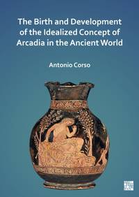
ria9781803271644_inpPaperback / softback. New. New Book; Fast Shipping from UK; Not signed; Not First Edition; Bringing together for the first time all the available evidence for the origination and development of the concept of Arcadia from the Homeric period to the early Roman Empire this book brings to light a treasure-trove of evidence bo paperback
Professor Dobie went to Cyprus to teach,but found murder instead of mathematics. Book
198123942Paris De Boccard 1981 in-4° 312 pp, nombreuses illustrations en noir et en couleurs
(Minnesota Mediterranean and East European Monographs XV) an extraordinarily sensitive and balanced analysis of an international crisis whose most recent phase was created in 1974 when Turkey invaded and occupied 37 percent of the island. This scholarly assessment could be useful in the hands of those who honestly seek to understand the nature of the Cyprus Question and those who may strive toward its solution. Whereas the Cyprus imbroglio affects primarily the various communities living on the island, chief among them the Greek and Turkish Cypriots, its international dimensions involve directly Greece and Turkey and other NATO Allies" 135p. maps. bibliography index. Book
An overview of the situation and its problems. 64p. maps, chronology bibliography Book
8vo., First Edition, with 17 plates on 8, a full-page portrait, full-page illustration and 7 full-page maps in the text; red cloth, gilt back, a fine copy in unclipped dustwrapper. The author's service included Palestine, SE Asia, Malaya, Singapore, Tunisia, Cyprus, Jamaica and Aden and covers pre-WWII regimental soldiering to the modern TA. Already uncommon in this condition.
2009RO30143982CYPRUS TOURISM ORGANISATION. 2009. In-8. Broché. Bon état, Couv. convenable, Dos satisfaisant, Intérieur frais. 111 pages augmentées de nombreuses illustrations en couleurs dans le texte -. . . . Classification Dewey : 53-Guide
117356Brookline, Hellenic College Press, 1987.
105553(Ldn.), Phaidon, 1973.
70326(Ldn.), Phaidon, 1973.
116340Leiden, Boston, Brill, 2012.
116339Leiden, Boston, Brill, 2012.
115100(Athens), Ekdotike Athenon, 1976.
100642Göteborg, Åström, 1971.
103706Göteborg, Åström, 1971.