[New Jersey] [Latin America]. [Florida]Biblio.com
1 995 résultats
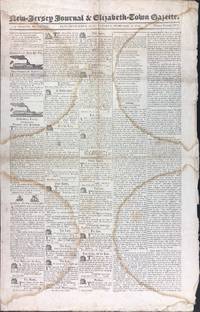
182541367Elizabethtown NJ: J. & E. Sanderson 1825. First edition. Self wrappers. A very good- copy with 4 large semi-circular dampstain marks throughout. Unpaged 4 pp. Illus. with b/w in-text drawings. 20 3/4 x 13 inches. Contents include: a full column on the Liberation of Peru led by General Sucre; the first meeting at the new seat of Government in Florida where the governor states "No part of North America is so little known.Visitors.had pronounced it a bank of sand not worth the money paid for it"; republished letters from Andrew Jackson John Quincy Adams and Henry Clay. This issue not at the American Antiquarian Society. Uncommon. J. & E. Sanderson unknown
191051160Collingswood NJ: E.L. Pardee 626 Park Ave. ca. 1910-1911. 4to. 23 original silver gelatin linen-backed images 7.5 x 9.5 in. printed on 9.25 x 11.5 sized photo stock paper w/ most having annotations and dates on verso in ink and pencil a few dated at lower right corner in white margin below image. Contemporary black pebbled cloth Shipman’s Common-Sense Binder w/ brass staples at gutter margin which slide to fastener at rear reinforced at margin w/ linen some wear rubbing wear to corners minor wear & creasing to gutter margin blanks of images still an excellent exemplar w/ ownership stamp on front pastedown. This remarkable photo album illustrates the building and improvement of infrastructure in and around Camden NJ and Gloucester NJ at the beginning of the 20th century for the Public Service Trolley Line Company. Pardee 1882-1932 was a New Jersey contractor and builder who worked on laying trolley tracks for the company. These images show the rebuilt timber fenders along the Pesauken Creek Bridge new retaining wall built for the Smith Property in Bellmawr NJ for the new Trolley Line bridge over the old sluiceway on Martha Pond on the Oswego River timber bridge along the White Horse Pike by Mooretown the rebuilding of the Electric Trolley line extending the Almonessen Branch to Blackwood as well as the Federal Street Bridge over Coopers Creek in Camden NJ. Of particular interest are the excellent series of photos showing the streets and houses through Gloucester NJ as the company ripped out the old wooden cord roads and laid brick for holding the trolley line ties. After World War I Pardee established the E. Brown Pardee Inc. brick stone and masonry supplies in Collingswood NJ expanding to other building materials through the 1920s until his death. After that the company was managed by his son Ernest Lewis Pardee until World War II. E.L. Pardee, 626 Park Ave., hardcover
1904107189<p>Large narrow Jersey coast map 11 1/2" x 44". Folds top and bottom margins are creased some minor additional creasing normal aging; otherwise very good. Unusual New Jersey geological map of part of the Jersey coast. Prepared by Henry B. Kummel state geologist this map shows part of the coast of New Jersey including Point Pleasant and Bay Head. Map also illustrates how much land is above or below sea level. This map is from the Annual Report of the State Geologist for 1903. Map sheet will be shipped folded. </p>
192241249Washington D.C.: Published by the United States Coast and Geodetic Survey 1922. Large folding nautical chart printed on heavy paper stock. Colored. A rare original coastal survey of New Jersey from Sea Girt to Little Egg Inlet including Manasquan Brielle Point Pleasant Beach Mantoloking Lafayette Seaside Park Island Beach State Park and Long Beach Island with an inset expanded map of Little Egg Inlet in the top left corner.<br/> <br/> Established by President Thomas Jefferson in 1807 as the Survey of the Coast the U.S. Coast and Geodetic Survey was the United States' first civilian scientific agency. This agency has followed its mission to survey the U.S. coastline create nautical charts of the coast and help increase maritime safety since its founding and has often played fascinating roles in significant chapters of U.S. history. It served in all theaters of the Civil War in the service of the Union Army and Navy pioneered acoustic exploration in the wake of the sinking of the Titanic and during WWI it worked to detect enemy submarines. In addition this agency worked to survey and produce detailed maps and renderings of the U.S. coast. These nautical survey maps commonly referred to as "T-sheets" provide fascinating insights into the history of the United States coastline which has and will continue to shift. These maps are the most important data source for understanding the physical and ecological characteristics of the U.S. shoreline. The present map is a highly detailed and accurate sea chart of Long Beach Island area and an important historical view of developing New Jersey. Published by the United States Coast and Geodetic Survey unknown
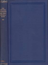
189735143Newark: Press of the New Jersey Historical Society 1897. First Edition. Hardcover. Very good. Small quarto. iii-viii 223 pages. Frontispiece engraving. Illustrated. Blue cloth hardcover with gilt title on the spine. Top edge gilt. Untrimmed text edges. Couple of small edge tears to the cloth head and base of the spine. Small scuff stain bottom of the spine. Light even toning to the end papers probably from a removed paper wrapper. Printed name label of "Bartlett Cowdrey" on the front paste down prabably the same as the historian and archivist Mary Bartlett Cowdrey. Her name and date of 1961 written on the right front flyleaf. A different owner's name on the verso of the right front flyleaf. Interior contents very clean. Press of the New Jersey Historical Society hardcover
1758016251Philadelphia: William Bradford 1758. First Edition. Hardcover. Title page with a few repaired tears hinged with following Preface page; two adjoining leaves pages 441-444 of text lacking and supplied with facsimiles. Contents Very Good binding about Fine. Folio 7-1/4" x 11-1/2" bound in contemporary calf leather with a decorative blindstamped border recently rebacked with a new gilt-lettered and decorated spine preserving original paste-downs and free endpapers; 4 763 pages. Title within rule border decorative woodcut head- and tail-pieces. An important compilation of the fundamental New Jersey charters and session laws of the proprietary period 1664 to 1702 up to Lord Cornbury's commission and instructions as Royal Governor when New Jersey became a crown colony under Queen Anne. Publication was ordered by the New Jersey Assembly in 1752 but two years were required to collect the documents to be included while the typesetting and printing took Bradford an additional three. By the date of publication some 170 copies had been subscribed. This title was the largest volume issued from Bradford's press and one of the largest from any eighteenth-century American press. Evans 8205; Sabin 39527. Early owner name on the title page and early twentieth century names on the front pastedown. <br/><br/> W[illiam] Bradford hardcover
1834D8076Trenton: Daniel Fenton 1834. Hardcover. Very Good. Contemporary calf gilt-stamped lettering in black leather spine label; 8vo 2 volumes bound in 1; pp. xii 339 1 plus colored folding map; iv 266. Boards scuffed; 3-inch tape repair to verso of map; foxing throughout; ownership signature on FFEP. The second history of New Jersey and the first gazetteer with the uncommon map. Felone New Jersey Books 726 727; Sabin 28001 27996. <br/><br/> Daniel Fenton hardcover
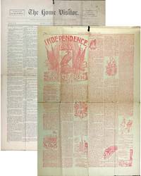
189141365Clinton NJ: E.O. Howell 1891. First edition. Self wrappers. A very good unopened uncut copy with folds two thin inch long holes at top margin a few tears along edges. 8 pp. Illus. with b/w in-text drawings. 22 x 15 1/4 inches. Includes an entire page printed in red ink to celebrate the Fourth of July hopefully without getting drunk. A temperance newspaper with much local news. Scarce. E.O. Howell unknown
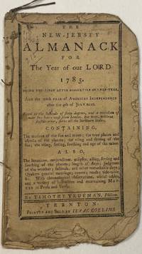
178441949Trenton: Printed and Sold by Isaac Collins 1784. 12mo. 40pp as issued. Stitched. Untrimmed with chipping at blank edges and blank margins. Very Good. Anatomical illustration on page 2. <br /> <br /> With a four-line poem on the Air Balloon tables of roads and distances currency court schedules. <br /> FIRST EDITION. Felcone Printing in New Jersey 403. Evans 18811. Drake 5132. ESTC W29806. Printed and Sold by Isaac Collins unknown
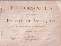
1896E35934New York: Commercial Publishing 1896. Wraps. Good. Oblong staple bound in printed wrappers. 64 pp. Illustrated throughout with photographs by Jewett of Main Street Orange New Jersey. A number of local adverts Good only front wrap with a chip to the upper outer corner and shallow loss at the bottom edge. Staining to the rear wrap. Pages a bit wavy. A scarce publication presenting place of interest in Orange New Jersey at the close of the 19th century. Views of residences businesses tree lines avenues interiors a baseball game and prize winning horses. SOLD AS IS. Commercial Publishing unknown
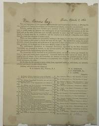
186440121Trenton 1864. Broadside 8-1/2" x 11-1/4." Addressed in ink at head of text to "Hon. Bowers Esq." Dated in typescript "Trenton September 8 1864." Signed in type at the end by W.S. Johnson S.S. Stryker Jr. and I.D. James members of the Committee on Campaign Documents. Some chipping at upper and lower blank edges. Light wear Good or so.<br /> <br /> The broadside lists 36 campaign pamphlets supporting the re-election of Abraham Lincoln and denouncing the "Copperhead Democrats." <br /> The stakes in the election could not be higher: "Hitherto parties have been divided upon questions of policy; but in the present contest the issue is boldly made up between the maintenance of our Constitutional Government on the one hand and on the other of its base and cowardly surrender to more than half vanquished treason armed in bloody array for its overthrow and the erection on its ruins of a despotism more odious than the world has tolerated in modern times."<br /> Not in Felcone. Not located on OCLC as of February 2025. unknown
191741252Washington D.C.: Published by the United States Coast and Geodetic Survey 1917. Nautical chart printed on heavy paper stock. Uncolored. A rare original coastal survey of the Hudson River including Ossining Nyack Tarrytown Yonkers and New York City as well as potential anchorage points in the Hudson for Naval use.<br/> <br/> Established by President Thomas Jefferson in 1807 as the Survey of the Coast the U.S. Coast and Geodetic Survey was the United States' first civilian scientific agency. This agency has followed its mission to survey the U.S. coastline create nautical charts of the coast and help increase maritime safety since its founding and has often played fascinating roles in significant chapters of U.S. history. It served in all theaters of the Civil War in the service of the Union Army and Navy pioneered acoustic exploration in the wake of the sinking of the Titanic and during WWI it worked to detect enemy submarines. In addition this agency worked to survey and produce detailed maps and renderings of the U.S. coast. These nautical survey maps commonly referred to as "T-sheets" provide fascinating insights into the history of the United States coastline which has and will continue to shift. These maps are the most important data source for understanding the physical and ecological characteristics of the U.S. shoreline. The present map is notable for the inclusion of various anchorage points for the "temporary anchorage of naval vessels" complete with a naval seal in the upper left corner of the sheet. This map is a highly detailed and accurate sea chart of the Hudson River and an important historical view of developing New York and New Jersey. Published by the United States Coast and Geodetic Survey unknown
191641256Washington D.C.: Published by the United States Coast and Geodetic Survey 1916. Large folding nautical chart printed on heavy paper stock. Uncolored with minor stains. A rare original coastal survey of the Hudson River including New York City from 53rd St to Fort Washington Park Weehawken and Edgewater as well as potential anchorage points in the Hudson for Naval use.<br/> <br/> Established by President Thomas Jefferson in 1807 as the Survey of the Coast the U.S. Coast and Geodetic Survey was the United States' first civilian scientific agency. This agency has followed its mission to survey the U.S. coastline create nautical charts of the coast and help increase maritime safety since its founding and has often played fascinating roles in significant chapters of U.S. history. It served in all theaters of the Civil War in the service of the Union Army and Navy pioneered acoustic exploration in the wake of the sinking of the Titanic and during WWI it worked to detect enemy submarines. In addition this agency worked to survey and produce detailed maps and renderings of the U.S. coast. These nautical survey maps commonly referred to as "T-sheets" provide fascinating insights into the history of the United States coastline which has and will continue to shift. These maps are the most important data source for understanding the physical and ecological characteristics of the U.S. shoreline. The present map is notable for the inclusion of anchorage points for US Naval use according to size complete with a naval seal in the upper left corner of the sheet. This map is a highly detailed and accurate sea chart of the Hudson River and an important historical view of developing New York and New Jersey. Published by the United States Coast and Geodetic Survey unknown
192141253Washington D.C.: Published by the United States Coast and Geodetic Survey 1921. Nautical chart printed on heavy paper stock. Colored. A rare original coastal survey of the border between New York and New Jersey at Kill Van Kull including Staten Island Elizabeth Newark Bay Bayonne and New York Bay.<br/> <br/> Established by President Thomas Jefferson in 1807 as the Survey of the Coast the U.S. Coast and Geodetic Survey was the United States' first civilian scientific agency. This agency has followed its mission to survey the U.S. coastline create nautical charts of the coast and help increase maritime safety since its founding and has often played fascinating roles in significant chapters of U.S. history. It served in all theaters of the Civil War in the service of the Union Army and Navy pioneered acoustic exploration in the wake of the sinking of the Titanic and during WWI it worked to detect enemy submarines. In addition this agency worked to survey and produce detailed maps and renderings of the U.S. coast. These nautical survey maps commonly referred to as "T-sheets" provide fascinating insights into the history of the United States coastline which has and will continue to shift. These maps are the most important data source for understanding the physical and ecological characteristics of the U.S. shoreline. The present map is a highly detailed and accurate sea chart of the coastal border between New York and New Jersey at Kill Van Kull and an important historical view of the developing states. Published by the United States Coast and Geodetic Survey unknown
192141254Washington D.C.: Published by the United States Coast and Geodetic Survey 1921. Large folding nautical chart printed on heavy paper stock. Uncolored with minor wear. A rare original coastal survey of the New York Harbor including Staten Island Bayonne Jersey City Statue of Liberty Governors Island and Brooklyn with sectioned anchorage areas.<br/> <br/> Established by President Thomas Jefferson in 1807 as the Survey of the Coast the U.S. Coast and Geodetic Survey was the United States' first civilian scientific agency. This agency has followed its mission to survey the U.S. coastline create nautical charts of the coast and help increase maritime safety since its founding and has often played fascinating roles in significant chapters of U.S. history. It served in all theaters of the Civil War in the service of the Union Army and Navy pioneered acoustic exploration in the wake of the sinking of the Titanic and during WWI it worked to detect enemy submarines. In addition this agency worked to survey and produce detailed maps and renderings of the U.S. coast. These nautical survey maps commonly referred to as "T-sheets" provide fascinating insights into the history of the United States coastline which has and will continue to shift. These maps are the most important data source for understanding the physical and ecological characteristics of the U.S. shoreline. The present map is notable for the inclusion of anchorage areas including general anchorage sections as well as "anchorage explosives" and "man-of-war anchorage" sections. This map is a highly detailed and accurate sea chart of New York Harbor and an important historical view of developing Ne w York and New Jersey. Published by the United States Coast and Geodetic Survey unknown
186633999Newark: Printed for the New Jersey Historical Society 1866. Hardcover. Good. Octavo. 182 pages. Map plate in text. Brown cloth hardcover with no titles on the outside. 1928 inscription written on the right front flyleaf. A later 1994 previous owner inscription written on the front paste down. Cloth torn head and base of the spine and on the corners. Interior contents clean. Printed for the New Jersey Historical Society hardcover
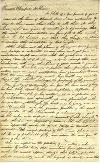
1823281351823. A three-page manuscript letter from Ephraim Smooth to Bloomfield McIlvaine exhorting him to follow the tenants of meditation and balance inherent in the Quaker tradition. <br /> <br /> A dance was held at the home of Obediah Sears and Ephraim Smooth writes at length about Quaker tradition of contemplation rejecting "ill-judged indulgence of riot & gaiety" refering to Bloomfield's education he graduated from the College of New Jersey later Princeton in 1812 and his power to influence the youths and finally offers a curative silent meditation with Simon Pure Obediah Broadbrim and himself to "cheerfully join in the dance of the spirit". Dated 5th day 7 month 1823 5 July 1823. Reference is made to the flute and fiddle made in Edenton North Carolina we assume; and addressed to "Bottany Bay" which we assume is the one on Edisto Island South Carolina. <br /> <br /> Bloomfield McIlvaine 22 Feb 1797- 18 Aug 1826 died at 30 in New Jersey. He married Henrietta Maria Banker in June 1824. His father was Joseph McIlvaine who died a couple hours after his son aged 58. Joseph was a US senator for New Jersey. Bloomfield was a lawyer - his extensive library takes four pages in his will just the books valued at $939.35. He is buried in Saint Mary's Episcopal Churchyard in Burlington New Jersey. unknown
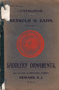
191044825N.P.: Privately printed n.d ca 1910. ca 1910. TRADE CATALOGUE. First edition. 8 7/8" x 6" in faded blue-green printed wrappers with illustration of a rosette in bright orange at center. 67 pp. Note. Index. Illustrations. Offers illustrations sizes and inventory numbers of various harness rosettes ornaments and saddle nails shields barrel ornaments harness ornaments crests Hame tug ornaments chains for housing and fronts monograms letters etc. Page one with 1" closed tear to side edge along with light wear to corners due to use. Sticker residue to spine edge; wrapper edges tanned; 1/2" closed tear to toe of front wrapper; spine reinforced with green archival tape and with light wear to extremities. Privately printed, n.d (ca 1910). unknown
191044858Newark: Baker Printing Co. 1910. 1910. TRADE CATALOGUE. First edition. 8vo. Decorated wrappers 119 pp. illustrated in black & white. This company manufacturers rubber and celluloid harness trimmings celluloid martingal rings and slide loops rein spreaders face pieces rubber compound harness trimmings hames light metal harness trimmings in gold silver and nickel humane bits and other specialties for the horse. All goods bear the Albright Trade Mark. Laid-in is a sheet providing discounted prices from the catalog. An old water stain on the title page that diminishes and is hardly noticeable after page 8 tiny nick to the fore-edge of first ten pages tiny closed tear to the fore-edge of title page else a very good copy of a trade catalog of accessories for the horse. Baker Printing Co., 1910. unknown
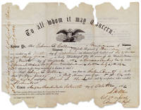
3731462<p>Govt. Print. Office May 15 1861. 8½ x 11 inches. Vignette of the American eagle. Paper losses primarily confined to margins although at places affecting one printed word and one handwritten word; usual folds; fair condition.</p> <p>The 1862-dated discharge paper for Edwin A. Collins b.1819 a forty-three year-old shoemaker-turned-musician and native of Salem County New Jersey. Collins was one of eleven musicians all privates who comprised the band for the 5th New Jersey Volunteers. The band was directed by Harry G. Frankenfield. Frankenfield had founded the Salem New Jersey Cornet Band 1860 and by October of 1861 he had raised the Regiment’s band in Trenton. The musical ensemble mustered out in August of 1862. John Hayward </p> <p>Collins’s discharge is autographed by Samuel Henry “Old Paddy†Starr seen here as a Colonel of the 5th Regiment. Starr was a vulgar and highly-volatile old-guard dragoon. A strict disciplinarian he was known among his subordinates as “Old Nose Bag.†If a soldier transgressed Starr had the offender tied and straddled to a fence with his face strapped into a horse’s nose bag. Faded Hoofbeats – Samuel H. “Old Paddy†Starr 6th US Cavalry online</p> <p>Collins was mustered out at Harrison Landing Virginia “Given at Camp near Alexandria†Virginia by Lieutenant S. Lee Perkins and autographed by Perkins and he is described as having light complexion black eyes and black hair. On the verso of Collins’s discharge it is recorded that received $40.66 in pay on October 31 1862.</p> <p>Details of Collins’s civilian life before and after the War have eluded us. We do not find him recorded in state or federal census records.</p> unknown
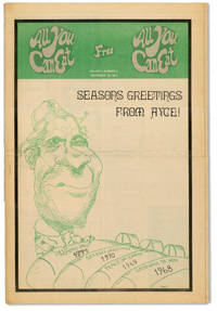
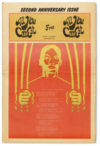
197141426New Brunswick NJ: All You Can Eat Collective 1971. First Edition. Tabloid 43.5cm; illustrated newsprint wrappers; 24pp; illus. Mild wear and toning to extremities old horizontal fold smoothed out; Near Fine. Attractive issue of this monthly newspaper published by the New Brunswick-based All You Can Eat Collective a group "seeking to bring people in New Jersey into a united struggle toward a world free of exploitation and oppression." Contents include articles on the opening of the New Brunswick women's center womens march for life the Young Lords Party local and international news and a centerfold poster of Che Guevarra. All You Can Eat Collective unknown
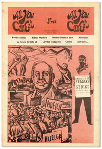
197241415New Brunswick NJ: All You Can Eat Collective 1972. First Edition. Tabloid 43.5cm; illustrated newsprint wrappers; 28pp; illus. Light wear toning and dustiness to extremities with a few tiny edge tears; unfolded; Very Good or better. Attractive issue of this monthly newspaper published by the New Brunswick-based All You Can Eat Collective a group "seeking to bring people in New Jersey into a united struggle toward a world free of exploitation and oppression" p.2. Contents include articles on the Fedders workers strike police harassment abortion laws in New Jersey the disaster in Buffalo Creek WV the Womens Bail Fund local and international news. All You Can Eat Collective unknown
197241418New Brunswick NJ: All You Can Eat Collective 1972. First Edition. Tabloid 43.5cm; illustrated newsprint wrappers; 24pp; illus. Light wear toning and dustiness to extremities with a few tiny edge tears and some creasing to lower right corners; unfolded; Very Good. Attractive issue of this monthly newspaper published by the New Brunswick-based All You Can Eat Collective a group "seeking to bring people in New Jersey into a united struggle toward a world free of exploitation and oppression." Contents include continuing coverage of the Fedders workers strike articles on free speech Attica protests at the Miami Republican Convention the plight of New Jersey migrant farmers the Tombs 7 workers struggles in Chile with local and international news. All You Can Eat Collective unknown
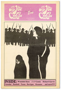
197341419New Brunswick NJ: All You Can Eat Collective 1973. First Edition. Tabloid 43.5cm; illustrated newsprint wrappers; 24pp; illus. Light wear toning and dustiness to extremities with a few tiny edge tears; unfolded; Very Good. Attractive issue of this monthly newspaper published by the New Brunswick-based All You Can Eat Collective a group "seeking to bring people in New Jersey into a united struggle toward a world free of exploitation and oppression." Contents include interviews with Father Daniel Berrigan and Richard Garvin landlord discrimination towards women police brutality on the Rutgers campus tax resistance local and international news with a centerfold dedicated to the rememberance of Wounded Knee and a column by Paul Krassner. All You Can Eat Collective unknown
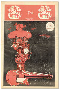
197241417New Brunswick NJ: All You Can Eat Collective 1972. First Edition. Tabloid 43.5cm; illustrated newsprint wrappers; 16pp; illus. Light wear toning and dustiness to extremities with a few tiny edge tears; unfolded; Very Good or better. Attractive issue of this monthly newspaper published by the New Brunswick-based All You Can Eat Collective a group "seeking to bring people in New Jersey into a united struggle toward a world free of exploitation and oppression." Contents include articles on the Miami Convention Coalition police brutality the Rahway inmates strike legal advice an homage to George Jackson local and international news and a centerfold dedicated to the history of rock and roll. All You Can Eat Collective unknown