Voltaire, M DBiblio.com
67 résultats
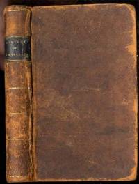
181129037Ostego N Y: H. & E. Phinney. Very Good with no dust jacket. 1811. Presumed 1st. Hardcover. Royalty; History Sweden; History Europe; 12mo 7" - 7½" tall; 275 pages; Contemporary sheep leather black and gilt leather spine label contents toned. Worldcat locates . H. & E. Phinney hardcover
Gundtoft, DorotheaIn Pristine Condition. unknown
1857231345Copenhagen: L'Imprimerie de Thiele 1857. First edition. 22 plates. 10 pp. text. 1 vols. Folio. Contemporary boards. Spine perished boards detached. Internally Fine. First edition. 22 plates. 10 pp. text. 1 vols. Folio. L'Imprimerie de Thiele unknown
Hans Bekker-Nielson, edNot in perfect condition. unknown
SONG8772472006Casscom Media 0000-00-00. hardcover. Used: Good. 8.30x0.50x10.90. Buy with confidence. Excellent Customer Service & Return policy. Casscom Media hardcover
1851200100AG1851. London Edinburgh & Dublin J & F. Tallis 1851. Original steel engraving / Vintage map. Drawn and engraved by John Rapkin. Partly hand-coloured. Illustrations by H. Warren and engravings by J.B. Allen. Plate Size: 25 cm x 34 cm. Sheet Size: 27.4 cm x 37.4 cm. Vintage 19th century map in very good condition. Published in the Illustrated Atlas And Modern History Of The World Geographical Political Commercial & Statistical Edited By R. Montgomery Martin. Beautiful and interesting map of Denmark: the Jutland Peninsula and the surrounding islands such as Zealand and Funen in the Baltic and the North Sea. The political subdivisions of Denmark are delineated and the towns and cities including Copenhagen Aarhus and Odense are shown. Off the east coast the Cattegat strait is identified. The southern coast of Sweden is shown as are the German coasts in the lower part of the map Hanover Mecklenburg and Prussia The Danish royal coat-of-arms can be seen in the upper right corner of the map. John Tallis 7 November 1817 3 June 1876 was an English cartographic publisher. His company John Tallis and Company published views maps and atlases in London from roughly 1838 to 1851. Tallis set up as a publisher with Frederick Tallis in Cripplegate in 1842; the business moved to Smithfield in 1846 and was dissolved in 1849. From 1851 to 1854 Tallis operated as John Tallis and Company. He started The illustrated news of the world and national portrait gallery of eminent personages in 1858 selling it for £1370 in 1861; it folded in 1863. Wikipedia The most important project John Tallis undertook was the 'Illustrated Atlas' from 1851. The original map we offer here was part of this exceptional Atlas and all the maps it contained are still today considered as the last reminder of an era of lavish map production. Tallis worked the project together with John Rapkin 1815-1876 and it was Rapkin's style and talent that we have to thank for when we marvel at these maps today. What makes these maps so special is the detail of engraved vignettes that surround the map and often show indigenous scenes people in their environment and even more so historical buildings or historical views of towns and cities architecture and landscape. The project of 'The Illustrated Atlas' was designed to be finished just in time for the anxiously awaited "Great Exhibition of the Works of Industry of All Nations" or The Great Exhibition sometimes referred to as the Crystal Palace Exhibition in reference to the temporary structure in which it was held was an international exhibition that took place in Hyde Park London from 1 May to 11 October 1851. It was the first in a series of World's Fairs exhibitions of culture and industry that became popular in the 19th century and it was a much-anticipated event. The Great Exhibition was organized by Henry Cole and Prince Albert husband of the reigning monarch Queen Victoria. It was attended by numerous notable figures of the time including Charles Darwin Samuel Colt members of the Orléanist Royal Family and the writers Charlotte Brontë Charles Dickens Lewis Carroll George Eliot and Alfred Tennyson. Music for the opening was under the direction of Sir George Thomas Smart and the continuous music from the exhibited organs for the Queen's procession was "under the superintendence of William Sterndale Bennett". Wikipedia unknown
Rogers, Margaret & RobinIn Pristine Condition. unknown
Holst, Mads Kähler & RasIn Pristine Condition. unknown
Mulder, WilliamIn Pristine Condition. unknown
Polster, BerndIn Pristine Condition. unknown
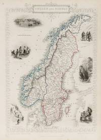
1851200099AG1851. London Edinburgh & Dublin J & F. Tallis 1851. Original steel engraving / Vintage map. Drawn and engraved by John Rapkin. Partly hand-coloured. Illustrations by J. Marchant and engraved by J.H. Kernot. Plate Size: 23.5 cm x 34.5 cm. Sheet Size : 27.4 cm x 37.4 cm. Vintage 19th century map in very good condition. Published in the Illustrated Atlas And Modern History Of The World Geographical Political Commercial & Statistical Edited By R. Montgomery Martin. Beautiful and interesting map of the Sweden and Norway. Denmark the Baltic states and Finland can be seen also. In the Baltic Sea Gotland and Aland islands are included as are the island further north above the Arctic Circle Loffoden Tomsen islands. The political subdivisions are also delineated. Stockholm and Christiania Oslo are identified on the map as are many other towns and cities. Relief is depicted by hachuring. Sweden and Norway or SwedenNorway officially the United Kingdoms of Sweden and Norway or as the United Kingdoms was a personal union of the separate kingdoms of Sweden and Norway under a common monarch and common foreign policy that lasted from 1814 until its peaceful dissolution in 1905. John Tallis 7 November 1817 3 June 1876 was an English cartographic publisher. His company John Tallis and Company published views maps and atlases in London from roughly 1838 to 1851. Tallis set up as a publisher with Frederick Tallis in Cripplegate in 1842; the business moved to Smithfield in 1846 and was dissolved in 1849. From 1851 to 1854 Tallis operated as John Tallis and Company. He started The illustrated news of the world and national portrait gallery of eminent personages in 1858 selling it for £1370 in 1861; it folded in 1863. Wikipedia The most important project John Tallis undertook was the 'Illustrated Atlas' from 1851. The original map we offer here was part of this exceptional Atlas and all the maps it contained are still today considered as the last reminder of an era of lavish map production. Tallis worked the project together with John Rapkin 1815-1876 and it was Rapkin's style and talent that we have to thank for when we marvel at these maps today. What makes these maps so special is the detail of engraved vignettes that surround the map and often show indigenous scenes people in their environment and even more so historical buildings or historical views of towns and cities architecture and landscape. The project of 'The Illustrated Atlas' was designed to be finished just in time for the anxiously awaited "Great Exhibition of the Works of Industry of All Nations" or The Great Exhibition sometimes referred to as the Crystal Palace Exhibition in reference to the temporary structure in which it was held was an international exhibition that took place in Hyde Park London from 1 May to 11 October 1851. It was the first in a series of World's Fairs exhibitions of culture and industry that became popular in the 19th century and it was a much-anticipated event. The Great Exhibition was organized by Henry Cole and Prince Albert husband of the reigning monarch Queen Victoria. It was attended by numerous notable figures of the time including Charles Darwin Samuel Colt members of the Orléanist Royal Family and the writers Charlotte Brontë Charles Dickens Lewis Carroll George Eliot and Alfred Tennyson. Music for the opening was under the direction of Sir George Thomas Smart and the continuous music from the exhibited organs for the Queen's procession was "under the superintendence of William Sterndale Bennett". Wikipedia unknown
Brown, Jules, Paul Karr,In Pristine Condition. unknown
173049794Wien ca. 1730 49x585 cm. Kobberstukket håndkoloreet Skandinavienskort med Estland Letland Litauen og det vestlige Rusland. Velbevaret indrammet under glas i fin ramme af brun birketræsfiner. Håndkolorereingen en smule svag. <br/><br/><em>Kortet er fra Seutter's "Atlas Novus" som blev udgivet 1730-35. </em> unknown
179852947Åbo Frenckellska Boktryckeriet 1798. Orig. blanke kartonomslag. Håndskrevet rygtitel. Lidt rifter i rygpapiret. 41502 pp. Lidt spredte brunpletter. De sidste 5 blade med en skjold øverst. <br/><br/><em>Originaludgaven. First edition. "His Inleding till chemien 1798 was the first Swedishlanguage textbook written in the spirit of the new combustion theory. Although he accepted the phlogiston theory early in his career Gadolin attempted to understand Lavoisier’s ideas. In a paper published in 1788 he tried to define phlogiston and admitted that the French explanation of combustion was superior to some phlogiston theories but for a long time he was not wholly converted. His lectures always made use of the new chemistry and he eventually became the spokesman in Scandinavia for Lavoisier’s nomenclature and combustion theory often encountering Berzelius opposition."DSB.Poggendorff I 827. - Neville I p. 496. </em> unknown
177248558Hafniæ Godiche N. Möller 1772-92. - Registerbind 1878. Folio. Bd. 1-2 i samtidige helldrbd. med rig rygforgyldning og ophøjede bind. Med en del brugsspor. Bd. 3-7 samt registerbindet. i nyereensartede hshirtbd. Med 12 foldetabeller. Bd. 1-3 med de 19 kobberstukne plancher af håndskriftfaksimiler. Bd. 4-7 uden håndskriftfaksimiler. Spredt papirsbruning men ellers ren bortset fra et titelblad som er noget smudsigt. Supplementsbindet kaldet VIII som udkom 1834 er ikke tilstede. <br/><br/><em>The largest collection of Danish medieval texts. In 1834 - 30 years later - a supplementary volume was published called Vol. VIII this is not present here. With the Index-volume in 2 parts published more than 100 years after the first volume. - From vol. IV P.F. Suhm was editor after the death of Langebek. "I dtte værk der indeholder de vigtigste kilder til dansk middelalder og som står mål med tilsvarende udenlandske værker i samtiden finder man resultatet af mange års grundige studier." DBL. </em> unknown
177256743Hafniæ Godiche N. Möller 1772-92. - VIII 1834 og Registerbind IX 1878. Folio. Bind 1-7 i samtidige hellædrbind i flammet kalv. Ophøjede bind. Rig rygforgyldning. Forgyldte tome- og titelfelter i skind. Nogle kapitæler slidte. Bind 8 som ikke udkom i samtiden men først 1834 er i originalt papbd. med shirtryg. Bind 9 som først udkom 1878 er i nyere hfableabd. De 7 første bind indeholder en del foldetabeller kobberstukne faksimiler af håndskrifter kobberstukne foldekort etc. Disse 7 bind har tilhørt retshistorikeren J.L.A. kolderup-Rosenvinge. <br/><br/><em>The largest collection of Danish medieval texts. In 1834 - 30 years later - a supplementary volume was published called Vol. VIII this is present here together with the Index-volume published more than 100 years after the first volume. - From vol. IV P.F. Suhm was editor after the death of Langebek. </em> unknown
1747KAADGC8B9ZXBLund Uppsala Copenhagen Helsinki and Turku 1747. Mostly 4to. 40 volumes. A remarkable collection of Scandinavian academic theses or dissertations or in two cases editions that served to promote a scholars appointment as a professor on the Middle East and the Islamic world mostly printed in the second half of the 18th century. Most are very rare many known only from three or fewer copies. The praeses advisor played a greater role in the production of a thesis than they do today often choosing the topic and even writing much of the text so that the praeses and the respondent the student who defended the thesis to attain a degree prepared the publication together more-or-less as co-authors. The present collection includes the works of the principal Swedish orientalists of their time mainly teaching and publishing at the universities of Uppsala and Lund the great Matthias Norberg 1747-1826 serving as praeses for twenty-two of the theses. The topics covered include medicine in the Middle East dietetics history linguistics and literature education and the erudition of Middle Eastern rulers. Examples include dissertations on leprosy in Arabia the caliphate government the sacred bee of ancient Egypt the Nazarenes first-century followers of Jesus who also retained their devotion to the Torah several aspects of the Arabic language and dialects etc. Some of the dissertations are editions of translations of oriental writings. Examples are a Latin translation of a part of the Bakthiyar namah ten viziers here issued in two parts and an edition and translation of the Lebanese Maronite Germanus Conti's notes on viniculture and the wine press in the Orient. The theses are listed below with the names of both the praeses listed first and the respondent listed second. Altogether this varied collection of theses gives a beautiful overview of the diversity and richness of oriental studies in the 18th and 19th century and Scandinavias important role in those studies.l For a more detailed list of the 40 theses including the 2 duplicates their contents and their condition please send us an inquiry. unknown