6 résultats
1857231345Copenhagen: L'Imprimerie de Thiele 1857. First edition. 22 plates. 10 pp. text. 1 vols. Folio. Contemporary boards. Spine perished boards detached. Internally Fine. First edition. 22 plates. 10 pp. text. 1 vols. Folio. L'Imprimerie de Thiele unknown
1851200100AG1851. London Edinburgh & Dublin J & F. Tallis 1851. Original steel engraving / Vintage map. Drawn and engraved by John Rapkin. Partly hand-coloured. Illustrations by H. Warren and engravings by J.B. Allen. Plate Size: 25 cm x 34 cm. Sheet Size: 27.4 cm x 37.4 cm. Vintage 19th century map in very good condition. Published in the Illustrated Atlas And Modern History Of The World Geographical Political Commercial & Statistical Edited By R. Montgomery Martin. Beautiful and interesting map of Denmark: the Jutland Peninsula and the surrounding islands such as Zealand and Funen in the Baltic and the North Sea. The political subdivisions of Denmark are delineated and the towns and cities including Copenhagen Aarhus and Odense are shown. Off the east coast the Cattegat strait is identified. The southern coast of Sweden is shown as are the German coasts in the lower part of the map Hanover Mecklenburg and Prussia The Danish royal coat-of-arms can be seen in the upper right corner of the map. John Tallis 7 November 1817 3 June 1876 was an English cartographic publisher. His company John Tallis and Company published views maps and atlases in London from roughly 1838 to 1851. Tallis set up as a publisher with Frederick Tallis in Cripplegate in 1842; the business moved to Smithfield in 1846 and was dissolved in 1849. From 1851 to 1854 Tallis operated as John Tallis and Company. He started The illustrated news of the world and national portrait gallery of eminent personages in 1858 selling it for £1370 in 1861; it folded in 1863. Wikipedia The most important project John Tallis undertook was the 'Illustrated Atlas' from 1851. The original map we offer here was part of this exceptional Atlas and all the maps it contained are still today considered as the last reminder of an era of lavish map production. Tallis worked the project together with John Rapkin 1815-1876 and it was Rapkin's style and talent that we have to thank for when we marvel at these maps today. What makes these maps so special is the detail of engraved vignettes that surround the map and often show indigenous scenes people in their environment and even more so historical buildings or historical views of towns and cities architecture and landscape. The project of 'The Illustrated Atlas' was designed to be finished just in time for the anxiously awaited "Great Exhibition of the Works of Industry of All Nations" or The Great Exhibition sometimes referred to as the Crystal Palace Exhibition in reference to the temporary structure in which it was held was an international exhibition that took place in Hyde Park London from 1 May to 11 October 1851. It was the first in a series of World's Fairs exhibitions of culture and industry that became popular in the 19th century and it was a much-anticipated event. The Great Exhibition was organized by Henry Cole and Prince Albert husband of the reigning monarch Queen Victoria. It was attended by numerous notable figures of the time including Charles Darwin Samuel Colt members of the Orléanist Royal Family and the writers Charlotte Brontë Charles Dickens Lewis Carroll George Eliot and Alfred Tennyson. Music for the opening was under the direction of Sir George Thomas Smart and the continuous music from the exhibited organs for the Queen's procession was "under the superintendence of William Sterndale Bennett". Wikipedia unknown
1881DEMO016714INew York: Harper & Bros 1881. First American edition. Hardcover. Very Good. Octavos blue-green pictorial cloth. <br/><br/>Adventures and observations compiled in a series of journeys to Scandinavia 1871-1878. Map & 235 illustrations Harper & Bros hardcover
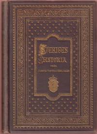
1900LASW00044Minneapolis: Svenska Amerikanska Postens Förlag 1900 WYSIWYG pricing--no added shipping charge for standard shipping within USA. Textured brown cloth blocked with ornate gilt patterns & titles on front boards & spines and blind decorative border on rear boards volumes range from 400 to 600 pages and illustrated with many woodcuts and wood engravings. Most volumes are very good but one leaf pp 15-16 is torn out of volume 2 and laid in; this leaf also has a chip from fore-edge with loss of a few words; and three leaves pp 171-176 of volume 3 have large tears but without loss. Gilt pattern is rubbed off of spines but still bright on front boards. This is a Swedish-language history of Sweden. Vol. 1: 1060-1350 by Oskar Montelius. Vol. 2: 1350-1521 by Hans Hildebrand. Vol 3: 1521-1611 by Oskar Alin. Vol. 4: 1611-1718 by Martin Veibull. Vol. 5: 1718-1809 by Rudolf Tengberg. Vol. 6: 1809-1875 by Teofron Säve. Shipping weight 10 lbs. . Varying/No dj. 20½ X 14½ cm. Svenska Amerikanska Postens Förlag Hardcover
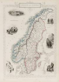
1851200099AG1851. London Edinburgh & Dublin J & F. Tallis 1851. Original steel engraving / Vintage map. Drawn and engraved by John Rapkin. Partly hand-coloured. Illustrations by J. Marchant and engraved by J.H. Kernot. Plate Size: 23.5 cm x 34.5 cm. Sheet Size : 27.4 cm x 37.4 cm. Vintage 19th century map in very good condition. Published in the Illustrated Atlas And Modern History Of The World Geographical Political Commercial & Statistical Edited By R. Montgomery Martin. Beautiful and interesting map of the Sweden and Norway. Denmark the Baltic states and Finland can be seen also. In the Baltic Sea Gotland and Aland islands are included as are the island further north above the Arctic Circle Loffoden Tomsen islands. The political subdivisions are also delineated. Stockholm and Christiania Oslo are identified on the map as are many other towns and cities. Relief is depicted by hachuring. Sweden and Norway or SwedenNorway officially the United Kingdoms of Sweden and Norway or as the United Kingdoms was a personal union of the separate kingdoms of Sweden and Norway under a common monarch and common foreign policy that lasted from 1814 until its peaceful dissolution in 1905. John Tallis 7 November 1817 3 June 1876 was an English cartographic publisher. His company John Tallis and Company published views maps and atlases in London from roughly 1838 to 1851. Tallis set up as a publisher with Frederick Tallis in Cripplegate in 1842; the business moved to Smithfield in 1846 and was dissolved in 1849. From 1851 to 1854 Tallis operated as John Tallis and Company. He started The illustrated news of the world and national portrait gallery of eminent personages in 1858 selling it for £1370 in 1861; it folded in 1863. Wikipedia The most important project John Tallis undertook was the 'Illustrated Atlas' from 1851. The original map we offer here was part of this exceptional Atlas and all the maps it contained are still today considered as the last reminder of an era of lavish map production. Tallis worked the project together with John Rapkin 1815-1876 and it was Rapkin's style and talent that we have to thank for when we marvel at these maps today. What makes these maps so special is the detail of engraved vignettes that surround the map and often show indigenous scenes people in their environment and even more so historical buildings or historical views of towns and cities architecture and landscape. The project of 'The Illustrated Atlas' was designed to be finished just in time for the anxiously awaited "Great Exhibition of the Works of Industry of All Nations" or The Great Exhibition sometimes referred to as the Crystal Palace Exhibition in reference to the temporary structure in which it was held was an international exhibition that took place in Hyde Park London from 1 May to 11 October 1851. It was the first in a series of World's Fairs exhibitions of culture and industry that became popular in the 19th century and it was a much-anticipated event. The Great Exhibition was organized by Henry Cole and Prince Albert husband of the reigning monarch Queen Victoria. It was attended by numerous notable figures of the time including Charles Darwin Samuel Colt members of the Orléanist Royal Family and the writers Charlotte Brontë Charles Dickens Lewis Carroll George Eliot and Alfred Tennyson. Music for the opening was under the direction of Sir George Thomas Smart and the continuous music from the exhibited organs for the Queen's procession was "under the superintendence of William Sterndale Bennett". Wikipedia unknown
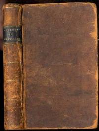
181129037Ostego N Y: H. & E. Phinney. Very Good with no dust jacket. 1811. Presumed 1st. Hardcover. Royalty; History Sweden; History Europe; 12mo 7" - 7½" tall; 275 pages; Contemporary sheep leather black and gilt leather spine label contents toned. Worldcat locates . H. & E. Phinney hardcover