Hermannides, RutgerAntiquariat.de

50 résultats
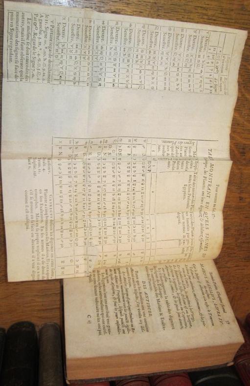
16695753CBAmsterdam, Peter le Grand, 1669. 24°. (18) Bl., 580 S. Mit figürlichem Kupfertitel und 2 gef. Karten, gest. von Aegidius Valkenier. Pergament d. Zt. mit hs. Rückentitel. + Wichtig: Für unsere Kunden in der EU erfolgt der Versand alle 14 Tage verzollt ab Deutschland / Postbank-Konto in Deutschland vorhanden +, 5753C 1. (von ?) Band.
1618592831618. Rare Seventeenth-Century Danish Decree Regulating Boatmen and Firearms Christian IV King of Denmark. Forordning om Baadsmend oc Bysseskyttere. Copenhagen: S.n. 12 November 1618. 4 pp. Quarto 7" x 5-3/4". Disbound folded sheet forming 2 leaves bound into recent marbled boards gilt-stamped calf title label to front. Light rubbing to extremities with minor wear to spine light toning to text. $400. This is a royal decree regulating boatmen and users of the arquebus a musket-like firearm popular in the early modern period. OCLC locates 4 copies none in North America. Bibliotheca Danica 19000000. unknown books
1628592821628. Christian IV King of Denmark. Forordning om Saltpeter oc Krud. Copenhagen: S.n. 19 September 1628. 4 pp. Quarto 7" x 6". Disbound folded sheet forming 2 leaves laid into recent textured paper folder hand-lettered title label to front. Some edgewear toning and faint dampstaining to text otherwise fine. $400. This is a royal decree regarding saltpeter and gunpowder or "Krud" as it was known in Old Danish. It aimed to discourage unauthorized shipments into his kingdom. OCLC locates no copies. Bibliotheca Danica 19000000. unknown books
1697910237CGNürnberg:, Riegel, 1697. Kupferstich 29 x 57 cm, Blattgröße 34,5 x 60,5 cm.
1660441AG1660. Amsterdam Blaeu c.1660. Beautifully handcoloured Original Engraving copper engraving with the decorative and pictoresque Cartouches. Beautifully framed. Size of Frame with map: 66.5 cm x 80 cm. Map itself measures: 44 cm x 58 cm. Excellent condition of this beautiful original 18th century map of this area in Denmark. Framed Handcoloured ! Professionally cleaned historical map beautifully and professionally mounted/restored on see-through acid-free paper. Willem Janszoon Blaeu also abbreviated to Willem Jansz. Blaeu was a Dutch cartographer atlas maker and publisher. Blaeu was born at Uitgeest or Alkmaar. As the son of a well-to-do herring salesman he was destined to succeed his father in the trade but his interests lay more in Mathematics and Astronomy. Between 1594 and 1596 as a student of the Danish astronomer Tycho Brahe he qualified as an instrument and globe maker. In 1600 he discovered the second ever variable star now known as P Cygni. Once he returned to Holland he made country maps and world globes and as he possessed his own printing works he was able to regularly produce country maps in an atlas format some of which appeared in the Atlas Novus published in 1635. In 1633 he was appointed map-maker of the East Indian Company. He was also an editor and published works of Willebrord Snell Descartes Adriaan Metius Roemer Visscher Gerhard Johann Vossius Barlaeus Hugo Grotius Vondel and the historian and poet Pieter Corneliszoon Hooft. He died in Amsterdam. He had two sons Johannes and Cornelis Blaeu who continued their father's mapmaking and publishing business after his death in 1638. Prints of the family's works are still sold today. Original maps are rare collector items. The Dutch painter Johannes Vermeer of Delft 1632-1675 holds a position of great honor among map historians. Several of his paintings illustrate maps hanging on walls or globes standing on tables or cabinets. Vermeer painted these cartographical documents with such detail that it is often possible to identify the actual maps. Evidently Vermeer was particularly attached to a Willem Blaeu - Balthasar Florisz van Berckenrode map of Holland and West Friesland as he represented it as a wall decoration in three of his paintings. Though no longer extant the map's existence is known from archival sources and second edition published by Willem Blaeu in 1621 titled "Nova et Accurata Totius Hollandiae Westfriesiaeq. Topographia Descriptore Balthazaro Florentio a Berkenrode Batavo". Vermeer must have had a copy at his disposal or the earlier one published by Van Berckenrode. Around 1658 he showed it as a wall decoration in his painting "Officer and Laughing Girl" which depicts a soldier in a large hat sitting with his back to viewer talking with a smiling girl who holds a glass in her hand. Bright sunlight bathes the girl and the large map on the wall. Vermeer's gift for realism is evidenced by the fact that the wall map mounted on linen and wooden rods is identifiable as Blaeu's 1621 map of Holland and West Friesland. He captures all of its characteristic design decoration and geographic content." His maps formed the bulk of the Atlas Maior that became a collector's item in Amsterdam. One of Blaeu's globes was purchased at auction by Maarten Magielse a Dutch salesman for the record price of 60.000 euro about $80.000. Magielse is now renting it to the globe museum in Vienna where it is being exhibited. Wikipedia unknown
1680200040AG1680. Amsterdam F. de Wit c.1680. Original hand-coloured engraving. Plate Size: 58.1 cm x 48.8 cm. Sheet Size: 63.8 cm x 53 cm. Original map. In very good condition with only the slightest hints of browning to outer margns only. This beautifully engraved chart shows the main Danish islands of Funen and Zealand plus the eastern coastline of the Jutland peninsula and a little of southern Sweden. The major Danish cities like Copenhagen Aarhus and Odense are shown on the map. The map is filled with minute detail of fortresses cities towns and tiny villages. Relief depicted pictorially The lower right corner of the map bears a stunningly decorative cartouche featuring the Danish royal coat-of-arms and a Classical scene of putti and merfolk frolicking in the sea with the god Mercury in the foreground. A small compass rose lies off the Schleswig Holstein coast in the Colberger Heide. Frederick de Wit 1629/1630 1706 was a Dutch cartographer and artist who drew printed and sold maps. By 1648 during the height of the Dutch Golden Age De Wit had moved from Gouda to Amsterdam. As early as 1654 he had opened a printing office and shop under the name "De Drie Crabben" the Three Crabs which was also the name of his house on the Kalverstraat. In 1655 De Wit changed the name of his shop to the "Witte Pascaert" the White Chart. Under this name De Wit and his firm became internationally known. The first cartographic images that De Wit engraved were a plan of Haarlem that has been dated to 1648. The first charts engraved by De Wit were published in 1654 under the "De Drie Crabben" address. The first map that was both engraved and dated by De Wit was that of Denmark: "REGNI DANIÆ Accuratissima delineatio Perfeckte Kaerte van 't CONJNCKRYCK DENEMARCKEN" in 1659. His first world maps "NOVA TOTIUS TERRARUM ORBIS TABULA AUCTORE F. DE WIT" and Nova Totius Terrarum Orbis Tabula appeared around 1660. His Atlas began to appear around 1662 and by 1671 included anywhere from 17 to 151 maps each. In the 1690s he began to use a new title page "Atlas Maior" but continued to use his old title page. His atlas of the Low Countries first published in 1667 was named Nieuw Kaertboeck van de XVII Nederlandse Provinciën and contained 14 to 25 maps. De Wit quickly expanded upon his first small folio atlas which contained mostly maps printed from plates that he had acquired to an atlas with 27 maps engraved by or for him. By 1671 he was publishing a large folio atlas with as many as 100 maps. After Frederick de Wit's death in 1706 his wife Maria continued the business for four years printing and editing De Wit's maps until 1710. However as De Wit's son Franciscus was already a prosperous merchant by this time and had little interest in his father's business he did not take over the publishing house. In 1710 Maria sold the firm at auction. At the auction most of the atlas plates and some of the wall map were sold to Pieter Mortier whose publishing company grew to become one of the largest cartography publishing houses of the 18th century. The 27 chart plates from his 1675 Sea atlas were sold at the 1710 auction to the Amsterdam print seller Luis Renard who published them under his own name in 1715 and then sold them to Rennier and Joshua Ottens who continued to publish them until the mid-1700s. Wikipedia unknown
1697910231CGNürnberg:, Riegel, 1697. Kupferstich 30,5 x 57,5 cm, Blattgröße 34,5 x 60,5 cm.
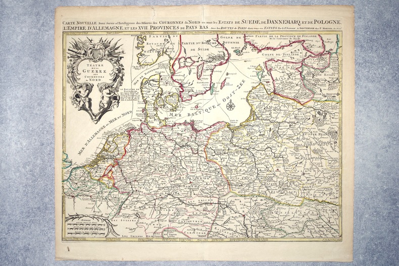
16962308A AMSTERDAM. CHEZ P. MORTIER. SANS DATE (VERS 1696). GRANDE CARTE GEOGRAPHIQUE, GRAVEE PAR JOAN VAN LUGTENBURG, LIMITES COLORIEES A LA MAIN D'EPOQUE (46,5 X 58 CENTIMETRES ENVIRON, 53 X 61,5 CENTIMETRES ENVIRON AVEC LES MARGES), AVEC UN CARTOUCHE DECORATIF AUX ATTRIBUTS MILITAIRES DONNANT LE TITRE. BON ETAT.
1662902605AGAmsterdam:, Joan Blaeu, 1662. Altkolorierter Kupferstich 42,5 x 56 cm, Blattgröße 56 x 65,5 cm.
167922260(Ohne Ort und Drucker), 1679. 172 S. Kl.-8°. Mod. HPgmt.
165051209Frederick de Wit 1650. Contemporary Coloring. With Wonderful Cartouche Upper Right. 1 vols. 23 x 20 inches. About Fine. Framed and glazed. Contemporary Coloring. With Wonderful Cartouche Upper Right. 1 vols. 23 x 20 inches. Frederick de Wit unknown
165051209Frederick de Wit 1650. Contemporary Coloring. With Wonderful Cartouche Upper Right. 1 vols. 23 x 20 inches. About Fine. Framed and glazed. Contemporary Coloring. With Wonderful Cartouche Upper Right. 1 vols. 23 x 20 inches. Frederick de Wit unknown books
165597266Amsterdam, Aegidius Janssonius Valckenier, 1655. [12] Bll., 280 [i.e. 278] S., [11] Bll.; 95 S., [6] Bll. Mit 1 gestoch. Titel, 2 mehrf. gef. gestoch. Karten u. 24 mehrf. gef. Kupfertafeln (Stadtansichten). 12mo. 13,5 cm. Flexibles Ganzpergament d. Zt. mit Kordelschließen u. hs. RTitel (dieser verblasst).
168942652London, William Berry, (1689). Ca 58x88 cm. Frame and under plexiglass. Large engraved map of Denmark in contemp.outline colouring. Perhaps the largest engraved map of Denmark from the 17th century.
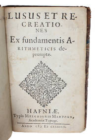
163456014Hafniæ (Copenhagen), Melchior Martzan, 1634. Lille 8vo. Lidt senere hldrbd. Let rygforgyldning. Rester af titeletiket. Ryg lidt slidt. (4),54,(2) pp., 1 kobberstukket planche. De første blade løse. Mangler blad A8 (Pp. 11-12).
168942652London William Berry 1689. Ca 58x88 cm. Frame and under plexiglass. Large engraved map of Denmark in contemp.outline colouring. Perhaps the largest engraved map of Denmark from the 17th century. <br/><br/><em>Berry is sometimes called the English Sanson as he copied Sanson's maps and his followers Jaillot Seller and Senex. This scarce map is a copy of Jaillot's map from 1674 in spite of the printed information "Described by Sanson corrected and amended by William Berry." The large map shows "Schonen Blecking Halland Dukedom of Sleswick and the Diocess of Holstein." - Bramsen p. 11 cartouschen a. p. 120. </em> unknown
163456014Hafniæ Copenhagen Melchior Martzan 1634. Lille 8vo. Lidt senere hldrbd. Let rygforgyldning. Rester af titeletiket. Ryg lidt slidt. 4542 pp. 1 kobberstukket planche. De første blade løse. Mangler blad A8 Pp. 11-12. <br/><br/><em>Originaludgaven af en af de allerførste lærebøger udgivet i Danmark vedrørende læren om de hele tal og regnearterne i matematikken. Bogen var tiltænkt som lærebog i elementær aritmetik for de studerende på Christian den IV's Akademi i Sorø og indøvelsen skete ved hjælp af en række opgaver som stilles i bogen. Lauremberg 1590-1658 var både mathematiker filolog og digter. Han blev af Chr. IV indkaldt til professoratet i matematik ved det adelige Akademi i Sorø hvor han forlod sin stilling i Rostock som det Filosofiske Fakultets dekan. I Sorø virkede han som professor i matematik og ingeniørvidenskab fra 1623 til sin død i 1658. Han var en ikke ubetydelig matematiker og foregangsmand særlig kendt er han for sin indførelse af logaritmerne i Danmark. Det er oså velkendt at Chr. IV havde udset Lauremberg til at udføre det første danske kartografiske værk ved opmåling af landet. Hans virksomhed som korttegner var allerede begyndt i Mecklenburg og det ses at han i en del år var optaget af denne virksomhed i Danmark. Kortværket blev imidlertid aldrig til noget til kongens store fortrydelse. Herefter overtog Johannes Meyer kortlægningen. Lauremberg er yderligere kendt som en af tidens mest fremragende latinske poeter således indeholder hans "Satyra" fra 1636 spirene til de senere plattyske "Skjæmtedigte".The very scarce first edition of one of the first elementary textbooks in arithmetics published in Denmark. The work should be used teaching mathematcs at the University in Sorø founded by the king Chr. IV in 1623.Bibl. Danica II18. - Niels Nielsen. Matematikken i Danmark 1528-1800 p. 127 No. 3. </em> unknown
170017341Amsterdam, de Wit, 1675 (recte um 1700). Ca. 49,5 cm x 57 cm. [4 Warenabbildungen]
167712570Lyon, Johann Anton Huguetan, 1677. 4. Auflage 8° (18,5-22,5 cm). 15 Bll., 806 S., 9 Bll. Pergament der Zeit mit handschriftlichem Rückentitel [5 Warenabbildungen]
1662SB-15294Ulm, Georg Wildeisen, 1662. 1011 S., 27 Bl. Ganzpergamentband der Zeit im Format 17 x 11 cm mit silberner Initial- und Jahreszahl-Prägung (1666). Reisebeschreibung des Geographen, Topographen und Reiseschriftstellers Martin Zeiller (1589 - 1661). Zeiler war nach dem Studium der Rechtswissenschaften zunächst als Hauslehrer und Notar in Linz tätig, mußte von dort aber vor den Nachstellungen der Gegenreformation fliehen. Von 1629 an lebte er in Ulm und hatte hier verschiedene Ämter im gymnasialen Schulwesen inne. Der auch historisch-geographisch vorgebildete Zeiller verfaßte zahlreiche Bücher, vorwiegend zu geographisch-topographischen Themen, ferner Reisehandbücher und -beschreibungen (die Ulmer Stadtbibliothek verwahrt 90 seiner Werke). Er berichtete nicht nur aus eigenem Erleben - dies wäre bei seiner enormen literarischen Produktivität auch gar nicht möglich gewesen - sondern verstand es, als Reisechronist seiner Zeit die Berichte und Beschreibungen seiner gelehrten Zeitgenossen mit Selbsterlebtem zu verbinden und produktiv aufzubereiten. So galt der vielbelesene, kenntnisreiche Reisechronist "bald, infolge seines ausgedehnten schriftstellerischen Wirkens als eine deutsche Berühmtheit. Gelehrte, Staatsmänner und Fürsten unterließen es nie, ihn auf ihrer Durchreise in Ulm aufzusuchen" (ADB 44, 1898, S. 782 - 784). So lag es nahe, daß Matthias Merian, als er Textautoren für seine "Topographia Germaniae" suchte, gern auf die Dienste Zeillers zurückgriff, der diese Aufgabe aufgrund seines ausgedehnten Wissens- und Erfahrungshorizontes auch glänzend bewältigte: "Für die Meriansche Topographie hat nun Z. eine Reihe von Textbüchern geliefert, die durch zweckdienliche Anordnung, geschickte Auswahl des mitzutheilenden sich vortheilhaft von den Leistungen der anderen Mitarbeiter abheben" (ebd.). Bei dem hier vorliegenden "Raisebuch" handelt es sich um ein zusammenfassendes, ergänztes und aktualisiertes "Compendium" zweier Reisebeschreibungen, die Zeiller in den Jahren 1632 und 1642 im Folioformat hatte drucken lassen. Zeiller berücksichtigte in dieser aktualisierten Fassung auch Veränderungen, die zwischenzeitlich als Folge der Kriegshandlungen des Dreißigjährigen Krieges eingetreten waren. Mit ganzseitiger Kupferstich-Illustration als Vortitelblatt, mehrfach gefalteter Deutschland-Karte (Totius Germaniae) im Format 41 x 32 cm, Schriftenverzeichnis des Autors sowie ausführlichem Register (vor allem: Ortsregister), das dem Leser eine sehr gute Navigation in dem umfangreichen Werk ermöglicht. Zum Inhalt (gekürzt, in Stichworten): Cap. 1: Vom alt / und neu Teutschland / ins Gemein. C. 2: Obern Steyrmarch / Ertz Bistum Salzburg / Churfürstenthum Bayern / Reichs Statt Regensburg. C. 3: Statt Regensburg / Ulm in Schwaben. C. 4: Rieß / Grafschafft Ottingen / Burggraftum und gebiet Nürnberg / Obere Pfalz / Egrischer Craiß / Voigtland / Meissen .C. 5: Wittenberg / Fürstentum Anhalt / Ertzstifft Magdeburg / Braunschweigerland / Schauenburg / Minden / Hildesheim / Halberstadt / Manßfeld. C. 6: Meissen /Neuburgische Pfalz / Sternstein / Leuchtenberg / Bayern / Passau / Lintz. C. 7: Under Oesterreich / Mähren. C. 8: Ober Oesterreich / Bayern / Pfalz Neubzrg / Marggraftum Burgau / Württemberger Land / Straßburg. C. 9: Hanau / Liechtenberg / Baden / Straßburg. C. 10: Lothringen / Metz / Sedan / Königreich Frankreich / Genff. C. 11: Schweitzerland / Basel Elsaß / Straßburg. C. 12: Württemberger Land / Burgau / Augspurg / Ober Oesterreich. C. 13: Wien / Graz / Salzburger Land / Bayern / Augspurg / Straßburg. C. 14: Worms / Franckfurt am Mayn / Würzburg / Nürnberg / Regensburg / Wien / Gratz. C. 15: Gratz / Schloß Waasen / Rackersburg / Pettau . / friaul / Venedig. C. 16: Trient / Tyrol / Bayern / Augspurg / Ulm. C. 17: Emden (Ostfriesland) / Meissen / Thüruingen / Francken / Nürnberg. C. 18: Königreich Dennemarck. C. 19: Königreich Schweden. C. 20 u. 21: Niderland / Calias / Emden / Ost-Frießland / Ostende / Brüssel / Amsterdam / Utrecht / Arnheim / Bremen / Lingen / Holland, Seeland 7 Lüttich / Luxemburg / Trier / Coblentz / Frankreich. C. 22: Hessen / Franckfurt am Mayn. C. 23: Schlesien / Laußnitz. C. 24: Polen / Preussen / Liffland. C. 25: Francken / Schwaben. C. 26: Schwaben / Graubunten / Schweitzer und Wallisser Land. C. 27: Unterschiedliche Raisen. C. 28: Kärnten. C. 29: Königreich Ungarn. C. 30: Acht unterschiedliche Raisen. C. 31: 26 unterschiedliche Raisen. C. 32: 13 unterschiedliche Raisen von Augspurg aus.
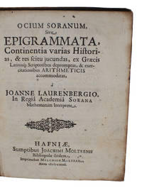
164048600Hafniae Joachim Moltken 1640. 4to. Contemp. full calf. Gil t spine. Wear to top of spine. Blindtooled lineborder on covers. Some wear to spine corners and along edges. Engraved bookmark on inside frontcover "North Library. 1860". 81111 pp. and 1 engraved plate with 6 illustrations. A bit of browning to one quire. A few annotations in a contemporary hand. Otherwise internally clean. <br/><br/><em>Originaludgaven af en af de allerførste lærebøger udgivet i Danmark vedrørende læren om de hele tal i mathematikken. Bogen var tiltænkt som lærebog i aritmetik for de studerende på Christian den IV's Akademi i Sorø. Bogen er på latin og indeholder 61 opgaver som han indpakker - for at være pædagogisk og fastholde studenternes interesse - i latinske hexametre med historisk mytologisk og anekdotisk indhold. De her indeholdte historier giver L. anledning til at fremsætte opgaver som studenterne skulle løse aritmetisk. I forordet fortæller han selv at han har bestræbt sig på at gøre sin matematik smagelig for den adelige ungdom ved praktiske opgaver og ved anekdoterLauremberg 1590-1658 var både mathematiker filolog og digter. Han blev af Chr. IV indkaldt til professoratet i matematik ved det adelige Akademi i Sorø hvor han forlod sin stilling i Rostock som det Filosofiske Fakultets dekan. I Sorø virkede han som professor i matematik og ingeniørvidenskab fra 1623 til sin død i 1658. Han var en ikke ubetydelig matematiker og foregangsmand særlig kendt er han for sin indførelse af logaritmerne i Danmark. Det er oså velkendt at Chr. IV havde udset Lauremberg til at udføre det første danske kartografiske værk ved opmåling af landet. Hans virksomhed som korttegner var allerede begyndt i Mecklenburg og det ses at han i en del år var optaget af denne virksomhed i Danmark. Kortværket blev imidlertid aldrig til noget til kongens store fortrydelse. Herefter overtog Johannes Meyer kortlægningen. Lauremberg er yderligere kendt som en af tidens mest fremragende latinske poeter således indeholder hans "Satyra" fra 1636 spirene til de senere plattyske "Skjæmtedigte".The very scarce first edition of one of the first textbooks in number theory published in Denmark The work should be used teaching mathematcs at the University in Sorø founded by the king Chr. IV in 1623. In 61 cases using latin epigrams of historical and mythological content he proposed 61 mathematical problems to be solved thus introducing pedagogical means in the teaching of mathemtics in Denmark.Bibl. Danica Supplement spalte 195. - Niels Nielsen. Matematikken i Danmark 1528-1800 p. 127 No. 5. </em> unknown
164048600Hafniae, Joachim Moltken, 1640. 4to. Contemp. full calf. Gil t spine. Wear to top of spine. Blindtooled lineborder on covers. Some wear to spine, corners and along edges. Engraved bookmark on inside frontcover ""North Library... (1860"". (8),111,(1) pp. and 1 engraved plate with 6 illustrations. A bit of browning to one quire. A few annotations in a contemporary hand. Otherwise internally clean.
16113462Latin manuscript on vellum with large 6 in diameter suspended black wax seal of James I of England and autograph of Anne of Denmark dated July 23 1610 granting title to Corrodownan Manor in County Cavan Ulster to one John Browne Gent. of Gorgiemill near Edinburgh and his descendants during the Plantation i.e. colonization of Ulster under James I beginning in 1609. The colonists were settled on land confiscated from the Irish inhabitants following the conquest of Ulster 1594-1603 under James's predecessor Elizabeth I. The Plantation was intended to consolidate royal control of Ulster and repress rebellion by importing a substantial Protestant population. Like John Browne and indeed James himself many of the new colonists were Scottish. Some of these families went on to form the backbone of the Protestant Ascendancy in the province. John Browne and his heirs however were not among them. Sir George Carew sent by the king in 1611 to report on the progress of the Plantation noted that "he Browne . sent an agent who took possession set the lands to the Irish returned to Scotland and . performed nothing." The land was sold in 1613 to another Scottish colonist Archibald Acheson. Acheson's descendants were raised to the peerage of Ireland in 1806 as Earls of Gosford and still owned the property in the late nineteenth century. The first nineteen lines of the document grant the Scottish Browne the rights and privileges of James's English and Irish citizens. Especially notable are the requirement that the grantee maintain an adequate supply of arms for defense against the king's enemies lines 77-80 the attempt to encourage the growth of towns 74-76 and the ban on sale of the property to "mere Irish" or to anyone who failed to acknowledge the sovereign as head of the church thus excluding all Catholics by swearing the Oath of Supremacy 114-121. See Rev. George Hill The Conquest of Ireland. An Historical Account of the Plantation of Ulster at the Commencement of the Seventeenth Century 1608-1620 Belfast 1877 308; idem Plantation Papers. Containing a Summary Sketch of the Great Ulster Plantation in the Year 1610 Belfast 1889 188-190; F.J. McCaughey Arvagh. Sources for a Local History Arvagh 1998 16.; Moiré chemise lined with exact recess for seal housed in handsome ruled red morocco clamshell case with gilt title to front cover and raised bands gilt particulars and decoration to spine; gilt rolled edges. Two leaves 65 x 81 cm; the first illuminated with a portrait of the king. Stain to upper left see image.; 65 x 81 cm; 1 pages; Signed by Notable Personage Related; All shipments through USPS insured Priority Mail. . hardcover books
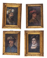
1700L1ABDB3KUTB6Denmark 1700. Collection of four paintings oil on paper or paperboard two measuring 8 x 5.5 cm frame 10.5 x 7.5 cm and two measuring 8.5 x 5.5 cm frame 10 x 7 cm all with a gilt wooden frame. Two sets of two miniature paintings the individual sets painted in matching style and set in matching frames with the two slightly larger frames painted to match the two smaller ones.Ad 1: Portrait of a 16th-century woman possibly Anne of Denmark 1532-1585 wearing a red feathered cap with her hair decorated with pearls a pearl earring a small pleated ruff and a low-necked black bodice with pearls.Ad 2: Portrait of a man with a drooping moustache in oriental costume. He wears a white turban decorated with a rooster a pearl earring and a gown with a large fur collar. The collar is set with gemstones on which hang insignia's of a crescent moon with the points down above three stars.Ad 3: Portrait of a 17th-century man wearing a broad-brimmed hat with a red feather a pearl earring and a leopard fur collar.Ad 4: Portrait of a man with a thick moustache wearing a pearl earring and a blue hat and oriental coat lined with lynx fur. Provenance: Manor House in Jutland. With an inscription at the back of ad 1 "Claude George Gew Anne 1738" and wax seals on the backs of ads 1 2 and 3. Ad 4 with a 19th-century ticket "95". The top layer of ad 3 slightly damaged at the top right revealing part of the red underpainting; otherwise an interesting set in good condition. ABE CAT Costumes & Uniforms unknown