147 résultats
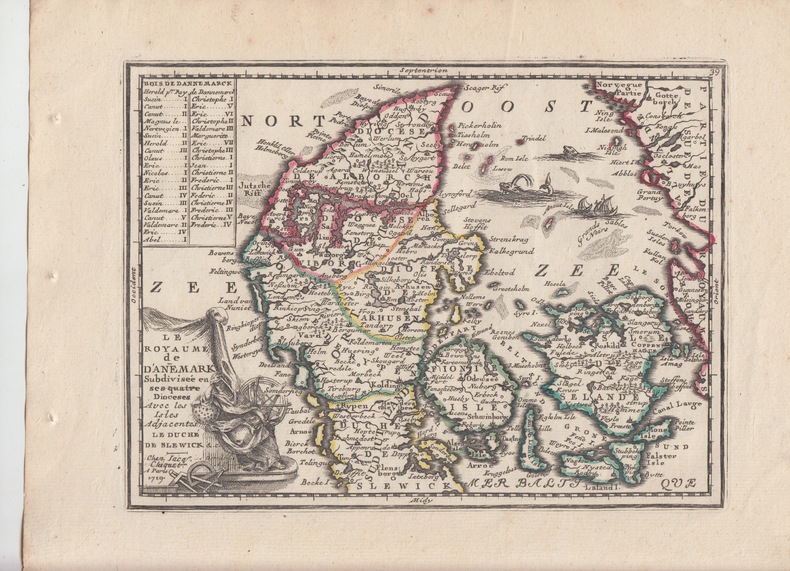
1719228771719 Paris,Nouveau et Curieux Atlas Geographique et historique., c.1719.DENMARK DANEMARK scandinavia bon état; map cuivre carte Chiquet -"Le Royaume de Danemark"schöne original altkolorierte Kupferstich-Karte von Chiquetaus seinem Atlas von 1719Blatt-Format: ca. 27,5 x 21 cm
171517514Amsterdam, um 1715. Ca. 53 cm x 62 cm. [4 Warenabbildungen]
18004532Copenhague chez C.C. Lose (Inst. Royal lithogr. A. dir) 1800 in-4 oblong, en ff.
174092364CBDarmstadt, 1740. 1 Doppelblatt, 34,8 x 21,9 cm.
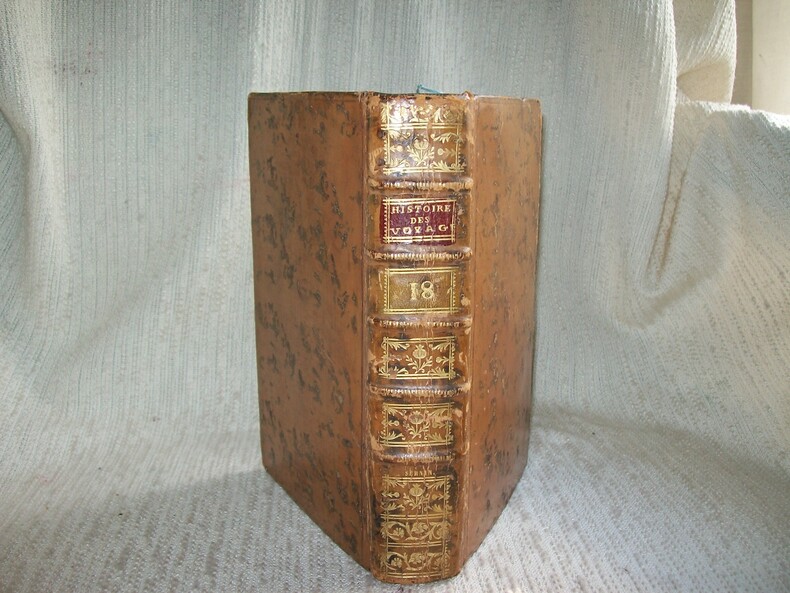
1730GITj081A Paris Hôtel de Thou 1730. In-8 660pp dont table. Pleine basane havane racinée, dos à nerfs orné de cadres de filets et fleurettes dorés, pièces de titre grenat et de tomaison tabac, tranches brique, reliure de l'époque. Orné d'une belle gravure hors texte. Bel exemplaire complet et en bon état, reliure fraîche et décorative. TOME XVIII seul contenant: Livre IV Kamtchatka, découverte et conquête par les Russes, leur commerce, pays et peuples voisins (Koriaques), vocabulaire de la langue du Kamtchatka et des îles Kourites, dialectes des Koriaques, des Kourites, Groënland, glaces, climat, minéraux, végétaux, bêtes, oiseaux et poissons, habitants du Groënland, Annales ou histoire du Groënland, 1ers établissements Danois dans le Groënland, établissements du Groënland depuis l'année 1733 jusqu'à l'an 1740. (j081)
178532516Leipzig : Weidmann und Reich, 1785. 1030 Seiten, Schrift: Fraktur / Altdeutsche Schrift. nachgebundene Ausgabe, Hardcover/Pappeinband, Exemplar in gutem Erhaltungszustand
180023341Kiel, Königl. Schulbuchdruckerei, 1800. - Angebunden: Collecten, Episteln und Evangelia auf alle Sonn- und Fest-Tage durchs ganze Jahr. Nebst beygefügter Historie vom Leiden und Sterben Jesu Christi, wie auch Morgen- und Abendgebete. Schleswig, Serrin Titel, Privileg des Dänischen Königs Christian VII, 10 n.n. Bll., 1212 SS., 14 n.n. Bll. Register, 104 SS. Anhang. 8° geglättetes Leder der Zeit über Holzdeckeln. Gepunzter Goldschnitt, hübsche Vorsätze mit Kattundruck-Papier. Einband berieben und etwas bestoßen, an den Kapitalen das Leder schadhaft, die beiden Schließen fehlend.
177016440Paris, Desnos, 1770. Petit in-12 de [12]-XXVIII-[12]-143-[1], plein maroquin grenat, dos lisse orné de de fleurons et roulettes dorés, pièce de titre verte foncée, triple filet doré en encadrement des plats, filet doré sur les coupes et roulette dorée sur les chasses, tranches dorées.
179434201AB[Altona], 1794. S. 57-72 mit Titelvignette. Gefaltet, Deckblatt nummeriert u. mit Namenszug "v. Schilling". Gebräunt, teils braunfleckig u. angestaubt, mit kleinen Randbeschädigungen.
17708-0-594Paris, Vincent, 1770. 8°(17x11cm), IV, 216 S.; 156 S.;215 S.; 208 S., Ledereinband
178111029Flensburg, gedruckt in der Serringhausenschen Buchdruckerey., 1781. (4) Seiten. Quart (19 x 15,5 cm). Rückenbroschur.
1762001893Paris Lattré 1762
1798014463Paris Chez Hyacinthe Langlois, libraire 1798 Demi-reliure à coins
178899327HBGermanien [i.e.: Kempten], o.V., 1788. 1 Bl., 282 Seiten, Ppbd. der Zeit, farbiger Blattschnitt, 16 x 9,5 cm.
174813188Regensburg (Stadtamhof), Gastl, 1747 - 1748. 3 Bde. 1 doppelblattgr. Titelblatt, 8 Bll., 663 S., 15 Bll. (Register); 640 S., 12 Bll. (Register); 615 S., 16 Bll. (Register). 2 Wappenkupfer und 1 gefalt. Kupferkarte. Kl.-8°. Ldr. der Zeit mit Rückenschildern und Rückenvergoldung (etw. bestoßen und beschabt, Rücken lädiert).
177329487Leipzig, s.e., 1773. 8vo. Mit je 1 gest. Portrait Stuensees u. Brandts. VIII, 294; 78 S. Hldr. d. Zt. auf 5 Bünden m. RSchild. u. Rückenvergoldung. Marmorierte Vorsatzpapiere, Rotschnitt.
177338635Kopenhagen, und zu finden in Franckfurt bey Joh. Bayrhoffer wohnhaft auf der kleinen Gallenga 1773. 238 Seiten, 48 Seiten 77 Seiten, Schrift: Fraktur / Altdeutsche Schrift. gebundene Ausgabe, Rücken fehlt, Papier bräunlich, Einband beschädigt.
172027817ABHamburgi [Hamburg], Literis Trausoldianis [Trausoldische Schriften, Trausold], 1720. 2 Blätter, 1440 S. Pergament der Zeit mit dreiseitigem Rotschnitt u. handschr. Rückentitel. Leicht gebräunt, Vorsätze u. anliegende Blätter leicht feuchtigkeitsspurig, kleine Wurmfraßspuren an den Vorsätzen und wenigen Rändern (ohne Textverlust), wenige Ecken geknickt, 2 Blätter mit Quetschfalte. Einband leicht fleckig.
177189781771 carte ancienne colorée d'époque en vert , rouge et jaune, cartouche non coloré, gravée par Arrivet. Format total : 50 centimètres de haut par 39 centimètres de large, 1771 Paris Lattré Editeur,
1780200039AG1780. Paris De l'Isle et Buache 1780. Original hand-coloured engraving. Plate Size: 64.4 cm x 48.7 cm. Sheet Size: 66.6 cm x 52.7 cm. Original map. In very good condition with the slightest traces of browning only. A very detailed and interesting map of Denmark - the Jutland peninsula and the archipelago of islands such as Funen Zealand and Bornholm- and the and southern Sweden. The Duchies of Brem and Meckelbourg and Pomeranie on the German coast can be seen in the lower part of the map. The cities of Hamburg Copenhagen and Rostock are included on the map. Relief is depicted pictorially. The sand banks and shallows along the coasts are also depicted. Block of annotative French text lies within the Baltic Sea. Guillaume Delisle 1675-1726 was a renowned mapmaker who led the reform of French cartography. A brother of the astronomer Joseph-Nicolas Delisle and a student of the astronomer Jean-Dominique Cassini Delisle learned to fix accurate positions by astronomical observation. The accuracy of his continental outlines and his reduction of gross errors in determining lines of longitude were considerable improvements over earlier maps. His earliest works published in 1700 were a pair of globes terrestrial and celestial maps of the continents and a world map in hemispheres. He prepared about 100 maps and wrote on mensuration and ancient geography. At 27 Delisle was admitted into the French Académie Royale des Sciences an institution financed by the French state. After that date he signed his maps with the title of "Géographe de l'Académie". Five years later he moved to the Quai de l'Horloge in Paris a true publishing hub where his business prospered. In 1718 he was the first to become chief geographer to the king. Encylopedia Britannica unknown
17975603Kiel, Verlag der Königl. Schulbuchhandlung, 1798 + 1797. Pappband der Zeit, 8°, [4], 94 S. [5] / [4], 80 S. [4], roter Farbschnitt; -Papier zum Teil stärker gebräunt und stockfleckig, Einband berieben und bestossen.
1720138888(Augsburg). (Um 1720). Kupferstich mit Text-Beschreibung u. -Erklärung an den Seiten. Format ca. 15,5 x 27,5 cm
174923190Altona, Burmester, 1749. Ausfaltbares Frontispiz (Porträt König Friedrich V. v. Dänemark), 10 n.n. Bll., 600 SS. 4° (ca. 17 x22 cm), Leder der Zeit über 5 Bünden. Einband an den Ecken restauriert, stärker beschabt und an Bünden und Außenfalzen brüchig und etw. schadhaft.
1780910795CG[Um 1780]. Kupferstich 16 x 23,5 cm, Blattgröße 21 x 26 cm.
174598449HBKiöbenhavn:, Christoph Georg Glasing, 1745. 6 Bll., 369 (15) Seiten, moderner HLdrbd. (unter Verwendung älteren Rückenleders), farbiger Blattschnitt, 21 x 17 cm. [4 Warenabbildungen]