Zülow, Carl vonAntiquariat.de

241 résultats
1828910860CGMagdeburg:, Creutz, 1828. Grenzkolorierte Lithographie 68 x 54 cm, Blattgröße 75 x 59,5 cm.
187812290Wien/ Pest/ Leipzig Verlag A Hartleben, 1878. mit 310 Textholzstichen (Plänen, Porträts) und 2 farb. Falt-Karten (Generalübersicht der Kriegsschauplätze nebst extra Karte des Kaukasus) ill. OLwd., VIII, 975 S., 4° (=29 x 21 cm)
186048337Mannheim: Löffler 1860. VII, 112 S. gebundene Ausgabe, geprägter Leinenband, Vollgoldschnitt, Exemplar in gutem Erhaltungszustand
18536005Mit 12 kreidelithographierten Tafeln (inkl. Titel) mit Tonplatte u. in gold gedruckter Bordüre, gedruckt bei J. Rauh in Wien, sowie mehrfach gefalt. federlithograpiertem Plan, lithographiert von J. v. Platzer u. Comp. in Agram. Wien, In Commission bei C. Gerold & Sohn, (1853). Quer-Folio (33,6 x 44,8 cm). 10 S. Leinwandband d. Zt. mit geprägtem Deckeltitel. [5 Warenabbildungen]
186059531Bädeker, Elberfeld 1860. XIV, 319 Seiten - XI, 374 Seiten mit einer Steindrucktafel, 8°, marmorierter Pappband der Zeit mit handschriftlichem Rückentitel auf Papierrückenschild, Bibliotheks-Exemplar (ordnungsgemäß entwidmet) mit Rückständen vom Rückenschild, Stempel auf Vorsatz und Schnitt, Titel von Band 1 in Kopie, Einband leicht berieben und bestoßen, Papier und Tafel leicht randgebräunt und vereinzelt braunfleckig, insgesamt ordentliches und innen sauberes Exemplar,
186161450Elberfeld, Bädeker, 1860-1861. Gr.-8°. Mit einer gefalt. lithogr. Tafel. XIV, 319 S.; 4 Bll., 374 S., 1 Bl., Blindgepr. Lwd.-Bde. d. Zt. m. goldgepr. Rückentiteln u. Kopfgoldschnitt.
1842404419BBStahlst. v. J. J. Hinchliff n. Bartlett, 1842. 15 x 18 cm. (ger. stockfl.).
18330550-21Wien, 4. Nov. 1833. gr.-4°. 1 Bll. In gutem Zustand.
189551246Wien, Heinrich Kirsch, 1895. 8°. Mit einem Titelbild in Lichtdruck u. Textabbildungen. 92 S., OKart.
185921675Zagreb, Gaj, 1859. 4 Bll., 462 S., 1 Bl. 1 Porträt und 1 Tafel (alles in Lithographie). Kl.-8°. Mod. Ldr. (leicht fleckig). [3 Warenabbildungen]
188417027Szegedin. Druck u. Verlag von L. Endrenyi & Comp. 1884. (6), 150, (2) Seiten. Halbleder-Einband der Zeit auf 4 Bünden mit Rückentitelvergoldung u. Lederecken. (Einband an den Kanten teils berieben. Papier teils fleckig). 20x13 cm
188535591Budapest. Carl Grill. (1885). 239, (95) Seiten. Mit zahlr. teils ganzseitigen Holzschnittansichten, vielen teils ill. Werbeanzeigen u. einem mehrfach gefalteten und farbigen Situationsplan i. Anhang. Ill. Original-Leinwand-Einband. (Einband fleckig. Papier teils etwas fleckig) 17x10 cm
1877146662Stuttgart. Verlag von August Auerbach. 1877. XII, (1), 397, (3) Seiten. Ansprechender Halbleinwand-Einband der Zeit mit marmorierten Deckeln. (Geringe Gebrauchsspuren). 21x13,5 cm
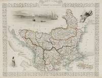
1851200055AG1851. London and New York J & F. Tallis 1851. Original steel engraving / Vintage map. Drawn and engraved by John Rapkin. Partly hand-coloured. Illustrations by H. Warren and engraved by J. Rogers. Plate Size: 32.5 cm x 26 cm. Sheet Size : 37.4 cm x 27.3 cm. Vintage 19th century map in very good condition. Published in the Illustrated Atlas And Modern History Of The World Geographical Political Commercial & Statistical Edited By R. Montgomery Martin. Beautiful and interesting map of South East Europe. Much of the Balkans was then under the control of the Ottoman Turks. The region is delineated into the historic - and future - nations and states including Croatia Herzegovina Bosnia Serbia Albania Macedonia northern Greece Bulgaria Walachia in Romania and Moldova. Russia can be seen extending down into the areas around the Black Sea. Hapsburg-Austria and the heel of the Italian peninsula is shown. Corfu Cyprus and the Greek islands can be seen lying of the archipelago. Gallipoli Sea of Marmara the Bosporus and Constantinople/Istanbul and Asia Minor/Anatolia are shown in the lower right corner. John Tallis 7 November 1817 3 June 1876 was an English cartographic publisher. His company John Tallis and Company published views maps and atlases in London from roughly 1838 to 1851. Tallis set up as a publisher with Frederick Tallis in Cripplegate in 1842; the business moved to Smithfield in 1846 and was dissolved in 1849. From 1851 to 1854 Tallis operated as John Tallis and Company. He started The illustrated news of the world and national portrait gallery of eminent personages in 1858 selling it for £1370 in 1861; it folded in 1863. Wikipedia The most important project John Tallis undertook was the 'Illustrated Atlas' from 1851. The original map we offer here was part of this exceptional Atlas and all the maps it contained are still today considered as the last reminder of an era of lavish map production. Tallis worked the project together with John Rapkin 1815-1876 and it was Rapkin's style and talent that we have to thank for when we marvel at these maps today. What makes these maps so special is the detail of engraved vignettes that surround the map and often show indigenous scenes people in their environment and even more so historical buildings or historical views of towns and cities architecture and landscape. The project of 'The Illustrated Atlas' was designed to be finished just in time for the anxiously awaited "Great Exhibition of the Works of Industry of All Nations" or The Great Exhibition sometimes referred to as the Crystal Palace Exhibition in reference to the temporary structure in which it was held was an international exhibition that took place in Hyde Park London from 1 May to 11 October 1851. It was the first in a series of World's Fairs exhibitions of culture and industry that became popular in the 19th century and it was a much-anticipated event. The Great Exhibition was organized by Henry Cole and Prince Albert husband of the reigning monarch Queen Victoria. It was attended by numerous notable figures of the time including Charles Darwin Samuel Colt members of the Orléanist Royal Family and the writers Charlotte Brontë Charles Dickens Lewis Carroll George Eliot and Alfred Tennyson. Music for the opening was under the direction of Sir George Thomas Smart and the continuous music from the exhibited organs for the Queen's procession was "under the superintendence of William Sterndale Bennett". Wikipedia unknown
182761539Znaim, Gedruckt bei Martin Hofmann, 1827. 8°. VIII, 208 S., 1 Bl.; 214 S., 17 Bll. (Register, Pränumeranten-Verzeichnis u. Berichtigungen), HLdr. d. Zt. m. Rückenverg., goldgepr. Rückenschild u. dreiseitigem Farbschnitt.
18522943Leipzig, Carl Geibel, 1852. Gr.-8°. XVI, 345 (1) S., HLdr. d. Zt. m. Rückenverg. u. goldgepr. Rückentitel.
181019112Dubrovnik [Ragusa], Martecchini [Martekini], 1806 - 1810. 2 Werke in 3 Bdn. Gr.-8°. HLdr. des 20. Jahrhunderts mit Rückentitel (etw. fleckig und bestoßen). [3 Warenabbildungen]
189331870Graz, Leykam, o. J. (1893). Kl.-8°. Mit 34 Textillustrationen von Franz Schlegel. 2 Bll., 168 S., 2 Bll. (das letzte weiß), Illustr.-OKart.
189354224Graz, Leykam, o. J. (1893). Kl.-8°. Mit 34 Textillustrationen von Franz Schlegel. 2 Bll., 168 S., 1 Bl., Illustr.-OLwd. m. dem eingeb. farb. illustr. OUmschlag u. dreiseitigem Goldschnitt.
1882121625Heidelberg. Carl Winter's Universitätsbuchhandlung. 1882. XII, 408 Seiten u. zwei Tafeln. Schlichter Halbleinwand-Einband der Zeit mit marmorierten Deckeln u. einem Rückenschild. (Einband an den Kanten etwas berieben. Papier teils etwas fleckig). 20x13 cm
1898147558V Praze. Nákladem Jana Laichtera na Král. Vinohradech 1898. XIII, (1), 701 Seiten. Halbleder-Einband mit mermorierten Deckeln u. Rückenvergoldung. (Einbandkante einseitig aufgebrochen u. stärker berieben). 21x14 cm
188518539München, Straub, 1885. SS. 65 bis 104, mit 4 ausfaltbaren Karten. Die Kollation entspricht der fortlaufenden Veröffentlichung der Vorträge, diese Schrift so vollständig. 8°, Orig.-Broschur.
188839362Graz, Leykam, 1888. Gr.-8°. 27 (1) S., OBrosch.
187321674Zagreb, Zupan, 1873. 3 Bll., 256 S. mit zahlr. teils ganzseit. Textxylographien und 1 ganzseit. xylographiertem Titel (in der Kollation). Kl.-4°. OLwd. (bestoßen und etw. berieben). [5 Warenabbildungen]
185410936Budapest, Heckenast, 1854. VIII, 335 S. 8°. HLwd. der Zeit (restauriert, leicht bestoßen).