[LATE 1960S GUIDE TO JAPAN].Biblio.com
2 969 résultats
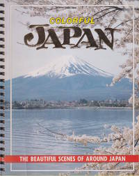
1960219689Yokohama.: Fukuda Card Co. Late1960s. Monochrome maps profuse colour photographic illustrations 69pp 25 x 20cm. Cover little creased with some cellotape adhered to upper corner overall a very good copy. A spiral-bound guide introducing tourists to some of Japan's most notable attractions lavishly illustrated in colour. . Fukuda Card Co. unknown
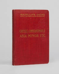
122894MacMillan & Co. London 1910 . Third edition second reprint. 8vo 17.5 x 12 cm pp. xlix 226 6 with 13 maps and 23 plans including folding map of Greece loosely inserted in rear pocket previous owner's signature on front free endpaper; publisher'sl red cloth gilt all edges red; an excellent copy.<br /> Dr Arthur Evans and Professor Ernest Gardner both well known experts on Greece Greek Art and Knossos contributed to this detailed guide. Maps include Delphi Olympia Tiryns and Mycenae. The first edition was published in 1901.<br /> MacMillan & Co., London, 1910 hardcover
1904132824London: MacMillan 1904. 2nd edition. Very Good. small octavo. original boards xxviii 245pp. maps plans index With colour maps & plans. Ownership signature & chipping to edges of front end paper & half-title o/w VG tight copy with tender hinges in slightly discoloured boards MacMillan hardcover
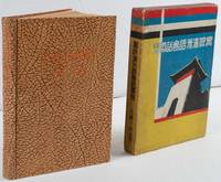
1935220033大阪. Osaka.: 巧人社. Kōjinsha. Showa 10 1935. 18 x 13cm 169pp hardback pictorial endpapers occasional spotting title page browned a very good copy in original pictorial slipcase. This book was published in 1935 three years after Manchukuo was founded. After a short introduction the book explains numbers pronouns and grammar before teaching Manchu conversations on various topics including weather time and travelling. The target readers would have been those visiting Manchuria on business or as tourists. Thus conversations are set in the context of shopping and travelling. Pronunciations of Manchu are written in the Latin alphabet and katakana. Humorous illustrations appear on the endpapers while the slipcase has been decorated in the distinctive colours of the Manchukuo flag with an illustration of a city gate. . 巧人社. [Kōjinsha]. hardcover
1846AQ31443London: Seeley Burnside and Seeley 1846. 2 xix 1 472pp. With an engraved folding map and 45 woodcut illustrations in the text. Original publisher's blind-stamped green cloth lettered in gilt to spine. Lightly rubbed marked spine sunned. Internally clean and crisp. 'Let us all pray for New Zealand that it may please Almighty God to avert the evils of a civil war from this newly-acquired and interesting colony'. The sole edition of an authoritative work of ecclesiastical geography that provides a detailed account of the rise and progress of Protestant missions throughout the world. The anonymous compiler provides detailed information on the political and colonial history of the regions in which missionaries laboured as well as valuable accounts of the 'superstitions' of the natives including instances of human sacrifice the 'prevalence of Paganism and Mahommetanism' cannibalism and the practice of 'Devil-Worship'. The majority of the text is devoted to the missions of Africa and India though extensive chapters relate Christian efforts in inter alia the West Indies Australasia and North America. In regards to West Indies the author provides notices on the origin of the Slave Trade its abolition and the death of the 'ever-to-be revered Mr. Wilberforce'. The chapter concerning North America is predominantly dedicated to Canada in particular the operations of the Hudson's Bay Fur Companies and the 'Native Indians of these Territories favourable to British trade'. The chapter concerning Australasia is divided between New Holland and New Zealand and notably include remarks in character and appearance of the Aborigines and 'the most warlike savages in the world' the New Zealanders respectively. The section on New Zealand strikingly concludes with a brief account of the eruption of conflicts between British and native forces that would prove to be the initial sorties of the bloody and protracted New Zealand Wars. . First edition. 8vo. Seeley, Burnside, and Seeley hardcover
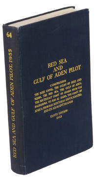
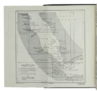
1955ABC_47446London 1955. 8vo. Published for the Hydrographic Department Admiralty Original blue cloth with yellow lettering on the spine and the front board the supplement is loosely inserted at the end of the volume: original printed paper wrappers stapled. With a folding map printed on both sides 2 coloured plates with diagrams printed on both sides 28 plates showing coastlines and occasionally a map many printed on both sides and many some illustrations in text. 2 LI = LIII: II plus 1 1 blank 1 blank 518 1 1 blank pp; Supplement: 20 pp. The essential standard sailing directions for the Red Sea and Gulf of Aden corresponding with zone NP64 on the official Admiralty charts. These nautical works - pilot guides and charts - were published by the United Kingdom Hydrographic Office which provides the necessary hydrographic and marine geospatial data to all kinds of maritime organisations across the world. The publications are not only used by the British Royal Navy but can also be found on board the majority of international merchant ships. The data provided in the pilot guides and other publications are compliant with SOLAS the Safety of Life at Sea treaty guidelines and are updated constantly in weekly "Notices to mariners" and supplements to and new editions of the pilot guides whenever necessary.The present copy is the 10th edition 1955 of the pilot guide with sailing directions and other information on the weather currents radar ranges etc. relating to the Red Sea and Gulf of Aden including the supplement issued in 1957. It includes an erroneous "advertisement to the eight edition" by the Hydrographer of the Navy Rear-Admiral Kenneth St Barbe Collins 1904-1982. The advertisement states that with the publication of "the ninth edition" presumably this volume the previous edition and its supplements are cancelled since the most up-to-date information has been compiled in the new edition and the weekly "Notices to mariners" that appeared after the publication of the 11th edition. The 10th edition of 1955 and its 1957 supplement were made redundant with the publication of the 11th edition in 1967. Each subsequent edition of the pilot supersedes the last which have appeared infrequently depending on newly available information from the mid-19th century until the present day.The front paste-down and recto of the first free endpaper contain a "caution" notice and room for the notation of "supplements and annual summaries of notices to mariners relating to this book" the first two pages are printed on red-pink paper. The binding shows minor signs of wear around the spine and corners of the boards the gutter after page II is somewhat weakened the head edge of the wrappers of the supplement are very slightly browned. Otherwise in very good condition. hardcover
1967ABC_46470London: United Kingdom Hydrographic Office 1967. Grey-blue back wrapper; the two quires map and back wrapper held together by two metal staples. Blue cloth with title information in yellow on front cover and spine the supplement loosely inserted at the end of the volume. Large 8vo. The main work with 3 maps including 2 folding and 82 views of coastal profiles on 52 plates. The supplement with 2 folding maps on the two sides of a single folding leaf and 4 views of coastal profiles on 3 pages. With: NAVIGATION - RED SEA - PILOT GUIDE. Supplement No. 7 - 1977 to Red Sea and Gulf of Aden pilot eleventh edition 1967 corrected to 4th March 1977 Whenever reference is made to the pilot this supplement must be consulted.London United Kingdom Hydrographic Office 1977. The essential standard sailing directions for the Red Sea and Gulf of Aden corresponding with zone NP64 on the official Admiralty charts. These nautical works - pilot guides and charts - were published by the United Kingdom Hydrographic Office which provides the necessary hydrographic and marine geospatial data to all kinds of maritime organisations across the world. The publications are not only used by the British Royal Navy but can also be found on board the majority of international merchant ships. The data provided in the pilot guides and other publications are compliant with SOLAS the Safety of Life at Sea treaty guidelines and are updated constantly in weekly "Notices to mariners" and supplements to and new editions of the pilot guides whenever necessary.The present copy is the 11th edition 1967 of the pilot guide with sailing directions and other information on the weather currents radar ranges etc. relating to the Red Sea and Gulf of Aden including the supplement issued in 1977. The first two pages are printed on red-pink paper. Binding slightly rubbed and faded board edges very slightly soiled fore-edge of the supplement slightly frayed. Overall in good condition. United Kingdom Hydrographic Office, hardcover
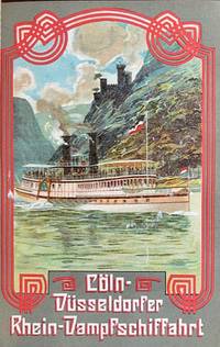
190759689Berlin: Hamburg-American Line J. Hermann Herz 1907. 12mo. 887 1 pp. Approx. 920 pp. including inserts duplicate numbering inserts. With 22 colour inserts plates chromolithograph folding panoramas chromolith pictorial maps colour-printed inserted ads numerous photo plates plates illustrated ads street maps maps. Pictorial red publisher’s cloth gilt black & white lettering front cover black advertising lettering spine & back cover minor shelfwear chipping & faint reinforcement to ffep. uniform interior toning as usual slight offsetting to a couple of the chromolith inserts ex-lib marking foot of spine title still G copy. Eighth edition of this detailed and nicely illustrated brochure for Hamburg-American Line ocean liner passengers detailing hotels restaurants museums and sights throughout Europe. Of particular interest are the beautifully printed chromolithograph inserts including steamships down the Rhine on the Coln-Dusseldorfer steamships; colour insert & map for the Rhaetian Railway Grisons Switzerland colour views traveling through Switzerland on the Montreux-Oberland Bernois railroad and the Bucher-Durrer’s Hotels folding panorama of seven lakes and peaks in the Swiss Alps. Hamburg-American Line, J. Hermann Herz, hardcover
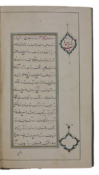
1850ABC_47715Qajar Iran 1850. Contemporary limp leather and woven floral-patterned cloth. 8vo 12.5 x 22 cm. Persian manuscript on polished paper. Black nasta'liq script in 15 lines per page ruled in green and blue with rubricated chapter headings and marginal medallions. A beautifully presented Persian manuscript comprising a unique guide to the barren crossing from Kerman to Kandahar in mid-19th century Qajar Persia. The guide perhaps actually used by two Russian owners whose inscriptions are extant on the front free endpaper in fact covers several routes through what is today south-eastern Iran and western Afghanistan providing reliable information on distances water sources and other relevant data. For instance a reader is told the number of houses in the most populated villages - and consequently the odds of spending the night sheltered indoors at a host's home. - The journey begins in the town of Kerman originally founded as a Sasanian outpost and proceeds to explain one's options to travel to the ancient city of Kandahar; also included are several other routes. The distances daily destinations and road options are all covered in detail for each journey. Apart from these practicalities a traveller also receives tips on the shrines or other tourist spots one might visit on a given day of travel.With two inscriptions in pre-reform Russian cursive on the front free endpaper dated 1855 and 1917. The first inscription appears to be a translation for the benefit of a Minister of the Russian Empire. The second mentions a journey across Afghanistan and Baluchistan possibly with the aid of this very manuscript or perhaps it was a souvenir. Certainly an interesting piece of travel writing and one designed not solely for the armchair traveller. Light wear to cloth though it is remarkably unfaded. Aside from one minor dampstain interior is bright and clean. hardcover
1946L95GI2DERRRALondon: hydrographic department admiralty colophon: printed by Butler & Tanner 1946. 8vo. With two maps to be used as an index 10 plates and a few illustrations in text. Publishers beige cloth. With: Supplement no. 5-1956 relating to the South Indian Ocean pilot sixth edition 1946 corrected to 23 April 1956. London hydrographic department admiralty colophon: printed by Tinlling & Co. Liverpool 1946. 8vo. With a loosely inserted folding plate illustrating the system of buoyage. Publishers wrappers. The standard pilot guide for the South Indian Ocean published by the British admiralty with a foreword by A.G.N. Wyatt rear-admiral and hydrographer of the navy. The first chapter includes general information such as details on the islands' government dependencies flora fauna populations trade products communication services shipping currency weights and measures time health etc. The other chapters give detailed navigational details directions latitudes and longitudes shoals tides winds light beacons anchorage dangers etc. for "Madagascar Iles Comores Ile de la Réunion Mauritius the Seychelles the Chagos Archipelago and other islands lying westward of longitude 80° East".With deaccession stamps. A good copy. hydrographic department, admiralty (colophon: printed by Butler & Tanner), hardcover
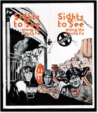
191517070Chicago: Rand McNalley 1915. Stapled Wraps. Very Good/No Dust Jacket As Issued. <br /> <br /> Stapled two-color illustrated wraps; folded in the center. stamp of the Mr. Foster Travel Service of Chicago on the rear. 8 by 9.25 inches; 52 columns on 28 pages; some b/w photo illustration with maps of routes on the inside rear cover.<br /> <br /> The bindings are tight and square. Text clean light even toning. Moderate shelf handling wear. Small diagonal fold dog-ear on lower front corner.<br /> <br /> Uncommon with only one copy located in the Denver Public Library reported in OCLC/WorldCat 36646700. Detailed descriptions of what may be seen along the routes. Mention of the San Francisco Exposition on the rear cover. Rand McNalley unknown
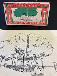
19812062Seattle: Pioneer Square Merchants Committee 1981. First Edition. Loose sheets. Very Good. Oblong 12mo. Pp. 48. Introduction by Mayor Charles Royer. Text by Walt Crowley. Illustrated throughout with line drawings by Lynette Miller. Bound in saddle-stapled stiff wraps printed in three colors. Accompanied by a folding map of the neighborhood. The original artwork accompanies the booklet totaling 27 drawings on 20 leaves of good quality artist paper. All original illustrations in the booklet are accounted for but for one: a depiction of the Washington Street Boat Landing Pergola. Booklet shows slight use. The artwork now protected in archival sleeves in a leather binder was occasionally prepared with white ink for pre-print production purposes. In sum a well preserved visual overview of Seattle's first neighborhood. Today many of the architectural fixtures remain protected by landmark status as they were then but others have been renovated and still others such as the Kingdome have disappeared entirely. (Pioneer Square Merchants Committee) unknown
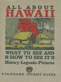
192849883Honolulu: Honolulu Star-Bulletin 1928. 1928. First edition. 6 3/4" x " in color pictorial boards showing Hawaiian hut outrigger and scenery. Covers printed in red yellow green and dark green. 228pp. Contents. Photo frontispiece. Photo plates. Text illustrations. Maps 6 large folding including city map of Honolulu. A well-illustrated and informative handbook. Details the history of Hawaii followed by information on Waikiki Beach Honolulu The Pali Manoa Bishop Museum Pearl Harbor Punchbowl Crater Oahu Waipio Valley Maui Kauai the pineapple kingdom on the Island of Lanai the leprosy colony on Molokai etc. Light wear to extremities. Near fine. Honolulu Star-Bulletin, 1928. hardcover
25890Couverture rigide. Bon/s.d. in-24. Paris Maison de la Bonne Presse s.d. 1904 in-24 XXXIII 1bl. 522pp 2bl.ff 3 cartes et 4 plans cartonnage déditeur en percaline olive dos lisse orné in-24 3 cartes dont une de la Palestine et 4 plans dont un de Jérusalem. Cartes et plans dans le texte. PREMIÈRE ÉDITION de cet ouvrage rédigé par des professeurs de Notre-Dame de France à Jérusalem. Notre-Dame de France est une vaste et puissante bâtisse dont la construction organisée par les Assomptionistes débute à la fin du XIXe siècle. Située sur une des collines qui domine Jérusalem elle témoigne d'une grandeur passée où elle accueillit et protégea les pèlerins de passage dans la Ville sainte. L'édifice fut également considéré comme un institut scientifique: les Assomptionistes disposèrent rapidement d'une imprimerie et d'une grande bibliothèque et contribuèrent à immortaliser la Palestine et Jérusalem en se livrant à des travaux photographiques voir Dominique Trimbur « Une présence française en Palestine - Notre-Dame de France » in Bulletin du Centre de recherche français de Jérusalem 1998. Les cartes et plans hors texte sont reliés à la fin de l'ouvrage. Cartonnage frotté. Quelques rousseurs éparses. Petit manque sur le dos. unknown
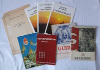
19602233421960s-1970s. Collection of eight items. <br> <br>"Lophuri and Bang Pa-In" published by The Information Bureau Royal State Railways of Siam in 1930: 13pp 24.5 x 17.5cm. Worn original stapled wrappers and one leaf torn with loss at extremities still a good reading copy. <br> <br>Three map fold brochures of Krung Rattanakosin with colour map and photographic illustrations one in Thai language 51.3 x 76.5cm folded 19.3 x 13cm. <br> <br>Four booklets in stapled wrappers: <br>Thai language guide to Rattanakosin 11pp 18.2 x 10.8cm. <br>"Guide to Ayuthaya and Bang Pa-in": Black and white photographic illustrations 37pp. 18.7 x 13.5cm. A prior owner's annotations throughout worn original wrappers backstrip torn with loss. <br>"Guide to Old Sukhothai" by Mali Khoksantiya: Folding map at rear black and white photographic illustrations 42pp. 18.3 x 13cm. Lightly browned original wrappers a prior owner's signature on upper wrapper. <br>"RSR Information Booklet": Folding map at rear black and white charts and photographic illustrations 51pp. 16 x 10.3cm. <br> <br>Overall in good condition. . unknown
188150859New York: D. Appleton & Co. 1881. 8vo. 8 pp. publ. ads xiv 265-500 4 pp. plus 20 pp. illust. ads. Numerous woodcut-engraved illustrations illustrated ads numerous maps & plans 10 folding 2 large inserted in rear pocket. Cobalt-blue publisher’s cloth embossed & decorated on front cover in gilt & black ad on rear for the New York Life Insurance company minor shelfwear rubbing couple tears at creases on 1 folding map repaired in rear pocket still a VG copy. First edition thus of this early Western and Southern railway guidebook describing railway schedules and stops from New York to Chicago Cincinnati to Louisville St. Louis as well as travel to San Francisco the Yostemite Valley Santa Cruz Pescadro Monterey San Jose Petrified Forest Santa Barbara Colorado Springs Texas Yellowstone Manitoba and much more. D. Appleton & Co., hardcover
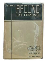
19379561San Francisco: Suttonhouse Ltd 1937. First edition. 8vo. 296pp. Black stamped bright blue boards pictorial endpapers illustrated by William Bender previous owner's endplate on front pastedown pages toned minor edge wear very good. In dust jacket with some chipping and wear very good. Suttonhouse Ltd unknown
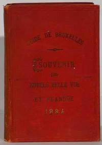
188453521Dehou Brussels 1884. Early Edition. Softcover. Very Good Condition/No Dust Jacket. Travel guide. Guide de Bruxelles et des ses Environs Brussels: Imprimerie M. Dehou 1884. 16mo 5th edition pp. 207 flexible red cloth boards with gilt lettering on front all edges gilt folding street map side by side French-English text illustrated plates. The author a hotel proprietor says the intent of this work is not to rival Baedeker and the like but to call attention to the improvements carried out by King Leopold II. Condition of this book: Small losses at spine ends chip in backstrip covers darkened especially at spine; overall good to very good. Size: 16mo very small. Text is in multiple languages. Text body is clean and free from previous owner annotation underlining and highlighting. Binding is tight covers and spine fully intact. All edges clean neat and free of foxing. Quantity Available: 1. Shipped Weight: Under 1 kilo. Category: Antiquarian & Rare; Belgium; 19th century; Travel & Places. Pictures of this item not already displayed here available upon request. Inventory No: 53521. . Dehou paperback
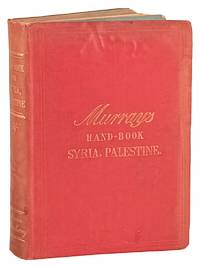
189247368London: John Murray 1892. Very Good. London: John Murray 1892. An Entirely New Edition. Octavo; red cloth stamped in gilt; dark topstain; blue printed endpapers; 403pp. index and advertisements. Maps and illustrations including to front and rear pockets; Jerusalem map at page 50 detached but present. Publisher's folded sheet laid in requesting travelers to send in information regarding hotels or any mistakes or omissions found in the book; blank form to verso. Wear to boards with moderate rippling and soiling; horizontal abrasion to rear boards; spine dulled; front board bowed but binding sound; ownership inscription to preliminaries. Chips to maps generally at folds; still an about Very Good copy of a scarce title. John Murray unknown
1815ABC_46389Amsterdam 1815. 12mo. Evert Maaskamp Original publisher's blue paper wrappers over boards. With an engraved title page including a vignette showing the Amsterdam publishing house of Evert Maaskamp 3 folding maps 1 folding plate showing coins 16 double-page maps and 2 full-page plates; all coloured by a contemporary hand. 2 380 XXII 10 pp. Very rare first edition of a rare early interesting and charming travel guide for The Netherlands containing three folding maps: a Carte generale itineraire. des routes du Pays Bas a Carte des routes entre Paris Londres et Amsterdam and a Carte generale de la Hollande 16 double-page maps and plans including a Carte itineraire des environs d'Amsterdam Carte itineraire d'Amsterdam à Haarlem et Leiden Les environs de Haarlem and a Plan itineraire d'Amsterdam Carte itinéraire dAnvers a Breda etc. all including the roads waterways and distances. The text starts with a Table des distances and the descriptions of 29 different routes mostly to and from places within the Netherlands but no. 29 is a description of a route from Amsterdam to Paris all including the number of postes indicated pp. 1-31. Manière de voyager follows on pp. 32-41 with interesting details on distances prices ways of travelling by diligence post coach horse-drawn canal barge etc. Pp. 42-380 contain accounts of the money industries agriculture products schools and universities dress customs societies cafés colleges and everything else you might wish to know. Further descriptions of the cities and villages followed by a Table de matières and Table des cartes etc. on pp. i-xxii. With the bookplate of John Murison on the front paste-down. Binding worn and shaved especially around the spine. Otherwise in good condition and untrimmed.l Cf. Koeman Atlantes Neerl. II p. 271 Maa 1-2. hardcover
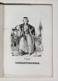
18504999<p>EUROPEAN TRAVEL GUIDE FOR YOUNG READERS</p><p>12mo 240 pp with engraved title page frontispiece and 7 further acqua-forte engraved plates. Bound in original publisher's printed brown wrappers minor damage to spine clean and fresh and excellent and very genuine copy. With stamps likely a bookseller's to head of cover and title page "Rodi-Ferrario". Very good.</p><p>Very rare first and only edition of this travel guide to Europe written as the title suggests for young readers in a pocket 12mo format. The guide moves from tours of Italy and Switzerland all the way to Poland Lithuania and Turkey as well as Great Britain providing 8 engraved plates of national costumes along the way. The charming illustrations depict: a young woman of 'Batz' Bath; a woman of Civita-Vechia Romagna; a citizen of Seville; a young woman of Gaeta Two Sicilies; a boatman from Le Havre a woman of Oberhash Switzerland; the Vizier of Constantinople; and finally a female Athenian. The commentary passes from the historical to contemporary details of travel between major destinations and occasional remarks of art-historical interest. Florence is noted to contain in the same breath the sepulcres of Galileo Aretino Machiavelli and Alfieri the latter having been sculpted by Canova p 72. England Scotland and Ireland are noted very much in passing: although the empire stretches 'to the Ganges' the islands themselves are accorded little interest. The guide does mention "the reknown of the univeristy of Oxford the most learned in England" with no mention however of its more easterly counterpart.</p><p>Unrecorded in OCLC no U.S. copy traced.</p><p> ICCU 1175063<br /><br /></p> Fratelli Reycend paperback
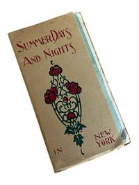
18988809New York: Merchants' Association of New York 1898. First edition. 6.5x3.5" 38pp. Photographs illustrations maps printed in light green and sepia. 4 color maps on foldout sheet bound in at rear 12x19". Corners bumped wrappers a bit edge worn. Few tears to map at folds and along edges old tape repairs to a couple of them. A very good example. <br /> <br /> Uncommon and attractive 19th century travel guide with maps of New York City showing hotels with rates theatres railroads trolley and steamboat lines. . Merchants' Association of New York unknown
1920217674China.: No publication details. Circa1920. Colour folding pictorial map 39.5 x 54cm lower corners a little stained one panel browned and some folds strengthened with washi on reverse an attractive map. This is a pictorial guide map of Yíheyuan the Summer Palace in Beijing. Kunming Lake is feature in the centre where a fancy pleasure boat is floating. Numerous buildings and walking paths are drawn in detail. No publishing date is recorded on the map. . No publication details. unknown
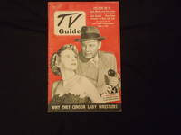
1951biblio11<p>8vo magazine illustrated 30 pp. Slight edgewear covers bright and clean less than normal aging very good plus to near mint condition. This early issue of the TV Guide features a picture of Ralph Bellamy on the cover. Includes an article about lady wrestlers and a short one on Hollywood screen tests. But the really interesting stuff relates to the programing of early television. This installment includes the time slots for Dean Martin and Jerry Lewis Jack Carson Danny Kaye The Cisco Kid The Frank Sinatra Show and The Perry Como Show. </p> TeleVision Guide, Inc.
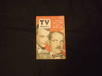
1953105089<p>8vo magazine illustrated 54 pp. Some slight cover and edgewear contents show normal aging; otherwise very good plus. This issue provides programing for the week of February 27 through March 5th 1953. While still and early issue in the series it has almost doubled in size from issues two years earlier. Groucho Marx is featured on the cover and a titile caption indicates that Johhny Ray will be on this week. This issue includes article on Groucho George Jessel and the Merry Mailman. Programing highlights include Ozzie & Harriet The Life of Riley The Jackie Gleason Show G.E. Theater I Love Lucy The Red Buttons Show and My Little Margie.</p> Triangle Publications, Inc.,