Karl BaedekerBiblio.com
2 949 résultats
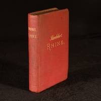
1900978Y31Leipsic : Karl Baedeker Publisher 1900. Cloth. Very Good Indeed. 6.5" by 4.5". Not Stated . A smart Baedeker handbook to the Rhine complete with folding maps and plans. Fourteenth revised edition of this Baedeker handbook.In the publisher's red cloth binding. Illustrated with forty-five maps and twenty-five plans twelve of which are folding. Collated complete. These 'Baedeker' handbooks from the company of German publisher Karl Baedeker set the standard for authoritative guidebooks for tourists. They contain among other things maps and information regarding routes travel facilities noteworthy sights attractions and museums written by specialists. This volume provides forty-nine routes including ones from Brussels to Cologne from Cologne to Dusseldorf from Coblenz to Mayence from Frankfort to Mannheim and from Strassburg to Bale. In the original cloth binding. Externally very smart with slight discolouration and a couple marks to the cloth and shelf wear. Internally firmly bound. Pages are generally bright and clean with occasional scattered spots. Front free endpaper is clipped causing offsetting to the title page. Very Good Indeed Karl Baedeker, Publisher hardcover
1018525483.Gpaperback. Good. Access codes and supplements are not guaranteed with used items. May be an ex-library book. paperback
45241653like new. unknown
0331541092.Gpaperback. Good. Access codes and supplements are not guaranteed with used items. May be an ex-library book. paperback
1396848142.Gpaperback. Good. Access codes and supplements are not guaranteed with used items. May be an ex-library book. paperback
0366774026.Gpaperback. Good. Access codes and supplements are not guaranteed with used items. May be an ex-library book. paperback
1931SKU1149242Leipzig: Karl Baedeker 1931 1931-01-01. Hardcover. Good. Leipzig 1931; German text; red cloth covered boards; beveled edges; mild shelf wear; illustrated jacket in poor condition with edges heavily chipped and rear flap detached and laid-in; 16 mo 5 3/4" to 6 3/4" tall; decorative edges; previous owner's name on free front end paper; interior pages and maps in very good condition; interior clean and unmarked; 512 pages. Leipzig: Karl Baedeker, 1931 hardcover
0483016977.Gpaperback. Good. Access codes and supplements are not guaranteed with used items. May be an ex-library book. paperback
1527851516.Gpaperback. Good. Access codes and supplements are not guaranteed with used items. May be an ex-library book. paperback
1910209039Leipzig: Karl Baedeker Publisher 1910. Fourth Edition. Stiff boards. VG. The fold out maps have a little bit of wear on the edges but intact and in good condition. Twelvemo. Stiff wraps. Bound in red cloth with gilt titles. x 250 pages frontispiece illustrations folded maps plans some folded 17 cm. Karl Baedeker, Publisher hardcover
1925blb05848Leipzig: Karl Baedeker 1925. Hardcover. Very Good. Red cloth on flexible boards with gilt lettering to front and spine and blind stamped horizontal and vertical rulings on front rear and spine. Text block edges marbled. Small book is tight square sharp-cornered and free of major flaws or markings inside and out - 25 maps including several fold-outs and 73 plans all present and near fine. Very nice copy. Karl Baedeker hardcover
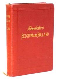
191021992Leipzig: Karl Baedeker Publisher 1910. Very Good/No Dust Jacket As Issued. <br /> Europe Before the Trenches - Rail Routes Canals Hotels Cafés and Cities at their Edwardian height.<br /> <br /> A handsome pre-First World War Baedeker guide to Belgium and Holland issued at the height of continental rail travel and just four years before much of this landscape would be transformed by war. The classic red Baedeker binding remains one of the most recognizable formats in travel publishing history designed for practical use yet now deeply associated with the golden age of European touring.<br /> <br /> The volume presents detailed route planning hotel recommendations urban descriptions railway information and exceptionally detailed folding maps and city plans for Belgium Holland and Luxembourg. Large folding maps of Brussels Amsterdam Rotterdam and regional transport routes remain visually striking and highly usable today offering collectors a snapshot of Europe immediately before the upheaval of 1914.<br /> <br /> Particularly appealing is the survival of the numerous folding maps and plans often the first components missing or damaged in Baedeker guides. The period bookseller label from Antwerp adds a modest continental provenance touch consistent with the book's original travel use.<br /> <br /> PHYSICAL DESCRIPTION: Original flexible red cloth stamped in gilt. Small octavo. Approximately 6.25 inches tall. Title page dated 1910. Illustrated throughout with 19 maps 37 town plans and 8 ground plans many folding and color printed. Ribbon marker present.<br /> <br /> CONDITION: Very Good. The bindings are tight and square. Text is clean; light even age-toning. Moderate shelf handling wear. Cloth remains bright with moderate handling wear Light rubbing at extremities and mild corner softening. Spine gilt somewhat faded though still legible. Folding maps appear generally sound and unusually well-preserved for a working travel guide of this period. A few folds show expected light wear from use. Bookseller label of Librairie Ackermann Anvers on front advertisement page. A solid and attractive example of this increasingly collectible Baedeker guide. HISTORICAL SIGNIFICANCE -<br /> Karl Baedeker transformed modern travel publishing through standardized portable guidebooks emphasizing accuracy cartographic detail and practical traveler information. By the late nineteenth and early twentieth centuries 'Baedeker' had become virtually synonymous with continental travel itself. These guides influenced generations of travelers and writers appearing frequently in literary works centered on European travel culture.<br /> <br /> This guide captures Europe at the height of Edwardian rail travel when continental touring had become accessible to affluent English-speaking travelers. Baedeker guides were prized for their accuracy and became essential companions for tourists scholars and literary travelers alike.<br /> <br /> The plans of Brussels Amsterdam and Rotterdam preserve urban landscapes before wartime destruction and modern redevelopment. Hotel listings tram routes cafés and museums now serve as vivid documentary records of pre-World War I European travel culture.<br /> <br /> SUBJECTS: Baedeker Guides Belgium Travel Holland Travel Luxembourg Travel European Rail Travel Edwardian Europe Folding Maps Cartography Pre-World War I Europe Amsterdam Maps Brussels Maps Rotterdam Maps Travel Cartography European History Guidebooks. Karl Baedeker Publisher unknown
elala5963Leipzig: Karl Baedeker nd. Stereotype Edition. Hinrichsen S7. 16mo. pp. 1 p.l. ix 1 331 1. with half-title. original cloth spine darkened extremities frayed inner front hinge partly cracked half-title browned. elala5963 Leipzig: Karl Baedeker, nd hardcover
189017436Leipsic: Karl Baedeker. 1890. Second Edition. Hardcover. Very Good-. Boards darkened rubbed and lightly soiled. Hinges started. Front map detached but present. Bookplate. Edges a bit tanned ; With 15 Maps 30 Plans and A panorama; 16mo 6" - 7" tall; 540 pages . Karl Baedeker hardcover
1898106328<p>16mo 4 1/4" x6 1/4" softcovers color folding maps. 31 pp. Spine a bit frayed split and chipped some darkening to covers and early owner signature on top margin of front cover some edgewear a section is a little loose because of spine split normal aging; otherwise considering the item about very good. Maps are clean and bright. This copy includes 9 folding maps of Paris including one showing railroads. While the accompanying text is in English the maps are in French. There is an additional folding map in the rear 10 total that shows omnibus and tramways in Paris.</p> Karl Baedeker,
1912003349Leipzig: Karl Baedeker Publisher 1912. A handsome copy in Very Near Fine condition. Bright clean square tight and unmarked. 11cm wide by 16cm tall. No owner's name or bookplate. No underlining. No highlighting. No margin notes. Complete with 62 maps 42 plans and ground-plans and 3 panoramas. The maps are in color and several fold-out. With two ribbon bookmarks sewn into the headband. All page edges are attractively marbled as issued. Bound-in at the end is the 38-page "Sketch of Norwegian and Swedish Grammar with Vocabulary and List of Phrases." Index. Bound in the publisher's red cloth gilt. Tenth Edition Revised and Augmented. Hardcover. Very Near Fine condition. 478pp. 38 page vocabulary. Karl Baedeker, Publisher Hardcover
195917471Freiburg: Karl Baedeker. 1959. Hardcover. Very Good. Gilt lettering a bit faded ; Mit 19 Karten 47 Stadtplänen 10 Grundrissen 178 Zeichnungen. ; 16mo 6" - 7" tall; 460 pages . Karl Baedeker hardcover
1903012A45Baedeker Leipzig 1903. 1903 pp. LXVI 489 40 p. Phrase Book "Danisch-Norwegische und Schwedische Sprachlehre zum Reisegebrauch" Plus 37 Maps and 22 Plans mostly in color. Some light damp staining. Some maps trimmed close loose or carelessly folded with slight tears. All edges marbled. 16mo. 160 mm. Original full flexible rose cloth binding gilt lettered. Name on title page. Overall a good copy. TRAVEL/3 0.0. Hardcover. Baedeker, Leipzig 1903. hardcover
elala5964Leipzig: Karl Baedeker London: Dulau And Co. & New York: Charles Scribner’s Sons nd. Stereotype Edition. Hinrichsen S9. 16mo. pp. 1 p.l. ix 1 331 1. with half-title. original cloth head of spine chipped front free-endpaper & half-title browned. elala5964 Leipzig: Karl Baedeker, London: Dulau And Co., & New York: Charles Scribner’s Sons, nd hardcover
3306651904. Flexible Boards . Good/No Jacket. Square and tight in lightly soiled red and gold covers. Corners gently bumped and/or lightly creased. Top edges lightly bent. Spine is 'lumpy' and gently scuffed. Once-colorful marbled edges have faded to shades of gray. Clean interior with no markings. Previous owner writing in pencil on ffep. First nine pages lightly damp stained and creased. 'Index of Streets and Plans of Paris' in cardstock wraps bound-in at rear. 13 maps and 38 plans. Fragile complete remnants of three maps and/or plans laid in. 15th ed. hardcover
1894272120Baedeker 1894. Bon Etat de conservation sous rhodoïd intérieur frais bonne tenue couv. un peu décolorée et ternie. in12. 1894. Cartonné. avec ses cartes dépliantes en couleurs livret indicateur et plans de Londres in fine Baedeker unknown
46770Leipzig Baedeker 1910. Kl.8° L 496 S. m. 19 Karten u. 36 Plänen und 8 Grundrissen. OLwd. m. Goldpräg. Kapitale etw. berieben Notizen in Bleistift a. hint. Vs. etw. gebrauchsspurig. 24. Auflage. 010 Leipzig, Baedeker, 1910 unknown
REIS0904Leipzig Baedeker 1936. LII 524 Seiten mit 34 Karten 75 Plänen u. einer gr. Straßenkarte in Deckeltasche OHLn. Ecken u. Kanten berieben Rückengelenk angeplatzt Leipzig, Baedeker 1936. unknown
0749-18Lpz. Baedeker 1912. 17. Aufl. XXXVI 400 S. Mit 4 gefalt. farb. Karten 34 gefalt. Plänen u. Grundrissen und Plananhang. OLn. m. OU. In sehr gutem Zustand. Hinrichsen D 436 Lpz., Baedeker 1912. unknown
1894093418Leipzig Paris: Baedeker/Ollendorf 1894. XXXII 362 S.; mit 12 Karten u. 27 Plänen Register; mit Plan-Anhang kpl.; 11. Aufl.; Hinrichsen² F 154; fliegender Vorsatz mit ExLibris u. Besitzervermerk Plan-Anhang lose dessen rückwärtiger Umschlag mit Notizen in Tinte Karten im Anhang sehr gut sehr wenige Bleistiftnotizen. Leinen. Befriedigend. 16 cm. Baedeker/Ollendorf Hardcover