77 résultats
4818Paris, au siège du Comité, 1913, 1 br. in-4 de (4)-32-(2) pp., paginées 305 à 336, texte sur 2 colonnes, carte ;
1978015567Paris Ader Picard Tajan 1978 In-8 carré Broché, couverture illustrée
1978ABE-243587021844 PAGES-DERNIERE EDITION-SONATE D'AUTOMNE D'INGMAR BERGMAN PAR JEAN DE BARONCELLI-LA PALESTINE EST NEE A CAMP DAVID PAR JEAN COHEN-NUAGES SUR TAHITI/II LE MISSIONNAIRE ET L'AVION-LES NOUVELLES HEBRIDES/1P-L'AFFAIRE DU PALAIS DE LA MEDITERRANEE-LES ECOUTES DU CANARD ENCHAINE EN APPEL-JACQUES BREL SERA INHUME AUX ILES MARQUISES/LA "BRELGIQUE" DE L'AMI FRANZ/VESOUL VEUT SE SOUVENIR/A LA TELEVISION ON L'APPELAIT JACKY-MORT DU CLOWN VICTOR FRATELLINI
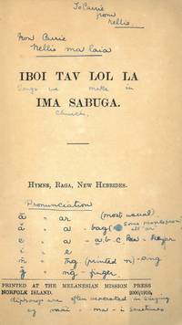
191077404New Hebrides 1910. 8vo. Blått blankt stivt omslag forsterket i ryggen med hyssing. Upaginert. 44 s. 8vo. Blue stiff wrappers strengthened with string at spine. Not paginated. 44 pp. Melanesisk. <br/><br/><em>Sjelden. Med noen håndskrevne ordforklaringer.Scarce. With some handwritten explanations. </em> unknown
ORD-12815Paris. Quantin. Vers 1890. In-8 (125 x 188mm) broché, plats de couverture illustrés en noir, 83 pages, illustrations dans le texte, certaines à pleine page et carte dépliante des Nouvelles Hébrides avec celle de la Nouvelle Calédonie dans un cartouche (carte datée de 1889). Les pages 81-82 donnent des Renseignements statistiques sur les îles malaisiennes (superficie et population). Rare plaquette dont le but est de favoriser la colonisation française des Nouvelles Hébrides, facilitée par la convention du 24 octobre 1887. Bon exemplaire.
1951788641951 Paris, Musée de l'Homme, 1951, grand in 8° broché, 103 pages agrafées ; 7 planches hors-texte et un grand schéma dépliant ; des passages soulignés au crayon et nombreuses annotations marginales sur les 10 dernières pages et page 33.
Ambrym Island Surveyed by Lieutenant & Commander H.E. Purey-Cust. assisted by Lieutenants W. Pudsey Dawson, F.C.C. Pasco, & A.E.H. Marescaux. H.M. Surveying Ship "Dart" 1893-4. Oceana P.t to Krong P.t from a survey by Lieut. Comm. R.L. Hancock and the Officers of H.M. Surveying Ship "Sealark", 1914. London Published at the Admiralty, 8th Oct. 1894, under the Superintendence of Captain W.J.L. Wharton, Hydrographer. Interesting rapresentation of Mount Benbow and its active crater. Small corrections: 1920. Folded editorially. Autore: Admiralty Charts. Luogo: Ambrym Island - New Hebrides. Anno: '900. Tecnica: incisione. Dimensioni: 643x984 mm
Anchorages in Epi Island In the upper part of the chart insert of Ringdove Bay Surveyed by Lieut. & Commander H.E. Purey-Cust, and the Officers of H.M. Surveying Ship "Dart" 1893, Yemyu Cove By Lieut. W.U. Moore, commanding H.M.S. Dart, 1883. In the lower part of the chart insert of Foreland Anchorage Surveyed by Lieut. & Commander H.E. Purey-Cust, and the Officers of H.M. Surveying Ship "Dart" 1893, Nelson Bay Surveyed by Lieut. & Commander H.E. Purey-Cust, and the Officers of H.M. Surveying Ship "Dart" 1893, Diamond Bay By Lieut. W.U. Moore, commanding H.M.S. Dart, 1883. London Published at the Admiralty, 12th Nov. 1894, under the Superintendence of Captain W.J.L. Wharton, Hydrographer. Small corrections: 1925. Autore: Admiralty Charts. Luogo: Epi Island - New Hebrides. Anno: '900. Tecnica: incisione. Dimensioni: 461x652 mm
Anchorages in Malekula Island. In the left part of the chart insert of Ure or Tomman Island Anchorage Surveyed by Lieut. & Commander H.E. Purey-Cust and the Officers of H.M.Surveying Ship "Dart" 1893. In the right part of the chart insert of Port Ravallec Surveyed by Lieut. & Commander H.E. Purey-Cust and the Officers of H.M.Surveying Ship "Dart" 1893, Lambumbu Harbour Sketch Survey by Lieut. K. Dixon, H.M.S. "Archer", 1903. London Published at the Admiralty, 25th Feb. 1895, under the Superintendence of Rear Admiral W.J.L. Wharton, Hydrographer. Small corrections: 1920. Autore: Admiralty Charts. Luogo: Malekula Island - New Hebrides. Anno: '900. Tecnica: incisione. Dimensioni: 457x652 mm
Ancient and original map of Anchorages in New Hebrides Islands. In the left side of the chart insert of Talomaco Anchorage From a French Government Plan published 1892, De La Table Anchorage From a French Government Plan published 1892, Requin Bay From a French Government Plan published 1884, Narovorovo By Lieut. J.B. Murray, H.M.S. "Pegasus", 1906.In the right side of the chart insert of Lonock Bay Surveyed by Lieut. H.F.J. Rowley, 1899. Assisted By Lieut. H. Thompson & G.D. Jephson & Lieut. J. Deed H.M.S. "Wallaroo" 1899, Hog Harbour Surveyed by Lieut. H.F.J. Rowley, Assisted By Lieut. H. Thompson & G.D. Jephson & Lieut. J. Deed H.M.S. "Wallaroo" 1899, London Published at the Admiralty, 2nd June 1900, under the Superintendence of Rear Admiral Sir W.J.L. Wharton, Hydrographer. Hog Harbour is place where today is possible to admire Lonnoc Beach and not far away Champagne Beach.Small corrections: 1925. Autore: Admiralty Charts. Luogo: Espiritu Santo Island - New Hebrides. Anno: '900. Tecnica: incisione. Dimensioni: 623x482 mm
Ancient and original map of Anchorages in the New Hebrides. In the upper part of the chart insert of Rodd's Anch.ge Surveyed by Commander H.E. Purey-Cust & the Officers of H.M. Surveying Ship "Dart", 1894, Sasun Bay Sketch Survey by Lieut. W.P. Dawson , H.M.S. Miranda, 1884, Rannon Anchorage Surveyed by Commander H.E. Purey-Cust & the Officers of H.M.Surveying Ship "Dart", 1894. In the lower part of the chart insert of Craig Cove Surveyed by Lieut. & Commander H.E. Purey-Cust & the Officers of H.M.Surveying Ship "Dart", 1893, Dip Point Anchorage Surveyed by Lieut.- Com. R.L. Hancock and the Officers of H.M.Surveying Ship "Sealark", 1914. London Published at the Admiralty, 17th Dec. 1894, under the Superintendence of Captain W.J.L. Wharton, Hydrographer. Small corrections: 1920. Autore: Admiralty Charts. Luogo: Ambrym Insula Vanuatu - New Hebrides. Anno: '900. Tecnica: incisione. Dimensioni: 461x649 mm
Ancient and original map of Anchorages in the New Hebrides Islands In the left side of the chart insert of Cliff Bay and Barree Bay, From a French Survey 1885 & H.M.S. Psyche 1905, Lisburn Anchorage By Lieut. Com. Moore, and the Officers of H.M.S. "Dart" 1883, Nogugu Anchorage Sketch Survey by Lieut. H.L. Haslewood H.M.S. "Pegasus", 1909, Walurigi Anchorage Sketch Survey by Lieut. W. Pudsey-Dawson H.M.S. Miranda, 1884, Dun-Dui Anchorage Sketch Survey by Lieut. W. Pudsey-Dawson H.M.S. Miranda, 1884, Betarara Anchorage From a French Government Plan made in 1905. In the middle of the chart insert of Bice Road, By Nav. Lieut. W.J. Symons, H.M.S. Wolverene, 1878, Steep Cliff Bay Surveyed by Commander H.E. Purey-Cust & Officers of H.M. Surveying Ship "Dart", 1894, Wea-Sisi Bay Sketch Survey by Lieut. W. Pudsey-Dawson H.M.S. Miranda, 1884, Lenakel Anchorage By Nav. Lieut. H. Hosken, H.M.S. Pearl, 1875 Additions by Lieut. J.B.L. Murray, H.M.S. Pegasus, 1906. In the right side of the chart insert of Lama Langa Sketch Survey by Lieut. H.L. Haslewood H.M.S. "Pegasus" 1909, South-West Bay By Nav. Lieut. Hosken and H.S. Penn, 1875. the North Anchorage by Lieut. W. Pudsey-Dawson, 1884, Port Resolution By Lieuts J.L. Marx, and H.H. Torlesse, 1885. London Published at the Admiralty, 31st July 1880, under the Superintendence of Captain F.J. Evans, Hydrographer. Small corrections: 1928. Autore: Admiralty Charts. Luogo: Tanna Island - New Hebrides. Anno: '900. Tecnica: incisione. Dimensioni: 610x483 mm
Ancient and original map in the upper part of the chart insert of Havannah Harbour Surveyed by Lieut. & Comm. G.C. Frederick, assisted by Lieut. H.J. Gedge, E.A. Day & B.T. Somerville, H.M. Surveying Ship "Dart" 1890. With additions from a survey by Lieut. G.E. Richards, H.M. Surveying Ship "Renard", 1878. In the lower part of the chart insert of Havannah Harbour inner part Surveyed by Lieut. & Comm. G.C. Frederick, assisted by Lieut. H.J. Gedge, E.A. Day & B.T. Somerville, H.M. Surveying Ship "Dart" 1890. London Published at the Admiralty, 1st April 1892, under the Superintendence of Captain W.J.L. Wharton, Hydrographer. Small corrections: 1920. Autore: Admiralty Charts. Luogo: Efate Island- Havannah Harbour - New Hebrides. Anno: '900. Tecnica: incisione. Dimensioni: 651x482 mm
Ancient and original map of Malo Island to Efate Island From Surveys by Lieut. & Comm. G.C. Frederick, assisted by Lieut.ts H.J. Gedge, E.A. Day & H.B.T. Somerville, H.M. Surveying Ship "Dart" 1890-91. and Lieut. & Comm. H.E. Purey-Cust, assisted by Lieut.ts W. Pudsey-Dawson, F.C.C. Pasco & A.E.H. Marescaux, H.M. Surveying Ship "Dart" 1892-93. London Published at the Admiralty, 1st Oct. 1894, under the Superintendence of Captain W.J.L. Wharton, Hydrographer. Interesting map incorporating the results of the survey of the HDS Dart frome the year 1890 to 1893. (Alexander Turnbull Library). Small corrections: 1928. Folded editorially. Autore: Admiralty Charts. Luogo: Efate Island - Malo Island - New Hebrides. Anno: '900. Tecnica: incisione. Dimensioni: 987x638 mm
Ancient and original map of Maskelyne Islands Surveyed by Lieut. & Comm. H.E. Purey-Cust, Assisted by Lieutenants W. Pudsey-Dawson, F.C.C. Pasco & A.E.H. Marescaux, H.M. Surveying Ship "Dart", 1893. In the upper left corner of the chart insert of Vao Anchorage. London Published at the Admiralty, 3rd Dec. 1894, under the Superintendence of Captain W.J.L. Wharton, Hydrographer. Small corrections: 1920. Autore: Admiralty Charts. Luogo: Maskeline Islands - New Hebrides. Anno: '900. Tecnica: incisione. Dimensioni: 485x646 mm
Ancient and original map of New Hebrides Surveyed by Lieutenant & Commander G.C. Frederick, assisted by Lieutenant H.J. Gedge, E.A. Day and H.B.T. Somerville, H.M. Surveying Ship "Dart" 1890. In the upper part of the chart insert of Fila harbour, Sasaki Anchorage, Metensa Bay. In the lower part of the chart insert of Efate Island (Sandwich Island), Meli I. Anchorage From a French Government Survey 1888, Na Ora Matua Anchorage By Nav. Lieut. H. Hosken, H.M. S. Pearl, 1875. London Published at the Admiralty, 21st March 1892, under the Superintendence of Captain W.J.L. Wharton, Hydrographer. Higly interesting rappresentation of Efate Island (Sandwich Island) in South Pacific Ocean. The insert of Fila Harbour shows the situation of the area before the constuction of the capital Port Vila. Water stain in the high left corner. Small corrections: 1930. Folded editorially. Autore: Admiralty Charts. Luogo: Efate Island Sandwich Island - New Hebrides. Anno: '900. Tecnica: incisione. Dimensioni: 957x649 mm
Ancient and original map of New Hebrides Isl.s South West Pacific. In the left side of the chart insert of Port Patteson, by Thomas Kerr, Master in the Ship Southern Cross 1860. with additions by Lieutenant H.P. Norwood, H.M.S. Prometheus 1911, Anuda or Cherry Island Sketch Survey by Lieutenant Wilfrid Nunn, H.M.S. Goldfinch, 1898, Torres or Vava Islands From a French Government Sketch Survey, 1895. In the right side of the chart insert of Hayter Bay, by Nav. Lieut. T.L. Mourilyan H.M.S. Basilisk 1872 Capt. J. Moresby, Espiegle and Malua Bays, by Lieut. R.N. Ommanney and Sub.Lieut. W.P. Dawson, 1882-4, Lakarere By T.C. Tilly Nav. Lieut. 1869, Port Olry by the Officers of the French ship of war "Segond"1880, Picot Bay From a French Government Sketch Survey, 1895, Ringdove Anchorage From a Sketch Survey by Lieut. W.R. Willis, H.M.S. "Ringdove" 1894, Port Narevin (Walter Bay) , Vi Paka Anchorage From a French Government Sketch Survey, 1895, Dives Bay Sketch Survey by the officers of the French Transport "laDives" 1886, Dillon Bay By T.C. Tilly, Master, H.M.S. Cordelia, 1861. London Published at the Admiralty, March 10th 1864, under the Superintendence of Capt. G.H. Richards, Hydrographer. Small corrections: 1924. Folded editorially. Autore: Admiralty Charts. Luogo: Vanua Lava - New Hebrides. Anno: '900. Tecnica: incisione. Dimensioni: 621x941 mm
North Coast of Aneityum Island showing Port Patrick, Ijipthav and Anau-Un-Se Anchorages From the Surveys by Captain Denham and Lieut. Chimmo H.M. Surveying Ship "Herald" 1853. London Published at the Admiralty, 20th Aug. 1887, under the Superintendence of Captain W.J.L. Wharton, Hydrographer. Small corrections: 1920. Folded editorially. Autore: Admiralty Charts. Luogo: Aneityum Island - New Hebrides. Anno: '900. Tecnica: incisione. Dimensioni: 631x971 mm
Ancient and original map of Port Sandwich Surveyed by Lieutenant & Commander G.C. Frederick Assisted by Lieut. H.J. Gedge, E.A. Day & B.T. Somerville, H.M. Surveying Ship "Dart", 1891. London Published at the Admiralty, 11th Oct. 1892, under the Superintendence of Captain W.J.L. Wharton, Hydrographer. Small corrections: 1931. Autore: Admiralty Charts. Luogo: Malekula Island - New Hebrides. Anno: '900. Tecnica: incisione. Dimensioni: 652x482 mm
Ysabel Island (Bugotu Island) Eastern part Sketch Survey by Lieutenant Frederick C.C. Pasco, assisted by Lieuts. C.E. Stainer, R. Aylen and K. Mackenzie-Grieve, H.M. Surveying Ship "Dart" 1902. London Published at the Admiralty, 3rd Marc. 1904, under the Superintendence of Rear Admiral Sir W.J.L. Wharton, Hydrographer. Small corrections: 1928. Folded editorially. Autore: Admiralty Charts. Luogo: Santa Isabel Island - Solomon Islands - New Hebrides. Anno: '900. Tecnica: incisione. Dimensioni: 657x986 mm
Ysabel Island (Bugotu Island) Western part Sketch Survey by Lieutenant Frederick C.C. Pasco, assisted by Lieuts. C.E. Stainer, R. Aylen and K. Mackenzie-Grieve, H.M. Surveying Ship "Dart" 1902. London Published at the Admiralty, 3rd Marc. 1904, under the Superintendence of Rear Admiral Sir W.J.L. Wharton, Hydrographer. Small corrections: 1919. Folded editorially. Autore: Admiralty Charts. Luogo: Santa Isabel Island - Solomon Islands - New Hebrides. Anno: '900. Tecnica: incisione. Dimensioni: 655x989 mm
1376076Noumea: Imprimeries Réunies de Nouméa, 1962 plaquette in-8, 17 pages, illustrations. Agrafé, très bon état. Plaquette touristique.
1994118125P., Le Livre de Paris, 1994, in-folio, 191 pp, préface de Patrick Mahé, richement illustré de gravures, photos et cartes en noir et en couleurs dans le texte et hors texte, reliure demi-toile bordeaux illustrée de l'éditeur, bon état
056010Paris Editions Albin Michel 1957 in 4 (25,5x19,5) 1 volume broché, couverture rempliée, sous chemise et étui de l'éditeur, 257 pages [2], avec des illustrations de Michel Lablais. Illustrations en couleurs reproduites à la main dans les ateliers du Coloris Moderne. Edition limitée, celui-ci un des 100 exemplaires numérotés sur vélin, comprenant une suite en sanguine des illustrations. Exemplaire enrichi d'un bel envoi autographe signé par Pierre Benoit, et d'un dessin orignal à la plume signé et dédicacé par Michel Lablais (joueur de tam-tam). Très bel exemplaire ( Photographies sur demande / We can send pictures of this book on simple request )
1369608Paris: Albin Michel, 1957 gr. in-8, 264 pages, illustrations. Reliure d'édit. en toile cirée vergée, vignette estampée sur le premier plat, très bon état. Un des 1400 ex. numéroté sur vélin . Cette édition publiée avec le concours de la Société des Amis des Nouvelles-Hébrides commémore le cinquantenaire du Condominium Franco-Britanniques sur ces iles.