3 résultats
178011138Genève: Jean-Léonard Pellet 1780. In-8 gr. mm. 253x195 mz. pelle coeva dorso restaurato decorazioni e titolo oro su tassello al dorso pp. 22 con 50 tavole la n. 17 e' bis a doppia pagina fuori testo incise in rame cosi' suddivise: 2 mappamondi 10 carte per l'Europa 8 per l'Asia 23 per l'America e le Antille 7 per l'Africa. Al fine una serie di 23 "Tableaux" numer. più volte ripieg. e relativi ai commerci navigazione finanze Compagnia delle Indie Orientali merci derrate e produzioni dalle Americhe all'Europa. Il volume che non porta il frontespizio fa parte dell'opera di G.-T. Raynal "Histoire philosophique et politique des Etablissements." pubblicata a Ginevra nel 1780-81 in 5 volumi. Cfr. Moreland/Bannister "Antique maps" p. 138: "Rigobert Bonne c. 1729 - c. 1795. As Royal Hydrographer Bonne's principal interest lay in the production of marine charts. He also provided maps for a notable atlas by Guillaume-Thomas Raynal" - Cohen-Ricci p. 854 e BrunetIV1126 che citano l'opera di Raynal "en 5 volumi dont un forme l'atlas composè de 49 cartes". Lievi fioriture altrimenti esemplare ben conservato. (Jean-Léonard Pellet), unknown
KART0261Genf J.L. Pellet ca 1780. 265 x 22 cm. 2 Bl. Ss. 5-22 50 doppelblattgroße Kupfertafeln 23 teils mehrfach gefaltete typogr. Falttafeln Lederband der Zeit auf 6 Bünden mit goldgepr. Rückenschild sehr gut erhalten die Karten überaus frisch und fleckenfrei in kräftigen Abzügen einige Textbl. bzw. Tafeln mit Quetschfalten. Atlaswerk zur Histoire philosophique von G.T. Raynal. Das Werk das zu einem großen Teil Diderot zugeschrieben wird erschien erstmals 1770 in Paris wurde von der Zensur verboten und im Ausland mehrfach nachgedruckt. Alle Karten in dieser Ausgabe außer der Karte 2 Planisphere suivant la projection de Mercator sind von Rigobert Bonne 1727-1794 wobei viele von Gaspard Andre gestochen wurden. Darin 2 Weltkarten sowie Karten v. Afrika 7 Asien 9 u. Europa 9 Nord- Mittel- und Südamerika 23.- Borba de Moraes II174; Sabin 68081; Sander 1656; Hill Coll. 250: ""This Geneva edition is considered the best edition. The atlas is very scarce"". [Genf] [J.L. Pellet] [ca 1780] unknown
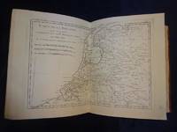
1794335970Venice: Andrea Santini 1794. Atlas. Quarto paper over boards 12 x 9 inches title written in manuscript on the spine. 98pp text with 61 hand colored double page maps on thick paper.<br/> <br/> General atlas of the universe engraved and published on 61 copper plates double page by Santini. Includes double page decorative title page and table of contents 'Tables des cartes geographiques qui composent le Nouvel Atlas De Mr. Grenet.' Showing various Empires Kingdom States Republics and Islands throughout the world major cities towns villages rivers and mountains. A few stains on map 34 and ink stains on 56 spine repaired but otherwise in very good condtiion. Grenet was a Jesuit educator base in Paris. Rigobert Bonne 1727-1795 was one of the most important cartographers of the late 18th century. He served as Hydrographer to France. Francois Santini 1776-1784 was an Italian cartographer based in Venice.<br/> <br/> Andrea Santini unknown