Wyld, James (1812-1887)Biblio.com
125 résultats
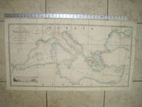
1853020822London: James Wyld Geographer to Her Majesty Charing Cross East 1853. Very Good condition only a little light soil SEE PHOTOS. This huge detailed map of the Mediterranean measures 99.5cm by 54cm when unfolded. The image itself is 93.5cm by 47.5cm. There is a finely engraved view of the entrance of Gibraltar Bay in the lower left corner. The map is a linen-backed copper engraving with original hand coloring. The map has handsome marbled paper endsheets and when folded-up measures 18cm by 12.5cm. SEE PHOTOS. Published by James Wyld Geographer to Her Majesty Charing Cross East London. A New General Atlas of Modern Geography Consisting of a Complete Collection of Maps of the Four Quarters of the Globe; Delineating their Physical Features and Coloured to Show the Limits of Their Respective States 1853. First Edition. Linen-backed hand-colored map. Very Good condition. 99.5cm by 54cm when unfolded. Great Packaging Fast Shipping. James Wyld, Geographer to Her Majesty, Charing Cross East Paperback
1880S218London: Hakluyt Society 1880. 1st Edition . No Binding. Vg. Folio. A single sheet folding map based on the map in Richard Hakluyt's ' Principall Navigations Voyages and Discoveries of the English Nation' associated with Edward Wright map-maker. The Wright Molyneux map. Called by Shakespeare in Twelth Night ' the new map with augmentation of the Indies'. To illustrate the Voyages of John Davies'. Map only lacks the 16pp booklet. 29 x 21 inches. One small repair. A trifle foxed. PLEASE EMAIL FOR PHOTO. Produced by THE TYPOGRAPHICAL PRINTING COMPANY. <br/> <br/> Hakluyt Society unknown
1823Map926London: Robt. Wilkinson 1823. 1st Edition . Hardback. Vg. Folio. 52 coloured plates - 45 maps 7 chrono-geological charts 7 maps double-page. Orignal boards and spine. Fine contents with hand-coloured maps thoughout. Rubbed and worn boards but a sound binding needing new paper covering pasted to the boards.The fine map plates are dated between 1800 and 1823 <br/> <br/> Robt. Wilkinson hardcover
1880GT058Edinburgh: John Bartholomew & Co. 1880. 1st Edition . Hardback. Fine. Folio. ND 1880 The Royal Horticultural Society Gardens in Kensington are still mapped but closed in 1882 being the Royal Albert Hall and Royal College of Music so this scarce map is published prior to that date. 23.5 x 33 x 23.5 inches 80x60 cms Folded and enclosed with a green cloth booklet 31pp with index of the streets etc. A nice copy with a few pin-holes where the folds intersect. A single un-dissected sheet pasted on linen with 36 panels when folded. From Hampstead to south of Battersea and Shepherd's Bush to Greenwich with printed and hand-colouring. The map has grid-lines each covering half mile suares with grid letters and numbers in the margins. Tower Bridge is not present. <br/> <br/> John Bartholomew & Co. hardcover
1840Map871London: Longman Hurst Row Orme & Co. 1840. 1st issue . Cloth. Vg. WALKERS COUNTY MAP SERIES. nd C1840. Folding map of Hampshire and The Isle of Wight laid on linen and dissected into 15 sections. Out-line hand-colour coloured woods and railway lines. Enclosed in a card case with a decorative paper label. Stain to the lower margin and affecting some folds otherwise an attractive travellers map in a v.g. condition. 41 x 34cms. <br/> <br/> Longman, Hurst, Row, Orme & Co. hardcover
1843Map872London: Longman Hurst Row Orme & Co. 1843. 1st issue . Cloth. Vg. WALKERS COUNTY MAP SERIES. nd c1843. Folding map of KENTlaid on linen and dissected into 15 sections. Out-line hand-colour coloured woods and railway lines. Enclosed in a card case with a decorative paper label. Covers worn otherwise an attractive travellers map in a very clean condition. 34 x41 cms.13 x 16 inches <br/> <br/> Longman, Hurst, Row, Orme & Co. hardcover
1840GT692London: Longman Rees Orme. 1840. 1st issue . Cloth. Vg. Folding map. WALKERS COUNTY MAP SERIES. nd C1840. Origina green boards with the original label with an attractive border. Folding map of Wiltshire laid on linen and folded into 15 sections. Out-line hand-colour coloured woods and railway lines. An attractive travellers map in a v.g. condition. 41 x 34cms.Parliamentary divisions updated in 1830. Please email for photos. <br/> <br/> Longman Rees Orme. hardcover
1830Le601London: G.G. and J. Robinson 1830. 3rd Edition . Hardback. Vg. 8vo. :Containing a Comprehensive System of Modern Geography After a New and Curious Methodlxiii 567 viii pp appendix. Original full plain calf gilt ruled compartments. 5 engraved plates in the Introduction A double hemisphere world map worn but complete as a frontis. and 6 folding maps Europe creased in the main section. "Corrected and considerably enlarged". New descriptions of America and Cook's Voyages I. A General View of the Terraqueous Globe: Being a Description of the Figure Motion and Magnitude of the Earth; The Theory of the Air Winds and Tides; the Doctrine of the Sphere; the Use of the Globes etc etc. II. A particular View of the Terraqueous Globe: Being an accurate Description of all the Empires Kingdoms States Provinces and Colonies in the known World; shewing the Extent of their Situation Extent Climate Air Soil Animal Vegetable and Mineral Productions . To which is added An Appendix: Containing a Geographical Table with the Names and Situations of the Chief Cities Towns &c. etc etc.The first edition of this educational book was <br/> <br/> G.G. and J. Robinson hardcover
1815Map697Edinburgh: John Thomson 1815. 1st Edition . No Binding. Fine. Original hand-colour fine scarce unfolded copy 490 X 700 From John Thomsons New General Atlas 1817 beautifully hand-coloured on thick paper <br/> <br/> John Thomson unknown
1814Map710Edinburgh: John Thomson 1814. 1st Edition . No Binding. Fine. Original hand-colour fine scarce unfolded copy 510 x 610 From John Thomsons New General Atlas 1817 beautifully hand-coloured on thick paper <br/> <br/> John Thomson unknown
1816Map696Edinburgh: John Thomson 1816. No Binding. Fine. Original hand-colour fine scarce unfolded copy 510 X 610 From John Thomsons New General Atlas 1817 beautifully hand-coloured on thick paper. <br/> <br/> John Thomson unknown
1814Map702Edinburgh: John Thomson 1814. 1st Edition . No Binding. Fine. Original hand-colour fine scarce unfolded copy some chipping to top edge 510 x 610 From John Thomsons New General Atlas 1817 beautifully hand-coloured on thick paper <br/> <br/> John Thomson unknown
1814Map699Edinburgh: John Thomson 1814. 1st Edition . No Binding. Fine. Original hand-colour fine scarce unfolded copy 610 x 510 From John Thomsons New General Atlas 1817 beautifully hand-coloured on thick paper <br/> <br/> John Thomson unknown
1817Map686Edinburgh: John Thomson 1817. No Binding. Fine. Original hand-colour fine scarce unfolded copy 470 X 540 From John Thomsons New General Atlas 1817 beautifully hand-coloured on thick paper <br/> <br/> John Thomson unknown
1814Map683Edinburgh: John Thomson 1814. No Binding. Fine. Original hand-colour fine scarce unfolded copy small damp stain to top margin and professional small repair to edge 510 X 580 From John Thomsons New General Atlas 1817 beautifully hand-coloured on thick paper. <br/> <br/> John Thomson unknown
1817Map693Edinburgh: John Thomson 1817. 1st Edition . No Binding. Fine. Original hand-colour fine scarce unfolded copy 510 X 620 From John Thomsons New General Atlas 1817 beautifully hand-coloured on thick paper <br/> <br/> John Thomson unknown
1816Map690Edinburgh: John Thomson 1816. Hardcover. Fine. Original hand-colour fine scarce unfolded copy small damp stain to top edge 510 X 610 From John Thomsons New General Atlas 1817 beautifully hand-coloured on thick paper <br/> <br/> John Thomson hardcover
1817Map688Edinburgh: John Thomson 1817. 1st Edition . No Binding. Fine. Original hand-colour fine scarce unfolded copy small damp stain to bottom edge 510 X 610 From John Thomsons New General Atlas 1817 beautifully hand-coloured on thick paper <br/> <br/> John Thomson unknown
1814Map705Edinburgh: John Thomson 1814. 1st Edition . No Binding. Fine. Original hand-colour fine scarce unfolded copy one edge sl. stain 470 x 520 From John Thomsons New General Atlas 1817 beautifully hand-coloured on thick paper <br/> <br/> John Thomson unknown
1816Map694Edinburgh: John Thomson 1816. No Binding. Fine. Original hand-colour fine scarce unfolded copy 490 X 620 From John Thomsons New General Atlas 1817 beautifully hand-coloured on thick paper. <br/> <br/> John Thomson unknown
1817Map687Edinburgh: John Thomson 1817. 1st Edition . No Binding. Fine. Original hand-colour fine scarce unfolded copy 620 X 490 From John Thomsons New General Atlas 1817 beautifully hand-coloured on thick paper <br/> <br/> John Thomson unknown
1816Map682Edinburgh: John Thomson 1816. 1st Edition . No Binding. Fine. Original hand-colour fine scarce unfolded copy small damp stain to top margin 510 X 610 From John Thomsons New General Atlas 1817 beautifully hand-coloured on thick paper <br/> <br/> John Thomson unknown
1817Map684Edinburgh: John Thomson 1817. 1st Edition . No Binding. Fine. Original hand-colour fine scarce unfolded copy 530 x 670mm From John Thomson's New General Atlas 1817 beautifully hand-coloured on thick paper wide margins <br/> <br/> John Thomson unknown
1814Map689Edinburgh: John Thomson 1814. No Binding. Fine. Original hand-colour fine scarce unfolded copy 520 X 650 From John Thomsons New General Atlas 1817 beautifully hand-coloured on thick paper <br/> <br/> John Thomson unknown
1817Map706Edin`: John Thomson 1817. 1st Edition . No Binding. Fine. Original hand-colour fine scarce unfolded copy one edge sl. Stain 410 x 520 From John Thomsons New General Atlas 1817 beautifully hand-coloured on thick paper <br/> <br/> John Thomson unknown