338 résultats
18452407150241xbvkFirenze, Presso gli editori - Tipografia e calcografia all'insegna di Clio, 1835-1845. X, 184 p. / XIX, 116 p.; XXIII, 771 p.; II+V+1 folded plates. / VII, 1.026 p. / 1.110 p. / 618 p. / XXVII, 1.102 p.; III folded plates. / VIII, 603 p. / XII, 273; XIII, 481 p. / XVII, 619 p. / XII, 652 p.; IV (of IX?) folded plates. / IX, 385 p.; V folded plates. / XXI, 1.091 p.; IV folded plates. / 311 p. / 1.133 p. / 670, VI; 83 p. / XXV, 1.064 p.; I folded plate. / 573 p. / XXIV, 844 pages. - Overall CCXXXIII, 13.713 pages; XXV (of 30?) often multiple-folded plates**. --- GILT-DECORATED AND -TITLED 'PUBLISHERs' HALF-LEATHER BINDING WITH MARBLED PANELS, sparkled edges (Vol. 8.II: Plain brown papercover of the period); 8vo.(ca. 23 x 15 x 95 cm; ca. 17 kg.).
185631024ABWinterthur, Topographische Anstalt von J. Wurster u. Comp., (1856). Quer-Folio. Titelseite, 17 Blatt mit Karten, 26 Seiten, 29 Blatt mit Karten. Halblederband mit Pappdeckeln. + Wichtig: Für unsere Kunden in der EU erfolgt der Versand alle 14 Tage verzollt ab Deutschland / Postbank-Konto in Deutschland vorhanden +, A|B [2 Warenabbildungen]
186427105ABBerlin, Ernst Schotte & Co Verlagsbuchhandlung, [1864]. 8° (22x15), 112 S., mit 7 gefalteten lith (teils farblith) Tafeln [so komplett], marmor Hln d.Zt, angestaubt, Kanten bestossen, anfangs etwas fingerfleckig, die Tafeln angerändert und mit etwas Fehlfalzung, ordentliches festes Exemplar, [= Der Garten-Ingenieur; 4/2],
187512639Wyld, London ca. 1875. Original hand-colour in block and outline, marking postal districts and railways in bold red. 21 segments, folded and linen-backed with marbled paper to folded end segments. Size 57x73, overall 59,5x77 cm. A bit tanned, verso a bit rubbed and stained.
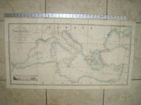
1853020822London: James Wyld Geographer to Her Majesty Charing Cross East 1853. Very Good condition only a little light soil SEE PHOTOS. This huge detailed map of the Mediterranean measures 99.5cm by 54cm when unfolded. The image itself is 93.5cm by 47.5cm. There is a finely engraved view of the entrance of Gibraltar Bay in the lower left corner. The map is a linen-backed copper engraving with original hand coloring. The map has handsome marbled paper endsheets and when folded-up measures 18cm by 12.5cm. SEE PHOTOS. Published by James Wyld Geographer to Her Majesty Charing Cross East London. A New General Atlas of Modern Geography Consisting of a Complete Collection of Maps of the Four Quarters of the Globe; Delineating their Physical Features and Coloured to Show the Limits of Their Respective States 1853. First Edition. Linen-backed hand-colored map. Very Good condition. 99.5cm by 54cm when unfolded. Great Packaging Fast Shipping. James Wyld, Geographer to Her Majesty, Charing Cross East Paperback
1880S218London: Hakluyt Society 1880. 1st Edition . No Binding. Vg. Folio. A single sheet folding map based on the map in Richard Hakluyt's ' Principall Navigations Voyages and Discoveries of the English Nation' associated with Edward Wright map-maker. The Wright Molyneux map. Called by Shakespeare in Twelth Night ' the new map with augmentation of the Indies'. To illustrate the Voyages of John Davies'. Map only lacks the 16pp booklet. 29 x 21 inches. One small repair. A trifle foxed. PLEASE EMAIL FOR PHOTO. Produced by THE TYPOGRAPHICAL PRINTING COMPANY. <br/> <br/> Hakluyt Society unknown
1892245892St. Louis, 1892. M. 1 farb. Faltkte. u. zahlr. Ktn.-Skizzen. S. 57-99. OU. m. St. u. Sign. (Trans. of The Acad. of Science of St. Louis 6,3).
1823Map926London: Robt. Wilkinson 1823. 1st Edition . Hardback. Vg. Folio. 52 coloured plates - 45 maps 7 chrono-geological charts 7 maps double-page. Orignal boards and spine. Fine contents with hand-coloured maps thoughout. Rubbed and worn boards but a sound binding needing new paper covering pasted to the boards.The fine map plates are dated between 1800 and 1823 <br/> <br/> Robt. Wilkinson hardcover
1880GT058Edinburgh: John Bartholomew & Co. 1880. 1st Edition . Hardback. Fine. Folio. ND 1880 The Royal Horticultural Society Gardens in Kensington are still mapped but closed in 1882 being the Royal Albert Hall and Royal College of Music so this scarce map is published prior to that date. 23.5 x 33 x 23.5 inches 80x60 cms Folded and enclosed with a green cloth booklet 31pp with index of the streets etc. A nice copy with a few pin-holes where the folds intersect. A single un-dissected sheet pasted on linen with 36 panels when folded. From Hampstead to south of Battersea and Shepherd's Bush to Greenwich with printed and hand-colouring. The map has grid-lines each covering half mile suares with grid letters and numbers in the margins. Tower Bridge is not present. <br/> <br/> John Bartholomew & Co. hardcover
1846KART0046Weimar, Geograph. Inst. 1846. Grenzkolor. Stahlst., 41 x 56 cm, mit Maßstäben u. statist. Übersicht sowie einer Nebenkarte. Breitrandig. Mittelfaltung. W. Rand mit Knick- u. Knitterspuren. Randläs. tlw. hinterlegt. Mittelfalz mit kl. hinterlegten Rissen. Zwei kl. Ecken fehlen. Papierbed. schwach gebr. Schönes Kartenbild. Nebekarte: Die nächste Umgebung von Breslau. Die Statistik zeigt die Einteilung der Provinz in Regierungs-Bezirke.
1840Map871London: Longman Hurst Row Orme & Co. 1840. 1st issue . Cloth. Vg. WALKERS COUNTY MAP SERIES. nd C1840. Folding map of Hampshire and The Isle of Wight laid on linen and dissected into 15 sections. Out-line hand-colour coloured woods and railway lines. Enclosed in a card case with a decorative paper label. Stain to the lower margin and affecting some folds otherwise an attractive travellers map in a v.g. condition. 41 x 34cms. <br/> <br/> Longman, Hurst, Row, Orme & Co. hardcover
1843Map872London: Longman Hurst Row Orme & Co. 1843. 1st issue . Cloth. Vg. WALKERS COUNTY MAP SERIES. nd c1843. Folding map of KENTlaid on linen and dissected into 15 sections. Out-line hand-colour coloured woods and railway lines. Enclosed in a card case with a decorative paper label. Covers worn otherwise an attractive travellers map in a very clean condition. 34 x41 cms.13 x 16 inches <br/> <br/> Longman, Hurst, Row, Orme & Co. hardcover
1840GT692London: Longman Rees Orme. 1840. 1st issue . Cloth. Vg. Folding map. WALKERS COUNTY MAP SERIES. nd C1840. Origina green boards with the original label with an attractive border. Folding map of Wiltshire laid on linen and folded into 15 sections. Out-line hand-colour coloured woods and railway lines. An attractive travellers map in a v.g. condition. 41 x 34cms.Parliamentary divisions updated in 1830. Please email for photos. <br/> <br/> Longman Rees Orme. hardcover
1830Le601London: G.G. and J. Robinson 1830. 3rd Edition . Hardback. Vg. 8vo. :Containing a Comprehensive System of Modern Geography After a New and Curious Methodlxiii 567 viii pp appendix. Original full plain calf gilt ruled compartments. 5 engraved plates in the Introduction A double hemisphere world map worn but complete as a frontis. and 6 folding maps Europe creased in the main section. "Corrected and considerably enlarged". New descriptions of America and Cook's Voyages I. A General View of the Terraqueous Globe: Being a Description of the Figure Motion and Magnitude of the Earth; The Theory of the Air Winds and Tides; the Doctrine of the Sphere; the Use of the Globes etc etc. II. A particular View of the Terraqueous Globe: Being an accurate Description of all the Empires Kingdoms States Provinces and Colonies in the known World; shewing the Extent of their Situation Extent Climate Air Soil Animal Vegetable and Mineral Productions . To which is added An Appendix: Containing a Geographical Table with the Names and Situations of the Chief Cities Towns &c. etc etc.The first edition of this educational book was <br/> <br/> G.G. and J. Robinson hardcover
188484454- 1 carte 30 x 23 cm, pliée en deux.
188484455- 1 carte 30 x 23 cm, pliée en deux.
188484456- 1 carte 30 x 23 cm, pliée en deux, réparée.
188484457- 1 carte 30 x 23 cm, pliée en deux.
188484458- 1 carte 30 x 23 cm, pliée en deux.
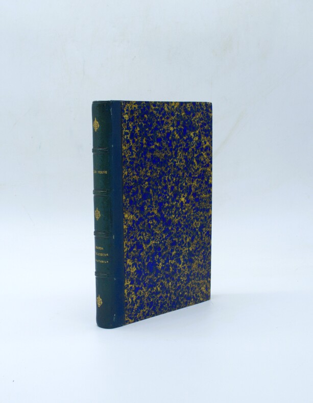
18861234821886 Librairie de l'Art, Jules Rouam, Editeur, Paris - 1886 - Nouvelle édition - In-8, reliure demi-chagrin, dos à 4 nerfs, titre et fleurons en dorés au dos - 362 pages + table - 4 cartes dépliantes dans l'ouvrage - Nombreuses gravures hors-texte et illustrations (lettrines bandeaux, culs-de-lampe)
1879PHO-2277Paris, Hetzel et Cie, s.d. [1879]. In-4° de VI, [2], 464 pp. 51 dessins par P. Philippoteaux. 66 fac-similé‚ et cartes par Matthis et Morieu. Demi-chagrin bleu, dos à 4 faux-nerfs orné, titre doré, tranches mouchetées rouges. (Reliure de l'époque). Quelques rousseurs. Bel ex. Ouvrage historique et géographique, réalisé en collaboration
18279452Bruxelles, PMG Vandermaelen éditeur, 1827 ; cinq tomes (Europe, Asie, Afrique, Amérique Septentrionale, Amérique Méridionale), in-folio atlantique (52,5 x 36 cm) ; demi-veau havane à petits coins verts, dos à faux-nerfs dorés, palette décorative dorée en tête et en pied, titre doré, tranches marbrées (reliure uniforme de l'époque) ; 1- Europe : (4), 43 pp., (1) p., tableau comparatif des principales hauteurs du globe (illustré en couleurs), carte d'assemblage de l'Europe et 29 cartes doubles. 2- Asie : (6) pp., carte d'assemblage de l'Asie et 111 cartes doubles. 3- Afrique : (4) pp., tableau d'assemblage de l'Afrique et 60 cartes doubles. 4- Amérique Septentrionale : (4), tableau d'assemblage et tableau provisoire d'assemblage d'une partie de l'Amérique Seple et d'une partie de l'Amérique Méridionale et 77 cartes doubles. 5- Amérique Méridionale : (4), carte d'assemblage d'Amérique Méridionale et 44 cartes doubles. Toutes les cartes sont en couleurs à quelques rares exceptions près et montées sur onglets.
1846B121426Bruxelles, Etablissement Géographique 1846 Page de titre + 1p. + 1 carte en double-page d'assemblage à l'échelle 1:10.000 + 9 plans de détails en double-page (plans parcellaires) à l'échelle 1:2500 ou 1:1250, Grand in-folio (59x38cm.), reliure d'époque en cuir brun (titre doré au premier plat, dos et bords frottés, plats usés, qqs. manque au dos), texte et intérieur sont frais, [Atlas cadastral historique d'une grande rareté, documentant le village de Bogaarden situé dans le Pajottenland. Dans les années 1840 il y avait le besoin de données géographiques précises à des fins fiscales et d'aménagement du territoire. Sur les plans de détail chaque parcelle de Bogaarden est numérotée et précisée (maisons, terres agricoles, vergers, chemins, cours d'eau). Chaque feuille comprend une échelle graphique en mètres, l'indication de la section spécifique et les numéros de parcelles individuelles et les noms des propriétaires], poids: 1.9kg., B121426
1900B121165Gand, Imp. N. Heins 1900 [16] pp. (texte) + 15 cartes coloriées en double-page, exemplaire numéroté à la main (no.30) et signé par A. Heins, signé avec dédicace autographe par A. Heins "à l'ami Paul Bergmans", tirage limtié à 100 exemplaires, 46x33cm., reliure cart. d'époque (plats marbrés, dos en cuir bordeaux, titre doré au dos), feuilles de garde marbrées, texte et planches sont frais, avec texte bilingue: français et néerlandais, bon état, poids: 1.9kg., [Nederlandse titel: "Groot plan van Gent gemaakt in 1619 door den landmeter Jac. Horenbault. Chromolithographisch facsimile,.."], B121165
1886B67378Sint-Nikolaas, J. Edom 1886 93pp., 28cm., dans "Annalen van den oudheidskundigen kring van het Land van Waas 10e deel 4e afl. juni 1886 / Annales du cercle archéologique du pays de Waas 10e tome 4e livr. juin 1886", br.orig., non-coupé, dos restauré