Wroth, Lawrence CBiblio.com

93 résultats
1999017926Mansfield Centre Connecticut: Martino Publishing 1999. Brand New HARDCOVER in perfect condition. STILL SEALED in the publisher's clear plastic SHRINKWRAP. NO rubbing. NO fading. Bright clean square and tight. Sharp corners. NO owner's name or bookplate. NOT a remainder. Fresh and crisp -- obviously never read. 1999 reprint of the 1944 original. A standard work. Illustrated with 22 FOLD-OUT maps. "An excellent study of those maps from Ptolemy to 1798 important in the development of the cartography of the Pacific area with facsimiles of 22 of the 104 maps described." -- Ristow 393 in GUIDE TO THE HISTORY OF CARTOGRAPHY. Hodgkiss/Tatham 137 in KEYGUIDE TO INFORMATION SOURCES IN CARTOGRAPHY. Bound in the original gilt-stamped brown cloth. Because this edition is bound in sturdy cloth it is much better suited to repeated use than the paper binding of the original edition. 1999 reprint of the 1944 original. Hardcover. New/in publisher's shrinkwrap. 8vo. vi pp. 87-268 22 folding plates. Great Packaging Fast Shipping. Martino Publishing Hardcover
1985024925Toms River New Jersey: Ocean County Historical Society 1985. Near Fine condition. NO cover wear or fraying. Hinges inner and outer are PERFECT. Brief gift note on endpaper. 1985. Reprint of the 1878 Woolman & Rose Philadelphia original. Limited to 700 numbered copies this being #121. The hand inked number "121" has bled through to adjoining pages as usual. All other pages are clean and unmarked. Profusely illustrated with more than 70 maps and prints of New Jersey Shore towns and architectural landmarks in Cape May Atlantic Ocean and Monmouth Counties. Many fold out maps. Tipped-in after the title page is a HUGE folding map THE STATE OF NEW JERSEY 1877 from US Coast Guard Survey Records. It measures a whopping 18" wide by 31.5" tall when unfolded and is imprinted with the populations of major cities in each NJ county from the 1875 Census. Bound in the original maroon cloth stamped in bright gold. Oversize Hardcover. 12" wide by 14.25" tall. This very large extremely heavy book will require extra postage for Priority and International shipments but only the standard charge for media mail. Reprint Limited to 700 numbered. Oversize Hardcover. Near Fine condition/No dust jacket as issued. Illus. by Rose T. F. . 374pp. Great Packaging Fast Shipping. Ocean County Historical Society Hardcover
1953003010New York: American Society of Civil Engineers 1953. Fine condition. Bright clean square and tight. Sharp corners. Gilt on cover is still bright and shiny. No owner's name or bookplate. Pages are fresh and crisp. No underlining. No highlighting. No margin notes. Illustrations throughout. Author Index. Subject Index. Includes: A HUNDRED YEARS OF AMERICAN CIVIL ENGINEERING 1852-1952 by J. K. Finch pp. 28-96; AN ENGINEERING CENTURY IN CALIFORNIA by Walter L. Huber pp. 97-111; SURVEYING AND MAPPING IN CANADA 1852-1952 by F. H. Peters pp. 857- 871; WATERWAY GROWTH IN THE UNITED STATES by William L. Hartley pp. 976-1041; HISTORY AND FUTURE OF FLOOD CONTROL by George R. Schneider pp. 1042- 1099; etc. There are also papers on Civil Engineering - History and Practice; Engineering Education; City Planning; Construction; Irrigation; Power Sanitary Engineering; Soil Mechanics; Structural; Surveying; Transportation; Waterways; Allied Interests Metals in the Economy; Synergism between Engineering and Petroleum; Iron and Steel Production 1851-1951. Bound in the original black cloth. . First Edition. Hardcover. Fine condition/No dust jacket. 8vo. xii 1330pp. American Society of Civil Engineers Hardcover
1969018432New Haven Connecticut & London: Yale University Press 1969. SIGNED by co-author Christian Brun on the title page his signature only NOT personalized to anyone. Very Good condition. Mild crease to one corner of a few early leaves. NOT a library discard. NO owner's name or bookplate. NO underlining. NO highlighting. NO margin notes. 1969. First Edition. Expertly described here are all separately published maps and charts in America until 1800 as well as those in books pamphlets almanacs magazines atlases and gazetteers. Illustrated with 18 map reproductions frontispiece in color; 1 folding. Bibliography. Index. Bound in the original gilt-stamped blue cloth. 7.75" wide by 10.25" tall. Signed by Christian F. Brun. First Edition. Hardcover. Very Good condition/No jacket. xxii 215pp. 18 plates . Great Packaging Fast Shipping. Yale University Press Hardcover
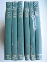
1995018762Storrs-Mansfield CT / Parsippany New Jersey: Martino Fine Books / About Books 1995. 6 separate volumes complete 5 volumes bound in 6 books WITH LARGE FOLD-OUT MAPS -- just like the first edition. SEE PHOTOS. Each of the 6 books in this 1995 large format edition measures 9.25" wide by 12.25" tall. This is NOT the later smaller format 3-volume reprint in which the maps are reduced in size. Unlike later reduced-size editions the maps in this 1995 six-volume edition measure as large as 21" by 33" when unfolded. SEE PHOTOS. As original co-publisher we are pleased to offer the few remaining sets of the 1995 large-format 6-volume edition recently rediscovered in our warehouse. They are BRAND NEW in perfect condition. STILL SEALED in the publisher's clear plastic SHRINKWRAP and the PUBLISHER'S CARDBOARD SHIPPING BOX. NO rubbing. NO fading. Bright clean square and tight. NO owner's name or bookplate. NOT a remainder. Fresh and crisp -- obviously never read. No date but 1995 First Martino/About Books printing "strictly limited to 350". Reprint of the original 1957-1963 six separate volumes: xiv 264; xiii 281; xiii 349; xiii 260; xix 222; iv 223-487pp. MAPPING THE TRANSMISSISSIPPI WEST is a monumental and exceptionally thorough work that is unlikely to be surpassed. The set is illustrated with a total of 376 maps including several that fold out. In this standard carto-bibliography are full descriptions of some 1300 maps from the year 1540 to about 1880. Wheat discusses each map showing the origins of its date and weighing its significance and accuracy. He also identifies the atlases and books in which the maps can be found. Norman Thrower: "Scholars and others who are interested in the American west have found Wheat's work indispensable." Ristow 382: "A comprehensive cartobibliography with many fine reproductions." The 6 volumes are uniformly bound in the original gilt-stamped green cloth. SEE PHOTOS. Oversize Hardcover. All 6 volumes measure 9.25" wide by 12.25" tall. This heavy set will require extra postage for Priority and International shipments. But for media mail you pay only our standard charge for 1 volume and we ship the other 5 volumes at no extra cost. First Martino/About Books printing. Oversize Hardcover. New/in publisher's shrinkwrap. Illus. by We ship all 6 volumes for cost of 1. 6 volumes: 9.25" wide by 12.25" tall. Great Packaging Fast Shipping. Martino Fine Books / About Books Hardcover
1995018771Storrs-Mansfield CT / Parsippany New Jersey: Martino Fine Books / About Books 1995. Vol. 5 Part I only of 6 separate books. As original co-publisher we are pleased to offer the few remaining individual volumes from our 1995 large-format 6-volume edition that were recently rediscovered in our warehouse. Oversize Hardcover. 9.25" wide by 12.25" tall. This volume is NOT from the later smaller format 3-volume reprint in which the maps are reduced in size. Offered here is Vol. 5 Part I only Vol. 5 was issued in 2 separate books. It is BRAND NEW in perfect condition. NO rubbing. NO fading. Bright clean square and tight. NO owner's name or bookplate. NOT a remainder. Fresh and crisp -- obviously never read. No date but 1995 First Martino/About Books printing "strictly limited to 350". Vol. 5 Part I only. Reprint of the 1963 Institute of Historical Cartography original. MAPPING THE TRANSMISSISSIPPI WEST is a monumental and exceptionally thorough work that is unlikely to be surpassed. In this standard carto-bibliography are full descriptions for hundreds of important maps 1861-1867. Many are illustrated on full page plates 9.25" wide by 12.25" tall. Wheat discusses each map showing the origins of its date and weighing its significance and accuracy. He also identifies the atlases and books in which the maps can be found. Norman Thrower: "Scholars and others who are interested in the American west have found Wheat's work indispensable." Ristow 382: "A comprehensive cartobibliography with many fine reproductions." Bound in the original gilt-stamped green cloth. This large heavy book will require extra postage for Priority and International shipments but only the standard charge for media mail. First Martino/About Books printing. Oversize Hardcover. New/No jacket as issued. xix 222pp. Great Packaging Fast Shipping. Martino Fine Books / About Books Hardcover
1995018772Storrs-Mansfield CT / Parsippany New Jersey: Martino Fine Books / About Books 1995. Vol. 5 Part 2 only of 6 separate books. As original co-publisher we are pleased to offer the few remaining individual volumes from our 1995 large-format 6-volume edition that were recently rediscovered in our warehouse. Oversize Hardcover. 9.25" wide by 12.25" tall. This volume is NOT from the later smaller format 3-volume reprint in which the maps are reduced in size. Offered here is Vol. 5 Part 2 only Vol. 5 was issued in 2 separate books. It is BRAND NEW in perfect condition. NO rubbing. NO fading. Bright clean square and tight. NO owner's name or bookplate. NOT a remainder. Fresh and crisp -- obviously never read. No date but 1995 First Martino/About Books printing "strictly limited to 350". Vol. 5 Part 2 only. Reprint of the 1963 Institute of Historical Cartography original. MAPPING THE TRANSMISSISSIPPI WEST is a monumental and exceptionally thorough work that is unlikely to be surpassed. In this standard carto-bibliography are full descriptions for hundreds of important maps from 1868 to the 1870s. Many are illustrated on full page plates 9.25" wide by 12.25" tall. Wheat discusses each map showing the origins of its date and weighing its significance and accuracy. He also identifies the atlases and books in which the maps can be found. As this is the final volume it contains a comprehensive index for all 6 books in the set. Norman Thrower: "Scholars and others who are interested in the American west have found Wheat's work indispensable." Ristow 382: "A comprehensive cartobibliography with many fine reproductions." Bound in the original gilt-stamped green cloth. This large heavy book will require extra postage for Priority and International shipments but only the standard charge for media mail. . First Martino/About Books printing. Oversize Hardcover. New/No jacket as issued. iv pp. 223-487. Great Packaging Fast Shipping. Martino Fine Books / About Books Hardcover
1995018317Storrs-Mansfield Connecticut: Maurizio Martino Publisher 1995. 1995 Enlarged edition. BRAND NEW in perfect condition. NO rubbing. NO fading. Bright clean square and tight. Sharp corners. NO owner's name or bookplate. NOT a remainder. Fresh and crisp -- obviously never read. No date but 1995 First Martino printing "strictly limited to 350". This 1995 edition has all the content of the 1942 original plus is updated and enlarged. There is a new introduction by Gary Kurutz that places Wheat's work in historical context and offers information on the book's production and initial reception. Also new are descriptions by Warren Heckrotte of 27 Gold Rush maps or variants that Wheat missed. Another plus is the frontispiece Map of the Southern Mines 1852 which did not appear in the 1942 trade edition but only in 22 deluxe presentation copies. Including the frontispiece there are a total of 27 full-page and double-page map facsimiles. This is an attractively produced book handsomely bound in the original tan cloth stamped in bright red and black over a cream color spine label. Oversize Hardcover. 9.25" wide by 12.25" tall. This large heavy book will require SUBSTANTIAL extra postage for international shipments but only the standard charge for priority or media mail. Updated and Expanded Edition. Oversize Hardcover. New/No jacket as issued. xlii 153pp. plates 262 total pages. Great Packaging Fast Shipping. Maurizio Martino Publisher Hardcover
1999018413Mansfield Centre Connecticut: Martino Publishing 1999. 2 volumes bound as 1 complete. BRAND NEW HARDCOVER in perfect condition. STILL SEALED in the publisher's clear plastic SHRINKWRAP. NO rubbing. NO fading. Bright clean square and tight. Sharp corners. NOT a library discard. NO owner's name or bookplate. NOT a remainder. Fresh and crisp -- obviously never read. No date but 1999 First Martino printing "Limited Edition Facsimile". Reprint of the 1937 two volume set. 2 vols. in 1: xii pp. 1-270; iv pp. 271-543 13 maps not included in the pagination. Well illustrated with 41 map reproductions including 13 that fold-out. Bound in the original pale yellow cloth stamped in bright gold over a handsome dark green spine panel. "Although emphasis is on the Northwest Coast of America this is a useful reference work for the student of the cartographic history of America. It contains an extensive index bibliography and list of place names as well as a list of maps. An exhaustive and scholarly publication which includes a note on practically every important map. 1507-1794." -- Ristow GUIDE TO THE HISTORY OF CARTOGRAPHY #377. Howes USIANA W7. Oversize Hardcover. 8.75" wide by 11" tall. This large heavy book will require extra postage for international shipments but only the standard charge for priority or media mail. First Martino printing. Oversize Hardcover. New/in publisher's shrinkwrap. 2 vols. in 1: xii pp. 1-270; iv pp. 271-543. Great Packaging Fast Shipping. Martino Publishing Hardcover
1984018064Utrecht: H&S / Hes Uitgevers 1984. This is the original 1984 FIRST EDITION in PERFECT condition. Brand New in a Brand New dust jacket. STILL SEALED in the publisher's clear plastic SHRINKWRAP thanks to a lucky warehouse find. NO chips. NO tears. NO creases. NO rubbing. NO fading. Bright clean square and tight. Sharp corners. NO owner's name or bookplate. NO remainder mark. Fresh and crisp -- obviously never read. A history of early globe production and their makers. Extensive descriptions of 340 globes made in London Paris Brussels Nuremberg Venice Amsterdam etc. Illustrated with 83 photos 9 in color. Translated into English from the Dutch manuscript by Willie ten Haken. Bound in the original gilt-stamped green cloth. Complete with a pristine dust jacket. 7" wide by 9.75" tall 18cm x 24.5 cm. . First Edition. Hardcover. New/in publisher's shrinkwrap. 290pp. Great Packing Fast Shipping. H&S / Hes Uitgevers Hardcover
19466825Washington DC: U.S. Department of State 1946-1947. fair. 47 maps cardboard covers 47 fold-out maps stain on fore-edge covers worn & scuffed: small tears creases ink name on front cover. Oversized volume measuring approximately 14.25" 36 cm by 20.5" 52.5 cm. This volume was an appendix to "Administrative Subdivisions of Japan " Department of State Publications 2749 Far Eastern Series 19. There is one map for each of the 47 subdivisions on Hokkaido Honshu Shikoku and Kyushu. U.S. Department of State unknown
198713336Norman OK USA: University of Oklahoma Press 1987. First Edition Second Printing. Paperback. Very Good/No Dust Jacket. Large paperback no marks many maps and illustrations with 224 pages. <br/><br/> University of Oklahoma Press paperback
1997018336Mansfield Centre Connecticut: Martino Fine Books 1997. 2 volumes complete bound as 1. BRAND NEW HARDCOVER in perfect condition. STILL SEALED in the publisher's clear plastic SHRINKWRAP. NO rubbing. NO fading. Bright clean square and tight. Sharp corners. NO owner's name or bookplate. NOT a remainder. Fresh and crisp -- obviously never read. No date but 1997 First Martino printing limited to 150 copies published @ $95. Facsimile reprint of the 1921 two-volume Hispanic Society of America/Yale University Press edition. 2 vols. in 1: xxvi 218pp. xi 291pp. 143 plates mostly photos of important globes. The standard reference on the subject. According to Ristow this is "a comprehensive work including an extensive bibliography an index of globemakers with locations of globes and a general index." -- #317 GUIDE TO THE HISTORY OF CARTOGRAPHY. Keyguide 316: "A comprehensive work that includes a bibliographical listing. Valuable for astronomers as well as carto-historians and geographers." Handsomely bound in the original blue cloth stamped in bright gold over a red spine panel. First Martino printing Limited to 150. Hardcover. New/in publisher's shrinkwrap. 2 vols. in 1: xxvi 218pp. xi 291pp. 143 plates. Great Packaging Fast Shipping. Martino Fine Books Hardcover
1967018898London: Map Collectors' Circle 1967. Complete with errata slip laid in. Near Fine condition. Clean and unmarked. NOT a library discard. NO owner's name or bookplate. Describes in detail 23 main entries plus variants. Includes collations. Lists all charts and maps. Cross referenced to Phillips. Illustrated with 22 plates 1 fold-out. Bound in the original tan wraps printed in black. 7.25" wide by 9.75" tall. First Edition. Softcover. Near Fine condition. 50pp. Great Packaging Fast Shipping. Map Collectors' Circle Paperback
1980017928London: Holland Press 1980. Brand New in perfect condition. NO rubbing. NO fading. Bright clean square and tight. Sharp corners. NO owner's name or bookplate. NO remainder mark. Fresh and crisp -- obviously never read. Revised Edition. 1980. 88 plates. In 1973 a preliminary version of this work appeared in 5 issues of the periodical MAP COLLECTORS' CIRCLE. For this 1980 revision an index has been added as well as 97 new or corrected entries. Described and commented on are over 700 maps of the period. A final chronological listing identifies the cartographer date of publication and gives an estimate of rarity for each map's principal edition or first state. Volume #5 in The Holland Press Cartographica series. Bound in the original gilt-stamped dark green boards. 7.5" wide by 10" tall. 1980 Revised Edition. Hardcover. New/No jacket. xxv 188pp. Great Packaging Fast Shipping. Holland Press Hardcover
1980018076London: Holland Press 1980. Near Fine condition. Bright clean square and tight. Sharp corners. NO owner's name or bookplate. NO remainder mark. Fresh and crisp -- probably never read. Revised Edition. 1980. 88 plates. In 1973 a preliminary version of this work appeared in 5 issues of the periodical MAP COLLECTORS' CIRCLE. For this 1980 revision an index has been added as well as 97 new or corrected entries. Described and commented on are over 700 maps of the period. A final chronological listing identifies the cartographer date of publication and gives an estimate of rarity for each map's principal edition or first state. Volume #5 in The Holland Press Cartographica series. Bound in the original gilt-stamped dark green boards. 7.5" wide by 10" tall. 1980 Revised Edition. Hardcover. Near Fine condition/No jacket. xxv 188pp. Great Packaging Fast Shipping. Holland Press Hardcover
1973018834Ottawa: National Map Collection Public Archives of Canada 1973. Very Good condition. Covers lightly rubbed. NOT a library discard. NO owner's name or bookplate. Pages are clean and unmarked. NO underlining. NO highlighting. NO margin notes. A descriptive carto-bibliography with full collations contents notes lists of maps map measurements etc. Foreword by Theodore E. Layng Keeper of Maps in French and English. Subtitle: "No. 1 in a provisional series describing the atlases in the National Map Collection by country of origin." Bound in the original dark pink wraps stamped in white. 8.5" wide by 11" tall. . First Edition. Softcover. Very Good condition. xvii 132pp. Great Packaging Fast Shipping. National Map Collection, Public Archives of Canada Paperback
1906Map 753Sampson Low Marston & Co. Ltd. 1906. 2nd Edition . No Binding. Fine. 67x106 cms. 42 x 26 inches. A large folding map laid on linen. The first issue of the map was 1902 and this is the second edition. The Franco-British Exhibition site is included on what became White City and covered 140 acres. The tube lines are updated and include approved and those under construction. A beautifully coloured map in green red and blue. The tube lines are inserted onto a geographical map. It covers a wide area of London and the Home Counties. Unfaded colour and in fine condition. Some folds a trifle split but not worn. The map folds to be enclosed in the original pictorial boardswhich is complete and sound but a trifle foxed and faded. PLEASE EMAIL FOR PHOTOS. <br/> <br/> Sampson Low, Marston & Co. Ltd. unknown
1908013882Washington D. C.: Government Printing Office GPO 1908. Very Good condition. Bound in sturdy green cloth with a gilt lettered spine. All text pages maps and plates are clean and unmarked. NO foxing. 9.5" wide by 11.5" tall. "United States Geological Survey Professional Paper 60." 84pp 170 leaves 340 pages of maps and plates mostly in full-color many double-page one fold-out. All 170 plates are printed on the rectos only right-hand side of each page with the versos being blank. There are also 34 maps and figures in the text. This volume includes well over 100 beautiful full-color maps with examples from nearly every State and Territory of the United States Geology Survey. The maps also cover topics such as glaciation coast lines volcanism faulting lakes stream piracy alluviation wind and river erosion cycles etc. This copy is from the library of geologist and author Robert B. Sosman with his small ink-stamp on the front endpaper. Keywords: Cartography. Geology. First Edition. Oversize Hardcover heavy. Very Good condition. 84pp 170 leaves 340 pages . Government Printing Office (GPO) Hardcover
1904150900Berlin: Kartographische Abteilung der Königlich Preußischen Landesaufnahme 1904. One of just two known complete sets An exceedingly rare large 15-sheet map of China's strategically pivotal Liaodong Peninsula printed for senior German military commanders during the Russo-Japanese War and the Japanese siege of Port Arthur. We have traced one complete set at the Berlin State Library and the University and State Library Darmstadt has an incomplete set of six sheets. For the German army possessing up-to-date information on Liaodong was pressingly essential. Despite being officially neutral during the conflict Germany had significant geopolitical interests in north-eastern China having acted with Russia and France in 1895 to curtail Japanese expansion in East Asia after the First Sino-Japanese War. Russian-Japanese hostilities in particular the gruelling engagements around Port Arthur also threatened to spill over into Germany's nearby maritime territorial concession Qingdao. This highly detailed cartographic production printed at a scale of 1:42000 from Russian military maps from 1898-99 shows settlements of every size topography and spot-heights roads railway lines and other information of use in any potential military operation. 16 untrimmed photolithographed sheets 670 x 630 mm to 170 x 510 mm colour and black and white including 15 map sheets combining to form one large map as well as one key sheet with contemporary supplementary annotations. Generally clean and bright several sheets with fraying in margins 1 sheet with few tape repairs on verso 2 sheets with small loss at head in 1 case just crossing neatline occasional creases. A well-preserved set. unknown
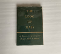
1952018855Madison: The University of Wisconsin Press 1952. SCARCE FIRST EDITION. Very Good condition in a Very Good dust jacket. SEE OUR PHOTOS. The jacket has small chips at the spine ends and corners. NOT price clipped $2.75. Protected by a removable Brodart clear-plastic sleeve. NOT a library discard. NO owner's name or bookplate. NO underlining. NO highlighting. NO margin notes. A few tiny brown speckles light foxing on the endpapers and one plate only. 1952. First Edition. A study of maps as art the importance of lettering calligraphy and type styles principles of design use of color hue intensity contrast projection etc. Figures. Tables. Bibliographical references. Bound in the original gilt-stamped green cloth. Complete with dust jacket. First Edition. Hardcover. Very Good condition/Very Good dust jacket. Illus. by NOT a library discard. 8vo. xi 105pp. Great Packaging Fast Shipping. The University of Wisconsin Press Hardcover
1991022980Chapel Hill: University of North Carolina Press 1991. BRAND NEW in a BRAND NEW dust jacket. Perfect condition. Still sealed in the publisher's clear plastic shrink wrap. NO chips. NO tears. NO creases. NO rubbing. NO fading. Sharp corners. Bright and shiny. Fresh crisp clean and unmarked. 1991. First Printing of the First Edition with complete number row 54321 on the copyright page. Illustrated with more than 100 maps bird's-eye views engravings etchings collotypes aquatints mezzotints steel engravings wood engravings and lithographs. Most are in full color. Includes notes on the artists printers publishers and history of the city. Views are accompanied by 97 excerpts from contemporary published works of visitors and residents e. g. Charles Dickens Frederick Marryat Harriet Martineau Benjamin Perley Poore Anthony Trollope Francis Trollope Mark Twain Walt Whitman. Bound in the original light gray cloth stamped in bright gold over a black panel on the spine. Complete with pristine dust jacket. Oversize Hardcover. Oblong. 15" wide by 11.5" tall. This VERY large VERY heavy book will require SUBSTANTIAL extra postage for Priority and International shipments but only the standard charge for media mail. . First Printing of the First Edition. Oversize Hardcover. New/New in publisher's shrinkwrap. xiv 297pp. Great Packaging Fast Shipping. University of North Carolina Press Hardcover
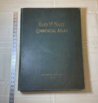
1929028276Chicago: Rand McNally & Company 1929. Good condition. Tears and creases to the title page. Vertical and corner creases up to page 6. SEE PHOTOS. Includes double page full color maps and other maps printed in yellow red and black. SEE PHOTOS. The double page maps open to an impressive 27.75" across. Contents: Part I: The World pp.4 - 23; Part II: The United States pp. 24 - 481; Part III: Foreign Countries pp. 482 - 537; Supplementary Maps: Canada Mexico China and Japan Polar Regions pp. 538 - 550. Bound in the original gilt-stamped green cloth. Oversize Hardcover. 15.50" wide by 20.75" tall by 2.25" thick at the spine. This massive extremely heavy book will require SUBSTANTIAL extra postage at our cost based on your locatuion. Sixtieth Edition 60th edition. Oversize Hardcover. Good condition. Illus. by NOT a library discard. 550 pages. Great Packaging Fast Shipping. Rand McNally & Company Hardcover
1929013898New York Chicago San Francisco: Rand McNally & Company 1929. 1929 edition No date on title page; 1929 on copyright page; no other printings listed. Very Good condition. 11.25" wide by 14.25" tall. Inner hinges are perfectly sound. Pages are clean and unmarked. Illustrated green endpapers feature scenes labeled Occident/Orient. First blank page has one vertical crease. Contains more than 125 pages of full-color maps. This 1929 edition is apparently quite scarce. Bound in the original dark green cloth lettered in gold on the front cover. Keywords: Atlases Map Reference Geography Maps. 1st ed No additional printings listed. Oversize Hardcover heavy. Very Good condition/No jacket probably as issued. 279pp. Rand McNally & Company Hardcover
1991018856Spokane Washington: The Arthur H. Clark Company 1991. Brand New HARDCOVER in a Brand New dust jacket. Perfect condition. NO chips. NO tears. NO creases. NO rubbing. NO fading. Bright shiny clean square and tight. Sharp corners. NOT a library discard. NO owner's name or bookplate. NO remainder mark. Fresh and crisp - obviously never read. 1991. First Edition. A fascinating look at a geographic misconception that persisted for two centuries. Extensively illustrated with 57 historic maps. Has a 23 page bibliography of sources for additional reading. List of chapter notes. Index. Bound in the original gilt-stamped maroon cloth. From the dust jacket: "The Island of California -- this misconception flourished on and off for almost two centuries following the Spanish discovery early in the 16th century. This book traces the origin of this strange notion -- how it evolved how it kept recurring and how it was finally put to rest." Volume XIII in the Spain in the West series. First Edition. Hardcover. New/New. 8vo. 398pp. Great Packaging Fast Shipping. The Arthur H. Clark Company Hardcover